Difficulty
Moderate
Trail Length
2.4 miles
Trail Type
Out And Back
Elevation Gain
350 ft
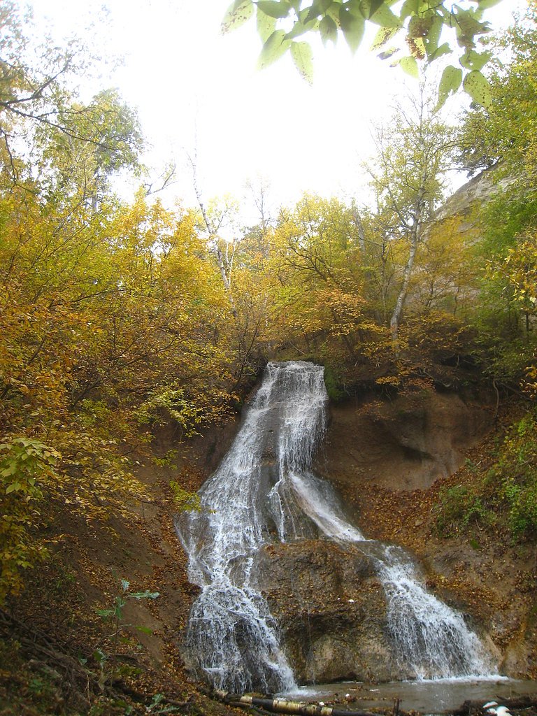
About Tyler Falls
Tyler Falls is a tucked-away, seasonal cascade in Nebraska's Fort Niobrara National Wildlife Refuge, managed by the FWS (U.S. Fish and Wildlife Service). This lesser-known drop tends to run after significant rainfall or snowmelt, offering a quiet, photogenic moment amid the refuge’s riparian corridors and native vegetation. Because flows are intermittent, visiting after wet weather gives the best chance of seeing the falls at their peak. Visitors most commonly reach Tyler Falls via a maintained out-and-back route that provides a compact day outing without requiring a long backcountry trek. The hike covers roughly 2.4 miles round-trip with about 350 feet of elevation gain and is typically rated moderate — a rewarding choice for hikers who enjoy a short climb and wildlife-viewing opportunities inside a protected national wildlife refuge. As always, check refuge access information before you go and be mindful of seasonal conditions and wildlife.
The Setting
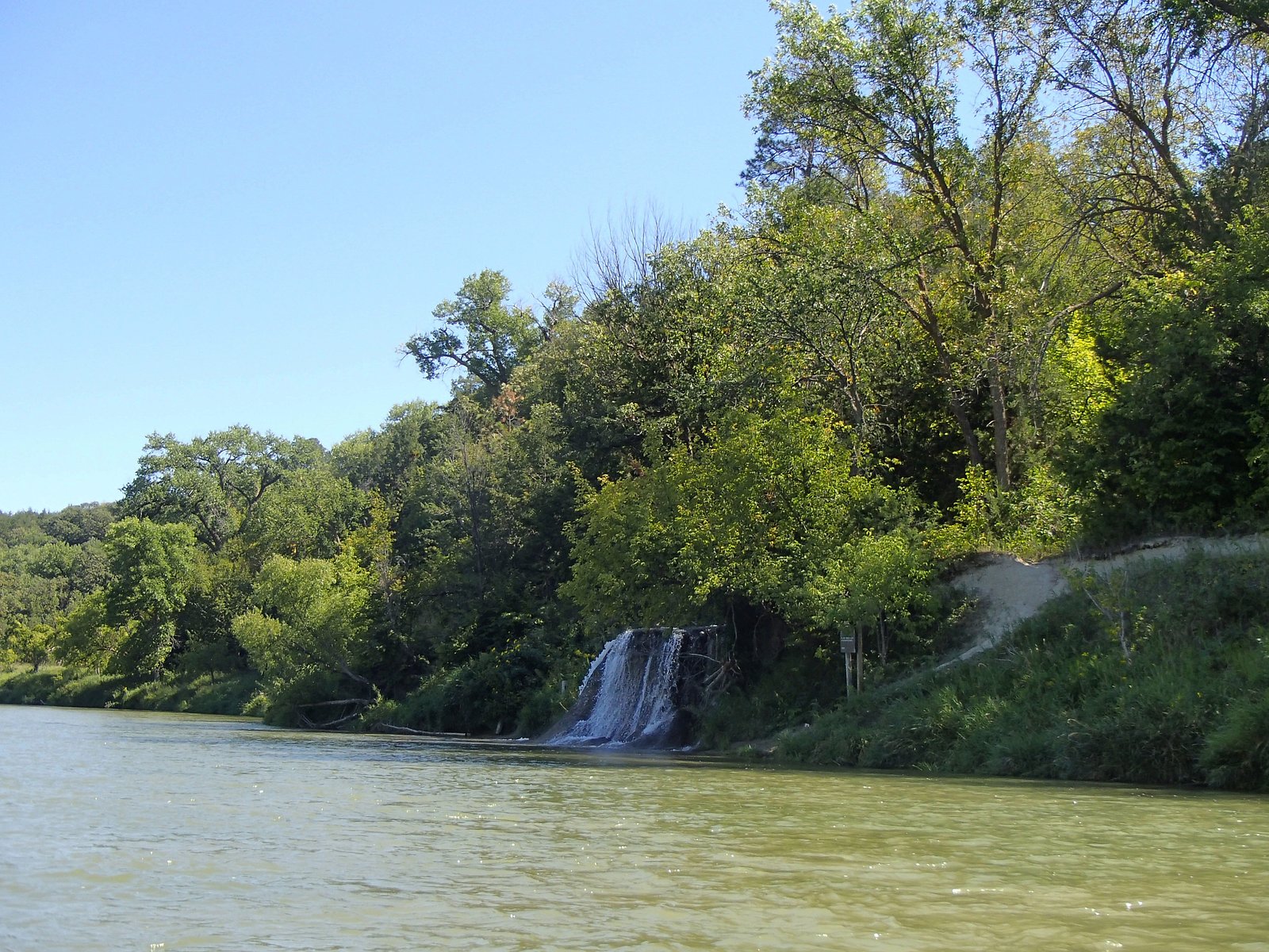
Tyler Falls sits at 2,418 feet within Fort Niobrara National Wildlife Refuge, fed by the Niobrara River, in the hills of Nebraska.
Nearby Falls Worth Visiting
Smith Falls, the tallest waterfall in Nebraska at 70 feet, lies 5.7 miles to the east. Also nearby: Fort Falls (45 ft, 2.0 mi) and Berry Falls (10 ft, 3.2 mi).
Trail & Hike Details
The Approach
The moderate 2.4-mile out-and-back trail gains 350 feet of elevation on the way to the falls.
Trail Description
Out-and-back route, 2.4 miles round-trip with approximately 350 feet of elevation gain; rated moderate. Specific USFS/USFWS trail surface, grade, and technical class data are not available for this route, so hikers should expect natural footing and some uphill sections. Plan for a short but moderately steep hike and check Fort Niobrara National Wildlife Refuge conditions before setting out.
What to Expect
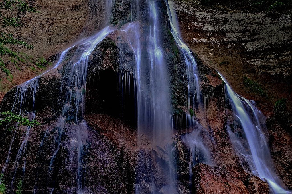
Tyler Falls is likely a small, seasonal waterfall that may not flow year-round. The surrounding area may include natural landscapes typical of Nebraska, such as grasslands or wooded areas.
Accessibility
The trail is not wheelchair accessible. Uneven terrain and elevation changes require steady footing.
Frequently Asked Questions
🐶 Are Dogs Allowed at Tyler Falls?
❌ Dogs are not allowed
Are There Any Fees or Permits Required?
🆖 No fees required
🏊 Is There Swimming at Tyler Falls?
❌ Swimming is not allowed
When to Visit
The best time to visit is typically after heavy rainfall or during spring snowmelt, when the waterfall is most likely to be flowing.
Seasonal Access
The best time to visit is Spring, Summer, and Fall. Winter access may be limited.
Safety Information
Visitors should be cautious of uneven terrain, slippery rocks, and potential wildlife encounters. Always check weather conditions before visiting.
Current Water Conditions
572 ft³/s
Current discharge — how much water is flowing
About average for this time of year
Based on 80 years of record
2.64 ft
Water depth at gauge
78°F
ComfortablePleasant for swimming
7-Day Discharge Trend
What does this mean for your visit?
Flow is about average for this time of year. The water is a comfortable 78 degrees F, pleasant for swimming. Expect slightly cloudy visibility and adequate dissolved oxygen levels. PH is alkaline at 8.6 and mineral content is typical.
Water Quality
Dissolved Oxygen
GoodAdequate oxygen levels
pH
AlkalineAbove normal range (6.5-8.5)
Water Clarity
Slightly cloudyMinor sediment present
Conductance
Dissolved minerals in the water
About This Gauge
7-Day Flow Outlook
Based on the USGS gauge Niobrara River near Sparks, Nebr. (5 km away).
Today
Low
572 cfs
6/10Tomorrow
Low
576 cfs
6/10Sun
Low
571 cfs
6/10Mon
Low
564 cfs
6/10Tue
Low
556 cfs
6/10Wed
Low
558 cfs
6/10Thu
Low
561 cfs
6/10Best window: Today — low flow, mostly sunny (trip score 6/10).
Best time of year: this gauge typically runs highest from mid February to mid May, peaking in March.
How we calculate this
This is a transparent outlook, not a precise forecast. We take the waterfall's current flow strength (how it ranks against its historical normal for today, from the nearest USGS stream gauge), carry that ranking forward along the gauge's seasonal curve, and nudge it for forecast rain. Confidence is highest for the next day or two and falls further out. Always check official conditions and your own judgment before visiting — high flows can be dangerous.
Know when to go.
Get a free email alert when waterfalls near Valentine hit peak flow. We only send when conditions are worth the trip — no weekly newsletters, no spam.
Weather Forecast
Location & Access
Getting There
Specific directions to Tyler Falls are not well-documented. Visitors are advised to consult local resources or maps for guidance. It may be located on private or less accessible land, so confirm access rights before visiting.
Get Directions on Google MapsParking
Parking availability is unclear. Visitors should prepare for limited or no designated parking areas near the site.
Elevation
2,418 feet above sea level
Coordinates
42.903833° N, -100.426106° W
Land Management
Managed by FWS
Visitor Tips & Gear
Check recent weather conditions to ensure the waterfall is flowing. Bring a map or GPS device, as the location may not be well-marked. Respect private property and local regulations.
As an Amazon Associate, we earn from qualifying purchases.
With 2.4 miles and 350 ft of elevation gain, sturdy boots and trekking poles will help on this moderate trail. Sun exposure on the trail makes good sun protection a must in summer.

Columbia Watertight II Rain Jacket
Packs into its own pocket, seam-sealed, and keeps you dry from spray and surprise rain.

Earth Pak Waterproof Dry Bag
Keeps your phone and gear dry when waterfall mist soaks everything else.

Waterproof Phone Pouch (AiRunTech)
Cheap insurance — take photos right next to the falls without killing your phone.

Timberland Euro Sprint Mid Waterproof
Trusted waterproof boot with premium leather and grippy rubber sole — reliable on rocky, wet trails.

TrailBuddy Trekking Poles
Lightweight aluminum, cork grips, and flip-locks that actually hold — a best-seller for good reason.

Polarized Sunglasses (Knockaround)
Cuts glare off the water so you actually see the falls — and your photos turn out better too.
Where to Stay

The Niobrara Lodge

Harmony Inn & Suites

Comfort Inn Valentine

Raine Motel
Browse vacation cabins and private rentals nearby
Unique outdoor stays — tents, yurts, and treehouses
Rent a campervan or RV for your waterfall road trip
Some links are affiliate links. We may earn a commission at no extra cost to you.
Additional Information
Nearby Attractions
Nearby attractions in Nebraska may include state parks, hiking trails, or other natural landmarks.
Wildlife
The area may feature local wildlife such as birds, deer, and small mammals. Be cautious of ticks and other insects.
Cities near Tyler Falls
Nearby Waterfalls
Writing about Tyler Falls? Embed this waterfall on your site for free.