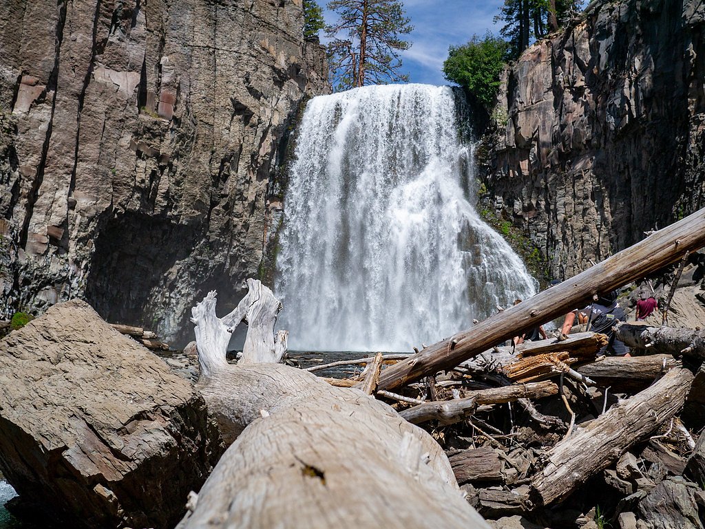
Lower Rainbow Falls
California • 101 ft
By Armen Suny · Last verified Mar 2026
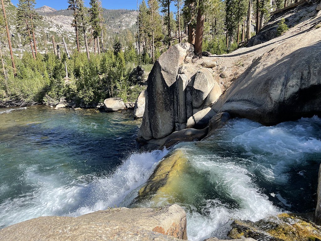
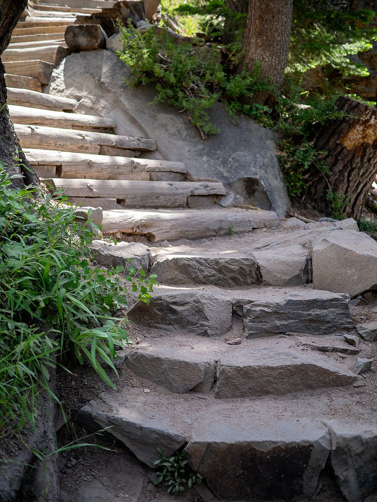
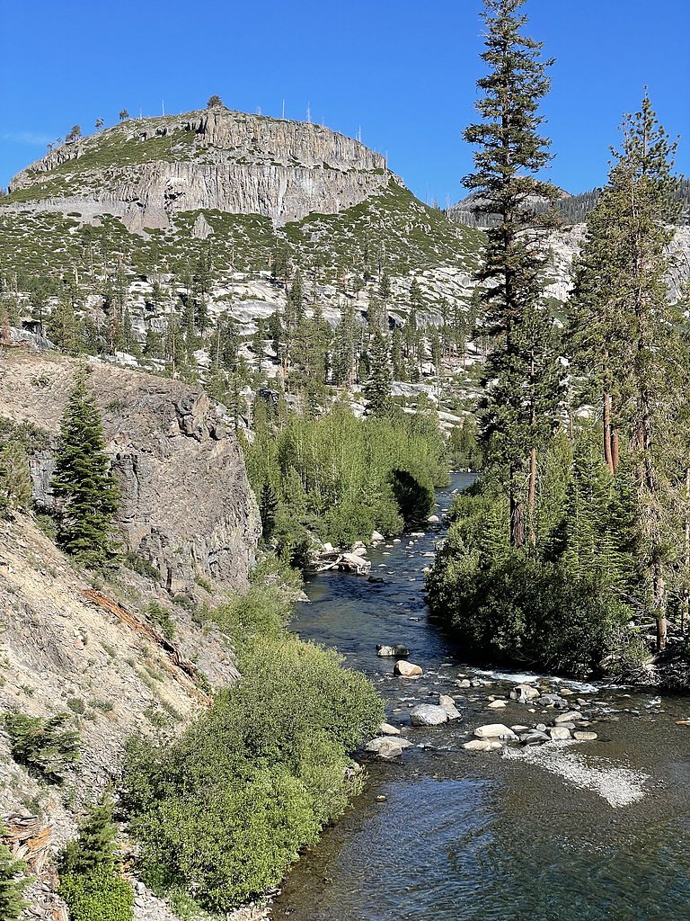
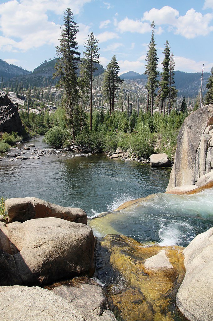
Photo Credits (5)
Difficulty
Moderate
Trail Length
2.5 miles
Trail Type
Out And Back
Elevation Gain
300 ft
About Lower Rainbow Falls
Lower Rainbow Falls is a picturesque 101-foot cascade tucked into the Mammoth Lakes area of California, pouring into a deep pool framed by rugged cliffs and forested slopes. The falls sit on land managed by the U.S. Forest Service within Inyo National Forest, and their dramatic drop and surrounding volcanic terrain make them a favorite reward for day hikers and photographers. The most common access is a moderate 2.5-mile out-and-back hike with about 300 feet of elevation gain that leads through mixed forest and rocky sections to the falls. The short USFS spur to the plunge is signed as RAINBOW FALLS WAGON TRAIL (Trail #2623B). If you’re planning an overnight, Pumice Flat Group Camp is the nearest campground, roughly 5.86 km away, making the falls an easy addition to a car-camping trip in the area.
The Setting
Lower Rainbow Falls sits at 7,218 feet within Inyo National Forest, in the high mountains of California. At 101 feet, it is among the taller waterfalls in California.
Height: 101 feet
Trail & Hike Details
The Approach
The moderate hike follows Rainbow Falls Wagon Trail (#2623B), a 2.5-mile out-and-back trail over natural surface. Expect 300 feet of elevation gain with grades of 8-10%. The trail is moderately developed (Class 2).
USFS Trail
RAINBOW FALLS WAGON TRAIL #2623B
Trail Class
Moderately Developed
Surface
Avg Grade
USFS Segment
0.03 miTrail Description
The hike to Lower Rainbow Falls is a moderately rated out-and-back of roughly 2.5 miles round-trip with about 300 feet of elevation gain. Expect a mix of native tread, occasional rocky footing and short steep pitches—difficulty is generally listed as moderate and the route is popular during peak season. The U.S. Forest Service maintains the short final approach as RAINBOW FALLS WAGON TRAIL (Trail #2623B). That USFS segment is recorded as a Class 2 trail on native material with a typical grade of 8–10% and a GIS-measured length of about 0.03 miles, so plan for a brief, slightly steeper spur onto natural surface right before the falls.
What to Expect
The falls cascade 101 feet. Dogs are welcome.
Accessibility
The trail is not wheelchair accessible. Uneven terrain and elevation changes require steady footing.
Frequently Asked Questions
🐶 Are Dogs Allowed at Lower Rainbow Falls?
✅ Dogs are allowed
Are There Any Fees or Permits Required?
🤑 Fee: $15.00
🏊 Is There Swimming at Lower Rainbow Falls?
❌ Swimming is not allowed
When to Visit
The best time to visit is late spring through early fall when the trail is accessible, and the water flow is typically at its peak.
Seasonal Access
The best time to visit is Spring, Summer, and Fall. Access roads and trails may close during winter due to snow. Check with Inyo National Forest for seasonal road closures.
Safety Information
Water temperature is currently 48°F — cold enough to cause numbness quickly. Avoid prolonged water contact and use caution near the falls.
Stay on designated trails to avoid unstable ground and steep drop-offs. Be cautious near the edge of the falls and supervise children closely. Carry plenty of water and be prepared for high-altitude conditions.
Current Water Conditions
104 ft³/s
Current discharge — how much water is flowing
About average for this time of year
Based on 15 years of record
3.73 ft
Water depth at gauge
48°F
Very coldExpect numbness within minutes
7-Day Discharge Trend
What does this mean for your visit?
Flow is about average for this time of year. Water temperature is very cold at 48 degrees F, expect numbness within minutes.
About This Gauge
7-Day Flow Outlook
Based on the USGS gauge MF SAN JOAQUIN R NR MAMMOTH LAKES CA (4 km away).
Today
Barely Flowing
104 cfs
5/10Tomorrow
Low
104 cfs
3/10Tue
Barely Flowing
92 cfs
5/10Wed
Barely Flowing
84 cfs
5/10Thu
Barely Flowing
83 cfs
5/10Fri
Barely Flowing
80 cfs
5/10Sat
Barely Flowing
72 cfs
5/10Best window: Today — barely flowing flow, sunny (trip score 5/10).
Best time of year: this gauge typically runs highest from early April to early July, peaking in May.
How we calculate this
This is a transparent outlook, not a precise forecast. We take the waterfall's current flow strength (how it ranks against its historical normal for today, from the nearest USGS stream gauge), carry that ranking forward along the gauge's seasonal curve, and nudge it for forecast rain. Confidence is highest for the next day or two and falls further out. Always check official conditions and your own judgment before visiting — high flows can be dangerous.
Know when to go.
Get a free email alert when waterfalls near Mammoth Lakes hit peak flow. We only send when conditions are worth the trip — no weekly newsletters, no spam.
Weather Forecast
Location & Access
Getting There
Lower Rainbow Falls is accessible via the Devils Postpile National Monument. Visitors typically park at the Reds Meadow area and hike to the falls. During the summer months, a mandatory shuttle system operates from Mammoth Mountain Main Lodge to Reds Meadow.
Get Directions on Google MapsParking
Parking is available at the Reds Meadow area, but it may be limited during peak seasons. Visitors should plan to use the shuttle system during summer months.
Elevation
7,218 feet above sea level
Coordinates
37.594382° N, -119.089021° W
Land Management
Managed by USFS
Visitor Tips & Gear
Arrive early to avoid crowds, especially during summer. Bring plenty of water, sunscreen, and sturdy footwear. Be prepared for changing weather conditions, as the area can be cooler at higher elevations.
This trail sits at 7,218 ft above sea level
Elevated TrailUV radiation is roughly 29% stronger at this elevation than at sea level, and the dry air accelerates dehydration. Extra sun protection and fluids go a long way.
As an Amazon Associate, we earn from qualifying purchases.

Coppertone Sport SPF 50 Sunscreen
UV intensity jumps ~4% per 1,000 ft — at this elevation you can burn in half the time.

Sun Bum SPF 30 Lip Balm (3-Pack)
Lips have almost no natural UV protection and burn fast in thin, dry mountain air.

Liquid I.V. Electrolyte Packets
You lose moisture ~2x faster at elevation — electrolytes help you absorb water efficiently.

ROCKNIGHT Polarized UV400 Sunglasses
High-altitude glare off rock and water is intense — UV400 lenses block 99%+ of UVA/UVB.
As an Amazon Associate, we earn from qualifying purchases.
With 2.5 miles and 300 ft of elevation gain, sturdy boots and trekking poles will help on this moderate trail. Sun exposure on the trail makes good sun protection a must in summer.

Polarized Sunglasses (Knockaround)
Cuts glare off the water so you actually see the falls — and your photos turn out better too.

Columbia Watertight II Rain Jacket
Packs into its own pocket, seam-sealed, and keeps you dry from spray and surprise rain.

Earth Pak Waterproof Dry Bag
Keeps your phone and gear dry when waterfall mist soaks everything else.

Waterproof Phone Pouch (AiRunTech)
Cheap insurance — take photos right next to the falls without killing your phone.

Timberland Euro Sprint Mid Waterproof
Trusted waterproof boot with premium leather and grippy rubber sole — reliable on rocky, wet trails.

TrailBuddy Trekking Poles
Lightweight aluminum, cork grips, and flip-locks that actually hold — a best-seller for good reason.
Where to Stay

Austria Hof Lodge

Edelweiss Lodge

Holiday Haus

Cinnamon Bear Inn
Browse vacation cabins and private rentals nearby
Unique outdoor stays — tents, yurts, and treehouses
Rent a campervan or RV for your waterfall road trip
Some links are affiliate links. We may earn a commission at no extra cost to you.
Nearby Campground
PUMICE FLAT GROUP CAMP
3.6 miles away · 4 sites
Overview Pumice Flat Group Camp is located in the Red's Meadows and Devils Postpile section of the eastern Sierra Nevada Mountains, just west of the full-service community of Mammoth Lakes, California. This group camping facility provides access to some of the most spectacular wilderness in the Sierras and many outdoor activities such as horseback riding, fishing, hiking, photography and geologic study of the dramatic landscape. Devils Postpile National Monument and the famous Ansel Adams Wildern
Book on Recreation.govNearby Hot Springs
Hot springs near Mammoth Lakes, California

Reds Meadow Hot Springs
Reds Meadow Hot Springs flows at an impressive 115°F high in the Eastern Sierra at 7,638 feet elevation, delivering water 72 de...

Fumaroles
Fumaroles vent superheated steam high in the Sierra at 8,167 feet, where the geothermal system expresses itself through mountai...
Fish Creek Hot Springs
Fish Creek Hot Springs, also called Iva Bell Hot Springs, emerges at 110°F deep in Sierra National Forest's backcountry at 7,24...

Unnamed Spring Mono County 2
At 7,313 feet elevation, this 72-degree thermal spring near Mammoth Lakes flows just 45 meters from El Camino Sierra Road in ha...
Casa Diablo Hot Springs And Geyser
Casa Diablo Hot Springs and Geyser erupts at 199 degrees Fahrenheit—one of California's most extreme geothermal features. Locat...

Chance Spring
Chance Spring emerges modestly at 73 degrees Fahrenheit from land managed by Los Angeles Department of Water and Power near Mam...
Looking for a soak after your hike? Explore more hot springs near Mammoth Lakes, California on SoakingSprings.
Explore California springsAdditional Information
Nearby Attractions
Devils Postpile National Monument, Reds Meadow, Upper Rainbow Falls, Mammoth Lakes Basin.
Wildlife
The area is home to a variety of wildlife, including deer, birds, and small mammals. Visitors should be cautious of bears and store food properly.
Cities near Lower Rainbow Falls
Nearby Waterfalls
Writing about Lower Rainbow Falls? Embed this waterfall on your site for free.