
Photo Credits (5)
Difficulty
Moderate
Trail Length
2.4 miles
Trail Type
Out And Back
Elevation Gain
350 ft
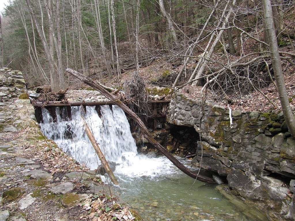
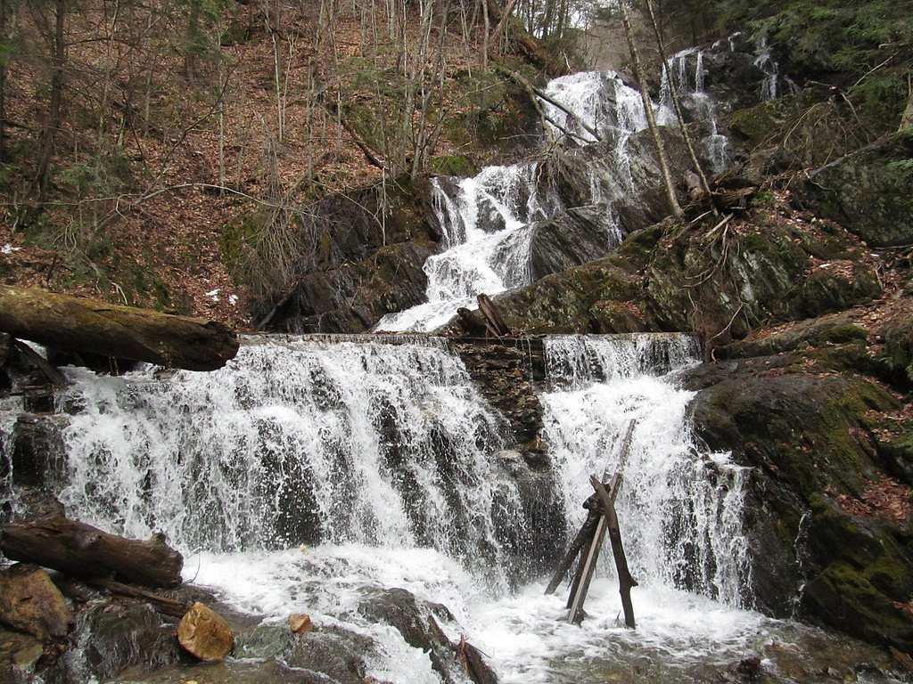
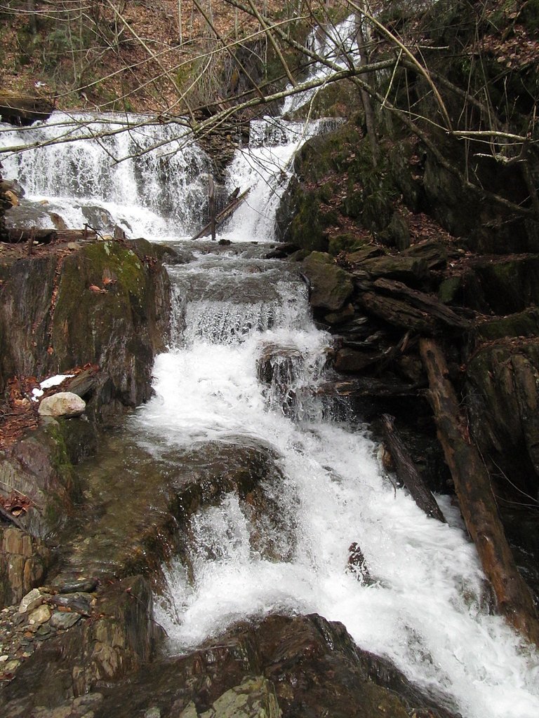
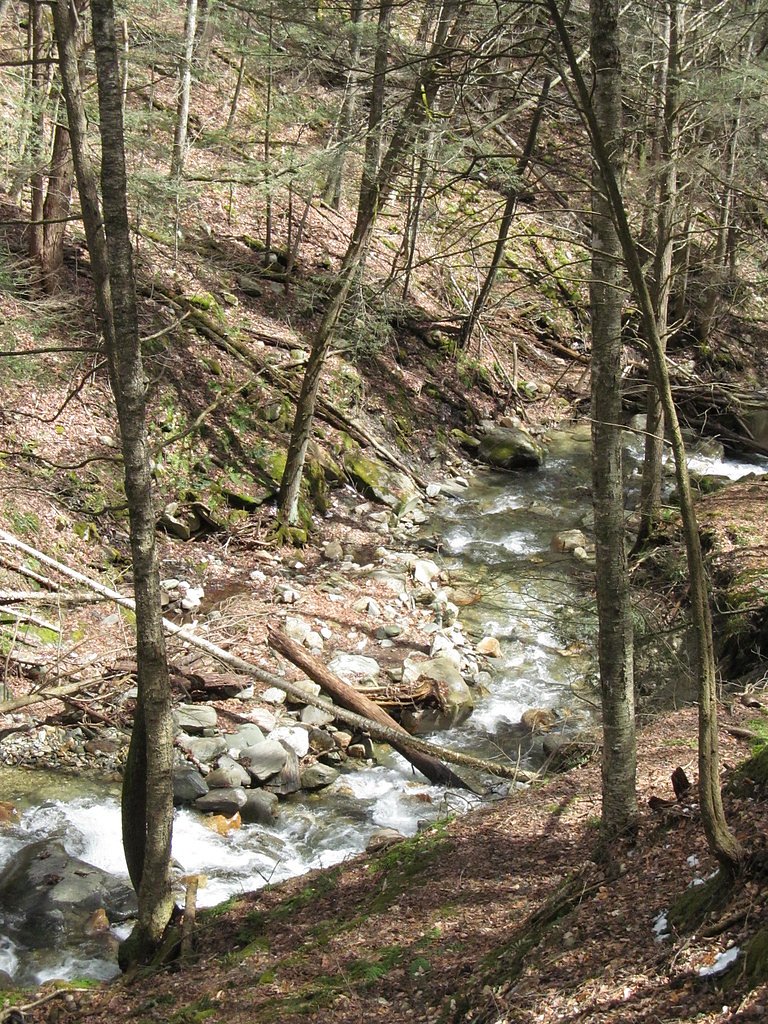
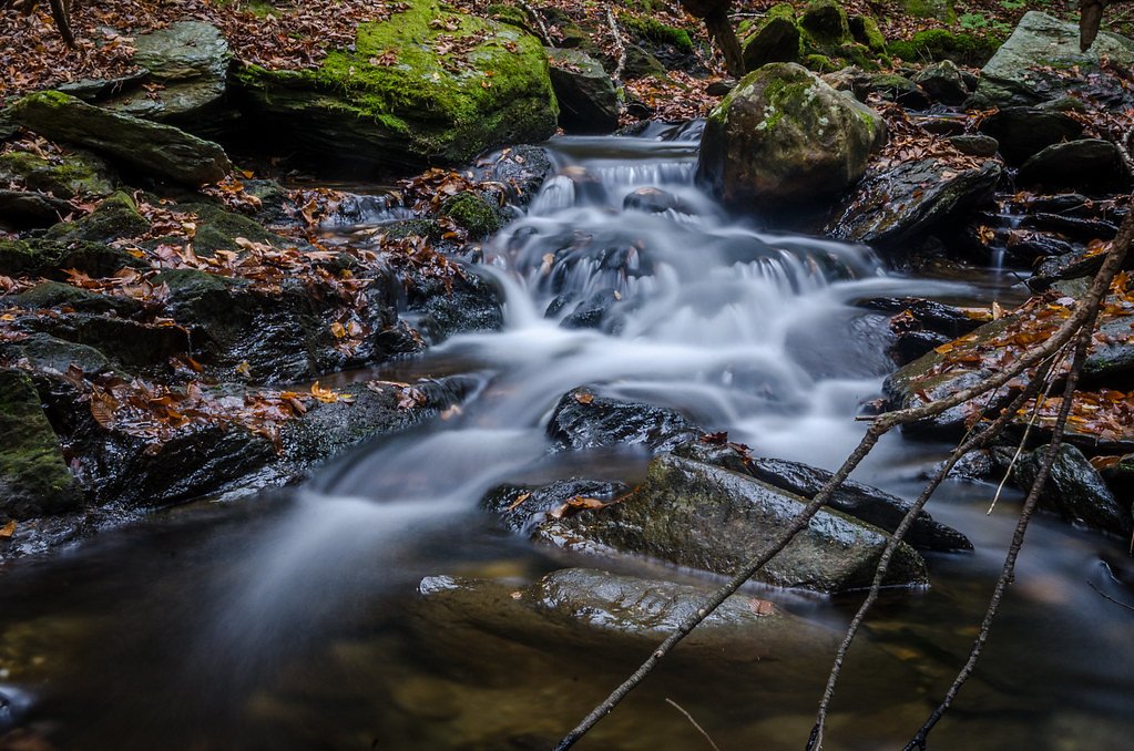
About Twin Cascade
Twin Cascade is a lovely, double-stream waterfall tucked into the forested hills of the Berkshires in western Massachusetts. Two parallel ribbons of water spill over a rocky slope into a shaded pool below, framed by mossy ledges and mature hardwoods that make the site especially peaceful in spring and colorful in autumn. The setting feels intimate and photogenic, making it a favorite stop for hikers and photographers seeking a quieter waterfall experience. The falls are reached by a moderate out-and-back hike, so visiting Twin Cascade pairs well with a morning or afternoon walk through mixed forest. While the area is not heavily developed, the trail’s gentle gain and scenic approach reward visitors with a close-up view of the twin drops and the chance to linger on the rocks near the base when flows are safe. Worth noting: there isn’t a campground immediately adjacent to the falls, so plan logistics accordingly before you go.
The Setting
Twin Cascade sits at 1,053 feet along the Cold River, in the foothills of Massachusetts.
Nearby Falls Worth Visiting
Tannery Falls, the tallest waterfall in Massachusetts at 80 feet, lies 3.6 miles to the south.
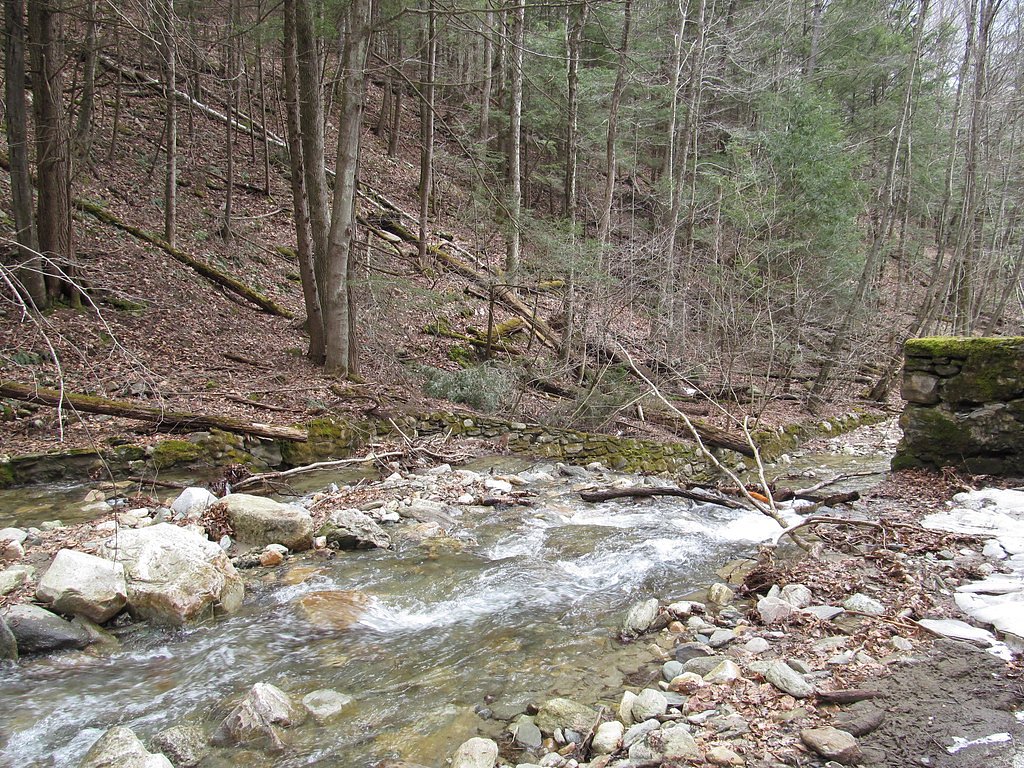
Trail & Hike Details
The Approach
The moderate 2.4-mile out-and-back trail gains 350 feet of elevation on the way to the falls.
Trail Description
The trail to Twin Cascade is a 2.4-mile out-and-back route with about 350 feet of elevation gain and a moderate difficulty rating. The path winds through mixed hardwood forest on a mostly natural dirt surface with roots and occasional rocky sections; after rain the tread can become muddy and slippery, so sturdy, grippy footwear is recommended. The grade is generally gentle but includes short steeper pitches approaching the waterfall, and the trail class is typical of backcountry hiking—singletrack with some uneven footing. Expect a peaceful, forested approach that opens onto the twin drops at the end of the trail.
What to Expect
Dogs are welcome.
Accessibility
The trail is not wheelchair accessible. Uneven terrain and elevation changes require steady footing.
Frequently Asked Questions
🐶 Are Dogs Allowed at Twin Cascade?
✅ Dogs are allowed
Are There Any Fees or Permits Required?
🆖 No fees required
🏊 Is There Swimming at Twin Cascade?
❌ Swimming is not allowed
When to Visit
The best time to visit Twin Cascade is in the spring or after heavy rainfall, when the water flow is at its peak.
Seasonal Access
The best time to visit is Spring, Summer, and Fall. Winter access may be limited.
Safety Information
Exercise caution on the trail, especially after rain, as it can be slippery. Be aware of ticks and other insects in the area. Stay on marked trails to avoid damaging the environment or getting lost.
Current Water Conditions
4 ft³/s
Current discharge — how much water is flowing
About average for this time of year
Based on 11 years of record
3.58 ft
Water depth at gauge
65°F
CoolRefreshing for swimming
7-Day Discharge Trend
What does this mean for your visit?
Flow is about average for this time of year. Water temperature is a refreshing 65 degrees F, good for a quick swim. Mineral content is typical.
Water Quality
Conductance
Dissolved minerals in the water
About This Gauge
7-Day Flow Outlook
Based on the USGS gauge COLD RIVER AT FLORIDA, MA (3 km away).
Today
Moderate
4 cfs
5/10Tomorrow
Moderate
4 cfs
8/10Tue
Moderate
6 cfs
4/10Wed
Moderate
8 cfs
6/10Thu
Moderate
8 cfs
8/10Fri
Moderate
9 cfs
4/10Sat
Moderate
7 cfs
6/10Best window: Tomorrow — moderate flow, sunny (trip score 8/10).
Best time of year: this gauge typically runs highest from late March to late April, peaking in April.
How we calculate this
This is a transparent outlook, not a precise forecast. We take the waterfall's current flow strength (how it ranks against its historical normal for today, from the nearest USGS stream gauge), carry that ranking forward along the gauge's seasonal curve, and nudge it for forecast rain. Confidence is highest for the next day or two and falls further out. Always check official conditions and your own judgment before visiting — high flows can be dangerous.
Know when to go.
Get a free email alert when waterfalls near North Adams hit peak flow. We only send when conditions are worth the trip — no weekly newsletters, no spam.
Weather Forecast
Location & Access
Getting There
Twin Cascade is located near the town of Williamstown, Massachusetts. It can be accessed via a short trail from the parking area on Petersburg Road (Route 2).
Get Directions on Google MapsParking
There is limited roadside parking available near the trailhead on Petersburg Road.
Elevation
1,053 feet above sea level
Coordinates
42.676472° N, -73.002323° W
Visitor Tips & Gear
Visit early in the day to avoid crowds and ensure parking availability. Wear sturdy shoes, especially if visiting after rain, as the trail can be slippery. Bring a camera to capture the beauty of the falls.
As an Amazon Associate, we earn from qualifying purchases.
With 2.4 miles and 350 ft of elevation gain, sturdy boots and trekking poles will help on this moderate trail. Sun exposure on the trail makes good sun protection a must in summer.

Polarized Sunglasses (Knockaround)
Cuts glare off the water so you actually see the falls — and your photos turn out better too.

Columbia Watertight II Rain Jacket
Packs into its own pocket, seam-sealed, and keeps you dry from spray and surprise rain.

Earth Pak Waterproof Dry Bag
Keeps your phone and gear dry when waterfall mist soaks everything else.

Waterproof Phone Pouch (AiRunTech)
Cheap insurance — take photos right next to the falls without killing your phone.

Timberland Euro Sprint Mid Waterproof
Trusted waterproof boot with premium leather and grippy rubber sole — reliable on rocky, wet trails.

TrailBuddy Trekking Poles
Lightweight aluminum, cork grips, and flip-locks that actually hold — a best-seller for good reason.
Where to Stay

Hotel Downstreet, an Ascend Collection Hotel

Blue Vista Motor Lodge

Vacation Village in the Berkshires

Villager Motel
Browse vacation cabins and private rentals nearby
Unique outdoor stays — tents, yurts, and treehouses
Rent a campervan or RV for your waterfall road trip
Some links are affiliate links. We may earn a commission at no extra cost to you.
Nearby Campground
INDIAN HOLLOW
24.4 miles away · 2 sites
Overview With abundant wildlife, lush scenery and waterfront views, Indian Hollow Group Campground, located at the Knightville Dam and Reservoir, offers groups and clubs a recreational oasis.Recreation The rivers and streams at Knightville offer excellent trout fishing, and the river is stocked with trout in both the spring and fall. The surrounding hills provide prime upland game habitat, and the Commonwealth of Massachusetts stocks pheasants for the fall hunting season. Hunting and fishing are
Book on Recreation.govNearby Hot Springs
Hot springs near North Adams, Massachusetts
Sand Spring
Sand Spring surfaces at 75°F in Williamstown, Massachusetts — one of the few thermal features in New England. At just 670 feet ...

Lebanon Spring
Lebanon Spring discharges at 72°F at 663 feet elevation in Columbia County, flowing 24 degrees above ambient air temperature ju...
Looking for a soak after your hike? Explore more hot springs near North Adams, Massachusetts on SoakingSprings.
Explore Massachusetts springsAdditional Information
Nearby Attractions
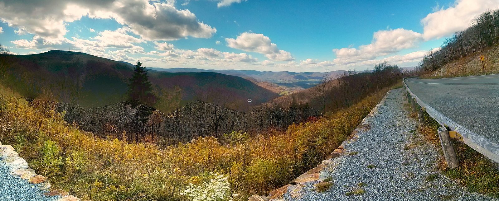
Nearby attractions include Mount Greylock State Reservation, the highest peak in Massachusetts, and the town of Williamstown, which offers cultural attractions like the Clark Art Institute.
Wildlife
The area is home to a variety of wildlife, including birds, deer, and small mammals. Visitors may also encounter insects such as mosquitoes and ticks.
Cities near Twin Cascade
Nearby Waterfalls
Writing about Twin Cascade? Embed this waterfall on your site for free.