Tory Falls
By Armen Suny · Last verified May 2026
Difficulty
Easy
Trail Length
1.2 miles
Trail Type
Out And Back
Elevation Gain
200 ft
About Tory Falls
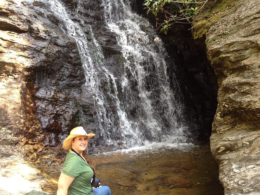
Tory Falls is a small but scenic waterfall located in Hanging Rock State Park, North Carolina. It is known for its cascading flow over a rocky ledge and is a popular spot for hikers exploring the park.
The Setting
Tory Falls sits at 1,434 feet within Hanging Rock State Park, fed by the Dan River, in the foothills of North Carolina.
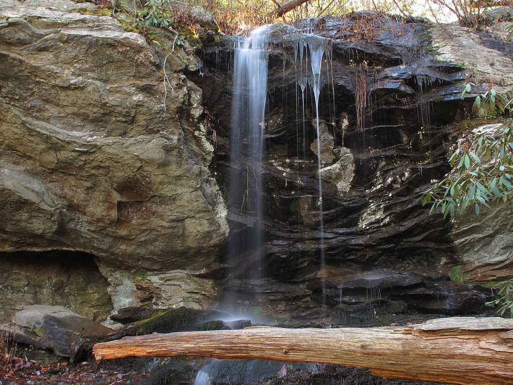
Nearby Falls Worth Visiting
Lower Cascade Falls (35 ft) lies 1.9 miles to the northeast.
Trail & Hike Details
The Approach
The easy 1.2-mile out-and-back trail gains 200 feet of elevation on the way to the falls.
Trail Description
The trail to Tory Falls is short and easy, making it accessible for most visitors. It is a well-maintained path that leads to a viewing area for the waterfall. The trail also connects to Tory's Den, a historic cave nearby.
What to Expect
Dogs are welcome.
Accessibility
The trail is not wheelchair accessible. Uneven terrain and elevation changes require steady footing.
Frequently Asked Questions
🐶 Are Dogs Allowed at Tory Falls?
✅ Dogs are allowed
Are There Any Fees or Permits Required?
🆖 No fees required
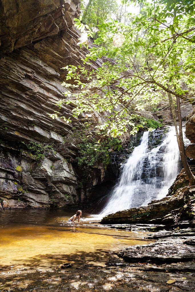
🏊 Is There Swimming at Tory Falls?
❌ Swimming is not allowed
When to Visit
Spring and fall are the best times to visit due to pleasant weather and vibrant foliage. The waterfall may have reduced flow during dry summer months.
Seasonal Access
The best time to visit is Spring, Summer, and Fall. Winter access may be limited.
Safety Information
Exercise caution near the waterfall as rocks can be slippery. Stay on marked trails to avoid getting lost or encountering hazardous areas.
Current Water Conditions
59 ft³/s
Current discharge — how much water is flowing
Much lower than usual for this time of year
Based on 84 years of record
1.33 ft
Water depth at gauge
7-Day Discharge Trend
What does this mean for your visit?
Flow is well below normal for this time of year, so the waterfall may be a trickle.
About This Gauge
This gauge is on a nearby waterway and may not reflect exact conditions at the falls.
7-Day Flow Outlook
Based on the USGS gauge DAN RIVER NEAR FRANCISCO, NC (13 km away).
Today
Roaring
67 cfs
6/10Tomorrow
Roaring
68 cfs
6/10Tue
Roaring
59 cfs
9/10Wed
Strong
55 cfs
10/10Thu
Strong
55 cfs
10/10Fri
Strong
57 cfs
10/10Sat
Roaring
64 cfs
6/10Best window: Wed — strong flow, sunny (trip score 10/10).
Best time of year: this gauge typically runs highest from early March to early May, peaking in April.
How we calculate this
This is a transparent outlook, not a precise forecast. We take the waterfall's current flow strength (how it ranks against its historical normal for today, from the nearest USGS stream gauge), carry that ranking forward along the gauge's seasonal curve, and nudge it for forecast rain. Confidence is highest for the next day or two and falls further out. Always check official conditions and your own judgment before visiting — high flows can be dangerous.
Know when to go.
Get a free email alert when waterfalls near Danbury hit peak flow. We only send when conditions are worth the trip — no weekly newsletters, no spam.
Weather Forecast
Location & Access
Getting There
Tory Falls is located within Hanging Rock State Park. Visitors can access the trailhead from the main park entrance off Hanging Rock Park Road. Follow signs for the Tory's Den Trail.
Get Directions on Google MapsParking
Parking is available at the Tory's Den parking area within Hanging Rock State Park. Spaces may be limited during peak seasons.
Elevation
1,434 feet above sea level
Coordinates
36.401527° N, -80.298108° W
Land Management
Managed by UNK
Visitor Tips & Gear
Visit early in the day to avoid crowds, especially on weekends. Wear sturdy shoes as the trail may be muddy after rain. Bring water and a camera to capture the scenery.
As an Amazon Associate, we earn from qualifying purchases.
This easy 1.2 miles hike is straightforward — comfortable trail shoes and plenty of water should do. Sun exposure on the trail makes good sun protection a must in summer.

Columbia Watertight II Rain Jacket
Packs into its own pocket, seam-sealed, and keeps you dry from spray and surprise rain.

Earth Pak Waterproof Dry Bag
Keeps your phone and gear dry when waterfall mist soaks everything else.

Waterproof Phone Pouch (AiRunTech)
Cheap insurance — take photos right next to the falls without killing your phone.

Polarized Sunglasses (Knockaround)
Cuts glare off the water so you actually see the falls — and your photos turn out better too.

Osprey Daylite Daypack
Light, organized, and just the right size for a day hike — fits water, snacks, and layers.

OR Sombriolet Sun Hat
UPF 50+ sun protection with vents so your head doesn't cook on exposed trail sections.
Where to Stay

Quality Inn Mount Airy Mayberry

Comfort Inn Mount Airy

Wolf Creek Farm B&B and Motorcycle Manor at Wolf Creek Farm, LLC

Quality Inn Jonesville I-77
Browse vacation cabins and private rentals nearby
Unique outdoor stays — tents, yurts, and treehouses
Rent a campervan or RV for your waterfall road trip
Some links are affiliate links. We may earn a commission at no extra cost to you.
Additional Information
Nearby Attractions
Tory's Den (historic cave), Hanging Rock Trail, Lower Cascades Falls, and Moore's Knob Loop Trail.
Wildlife
The area is home to a variety of wildlife, including birds, deer, and small mammals. Be cautious of snakes during warmer months.
Cities near Tory Falls
Nearby Waterfalls
Writing about Tory Falls? Embed this waterfall on your site for free.