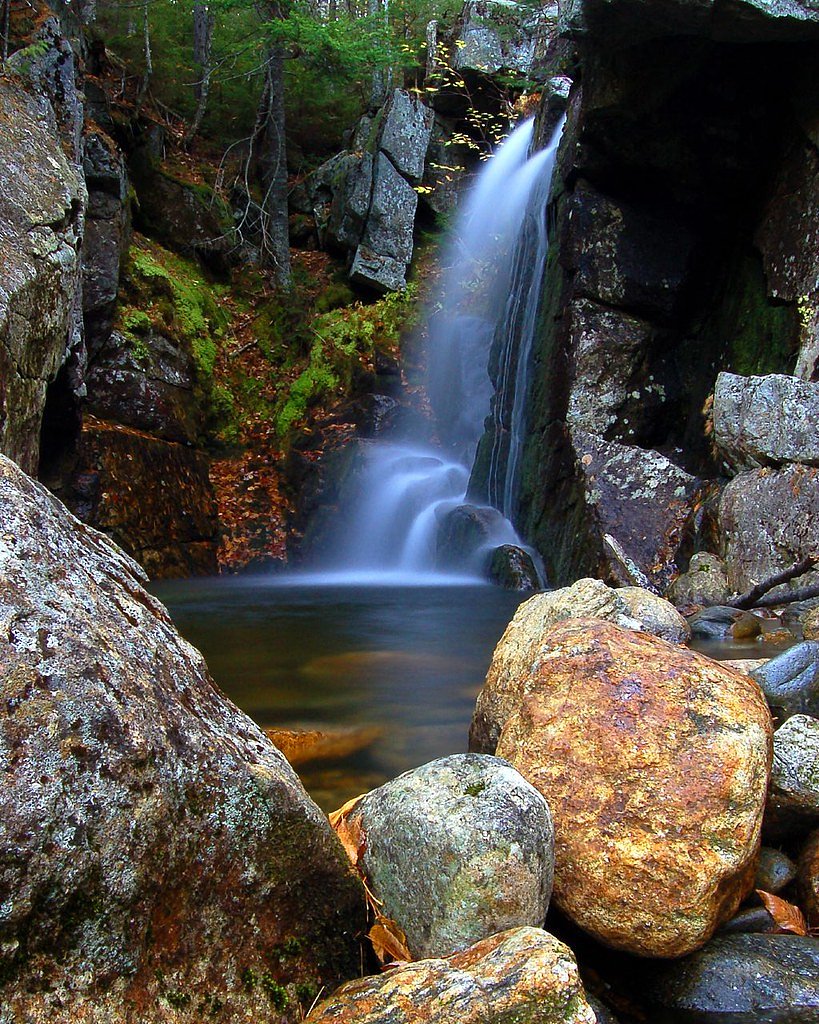
Thompson Falls
By Armen Suny · Last verified May 2026
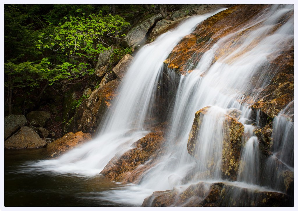
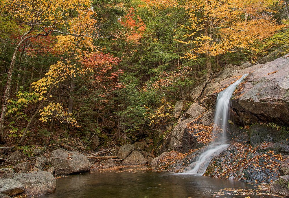
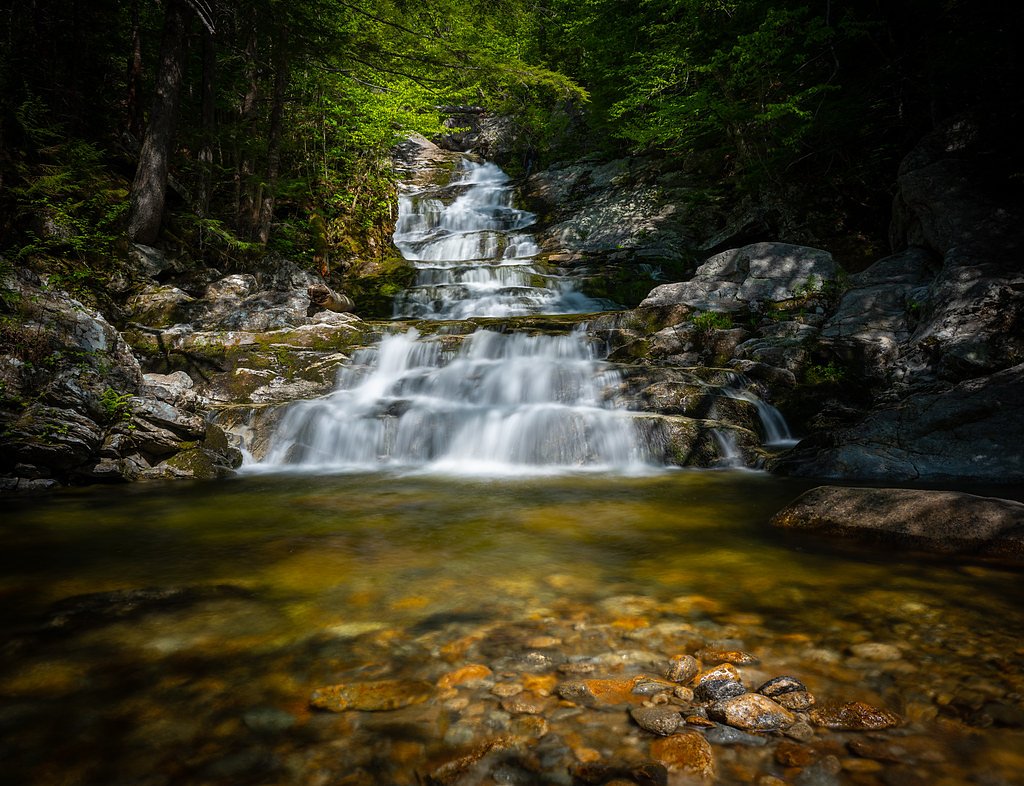
Photo Credits (3)
Difficulty
Moderate
Trail Length
2.4 miles
Trail Type
Out And Back
Elevation Gain
350 ft
About Thompson Falls
Thompson Falls is a picturesque waterfall located in the White Mountain National Forest near North Conway, New Hampshire. It features a series of cascades and pools surrounded by lush forest, making it a popular destination for hikers and nature enthusiasts.
The Setting
Thompson Falls sits at 807 feet within White Mountain National Forest, fed by the Saco River, in the foothills of New Hampshire.
Trail & Hike Details
The Approach
The moderate hike follows Thompson Falls Trail (#96646), a 2.4-mile out-and-back trail over natural surface. Expect 350 feet of elevation gain with grades of 8-10%. The trail is developed (Class 3).
USFS Trail
THOMPSON FALLS TRAIL #96646
Trail Class
Developed
Surface
Avg Grade
USFS Segment
0.36 miTrail Description
The trail to Thompson Falls is a short and relatively easy hike through a wooded area. It is well-marked and features gentle terrain, making it suitable for most visitors. The trail leads to a series of cascades and pools, offering scenic views and opportunities for photography.
What to Expect
Dogs are welcome.
Accessibility
The trail is not wheelchair accessible. Uneven terrain and elevation changes require steady footing.
Frequently Asked Questions
🐶 Are Dogs Allowed at Thompson Falls?
✅ Dogs are allowed
Are There Any Fees or Permits Required?
🆖 No fees required
🏊 Is There Swimming at Thompson Falls?
❌ Swimming is not allowed
When to Visit
Spring and early summer are ideal for visiting Thompson Falls, as the water flow is typically strongest during these seasons. Fall offers beautiful foliage, while summer provides a lush green backdrop.
Seasonal Access
The best time to visit is Spring, Summer, and Fall. Winter access may be limited. Check with White Mountain National Forest for seasonal road closures.
Safety Information
Exercise caution near the falls, as rocks can be slippery. Be aware of changing weather conditions and dress appropriately. Carry a map or GPS device, as cell service may be limited.
Current Water Conditions
934 ft³/s
Current discharge — how much water is flowing
Higher than usual for this time of year
Based on 102 years of record
3.71 ft
Water depth at gauge
7-Day Discharge Trend
What does this mean for your visit?
The water is flowing higher than usual for this time of year.
About This Gauge
This gauge is on a nearby waterway and may not reflect exact conditions at the falls.
7-Day Flow Outlook
Based on the USGS gauge Saco River near Conway, NH (9 km away).
Today
Barely Flowing
1009 cfs
3/10Tomorrow
Barely Flowing
915 cfs
4/10Tue
Barely Flowing
950 cfs
3/10Wed
Low
998 cfs
3/10Thu
Low
967 cfs
3/10Fri
Low
949 cfs
3/10Sat
Low
833 cfs
4/10Best window: Tomorrow — barely flowing flow, patchy fog then sunny (trip score 4/10).
Best time of year: this gauge typically runs highest from late March to early June, peaking in May.
How we calculate this
This is a transparent outlook, not a precise forecast. We take the waterfall's current flow strength (how it ranks against its historical normal for today, from the nearest USGS stream gauge), carry that ranking forward along the gauge's seasonal curve, and nudge it for forecast rain. Confidence is highest for the next day or two and falls further out. Always check official conditions and your own judgment before visiting — high flows can be dangerous.
Know when to go.
Get a free email alert when waterfalls near North Conway hit peak flow. We only send when conditions are worth the trip — no weekly newsletters, no spam.
Weather Forecast
Location & Access
Getting There
Thompson Falls can be accessed via the trailhead located near the Wildcat Mountain Ski Area. Visitors typically park at the ski area and follow the trail to the falls.
Get Directions on Google MapsParking
Parking is available at the Wildcat Mountain Ski Area, but availability may vary depending on the season.
Elevation
807 feet above sea level
Coordinates
44.041459° N, -71.179238° W
Land Management
Managed by USFS
Visitor Tips & Gear
Wear sturdy footwear as the trail may be muddy or slippery, especially after rain. Arrive early during peak seasons to secure parking. Bring insect repellent during the summer months.
As an Amazon Associate, we earn from qualifying purchases.
With 2.4 miles and 350 ft of elevation gain, sturdy boots and trekking poles will help on this moderate trail. Sun exposure on the trail makes good sun protection a must in summer.

Polarized Sunglasses (Knockaround)
Cuts glare off the water so you actually see the falls — and your photos turn out better too.

Columbia Watertight II Rain Jacket
Packs into its own pocket, seam-sealed, and keeps you dry from spray and surprise rain.

Earth Pak Waterproof Dry Bag
Keeps your phone and gear dry when waterfall mist soaks everything else.

Waterproof Phone Pouch (AiRunTech)
Cheap insurance — take photos right next to the falls without killing your phone.

Timberland Euro Sprint Mid Waterproof
Trusted waterproof boot with premium leather and grippy rubber sole — reliable on rocky, wet trails.

TrailBuddy Trekking Poles
Lightweight aluminum, cork grips, and flip-locks that actually hold — a best-seller for good reason.
Where to Stay

Comfort Inn & Suites North Conway

Kancamagus Swift River Inn

White Mountains Getaway with amazing views!

Home2 Suites By Hilton North Conway, NH
Browse vacation cabins and private rentals nearby
Unique outdoor stays — tents, yurts, and treehouses
Rent a campervan or RV for your waterfall road trip
Some links are affiliate links. We may earn a commission at no extra cost to you.
Nearby Campground
Saco Ranger District
4.8 miles away · 0 sites
Located on the south eastern part of the forest, the District offers a variety of different recreational opportunities. Journey across the Kancamagus Scenic Byway; experience the famous Mt Chocorua area; find solitude in the Presidential Range-Dry River or Sandwich Wildernesses; or discover the beauty along Scenic Route 113. Recreational opportunities are endless: hiking, camping, hiking, biking, fishing, skiing (alpine, cross country, and backcountry), snowmobiling, snowshoeing and much more.
Book on Recreation.govAdditional Information
Nearby Attractions
Wildcat Mountain Ski Area, Mount Washington, and the White Mountain National Forest.
Wildlife
The area is home to a variety of wildlife, including birds, squirrels, and occasionally deer. Visitors should be cautious of ticks during warmer months.
Cities near Thompson Falls
Nearby Waterfalls
Other waterfalls named Thompson Falls
2 other waterfalls share this name across the U.S.
Writing about Thompson Falls? Embed this waterfall on your site for free.