
Tangerine Falls
California • 100 ft
By Armen Suny · Last verified May 2026
Difficulty
Moderate
Trail Length
2.5 miles
Trail Type
Out And Back
Elevation Gain
900 ft
About Tangerine Falls
Tangerine Falls is a seasonal cascade tucked into the hills near Santa Barbara, located within Los Padres National Forest. The falls drop roughly 100 feet and are at their most dramatic after heavy winter and spring rains, when the canyon fills with riparian greenery and chaparral; the setting rewards photographers and hikers looking for a lush, relatively secluded outing. The route to the falls follows the Cold Spring Trail on a moderate 2.5-mile out-and-back that gains about 900 feet in elevation. Expect shaded stretches, creek crossings and rocky sections, with a short final approach that requires scrambling over boulders to reach the base and best viewpoints. The nearest developed camping is Upper Oso Campground, approximately 12.9 km away, so most visitors treat Tangerine Falls as a day hike.
The Setting
Tangerine Falls sits at 1,657 feet in the hills of California. At 100 feet, it is among the taller waterfalls in California.
Height: 100 feet
Trail & Hike Details
The Approach
The moderate 2.5-mile out-and-back trail gains 900 feet of elevation on the way to the falls.
Trail Description
Trail: Cold Spring Trail (out-and-back), 2.5 miles total. Elevation gain: ~900 feet. Difficulty: Moderate. Surface and terrain: mixed dirt and rocky tread with creek crossings and shaded canyon sections. Grade: a steady climb through the canyon; much of the ascent is moderate but sustained. Trail class/technical: generally a moderate hiking route, with a short final scramble over rocks to access the base of the falls — careful footing and good shoes recommended. Features: seasonal waterfall ~100 feet tall, multiple creek crossings, shaded riparian corridor; suitable for day hikes when water is present.
What to Expect
The falls cascade 100 feet. Dogs are welcome.
Accessibility
The trail is not wheelchair accessible. Uneven terrain and elevation changes require steady footing.
Frequently Asked Questions
🐶 Are Dogs Allowed at Tangerine Falls?
✅ Dogs are allowed
Are There Any Fees or Permits Required?
🆖 No fees required
🏊 Is There Swimming at Tangerine Falls?
❌ Swimming is not allowed
When to Visit
The best time to visit Tangerine Falls is in late winter or early spring, after significant rainfall, when the waterfall is flowing at its peak.
Seasonal Access
The best time to visit is Spring and Winter.
Safety Information
The trail can be slippery, especially after rain. Use caution during creek crossings and while scrambling over rocks near the falls. Poison oak is common in the area, so stay on the trail.
Current Water Conditions
13 ft³/s
Current discharge — how much water is flowing
Higher than usual for this time of year
Based on 46 years of record
19.60 ft
Water depth at gauge
7-Day Discharge Trend
What does this mean for your visit?
The water is flowing higher than usual for this time of year.
About This Gauge
7-Day Flow Outlook
Based on the USGS gauge GIBRALTAR DAM DIV WEIR A GIBRALTAR DAM CA (7 km away).
Today
Moderate
13 cfs
9/10Tomorrow
Moderate
12 cfs
9/10Mon
Moderate
12 cfs
9/10Tue
Moderate
12 cfs
9/10Wed
Moderate
13 cfs
9/10Thu
Moderate
13 cfs
9/10Fri
Moderate
14 cfs
9/10Best window: Today — moderate flow, mostly sunny (trip score 9/10).
Best time of year: this gauge typically runs highest from mid July to mid August, peaking in June.
How we calculate this
This is a transparent outlook, not a precise forecast. We take the waterfall's current flow strength (how it ranks against its historical normal for today, from the nearest USGS stream gauge), carry that ranking forward along the gauge's seasonal curve, and nudge it for forecast rain. Confidence is highest for the next day or two and falls further out. Always check official conditions and your own judgment before visiting — high flows can be dangerous.
Know when to go.
Get a free email alert when waterfalls near Montecito hit peak flow. We only send when conditions are worth the trip — no weekly newsletters, no spam.
Weather Forecast
Location & Access
Getting There
The trailhead for Tangerine Falls is accessed via the Cold Spring Trail, which begins near Mountain Drive in Montecito, California. The trailhead is well-marked and located in a residential area.
Get Directions on Google MapsParking
Parking is available along Mountain Drive near the trailhead. Be mindful of residential parking restrictions and signage.
Elevation
1,657 feet above sea level
Coordinates
34.469875° N, -119.658837° W
Visitor Tips & Gear
Wear sturdy shoes with good grip, as the trail can be slippery near the creek crossings and the falls. Bring plenty of water and be prepared for some rock scrambling near the end of the trail.
As an Amazon Associate, we earn from qualifying purchases.
With 2.5 miles and 900 ft of elevation gain, sturdy boots and trekking poles will help on this moderate trail. Icy conditions are common in winter — traction cleats are a smart addition.

Columbia Watertight II Rain Jacket
Packs into its own pocket, seam-sealed, and keeps you dry from spray and surprise rain.

Earth Pak Waterproof Dry Bag
Keeps your phone and gear dry when waterfall mist soaks everything else.

Waterproof Phone Pouch (AiRunTech)
Cheap insurance — take photos right next to the falls without killing your phone.

Timberland Euro Sprint Mid Waterproof
Trusted waterproof boot with premium leather and grippy rubber sole — reliable on rocky, wet trails.

TrailBuddy Trekking Poles
Lightweight aluminum, cork grips, and flip-locks that actually hold — a best-seller for good reason.

Kahtoola MICROspikes
Cult-favorite traction cleats that grip ice and wet rock — essential for winter waterfall hikes.
Where to Stay

Best Western Plus Santa Barbara

Beachside Inn

Lemon Tree Inn

Ramada by Wyndham Santa Barbara
Browse vacation cabins and private rentals nearby
Unique outdoor stays — tents, yurts, and treehouses
Rent a campervan or RV for your waterfall road trip
Some links are affiliate links. We may earn a commission at no extra cost to you.
Nearby Campground
UPPER OSO CAMPGROUND
8 miles away · 19 sites
Overview Upper Oso Campground provides ample opportunity for exploration of California's coastal mountains. It is a family-friendly campground, equipped with equestrian sites, and is close to a variety of trails and several mountain streams.Recreation A variety of hiking, mountain biking and horseback riding trails begin in and around the campground, including the Santa Cruz Trail, which traverses 18 miles north to the San Rafael Wilderness. The 2.5-mile Aliso National Recreation Trail leads thro
Book on Recreation.govNearby Hot Springs
Hot springs near Montecito, California

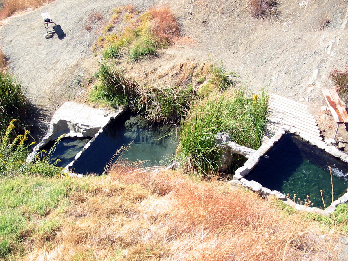
Montecito Hot Springs
Montecito Hot Springs reaches 118°F on steep chaparral slopes 1,594 feet above sea level in the Santa Ynez Mountains, requiring...
Little Caliente Spring
Little Caliente Spring emerges at 90°F in the Los Padres National Forest, where thermal waters rise 28 degrees above ambient in...
Boron Spring
Boron Spring seeps forth at 72°F from Santa Barbara County's coastal foothills near Toro Canyon, flowing just 8°F above ambient...

Agua Caliente Spring
Agua Caliente Spring emerges at an exceptional 133 degrees Fahrenheit in the Santa Ynez Mountains of Santa Barbara County near ...
San Marcos Hot Spring
San Marcos Hot Spring emerges at 110°F on the slopes above Goleta in the Santa Ynez Mountains. The 49-degree temperature differ...
Vickers Hot Springs
Vickers Hot Springs delivers 124-degree water in Los Padres National Forest near Ventura County, producing water 60 degrees war...
Looking for a soak after your hike? Explore more hot springs near Montecito, California on SoakingSprings.
Explore California springsAdditional Information
Nearby Attractions
Nearby attractions include the Santa Barbara Botanic Garden, Inspiration Point, and the beaches of Santa Barbara.
Wildlife
The area is home to a variety of wildlife, including birds, lizards, and occasionally deer. Be cautious of poison oak along the trail.
Cities near Tangerine Falls
Nearby Waterfalls

Writing about Tangerine Falls? Embed this waterfall on your site for free.