


Photo Credits (5)
Difficulty
Easy
Trail Length
2.5 miles
Trail Type
Out And Back
Elevation Gain
400 ft
About Strawberry Falls
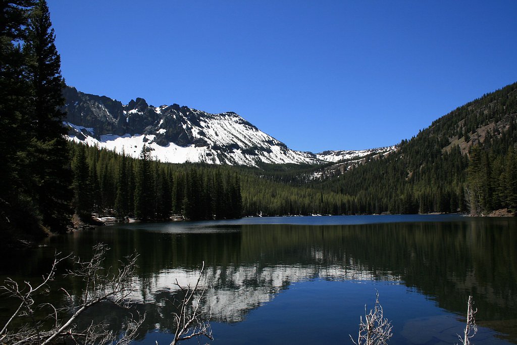
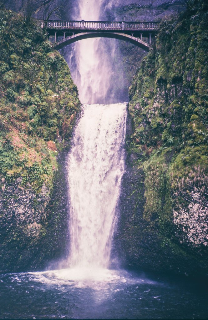
Strawberry Falls is a picturesque waterfall tucked into the Strawberry Mountain Wilderness in eastern Oregon, managed by the U.S. Forest Service within Malheur National Forest (NF). The falls are prized for their serene setting and the easy access from trails that lead down toward nearby Strawberry Lake, making this a favorite outing for hikers and nature lovers seeking a peaceful alpine water feature. The hike to Strawberry Falls is approachable and welcoming to most skill levels: it follows an out-and-back route through lush forest, with opportunities to pause for lake views and quiet wildlife observation. Managed by the USFS, the site feels remote yet easily reachable for a half-day adventure, offering a classic Oregon mountain-wilderness experience without a long slog in.
The Setting
Strawberry Falls sits at 6,634 feet within Malheur National Forest, in the high mountains of Oregon.
Trail & Hike Details
The Approach
The easy 2.5-mile out-and-back trail gains 400 feet of elevation on the way to the falls.
Trail Description
This is an easy, 2.5-mile out-and-back route with about 400 feet of elevation gain. The trail is well-defined and passes through shaded forest, opening occasionally to views of Strawberry Lake before dropping a short distance to the falls. The route is straightforward and family-friendly, suitable for hikers looking for a relaxed day hike in the Malheur National Forest (managed by the USFS).
What to Expect
Dogs are welcome.
Accessibility
The trail is not wheelchair accessible. Uneven terrain and elevation changes require steady footing.
Frequently Asked Questions
🐶 Are Dogs Allowed at Strawberry Falls?
✅ Dogs are allowed
Are There Any Fees or Permits Required?
🤑 Fee: $5.00
🏊 Is There Swimming at Strawberry Falls?
❌ Swimming is not allowed
When to Visit
The best time to visit Strawberry Falls is in late spring or early summer when the waterfall is at its fullest due to snowmelt. Fall also offers beautiful foliage, while summer provides warm weather for hiking.
Seasonal Access
The best time to visit is Spring, Summer, and Fall. Access roads and trails may close during winter due to snow. Check with Malheur National Forest for seasonal road closures.
Safety Information
Be prepared for changing weather conditions, especially at higher elevations. Carry a map or GPS device, as cell service may be limited. Watch for slippery rocks near the waterfall.
7-Day Flow Outlook
Based on the USGS gauge JOHN DAY R AT BLUE MTN HOT SPGS NR PRAIRIE CITY,OR (12 km away).
Today
Barely Flowing
26 cfs
2/10Tomorrow
Barely Flowing
27 cfs
2/10Tue
Barely Flowing
26 cfs
5/10Wed
Barely Flowing
26 cfs
2/10Thu
Barely Flowing
27 cfs
2/10Fri
Barely Flowing
27 cfs
2/10Sat
Barely Flowing
27 cfs
2/10Best window: Tue — barely flowing flow, mostly sunny (trip score 5/10).
Best time of year: this gauge typically runs highest from late March to late June, peaking in May.
How we calculate this
This is a transparent outlook, not a precise forecast. We take the waterfall's current flow strength (how it ranks against its historical normal for today, from the nearest USGS stream gauge), carry that ranking forward along the gauge's seasonal curve, and nudge it for forecast rain. Confidence is highest for the next day or two and falls further out. Always check official conditions and your own judgment before visiting — high flows can be dangerous.
Know when to go.
Get a free email alert when waterfalls near Prairie City hit peak flow. We only send when conditions are worth the trip — no weekly newsletters, no spam.
Is Strawberry Falls Frozen?
Updated about 21 hours agoNot frozen highs above freezing lately north-facing, shaded 5 more freezing days forecast
Strawberry Falls is not frozen right now; highs have been above freezing. Yesterday ran 46°F to 30°F. 5 freezing days are forecast, so ice may start to form.
- Days below freezing
- 0 of the last 14
- Current cold streak
- 0 days
- Freezing days ahead
- 5 of the next 7
- Flow
- 25 ft³/s
Winter safety. Frozen falls are the one waterfall trip with a documented injury pattern: falling ice, and ice-glazed rock and trail. Wear microspikes, keep well back from the base and from overhangs, and never walk out on ice over moving water.
Estimate from Open-Meteo daily temperatures at the falls, the LiDAR-measured facing direction, and the nearest stream gauge. It is a likelihood, not a report from the trail. See every frozen waterfall in Oregon.
Weather Forecast
The Terrain, Seen by LiDAR
Aircraft-mounted lasers measured this ground to within inches. Trees and buildings are digitally stripped away, leaving the bare shape of the land the water has carved.
Along the line through the falls, the bare ground drops about 240 feet, most of it in one sheer step, the signature of a plunge waterfall. The ground at the falls is roughly 6,628 feet above sea level.
The ground changes about 204 feet in the 500 feet above the falls and 47 feet in the 500 feet below. Facing north, the falls stay mostly shaded, with soft, even light all day.
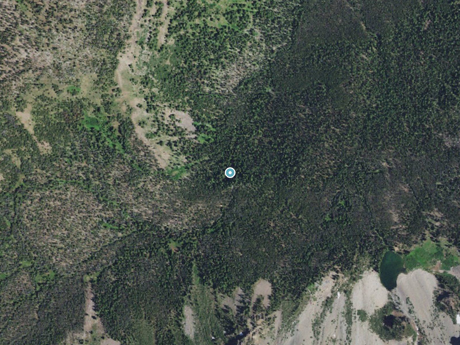
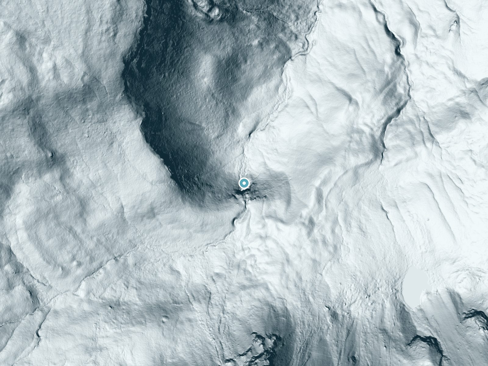
Drag to compare. The dot marks the waterfall. The frame is about a mile across.
- Ground elevation
- 6,628 feet
- Measured by 1-meter lidar
- Drop at the falls
- About 240 feet
- Change in ground height within ~250 feet of the falls
- Faces
- North
- Mostly shaded, so the light stays soft and even all day.
A slice through the lidar ground surface, from above the falls to downstream (heading north).
Elevation data: USGS 3D Elevation Program. Aerial imagery: USGS The National Map. Public domain.
Location & Access
Getting There
Strawberry Falls is accessed via the Strawberry Basin Trailhead, which is located near Prairie City, Oregon. From Prairie City, take County Road 60 to Forest Road 6001, which leads to the trailhead.
Get Directions on Google MapsParking
Parking is available at the Strawberry Basin Trailhead. The parking area may be limited during peak seasons, so arriving early is recommended.
Elevation
6,634 feet above sea level
Coordinates
44.296424° N, -118.693224° W
Land Management
Managed by USFS
Visitor Tips & Gear
Wear sturdy hiking shoes, as the trail may be uneven in some areas. Bring insect repellent during the summer months, as mosquitoes can be present. Arrive early to secure parking and enjoy the trail before it gets crowded.
This trail sits at 6,634 ft above sea level
Elevated TrailUV radiation is roughly 27% stronger at this elevation than at sea level, and the dry air accelerates dehydration. Extra sun protection and fluids go a long way.
As an Amazon Associate, we earn from qualifying purchases.

Coppertone Sport SPF 50 Sunscreen
UV intensity jumps ~4% per 1,000 ft — at this elevation you can burn in half the time.

Sun Bum SPF 30 Lip Balm (3-Pack)
Lips have almost no natural UV protection and burn fast in thin, dry mountain air.

Liquid I.V. Electrolyte Packets
You lose moisture ~2x faster at elevation — electrolytes help you absorb water efficiently.

ROCKNIGHT Polarized UV400 Sunglasses
High-altitude glare off rock and water is intense — UV400 lenses block 99%+ of UVA/UVB.
As an Amazon Associate, we earn from qualifying purchases.
This easy 2.5 miles hike is straightforward — comfortable trail shoes and plenty of water should do. Sun exposure on the trail makes good sun protection a must in summer.

Polarized Sunglasses (Knockaround)
Cuts glare off the water so you actually see the falls — and your photos turn out better too.

Columbia Watertight II Rain Jacket
Packs into its own pocket, seam-sealed, and keeps you dry from spray and surprise rain.

Earth Pak Waterproof Dry Bag
Keeps your phone and gear dry when waterfall mist soaks everything else.
Waterproof Phone Pouch (AiRunTech)
Cheap insurance — take photos right next to the falls without killing your phone.

JOBY GorillaPod Starter Kit
Wraps around railings and rocks for long-exposure waterfall shots — no flat surface needed.

Osprey Daylite Daypack
Light, organized, and just the right size for a day hike — fits water, snacks, and layers.
Where to Stay

John Day Motel

Best Western John Day Inn

Dreamers Lodge

John Day Lakehouse w/ a Great Outdoor Space!
Browse vacation cabins and private rentals nearby
Unique outdoor stays — tents, yurts, and treehouses
Rent a campervan or RV for your waterfall road trip
Some links are affiliate links. We may earn a commission at no extra cost to you.
Nearby Campground
Big Creek Campground
8.5 miles away · 15 sites
Overview Big Creek Campground sits at the edge of beautiful Logan Valley along Big Creek and is a great starting point for multiple recreation opportunities, including mountain biking, hiking, stream fishing, hunting and bird watching and exploring the Strawberry Mountain Wilderness. In the spring and early summer the area is exceptional for wildflower viewing.Recreation Big Creek Campground offers a central base for all your recreation activities. From casting a line in Big Creek to biking nearb
Book on Recreation.govNearby Hot Springs
Hot springs near Baker City, Oregon

Limekiln Hot Spring
Limekiln Hot Spring emerges at 70°F just 1.7 meters from Indian Creek Road in Grant County, making it one of Oregon's most acce...
Blue Mountain Hot Springs
Blue Mountain Hot Springs flows at 136°F in Grant County at 4,259 feet elevation, requiring a 670-foot walk from Summit Prairie...
Joaquin Miller Hot Springs
Joaquin Miller Hot Springs flows at 104°F, registering 57 degrees above ambient at 3,942 feet elevation in Grant County's fores...
Mount Vernon Hot Springs
Mount Vernon Hot Springs flows at 121°F in Grant County's mountains, emerging at 3,448 feet elevation and running 72 degrees ab...
Unnamed Spring Harney County 2
This spring emerges at 165°F just 70 meters from Clark Lane in Harney County, making it one of the hottest roadside-accessible ...
Unnamed Spring Harney County 1
An unnamed thermal spring in Harney County emerges at 72°F at 4,205 feet elevation near Burns, running 23 degrees above the amb...
Looking for a soak after your hike? Explore more hot springs near Baker City, Oregon on SoakingSprings.
Explore Oregon springsAdditional Information
Nearby Attractions
Strawberry Lake, Strawberry Mountain, and other trails in the Strawberry Mountain Wilderness.
Wildlife
The area is home to a variety of wildlife, including deer, birds, and small mammals. Be cautious of bears and other larger animals in the wilderness.
Cities near Strawberry Falls
Nearby Waterfalls
Writing about Strawberry Falls? Embed this waterfall on your site for free.