Slide Falls
By Armen Suny · Last verified Mar 2026
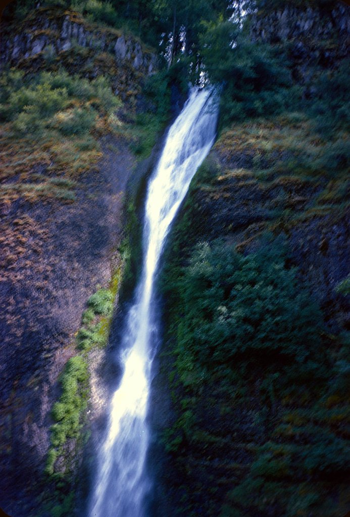
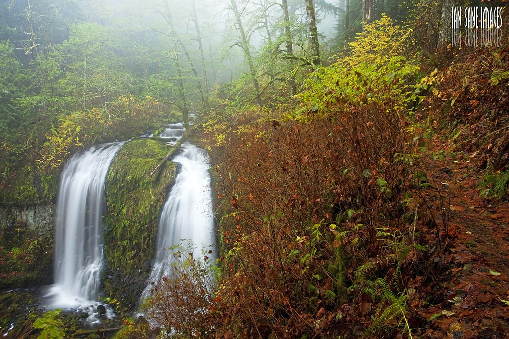
Photo Credits (5)
Difficulty
Moderate
Trail Length
2.0 miles
Trail Type
Out And Back
Elevation Gain
300 ft
About Slide Falls
Slide Falls is a picturesque, lesser-known waterfall tucked into Malheur National Forest and managed by the U.S. Forest Service. Its forested setting and relatively low visitation make this a peaceful stop for hikers and photographers looking for a quieter outdoor experience in eastern Oregon. The falls are reached by a short, accessible hike that rewards visitors with the sound and sight of cascading water set among native trees and understory. Access to Slide Falls is via a roughly 2.0-mile out-and-back trail that gains about 300 feet and is typically rated moderate. The nearest developed camping is Big Creek Campground, approximately 12.7 km away, so day-trip planning or a longer drive to a campsite is recommended. Because the falls sit on USFS land, standard forest rules and Leave No Trace practices apply—pack out what you bring in and respect trail closures or seasonal restrictions.
The Setting
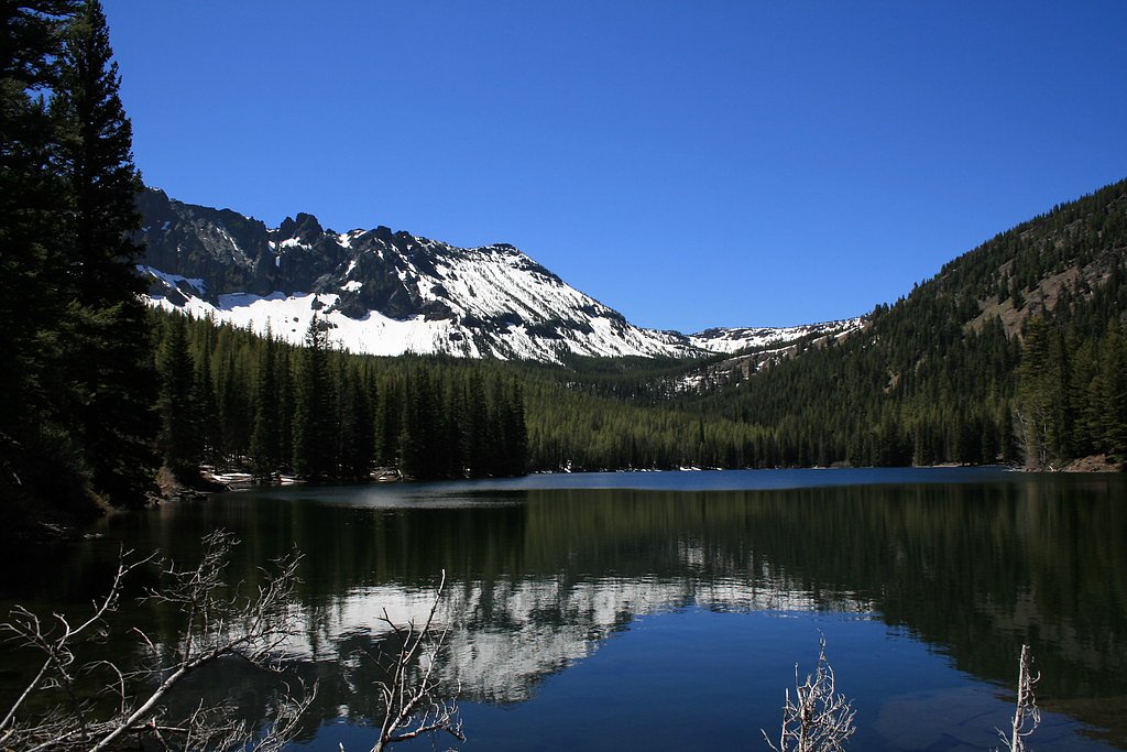
Slide Falls sits at 6,808 feet within Malheur National Forest, in the high mountains of Oregon.
Trail & Hike Details
The Approach
The moderate 2.0-mile out-and-back trail gains 300 feet of elevation on the way to the falls.
Trail Description
Hike type: out-and-back; distance: 2.0 miles; elevation gain: ~300 ft; difficulty: moderate. The route to Slide Falls winds through forested terrain and includes uneven tread and some steep sections that make the hike moderately challenging. The trail is managed by the U.S. Forest Service within Malheur National Forest—expect a natural, forest trail rather than paved surfaces, and plan footwear accordingly.
What to Expect
Visitors can expect a peaceful hike through dense forests leading to a beautiful waterfall. The area around the falls may be slippery, so caution is advised. Wildlife sightings are possible, and the trail is typically less crowded than more popular destinations.
Accessibility
The trail is not wheelchair accessible. Uneven terrain and elevation changes require steady footing.
Frequently Asked Questions
🐶 Are Dogs Allowed at Slide Falls?
❌ Dogs are not allowed
Are There Any Fees or Permits Required?
🆖 No fees required
🏊 Is There Swimming at Slide Falls?
❌ Swimming is not allowed
When to Visit
Spring and early summer are ideal for visiting Slide Falls, as the waterfall flow is typically strongest during these seasons.
Seasonal Access
The best time to visit is Spring, Summer, and Fall. Access roads and trails may close during winter due to snow. Check with Malheur National Forest for seasonal road closures.
Safety Information
The trail can be slippery, especially after rain. Wear appropriate footwear and stay on marked paths. Cell service may be limited, so plan accordingly.
Current Water Conditions
31 ft³/s
Current discharge — how much water is flowing
Much lower than usual for this time of year
1.21 ft
Water depth at gauge
7-Day Discharge Trend
What does this mean for your visit?
Flow is well below normal for this time of year, so the waterfall may be a trickle.
About This Gauge
This gauge is on a nearby waterway and may not reflect exact conditions at the falls.
7-Day Flow Outlook
Based on the USGS gauge JOHN DAY R AT BLUE MTN HOT SPGS NR PRAIRIE CITY,OR (10 km away).
Today
Barely Flowing
31 cfs
4/10Tomorrow
Barely Flowing
33 cfs
3/10Sat
Low
33 cfs
4/10Sun
Low
33 cfs
4/10Mon
Barely Flowing
31 cfs
5/10Tue
Barely Flowing
29 cfs
5/10Wed
Barely Flowing
29 cfs
5/10Best window: Mon — barely flowing flow, mostly sunny (trip score 5/10).
Best time of year: this gauge typically runs highest from late March to late June, peaking in May.
How we calculate this
This is a transparent outlook, not a precise forecast. We take the waterfall's current flow strength (how it ranks against its historical normal for today, from the nearest USGS stream gauge), carry that ranking forward along the gauge's seasonal curve, and nudge it for forecast rain. Confidence is highest for the next day or two and falls further out. Always check official conditions and your own judgment before visiting — high flows can be dangerous.
Know when to go.
Get a free email alert when waterfalls near Prairie City hit peak flow. We only send when conditions are worth the trip — no weekly newsletters, no spam.
Weather Forecast
Location & Access
Getting There
Slide Falls is located in a remote area of Oregon. Access details may vary depending on the season, and visitors are advised to check local trail or park information for the most accurate directions.
Get Directions on Google MapsParking
Parking availability is uncertain, but visitors may need to park at a nearby trailhead or designated area. It is recommended to arrive early during peak seasons to secure a spot.
Elevation
6,808 feet above sea level
Coordinates
44.296859° N, -118.660282° W
Land Management
Managed by USFS
Visitor Tips & Gear
Wear sturdy hiking shoes due to uneven terrain. Bring plenty of water and snacks, as there are no facilities nearby. Check weather conditions before your visit, as rain can make the trail slippery.
This trail sits at 6,808 ft above sea level
Elevated TrailUV radiation is roughly 27% stronger at this elevation than at sea level, and the dry air accelerates dehydration. Extra sun protection and fluids go a long way.
As an Amazon Associate, we earn from qualifying purchases.

Coppertone Sport SPF 50 Sunscreen
UV intensity jumps ~4% per 1,000 ft — at this elevation you can burn in half the time.

Sun Bum SPF 30 Lip Balm (3-Pack)
Lips have almost no natural UV protection and burn fast in thin, dry mountain air.

Liquid I.V. Electrolyte Packets
You lose moisture ~2x faster at elevation — electrolytes help you absorb water efficiently.

ROCKNIGHT Polarized UV400 Sunglasses
High-altitude glare off rock and water is intense — UV400 lenses block 99%+ of UVA/UVB.
As an Amazon Associate, we earn from qualifying purchases.
With 2.0 miles and 300 ft of elevation gain, sturdy boots and trekking poles will help on this moderate trail. Sun exposure on the trail makes good sun protection a must in summer.

Polarized Sunglasses (Knockaround)
Cuts glare off the water so you actually see the falls — and your photos turn out better too.

Columbia Watertight II Rain Jacket
Packs into its own pocket, seam-sealed, and keeps you dry from spray and surprise rain.

Earth Pak Waterproof Dry Bag
Keeps your phone and gear dry when waterfall mist soaks everything else.

Waterproof Phone Pouch (AiRunTech)
Cheap insurance — take photos right next to the falls without killing your phone.

Timberland Euro Sprint Mid Waterproof
Trusted waterproof boot with premium leather and grippy rubber sole — reliable on rocky, wet trails.

TrailBuddy Trekking Poles
Lightweight aluminum, cork grips, and flip-locks that actually hold — a best-seller for good reason.
Where to Stay

John Day Motel

Best Western John Day Inn

Dreamers Lodge

John Day Lakehouse w/ a Great Outdoor Space!
Browse vacation cabins and private rentals nearby
Unique outdoor stays — tents, yurts, and treehouses
Rent a campervan or RV for your waterfall road trip
Some links are affiliate links. We may earn a commission at no extra cost to you.
Nearby Campground
Big Creek Campground
7.9 miles away · 15 sites
Overview Big Creek Campground sits at the edge of beautiful Logan Valley along Big Creek and is a great starting point for multiple recreation opportunities, including mountain biking, hiking, stream fishing, hunting and bird watching and exploring the Strawberry Mountain Wilderness. In the spring and early summer the area is exceptional for wildflower viewing.Recreation Big Creek Campground offers a central base for all your recreation activities. From casting a line in Big Creek to biking nearb
Book on Recreation.govNearby Hot Springs
Hot springs near Prairie City, Oregon
Blue Mountain Hot Springs
Blue Mountain Hot Springs flows at 136°F in Grant County at 4,259 feet elevation, requiring a 670-foot walk from Summit Prairie...

Limekiln Hot Spring
Limekiln Hot Spring emerges at 70°F just 1.7 meters from Indian Creek Road in Grant County, making it one of Oregon's most acce...
Joaquin Miller Hot Springs
Joaquin Miller Hot Springs flows at 104°F, registering 57 degrees above ambient at 3,942 feet elevation in Grant County's fores...
Mount Vernon Hot Springs
Mount Vernon Hot Springs flows at 121°F in Grant County's mountains, emerging at 3,448 feet elevation and running 72 degrees ab...
Unnamed Spring Harney County 2
This spring emerges at 165°F just 70 meters from Clark Lane in Harney County, making it one of the hottest roadside-accessible ...
Sitz Warm Spring
Sitz Warm Spring flows in Harney County near Burns at an unrecorded temperature, designated only as warm in historical surveys....
Looking for a soak after your hike? Explore more hot springs near Prairie City, Oregon on SoakingSprings.
Explore Oregon springsAdditional Information
Nearby Attractions
Other nearby waterfalls and hiking trails may be worth exploring. Check local guides for recommendations.
Wildlife
The area is home to various wildlife, including birds, deer, and small mammals. Be respectful of the natural habitat.
Cities near Slide Falls
Nearby Waterfalls
Other waterfalls named Slide Falls
2 other waterfalls share this name across the U.S.
Writing about Slide Falls? Embed this waterfall on your site for free.