
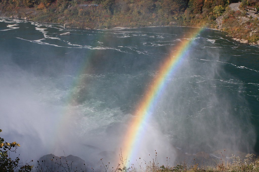
Stark Falls
By Armen Suny · Last verified Mar 2026


Photo Credits (5)
Difficulty
Moderate
Trail Length
2.4 miles
Trail Type
Out And Back
Elevation Gain
350 ft
About Stark Falls
Stark Falls is a scenic waterfall located along the Raquette River in the Adirondack region of New York. It is a roadside waterfall, making it easily accessible for visitors. The falls are part of a series of cascades in the area and are known for their picturesque views and the surrounding natural beauty.
The Setting
Stark Falls sits at 1,306 feet along the Raquette River, in the foothills of New York.
Trail & Hike Details
The Approach
The moderate 2.4-mile out-and-back trail gains 350 feet of elevation on the way to the falls.
Trail Description
No hiking is required to view Stark Falls as it is a roadside waterfall. Visitors can enjoy the view from the pull-off area or walk a short distance along the road for a better perspective.
What to Expect
Dogs are welcome.
Accessibility
The trail is not wheelchair accessible. Uneven terrain and elevation changes require steady footing.
Frequently Asked Questions
🐶 Are Dogs Allowed at Stark Falls?
✅ Dogs are allowed
Are There Any Fees or Permits Required?
🆖 No fees required
🏊 Is There Swimming at Stark Falls?
❌ Swimming is not allowed
When to Visit
Spring and early summer are ideal times to visit Stark Falls due to higher water levels from snowmelt and rainfall.
Seasonal Access
The best time to visit is Spring, Summer, Fall, and Winter.
Safety Information
Exercise caution when parking along the roadside and avoid getting too close to the water's edge, as the rocks can be slippery. Be mindful of traffic when walking near the road.
Current Water Conditions
2,330 ft³/s
Current discharge — how much water is flowing
Higher than usual for this time of year
Based on 65 years of record
5.11 ft
Water depth at gauge
7-Day Discharge Trend
What does this mean for your visit?
The water is flowing higher than usual for this time of year.
About This Gauge
This gauge is on a nearby waterway and may not reflect exact conditions at the falls.
7-Day Flow Outlook
Based on the USGS gauge RAQUETTE RIVER AT SOUTH COLTON NY (11 km away).
Today
Moderate
2656 cfs
6/10Tomorrow
Moderate
3044 cfs
6/10Fri
Moderate
2881 cfs
6/10Sat
Moderate
2247 cfs
6/10Sun
Moderate
2717 cfs
6/10Mon
Moderate
2602 cfs
6/10Tue
Moderate
2553 cfs
6/10Best window: Today — moderate flow, chance showers and thunderstorms then mostly sunny (trip score 6/10).
Best time of year: this gauge typically runs highest from early March to early June, peaking in April.
How we calculate this
This is a transparent outlook, not a precise forecast. We take the waterfall's current flow strength (how it ranks against its historical normal for today, from the nearest USGS stream gauge), carry that ranking forward along the gauge's seasonal curve, and nudge it for forecast rain. Confidence is highest for the next day or two and falls further out. Always check official conditions and your own judgment before visiting — high flows can be dangerous.
Know when to go.
Get a free email alert when waterfalls near Cranberry Lake hit peak flow. We only send when conditions are worth the trip — no weekly newsletters, no spam.
Weather Forecast
Location & Access
Getting There
Stark Falls is located along Route 56 in the Adirondack Park. The falls are visible from the road, and there is a small pull-off area nearby for parking.
Get Directions on Google MapsParking
There is a small roadside pull-off area near the falls where visitors can park. Parking may be limited during busy times.
Elevation
1,306 feet above sea level
Coordinates
44.451571° N, -74.766877° W
Visitor Tips & Gear
Visit during spring or after heavy rains for the most impressive water flow. Be cautious when parking along the roadside, as traffic may be present.
As an Amazon Associate, we earn from qualifying purchases.
With 2.4 miles and 350 ft of elevation gain, sturdy boots and trekking poles will help on this moderate trail. Icy conditions are common in winter — traction cleats are a smart addition.

Columbia Watertight II Rain Jacket
Packs into its own pocket, seam-sealed, and keeps you dry from spray and surprise rain.

Polarized Sunglasses (Knockaround)
Cuts glare off the water so you actually see the falls — and your photos turn out better too.

Earth Pak Waterproof Dry Bag
Keeps your phone and gear dry when waterfall mist soaks everything else.

Waterproof Phone Pouch (AiRunTech)
Cheap insurance — take photos right next to the falls without killing your phone.

Timberland Euro Sprint Mid Waterproof
Trusted waterproof boot with premium leather and grippy rubber sole — reliable on rocky, wet trails.

TrailBuddy Trekking Poles
Lightweight aluminum, cork grips, and flip-locks that actually hold — a best-seller for good reason.
Where to Stay

Camp Lake Bear

Fairfield Inn & Suites by Marriott Canton

White Pine Camp

Best Western Potsdam University Park Inn
Browse vacation cabins and private rentals nearby
Unique outdoor stays — tents, yurts, and treehouses
Rent a campervan or RV for your waterfall road trip
Some links are affiliate links. We may earn a commission at no extra cost to you.
Additional Information
Nearby Attractions
Other waterfalls along the Raquette River, such as Jamestown Falls and Moody Falls. The Adirondack Park also offers numerous hiking trails and scenic drives.
Wildlife
The area around Stark Falls is home to various wildlife, including birds, deer, and small mammals. Keep an eye out for bald eagles and other bird species near the river.
Cities near Stark Falls
Nearby Waterfalls

Writing about Stark Falls? Embed this waterfall on your site for free.