Photo Credits (2)
Difficulty
Moderate
Trail Length
2.4 miles
Trail Type
Out And Back
Elevation Gain
350 ft
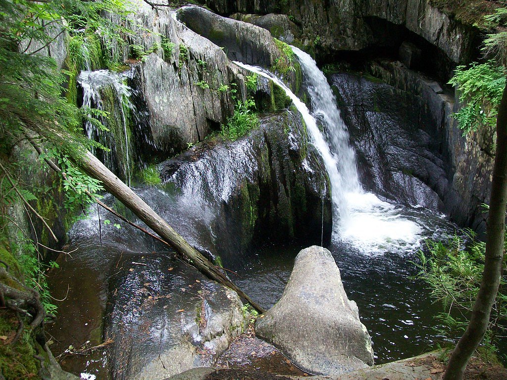
About Stair Falls
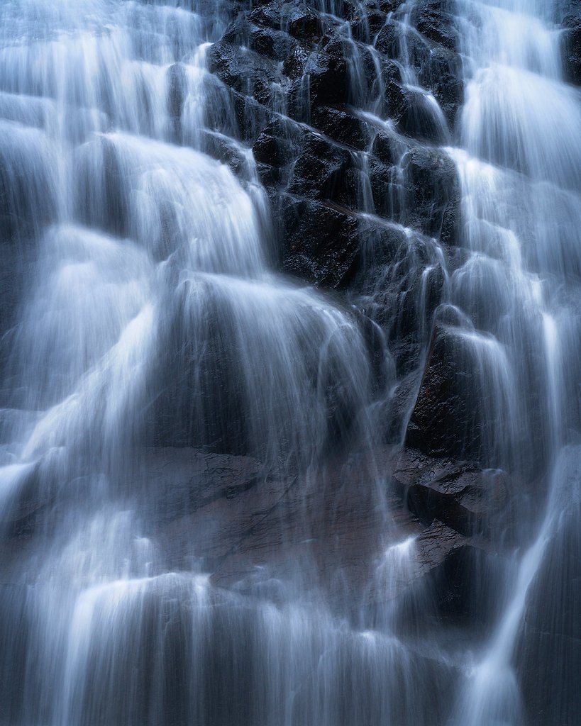
Stair Falls is a series of stair-step cascades on the St. Croix River near the U.S.–Canada border. The falls thread through a rocky river channel, making them a rewarding destination for paddlers who can approach the cascades from the water and for hikers who enjoy rugged riverine scenery and quiet wildlife viewing along the shore. On foot, access follows a roughly 2.4-mile out-and-back route that climbs about 350 feet and is generally rated moderate; the hiking approach can be uneven and is not extensively maintained, so many visitors choose to combine a paddle with short shoreline walks for the best views. The nearest managed camping is at Katahdin Woods and Waters National Monument (camping and huts), approximately 37.11 km away.
The Setting
Stair Falls sits at 531 feet along the Seboeis River, in the foothills of Maine.
Trail & Hike Details
The Approach
The moderate 2.4-mile out-and-back trail gains 350 feet of elevation on the way to the falls.
Trail Description
Route type: out-and-back, distance: ~2.4 miles, elevation gain: ~350 feet, difficulty: moderate. Official trail surface, grade, and any USFS trail number for the route to Stair Falls are not available; the hiking approach can be informal with variable footing and limited signage. Because the St. Croix River provides direct water access, many visitors reach the cascades by canoe or kayak for close-up views, while hikers should be prepared for uneven terrain and route-finding. Nearest established camping: Katahdin Woods and Waters National Monument Camping and Huts — about 37.11 km away.
What to Expect
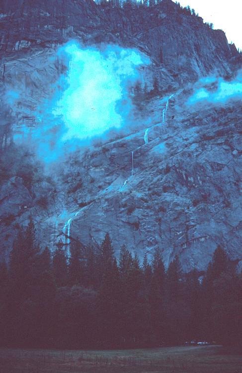
Visitors can expect a series of picturesque cascades surrounded by dense forest. The area is remote and offers a peaceful, natural setting. The falls are particularly striking during periods of high water flow, such as in spring or after heavy rains.
Accessibility
The trail is not wheelchair accessible. Uneven terrain and elevation changes require steady footing.
Frequently Asked Questions
🐶 Are Dogs Allowed at Stair Falls?
❌ Dogs are not allowed
Are There Any Fees or Permits Required?
🆖 No fees required
🏊 Is There Swimming at Stair Falls?
❌ Swimming is not allowed
When to Visit
Spring and early summer are ideal times to visit, as water levels are typically higher, enhancing the beauty of the falls.
Seasonal Access
The best time to visit is Spring, Summer, and Fall. Winter access may be limited.
Safety Information
The area is remote, so visitors should be prepared for limited cell service and bring adequate supplies. If paddling, be aware of river conditions and potential hazards such as strong currents or submerged rocks.
Current Water Conditions
Based on a USGS gauge 15.1 miles away
198 ft³/s
Current discharge — how much water is flowing
About average for this time of year
Based on 28 years of record
5.50 ft
Water depth at gauge
7-Day Discharge Trend
What does this mean for your visit?
Flow is about average for this time of year.
About This Gauge
This gauge is on a regional waterway. Conditions at the falls may differ, especially after local rain.
7-Day Flow Outlook
Based on the USGS gauge Seboeis River near Shin Pond, Maine (24 km away).
Today
Barely Flowing
214 cfs
3/10Tomorrow
Low
220 cfs
4/10Sun
Low
247 cfs
3/10Mon
Barely Flowing
259 cfs
5/10Tue
Barely Flowing
233 cfs
3/10Wed
Low
228 cfs
3/10Thu
Low
218 cfs
4/10Best window: Mon — barely flowing flow, sunny (trip score 5/10).
Best time of year: this gauge typically runs highest from late March to late May, peaking in April.
How we calculate this
This is a transparent outlook, not a precise forecast. We take the waterfall's current flow strength (how it ranks against its historical normal for today, from the nearest USGS stream gauge), carry that ranking forward along the gauge's seasonal curve, and nudge it for forecast rain. Confidence is highest for the next day or two and falls further out. Always check official conditions and your own judgment before visiting — high flows can be dangerous.
Know when to go.
Get a free email alert when waterfalls near Island Falls hit peak flow. We only send when conditions are worth the trip — no weekly newsletters, no spam.
Weather Forecast
Location & Access
Getting There
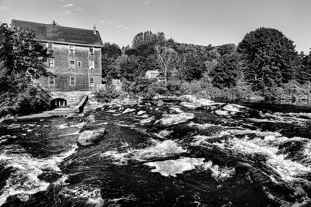
Stair Falls is located along the St. Croix River, accessible via nearby trails or by paddling on the river. The closest access point is typically through the town of Vanceboro, Maine. Visitors should consult local maps or guides for specific directions.
Get Directions on Google MapsParking
Parking availability is limited and may depend on the chosen access point. Visitors should plan ahead and check for designated parking areas near trailheads or river access points.
Elevation
531 feet above sea level
Coordinates
46.113328° N, -68.320259° W
Visitor Tips & Gear
Bring a detailed map or GPS device, as the area is remote and trails may not be well-marked. If paddling, ensure you have the proper equipment and experience for navigating the river. Check weather and river conditions before visiting.
As an Amazon Associate, we earn from qualifying purchases.
With 2.4 miles and 350 ft of elevation gain, sturdy boots and trekking poles will help on this moderate trail. Sun exposure on the trail makes good sun protection a must in summer.

Polarized Sunglasses (Knockaround)
Cuts glare off the water so you actually see the falls — and your photos turn out better too.

Columbia Watertight II Rain Jacket
Packs into its own pocket, seam-sealed, and keeps you dry from spray and surprise rain.

Earth Pak Waterproof Dry Bag
Keeps your phone and gear dry when waterfall mist soaks everything else.

Waterproof Phone Pouch (AiRunTech)
Cheap insurance — take photos right next to the falls without killing your phone.

Timberland Euro Sprint Mid Waterproof
Trusted waterproof boot with premium leather and grippy rubber sole — reliable on rocky, wet trails.

TrailBuddy Trekking Poles
Lightweight aluminum, cork grips, and flip-locks that actually hold — a best-seller for good reason.
Where to Stay

All Season Fun and Cozy Home in Island Falls, ME

Family-Friendly Home with Furnish Patio in Crystal!

Sewall House Yoga Retreat

Peaceful Oakfield Cabin on Mattawamkeag River!
Browse vacation cabins and private rentals nearby
Unique outdoor stays — tents, yurts, and treehouses
Rent a campervan or RV for your waterfall road trip
Some links are affiliate links. We may earn a commission at no extra cost to you.
Nearby Campground
Katahdin Woods and Waters National Monument Camping and Huts
23.1 miles away · 27 sites
Overview Katahdin Woods and Waters National Monument is located in Maine’s north woods. Katahdin Woods and Waters protects part of an extraordinary natural and cultural landscape: the mountains, woods, and waters where the East Branch of the Penobscot River and its tributaries, including the Wassataquoik Stream and the Seboeis River, run freely. Campsites, lean-tos and huts located throughout the monument provide opportunities to stay overnight while hiking, biking, paddling and enjoying other re
Book on Recreation.govAdditional Information
Nearby Attractions
The St. Croix River offers additional opportunities for paddling and exploring. Nearby, visitors can also explore the town of Vanceboro or other natural areas along the Maine-Canada border.
Wildlife
The area is home to a variety of wildlife, including birds, deer, and other forest animals. Visitors may also spot aquatic species in the river.
Cities near Stair Falls
Nearby Waterfalls
Other waterfalls named Stair Falls
2 other waterfalls share this name across the U.S.
Writing about Stair Falls? Embed this waterfall on your site for free.