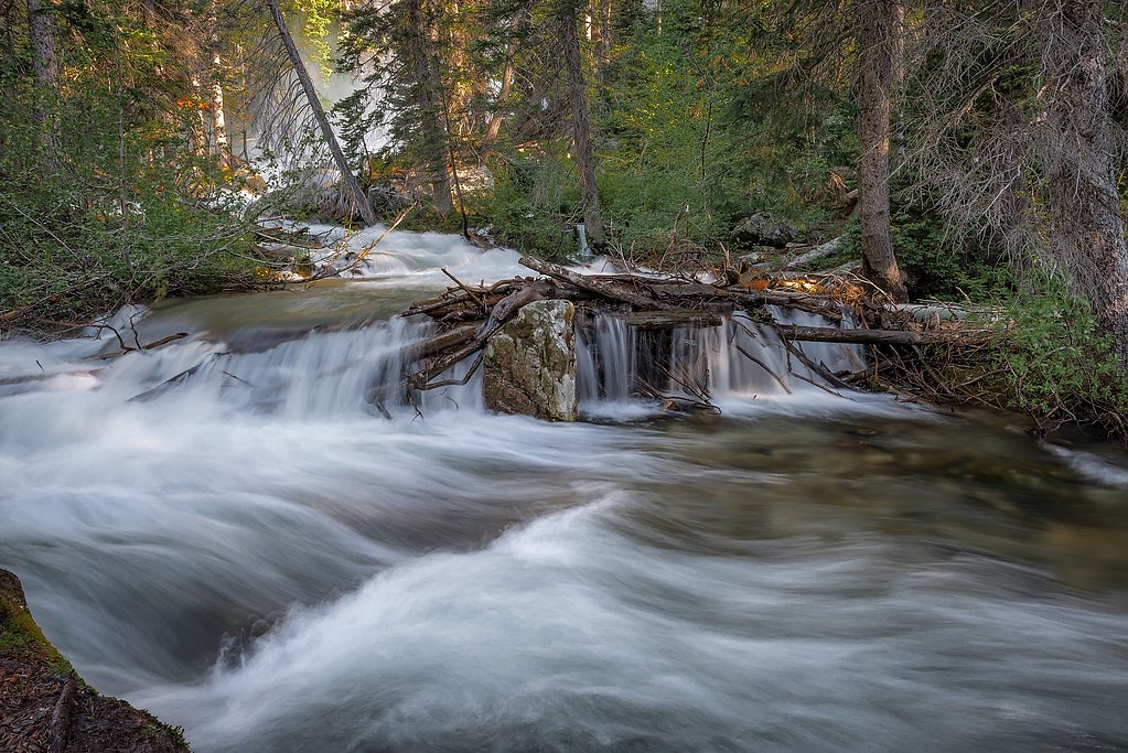
Spring Creek Falls
By Armen Suny · Last verified Mar 2026
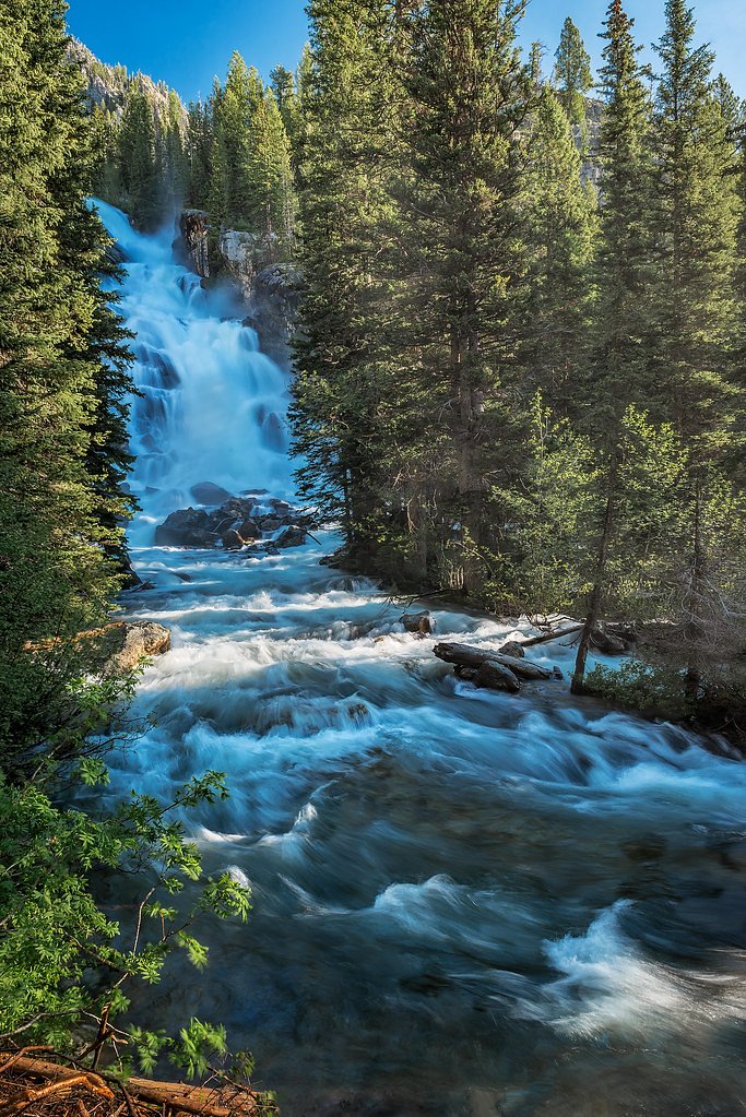
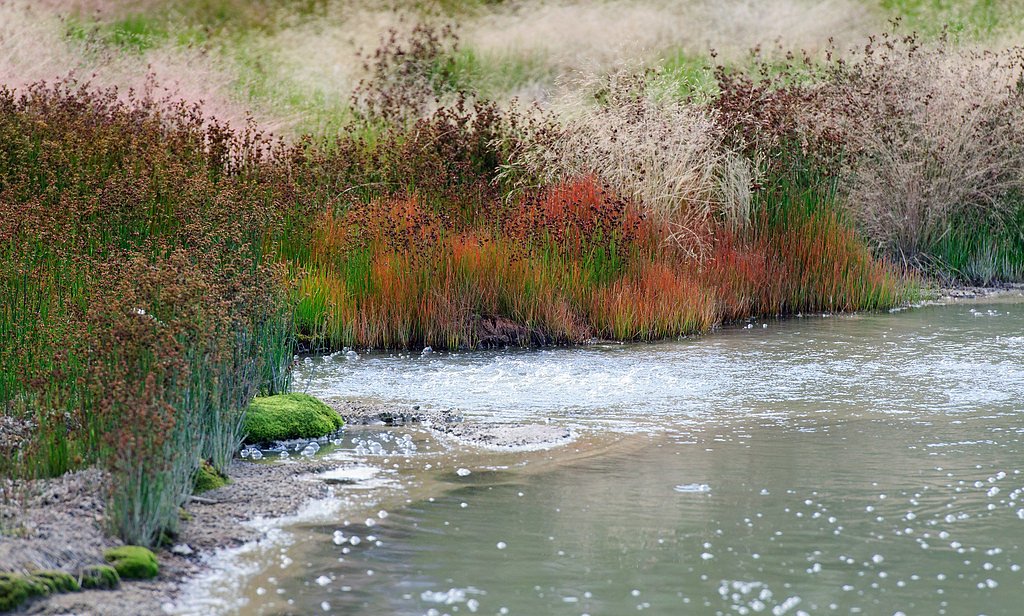
Photo Credits (5)
Difficulty
Easy
Trail Length
2.5 miles
Trail Type
Out And Back
Elevation Gain
300 ft
About Spring Creek Falls
Spring Creek Falls tumbles through a wooded basin in Bridger National Forest, offering a quiet, picture-book waterfall experience managed by the U.S. Forest Service. The falls are reached via the Spring Creek (Greys River) Trail — USFS Trail #3042 — and sit amid mixed forest that makes for a peaceful half-day outing or picnic stop. The setting is approachable and shaded, a favorite for hikers who want a scenic payoff without a long, strenuous approach. The trail to the falls is commonly done as an out-and-back route of about 2.5 miles with roughly 300 feet of elevation gain, making it an easy choice for families or casual hikers. For those planning an overnight or group stop, the Cottonwood Group Picnic Site is nearby (about 6.18 km away), and the whole area is administered by the U.S. Forest Service within Bridger National Forest.
The Setting
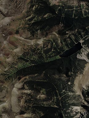
Spring Creek Falls sits at 8,409 feet within Bridger National Forest, fed by the Crow Creek, in the high alpine of Wyoming.
Trail & Hike Details
The Approach
The easy hike follows Spring Creek (Greys River) (#3042), a 2.5-mile out-and-back trail over natural surface. Expect 300 feet of elevation gain. The trail is developed (Class 3).
USFS Trail
SPRING CREEK (GREYS RIVER) #3042
Trail Class
Developed
Surface
USFS Segment
3.96 miTrail Description
Spring Creek (Greys River) Trail — USFS Trail #3042 — is listed in USFS GIS at 3.96 miles but is frequently described by visitors as a roughly 2.5-mile out-and-back route to the falls with about 300 feet of elevation gain. The USFS classifies the trail as Class 3 and records the tread surface as NATIVE MATERIAL (natural tread). Overall difficulty is rated easy for most hikers; the route is predominantly native-surface trail, moderate in grade, and ends at the base of the falls, making it suitable for day trips and hikers seeking a short, well-rewarded hike.
What to Expect
Dogs are welcome.
Accessibility
The trail is not wheelchair accessible. Uneven terrain and elevation changes require steady footing.
Frequently Asked Questions
🐶 Are Dogs Allowed at Spring Creek Falls?
✅ Dogs are allowed
Are There Any Fees or Permits Required?
🆖 No fees required
🏊 Is There Swimming at Spring Creek Falls?
❌ Swimming is not allowed
When to Visit
The best time to visit is in late spring or early summer when the water flow is strongest. Fall is also a great time to visit for cooler weather and colorful foliage.
Seasonal Access
The best time to visit is Spring, Summer, and Fall. Access roads and trails may close during winter due to snow. Check with Bridger National Forest for seasonal road closures.
Safety Information
Be cautious of slippery rocks near the waterfall. Check weather conditions before your visit, as the trail and access roads may become hazardous during rain or snow.
Current Water Conditions
40 ft³/s
Current discharge — how much water is flowing
Much lower than usual for this time of year
Based on 21 years of record
2.08 ft
Water depth at gauge
7-Day Discharge Trend
What does this mean for your visit?
Flow is well below normal for this time of year, so the waterfall may be a trickle.
About This Gauge
This gauge is on a nearby waterway and may not reflect exact conditions at the falls.
7-Day Flow Outlook
Based on the USGS gauge CROW CREEK NEAR FAIRVIEW, WY (22 km away).
Today
Barely Flowing
42 cfs
5/10Tomorrow
Low
46 cfs
3/10Fri
Low
47 cfs
3/10Sat
Low
48 cfs
3/10Sun
Low
44 cfs
4/10Mon
Barely Flowing
40 cfs
5/10Tue
Barely Flowing
37 cfs
5/10Best window: Today — barely flowing flow, mostly sunny (trip score 5/10).
Best time of year: this gauge typically runs highest from early April to early July, peaking in May.
How we calculate this
This is a transparent outlook, not a precise forecast. We take the waterfall's current flow strength (how it ranks against its historical normal for today, from the nearest USGS stream gauge), carry that ranking forward along the gauge's seasonal curve, and nudge it for forecast rain. Confidence is highest for the next day or two and falls further out. Always check official conditions and your own judgment before visiting — high flows can be dangerous.
Know when to go.
Get a free email alert when waterfalls near Smoot hit peak flow. We only send when conditions are worth the trip — no weekly newsletters, no spam.
Weather Forecast
Location & Access
Getting There
Spring Creek Falls is located near the town of Pinedale, Wyoming. Access typically involves driving on forest roads, which may be unpaved and require a high-clearance vehicle during certain seasons.
Get Directions on Google MapsParking
There is a small parking area near the trailhead, but availability may be limited during peak seasons.
Elevation
8,409 feet above sea level
Coordinates
42.633722° N, -110.741128° W
Land Management
Managed by USFS
Visitor Tips & Gear
Wear sturdy shoes as the trail may be muddy or uneven in places. Bring insect repellent during the summer months, and check road conditions before heading out, especially in the spring or after heavy rains.
This trail sits at 8,409 ft — the air is noticeably thinner
High AltitudeSome visitors experience headaches, fatigue, or shortness of breath at this elevation. Take it slow, stay hydrated, and consider supplemental oxygen if you're coming from a lower altitude.
As an Amazon Associate, we earn from qualifying purchases.

Coppertone Sport SPF 50 Sunscreen
UV intensity jumps ~4% per 1,000 ft — at this elevation you can burn in half the time.

Sun Bum SPF 30 Lip Balm (3-Pack)
Lips have almost no natural UV protection and burn fast in thin, dry mountain air.

Liquid I.V. Electrolyte Packets
You lose moisture ~2x faster at elevation — electrolytes help you absorb water efficiently.

ROCKNIGHT Polarized UV400 Sunglasses
High-altitude glare off rock and water is intense — UV400 lenses block 99%+ of UVA/UVB.

Boost Oxygen 10L Canister (2-Pack)
Portable supplemental oxygen for quick relief from headaches and shortness of breath.

Altitude Rx OxyBoost Complex
Antioxidant formula designed to support your body's natural altitude acclimation.
As an Amazon Associate, we earn from qualifying purchases.
This easy 2.5 miles hike is straightforward — comfortable trail shoes and plenty of water should do. Sun exposure on the trail makes good sun protection a must in summer.

Polarized Sunglasses (Knockaround)
Cuts glare off the water so you actually see the falls — and your photos turn out better too.

Columbia Watertight II Rain Jacket
Packs into its own pocket, seam-sealed, and keeps you dry from spray and surprise rain.

Earth Pak Waterproof Dry Bag
Keeps your phone and gear dry when waterfall mist soaks everything else.

Waterproof Phone Pouch (AiRunTech)
Cheap insurance — take photos right next to the falls without killing your phone.

JOBY GorillaPod Starter Kit
Wraps around railings and rocks for long-exposure waterfall shots — no flat surface needed.

Osprey Daylite Daypack
Light, organized, and just the right size for a day hike — fits water, snacks, and layers.
Where to Stay

Townhomes on the Green

Fairfield Inn by Marriott Afton Star Valley

Mountain Retreat By the River Star Valley Getaway

Kodiak Mountain Resort
Browse vacation cabins and private rentals nearby
Unique outdoor stays — tents, yurts, and treehouses
Rent a campervan or RV for your waterfall road trip
Some links are affiliate links. We may earn a commission at no extra cost to you.
Nearby Campground
COTTONWOOD GROUP PICNIC SITE
3.8 miles away · 2 sites
Overview Cottonwood Group Picnic Site is located next to scenic Cottonwood Lake on the Salt River Mountains, surrounded by the forests of western Wyoming.Recreation The lake offers great canoeing and boating for smaller craft, as well as fishing for brook and cutthroat trout. Hiking, mountain biking, off-road vehicle and horseback riding trails are in the area.Facilities This day-use picnic site can accommodate up to 25 guests and 8-10 vehicles. Vault toilets and drinking water are provided. A gr
Book on Recreation.govNearby Hot Springs
Hot springs near Smoot, Wyoming
Johnson Springs
Johnson Springs emerges at 115 degrees Fahrenheit at 6,080 feet elevation in Lincoln County near Afton, located just 220 feet f...
Auburn Hot Springs
Auburn Hot Springs discharges water at 144°F in Wyoming's Salt River Range, making it one of the state's genuinely scalding the...

Astoria Mineral Hot Springs
Astoria Mineral Hot Springs flows at 99°F from a roadside location 75.9 meters from West Johnny Counts Road in Teton County, Wy...
Pescadero Warm Spring
Pescadero Warm Spring surfaces at a mild 79 degrees Fahrenheit in Bear Lake County, Idaho, sitting right along Pescadero Road a...

Soda Springs
The town of Soda Springs, Idaho sits atop a carbonated aquifer that produces thousands of mineral springs, a geological oddity ...
Steamboat Hot Spring
Steamboat Hot Spring emerges near Soda Springs in Caribou County at 88 degrees Fahrenheit, one of many thermal features dotting...
Looking for a soak after your hike? Explore more hot springs near Smoot, Wyoming on SoakingSprings.
Explore Wyoming springsAdditional Information
Nearby Attractions
Nearby attractions include Fremont Lake and the Wind River Range, which offer additional hiking and outdoor recreation opportunities.
Wildlife
The area is home to various wildlife, including deer, elk, and birds. Be cautious of bears and carry bear spray if hiking in the region.
Cities near Spring Creek Falls
Nearby Waterfalls
Writing about Spring Creek Falls? Embed this waterfall on your site for free.