

Photo Credits (5)
Difficulty
Moderate
Trail Length
2.0 miles
Trail Type
Out And Back
Elevation Gain
300 ft
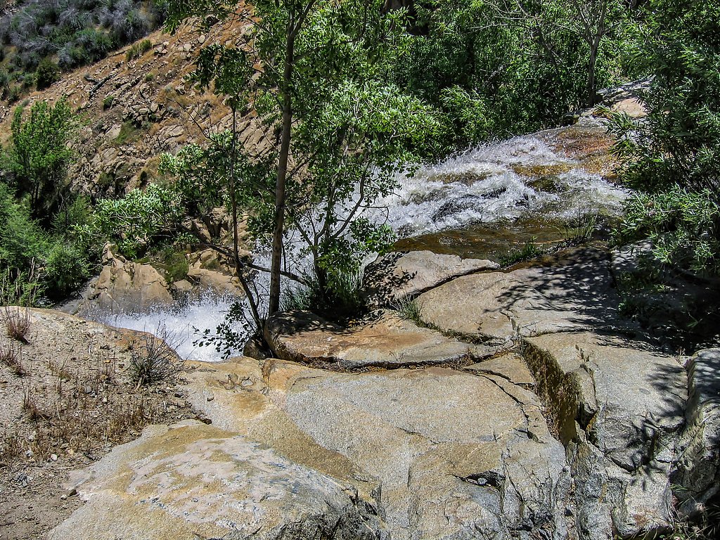
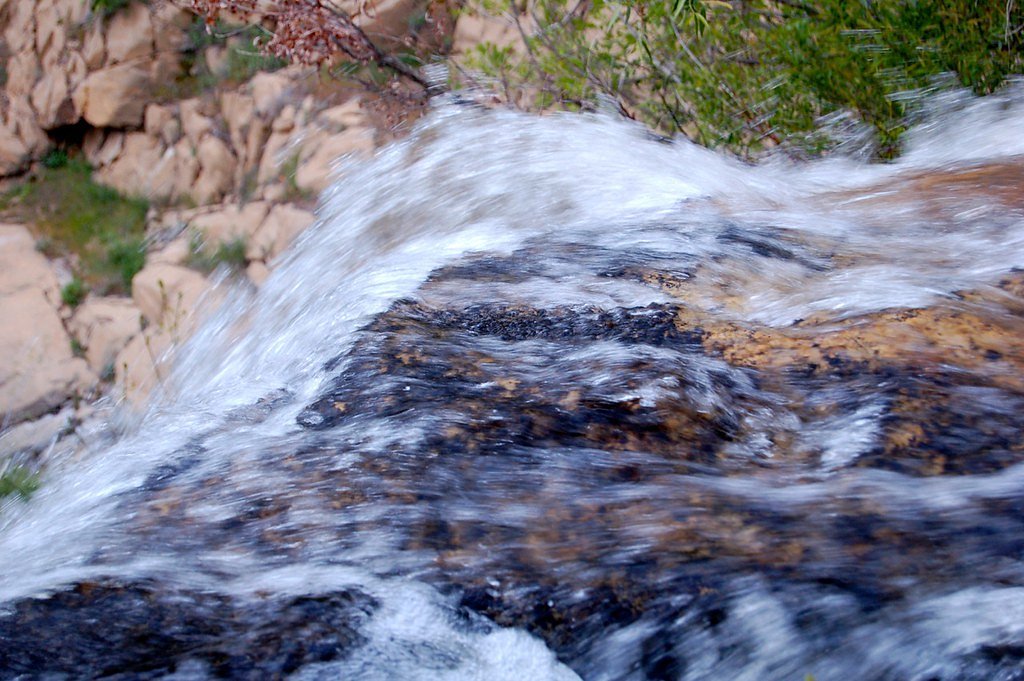
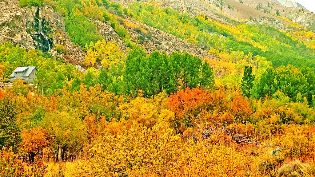
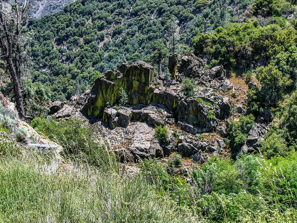
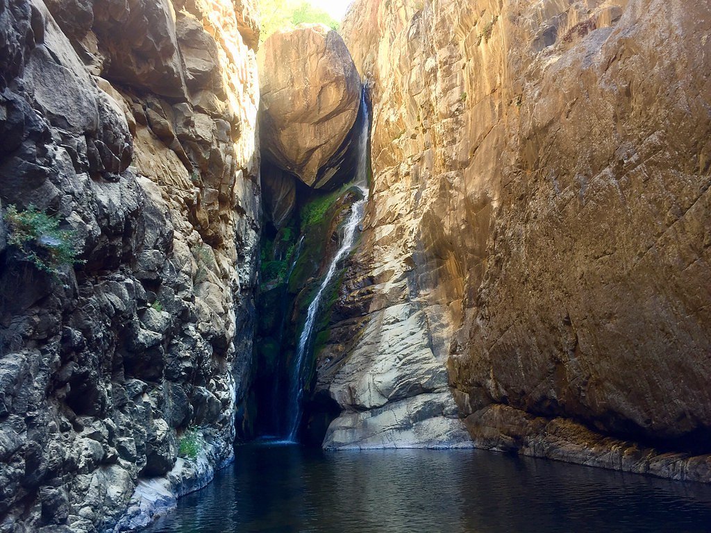
About South Creek Falls
South Creek Falls is a quietly scenic cascade tucked within Sequoia National Forest and managed by the U.S. Forest Service. The falls are at their most impressive in spring and early summer when mountain snowmelt feeds the creek, and the surrounding mixed-conifer forest makes for a peaceful, photo-friendly setting. Access to the falls is via the USFS Elephant Knob Trail (Trail #32E43), which delivers a compact, rewarding outing without a long drive into the backcountry. The hike to the falls is a moderate, out-and-back route of roughly 2.0 miles (GIS 1.8 miles) with about 300 feet of elevation gain—an ideal half-day trip for most day-hikers. If you want to turn this into an overnight trip, Redwood Meadow Campground lies nearby (about 9.11 km), offering a convenient place to camp before or after your visit.
The Setting
South Creek Falls sits at 3,950 feet within Sequoia National Forest, in the mountains of California.
Nearby Falls Worth Visiting
Salmon Creek Falls (120 ft) lies 5.4 miles to the southeast.
Trail & Hike Details
The Approach
The moderate hike follows Elephant Knob (#32E43), a 2.0-mile out-and-back trail over natural surface. Expect 300 feet of elevation gain with grades of 12-20%. The trail is developed (Class 3).
USFS Trail
ELEPHANT KNOB #32E43
Trail Class
Developed
Surface
Avg Grade
USFS Segment
1.80 miTrail Description
Elephant Knob Trail (USFS Trail #32E43) is a moderate Class 3 out-and-back of about 2.0 miles (GIS 1.8 miles) with approximately 300 feet of elevation gain. The tread is native material (dirt and natural rock) and typical grades run between 12–20%, so expect several sustained uphill sections. Class 3 indicates more uneven, steeper stretches where boots and sure footing are important; the surface can be rocky and occasionally uneven. The final approach opens to the cascade and surrounding greenery—sturdy footwear and basic route awareness will make the short hike more enjoyable.
What to Expect
Visitors can expect a peaceful hike through nature, culminating in a scenic waterfall. The area around the falls may be slippery, so caution is advised. Wildlife sightings are possible along the trail.
Accessibility
The trail is not wheelchair accessible. Uneven terrain and elevation changes require steady footing.
Frequently Asked Questions
🐶 Are Dogs Allowed at South Creek Falls?
❌ Dogs are not allowed
Are There Any Fees or Permits Required?
🆖 No fees required
🏊 Is There Swimming at South Creek Falls?
❌ Swimming is not allowed
When to Visit
The best time to visit South Creek Falls is during the spring and early summer when the water flow is strongest. Fall can also be a pleasant time to visit due to cooler temperatures and colorful foliage.
Seasonal Access
The best time to visit is Spring, Summer, and Fall. Winter access may be limited. Check with Sequoia National Forest for seasonal road closures.
Safety Information
Be cautious of slippery rocks near the waterfall. Check weather conditions before your visit, as rain can make the trail more challenging. Carry a first aid kit and let someone know your hiking plans.
Current Water Conditions
10 ft³/s
Current discharge — how much water is flowing
About average for this time of year
Based on 26 years of record
2.22 ft
Water depth at gauge
65°F
CoolRefreshing for swimming
7-Day Discharge Trend
What does this mean for your visit?
Flow is about average for this time of year. Water temperature is a refreshing 65 degrees F, good for a quick swim. PH is normal at 7.4 and mineral content is typical.
Water Quality
pH
NormalWithin healthy range (6.5-8.5)
Conductance
Dissolved minerals in the water
About This Gauge
This gauge is on a nearby waterway and may not reflect exact conditions at the falls.
7-Day Flow Outlook
Based on the USGS gauge SF TULE R NR CHOLOLLO CAMPGROUND NR PORTERVILLE CA (17 km away).
Today
Barely Flowing
10 cfs
5/10Tomorrow
Barely Flowing
10 cfs
5/10Mon
Barely Flowing
9 cfs
5/10Tue
Barely Flowing
9 cfs
5/10Wed
Barely Flowing
9 cfs
5/10Thu
Barely Flowing
9 cfs
5/10Fri
Barely Flowing
9 cfs
5/10Best window: Today — barely flowing flow, sunny (trip score 5/10).
Best time of year: this gauge typically runs highest from late February to late May, peaking in March.
How we calculate this
This is a transparent outlook, not a precise forecast. We take the waterfall's current flow strength (how it ranks against its historical normal for today, from the nearest USGS stream gauge), carry that ranking forward along the gauge's seasonal curve, and nudge it for forecast rain. Confidence is highest for the next day or two and falls further out. Always check official conditions and your own judgment before visiting — high flows can be dangerous.
Know when to go.
Get a free email alert when waterfalls near Ponderosa hit peak flow. We only send when conditions are worth the trip — no weekly newsletters, no spam.
Weather Forecast
Location & Access
Getting There
South Creek Falls is located in a remote area of California. Access typically involves driving to a nearby trailhead, followed by a hike. Exact directions may vary depending on the starting point, so consulting a map or GPS is recommended.
Get Directions on Google MapsParking
Parking is available at the trailhead, but spaces may be limited during peak seasons. Arrive early to secure a spot.
Elevation
3,950 feet above sea level
Coordinates
35.972169° N, -118.492857° W
Land Management
Managed by USFS
Visitor Tips & Gear
Start your hike early to avoid crowds and ensure parking availability. Bring plenty of water, especially during warmer months, and wear appropriate footwear for uneven terrain.
As an Amazon Associate, we earn from qualifying purchases.
With 2.0 miles and 300 ft of elevation gain, sturdy boots and trekking poles will help on this moderate trail. Sun exposure on the trail makes good sun protection a must in summer.

Polarized Sunglasses (Knockaround)
Cuts glare off the water so you actually see the falls — and your photos turn out better too.

Columbia Watertight II Rain Jacket
Packs into its own pocket, seam-sealed, and keeps you dry from spray and surprise rain.

Earth Pak Waterproof Dry Bag
Keeps your phone and gear dry when waterfall mist soaks everything else.

Waterproof Phone Pouch (AiRunTech)
Cheap insurance — take photos right next to the falls without killing your phone.

Timberland Euro Sprint Mid Waterproof
Trusted waterproof boot with premium leather and grippy rubber sole — reliable on rocky, wet trails.

TrailBuddy Trekking Poles
Lightweight aluminum, cork grips, and flip-locks that actually hold — a best-seller for good reason.
Where to Stay

Quiet Mind Lodge, Spa & Retreat Sequoias

Whispering Pines Lodge

Sequoia Lodge

Ponderosa Pines Cabin with Treehouse and Zipline
Browse vacation cabins and private rentals nearby
Unique outdoor stays — tents, yurts, and treehouses
Rent a campervan or RV for your waterfall road trip
Some links are affiliate links. We may earn a commission at no extra cost to you.
Nearby Campground
REDWOOD MEADOW
5.7 miles away · 14 sites
Overview Redwood Meadow Campground located within Sequoia National Forest, in the southern portion of Giant Sequoia National Monument. The area is named for the giant sequoia, the world's largest tree, which grows in more than 30 groves on the forest's lower slopes.Recreation Touring the Sequoia National Monument is the area's most popular activity. Hikers enjoy the Trail of a Hundred Giants as it wanders through the ong Meadow Giant Sequoia Grove. Other points of interest within the sourthern se
Book on Recreation.govNearby Hot Springs
Hot springs near Ponderosa, California
California Hot Springs
California Hot Springs emerges at 122°F from the Sierra Nevada's western slope in Kern County at 3,178 feet elevation. Located ...
Hot Spring
Hot Spring near Kernville emerges at 113°F from the Sierra Nevada foothills at 2,847 feet elevation, creating a warm thermal oa...

Scovern Hot Springs
Scovern Hot Springs, historically known as Agua Caliente, delivers impressively hot 133°F water in the Kern River Valley of the...
Ward Spring
Ward Spring flows at 70 degrees in Tulare County's southern Sierra Nevada foothills, producing water only 9.9 degrees above amb...

Jordan Hot Springs
Jordan Hot Springs delivers 124-degree water from the Golden Trout Wilderness at 6,533 feet elevation, ranking among California...

Miracle Hot Sprs, Hobo Hot Sprs
Miracle Hot Springs (also called Hobo Hot Springs) flows at 119°F along the spectacular Kern River canyon within Sequoia Nation...
Looking for a soak after your hike? Explore more hot springs near Ponderosa, California on SoakingSprings.
Explore California springsAdditional Information
Nearby Attractions
Nearby attractions may include other hiking trails, scenic viewpoints, or picnic areas. Research the surrounding area for additional activities.
Wildlife
The area is home to various wildlife, including birds, deer, and small mammals. Be respectful of the natural habitat and avoid feeding animals.
Cities near South Creek Falls
Nearby Waterfalls
Writing about South Creek Falls? Embed this waterfall on your site for free.