
Snake River Falls
By Armen Suny · Last verified Oct 2026
LiDAR & 3D terrainBefore you go
Private land: viewing only from two roped-off points, daily 9 a.m. to 5 p.m., $1 per adult. No hiking to the base, fishing, swimming or camping, and the owners can close access at any time.


Photo Credits (5)
Difficulty
Drive Up
About Snake River Falls
Snake River Falls is a broad waterfall where the Snake River spills over a ledge about 54 feet wide, about 23 miles southwest of Valentine near Merritt Reservoir. The falls are on private land, and the public may view them only from two roped-off viewing points beside the Snake Falls Sportsman's Club building, for a small fee. Hiking down the canyon to the base of the falls is no longer allowed.
Trail & Hike Details
The Approach
No hiking required. Snake River Falls is accessible by vehicle with a roadside viewing area.
Trail Description
There is no hiking trail. Short paths on both sides of the Sportsman's Club building lead to two roped-off viewing points above the falls. Do not cross any barriers.
What to Expect
A short walk from the parking area to overlooks of a wide falls in a canyon. There is no potable water and no public restrooms on site.
Accessibility
This waterfall is viewable from a vehicle-accessible area. No hiking is required.
Frequently Asked Questions
🐶 Are Dogs Allowed at Snake River Falls?
❌ Dogs are not allowed
Are There Any Fees or Permits Required?
🤑 Fee: $1.00
Permit required
Visitors must obtain permission from the landowner to access Snake River Falls. A small fee may be required.
🏊 Is There Swimming at Snake River Falls?
❌ Swimming is not allowed
When to Visit
Spring and early summer are ideal times to visit when water flow is typically at its peak. Fall offers beautiful foliage, while summer provides warm weather for outdoor activities.
Seasonal Access
The best time to visit is Spring, Summer, and Fall. Winter access may be limited.
Safety Information
Stay behind the ropes and barriers at the viewing points; the canyon edges are steep.
Current Water Conditions
These readings come from the USGS gauge on Niobrara River, 29.6 miles away, not on Snake River Falls's own stream. Use them as a sign of whether the area is running wet or dry.
668 ft³/s
Current discharge — how much water is flowing
About average for this time of year
Based on 81 years of record
2.66 ft
Water depth at gauge
60°F
ColdBracing — limit time in water
7-Day Discharge Trend
What does this mean for your visit?
Flow is about average for this time of year. Water temperature is a bracing 60 degrees F, limit your time in the water. Expect excellent dissolved oxygen levels. PH is normal at 8.1 and mineral content is typical.
Water Quality
Dissolved Oxygen
ExcellentSupports aquatic life
pH
NormalWithin healthy range (6.5-8.5)
Conductance
Dissolved minerals in the water
About This Gauge
This gauge is on a regional waterway. Conditions at the falls may differ, especially after local rain.
7-Day Flow Outlook
Based on the USGS gauge Niobrara River near Sparks, Nebr. (48 km away).
Today
Moderate
668 cfs
8/10Tomorrow
Moderate
663 cfs
8/10Sun
Moderate
720 cfs
6/10Mon
Moderate
797 cfs
6/10Tue
Moderate
775 cfs
6/10Wed
Moderate
769 cfs
6/10Thu
Moderate
739 cfs
8/10Best window: Today — moderate flow, mostly sunny (trip score 8/10).
Best time of year: this gauge typically runs highest from mid February to mid May, peaking in March.
How we calculate this
This is a transparent outlook, not a precise forecast. We take the waterfall's current flow strength (how it ranks against its historical normal for today, from the nearest USGS stream gauge), carry that ranking forward along the gauge's seasonal curve, and nudge it for forecast rain. Confidence is highest for the next day or two and falls further out. Always check official conditions and your own judgment before visiting — high flows can be dangerous.
Know when to go.
Get a free email alert when waterfalls near Crookston hit peak flow. We only send when conditions are worth the trip — no weekly newsletters, no spam.
Weather Forecast
The Terrain, Seen by LiDAR
Aircraft-mounted lasers measured this ground to within inches. Trees and buildings are digitally stripped away, leaving the bare shape of the land the water has carved.
1-meter lidar measures about 160 feet of descent through Snake River Falls, a steep tiered drop rather than a single free fall. The brink sits at about 2,892 feet above sea level.
Water arrives on almost flat ground and leaves through a ravine that loses about 126 feet in the first 500 feet below the falls. Facing northeast, the falls stay mostly shaded, with soft, even light all day.
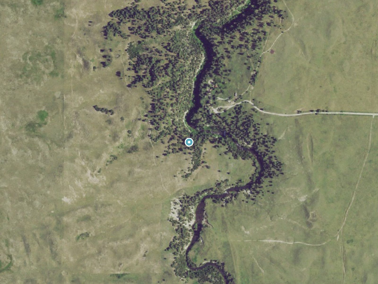
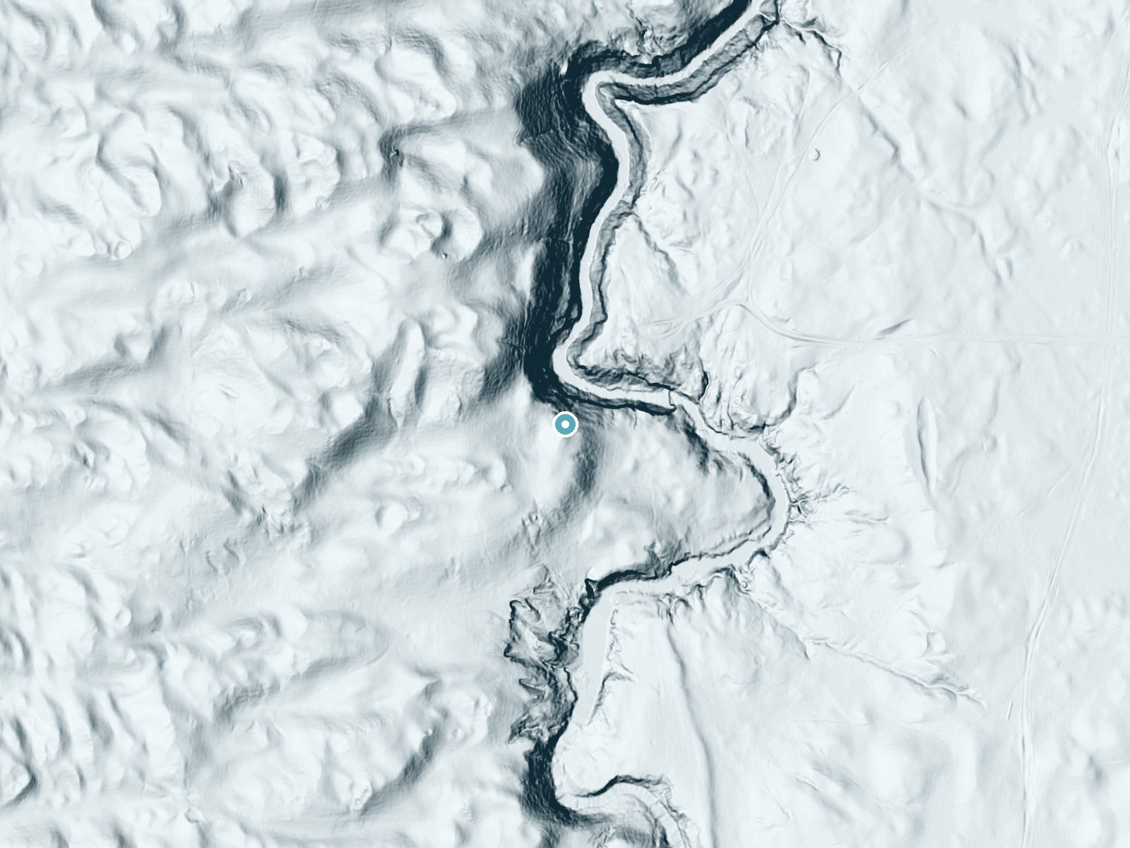
Drag to compare. The dot marks the waterfall. The frame is about a mile across.
- Ground elevation
- 2,892 feet
- Measured by 1-meter lidar
- Drop at the falls
- About 160 feet
- Change in ground height within ~250 feet of the falls
- Faces
- Northeast
- Mostly shaded, so the light stays soft and even all day.
A slice through the lidar ground surface, from above the falls to downstream (heading northeast).
Elevation data: USGS 3D Elevation Program. Aerial imagery: USGS The National Map. Public domain.
Location & Access
Getting There
Take Highway 97 about 23 miles southwest of Valentine, about 3 miles before Merritt Reservoir. Turn west about a quarter mile after the canal crosses the highway and watch for a windmill, a large water tank and a few trees.
Get Directions on Google MapsParking
Park near the Sportsman's Club building. There is limited space to turn around with campers and trailers.
Elevation
2,815 feet above sea level
Coordinates
42.675004° N, -100.857089° W
Visitor Tips & Gear
Bring cash for the $1 admission, paid at the drop box in front of the Sportsman's Club building. Viewing is open daily 9 a.m. to 5 p.m.
Where to Stay

Comfort Inn Valentine

Raine Motel

Super 8 by Wyndham Valentine NE

Heart City Cozy
Browse vacation cabins and private rentals nearby
Unique outdoor stays — tents, yurts, and treehouses
Rent a campervan or RV for your waterfall road trip
Some links are affiliate links. We may earn a commission at no extra cost to you.
Nearby Campground
Samuel R. McKelvie National Forest
9 miles away · 0 sites
Located south of Nenzel in Cherry County, this 116,000-acre national forest is a fantastic representation of the unique Nebraska Sandhills prairie ecosystem. Popular uses of the forest include hunting, fishing, horseback riding, camping and bird watching. There is one small campground located on the southwestern edge of the forest. Steer Creek Campground has 23 campsites, 8 horse corrals, potable water, and the 1-mile Blue Jay hiking trail.The Niobrara River Canoe Launch day use site on the Niobr
Book on Recreation.govAdditional Information
Nearby Attractions
Merritt Reservoir State Recreation Area, Smith Falls State Park, the Niobrara National Scenic River and Valentine National Wildlife Refuge.
Wildlife
The area around Snake River Falls is home to various bird species, deer, and other wildlife typical of Nebraska's Sandhills region.
Other waterfalls named Snake River Falls
1 other waterfall shares this name across the U.S.
Writing about Snake River Falls? Embed this waterfall on your site for free.