Slumber Falls
By Armen Suny · Last verified Oct 2026
LiDAR & 3D terrainBefore you go
Slumber Falls is on the grounds of Slumber Falls Camp, a private camp and retreat center. It is open only to registered guests.
Photo Credits (1)
About Slumber Falls
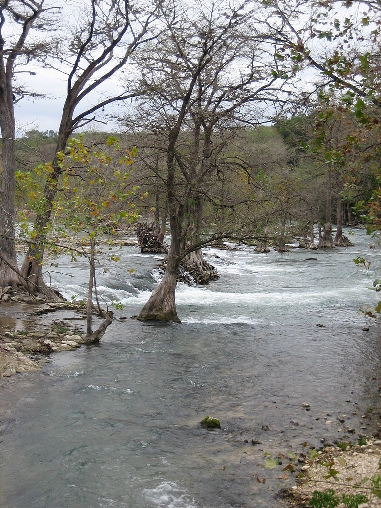
Slumber Falls is a small set of falls on the Guadalupe River at Slumber Falls Camp, about four miles northwest of New Braunfels on River Road in Comal County, Texas. The site was a swimming and picnic spot from the late 1800s and has been a church camp since 1958. It is now a private camp and retreat center and is not open to the public.
Trail & Hike Details
Trail Description
There is no public trail to Slumber Falls. The falls are on the private grounds of Slumber Falls Camp.
What to Expect
Swimming is permitted.
Accessibility
Accessibility may be limited due to the private property status and lack of detailed trail information. Contact the retreat center for specific accessibility details.
Frequently Asked Questions
🐶 Are Dogs Allowed at Slumber Falls?
❌ Dogs are not allowed
Are There Any Fees or Permits Required?
🤑 Fee: $0.00
Permit required
Access to Slumber Falls requires permission from the Slumber Falls Camp. Contact the camp for permit or reservation details.
🏊 Is There Swimming at Slumber Falls?
✅ Swimming is allowed
When to Visit
Spring and summer are the best times to visit, as the water flow is typically higher, and the weather is ideal for outdoor activities.
Seasonal Access
The best time to visit is Spring, Summer, and Fall. Winter access may be limited.
Safety Information
Exercise caution around the water, as currents in the Guadalupe River can be strong. Always supervise children and wear appropriate footwear to avoid slipping on wet rocks.
Current Water Conditions
These readings come from the USGS gauge on Comal Rv (oc), 3.2 miles away, not on Slumber Falls's own stream. Use them as a sign of whether the area is running wet or dry.
58 ft³/s
Current discharge — how much water is flowing
About average for this time of year
Based on 14 years of record
1.95 ft
Water depth at gauge
7-Day Discharge Trend
What does this mean for your visit?
Flow is about average for this time of year.
About This Gauge
7-Day Flow Outlook
Based on the USGS gauge Comal Rv (oc) nr Landa Lk, New Braunfels, TX (5 km away).
Today
Moderate
58 cfs
6/10Tomorrow
Moderate
58 cfs
6/10Thu
Moderate
57 cfs
8/10Fri
Moderate
58 cfs
8/10Sat
Moderate
63 cfs
5/10Sun
Moderate
65 cfs
5/10Mon
Moderate
61 cfs
8/10Best window: Thu — moderate flow, sunny (trip score 8/10).
Best time of year: this gauge typically runs highest from late November to mid December, peaking in November.
How we calculate this
This is a transparent outlook, not a precise forecast. We take the waterfall's current flow strength (how it ranks against its historical normal for today, from the nearest USGS stream gauge), carry that ranking forward along the gauge's seasonal curve, and nudge it for forecast rain. Confidence is highest for the next day or two and falls further out. Always check official conditions and your own judgment before visiting — high flows can be dangerous.
Know when to go.
Get a free email alert when waterfalls near New Braunfels hit peak flow. We only send when conditions are worth the trip — no weekly newsletters, no spam.
Is Slumber Falls Frozen?
Updated about 8 hours agoNot frozen highs above freezing lately north-facing, shaded
Slumber Falls is not frozen right now; highs have been above freezing. Yesterday ran 63°F to 58°F.
- Days below freezing
- 0 of the last 14
- Current cold streak
- 0 days
- Freezing days ahead
- 0 of the next 7
- Flow
- 58 ft³/s
Winter safety. Frozen falls are the one waterfall trip with a documented injury pattern: falling ice, and ice-glazed rock and trail. Wear microspikes, keep well back from the base and from overhangs, and never walk out on ice over moving water.
Estimate from Open-Meteo daily temperatures at the falls, the LiDAR-measured facing direction, and the nearest stream gauge. It is a likelihood, not a report from the trail.
Weather Forecast
The Terrain, Seen by LiDAR
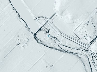
Aircraft-mounted lasers measured this ground to within inches. Trees and buildings are digitally stripped away, leaving the bare shape of the land the water has carved.
The bare-earth surface loses about 72 feet through the falls, but gradually, the profile of a cascade rather than a plunge. The ground at the falls is roughly 633 feet above sea level.
The ground changes about 74 feet in the 500 feet above the falls and 53 feet in the 500 feet below. Facing northeast, the falls stay mostly shaded, with soft, even light all day.
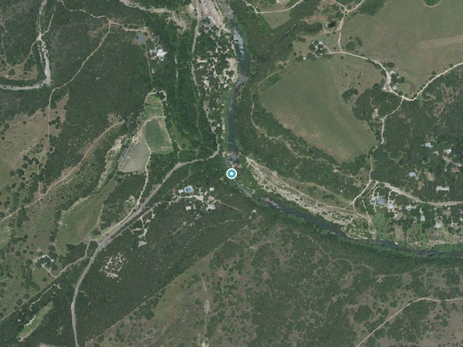
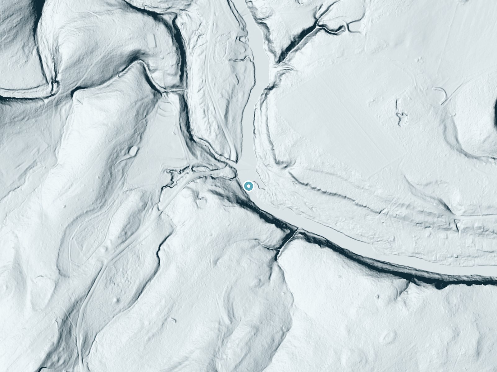
Drag to compare. The dot marks the waterfall. The frame is about a mile across.
- Ground elevation
- 633 feet
- Measured by 1-meter lidar
- Drop at the falls
- About 72 feet
- Change in ground height within ~250 feet of the falls
- Faces
- Northeast
- Mostly shaded, so the light stays soft and even all day.
A slice through the lidar ground surface, from above the falls to downstream (heading northeast).
Elevation data: USGS 3D Elevation Program. Aerial imagery: USGS The National Map. Public domain.
Location & Access
Getting There
Slumber Falls Camp is at 3610 River Road, about four miles northwest of New Braunfels. The property along this stretch of River Road is privately owned, with no public river access.
Get Directions on Google MapsParking
Parking is on camp property for registered campers and retreat guests only.
Hours
Elevation
636 feet above sea level
Coordinates
29.755501° N, -98.138898° W
Visitor Tips & Gear
Contact Slumber Falls Camp about camps or retreats if you want to visit. Do not enter the property or the riverbanks without permission.
Where to Stay

On Top of the World

Home2 Suites By Hilton New Braunfels

Tiny House on the Hill

Baymont Inn & Suites San Marcos
Browse vacation cabins and private rentals nearby
Unique outdoor stays — tents, yurts, and treehouses
Rent a campervan or RV for your waterfall road trip
Some links are affiliate links. We may earn a commission at no extra cost to you.
Nearby Campground
North Park
9.2 miles away · 20 sites
Overview North Park is only open Friday at 3pm until Sunday at 2pm April 1 - Sept 30. The Park is a primitive campground and each site comes with a picnic table, grill, fire ring, and access to the lake. Recreation Canyon Lake has become well known for boating, swimming, scuba diving, and so much more. Facilities Available facilities in the park include a vault restroom, 3 water fountains, 20 tent only campsites. Natural Features North Park is perched on top of a limestone bluff overlooking the
Book on Recreation.govNearby Hot Springs
Hot springs near New Braunfels, Texas
Looking for a soak after your hike? Explore more hot springs near New Braunfels, Texas on SoakingSprings.
Explore Texas springsAdditional Information
Nearby Attractions
Nearby attractions include the Guadalupe River for tubing and kayaking, as well as the city of New Braunfels, which offers shopping, dining, and cultural experiences.
Wildlife
The area around the falls may feature local wildlife such as birds, fish, and small mammals. Be mindful of the natural environment.
Cities near Slumber Falls
Nearby Waterfalls
 LiDAR
Writing about Slumber Falls? Embed this waterfall on your site for free.