
Photo Credits (5)
Difficulty
Moderate
Trail Length
2.4 miles
Trail Type
Out And Back
Elevation Gain
350 ft
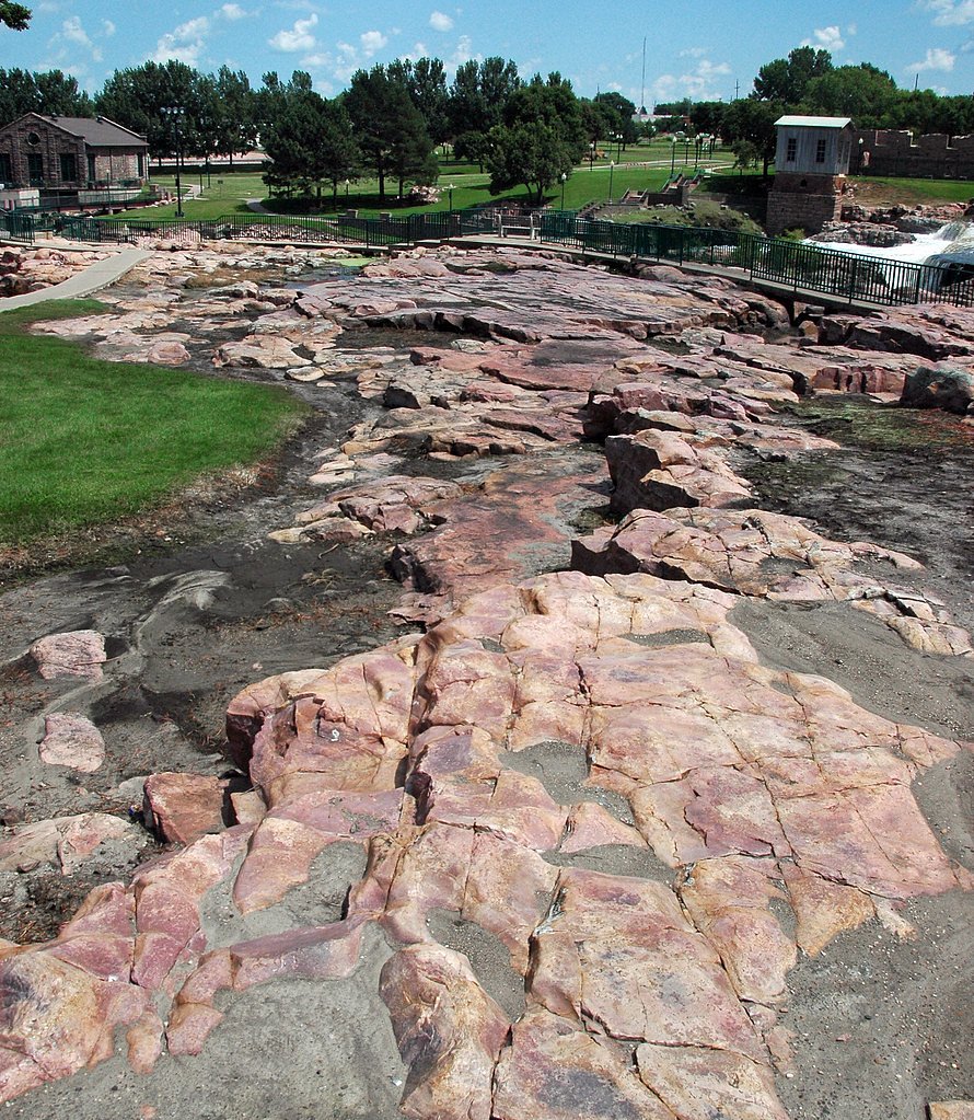
About Sioux Falls
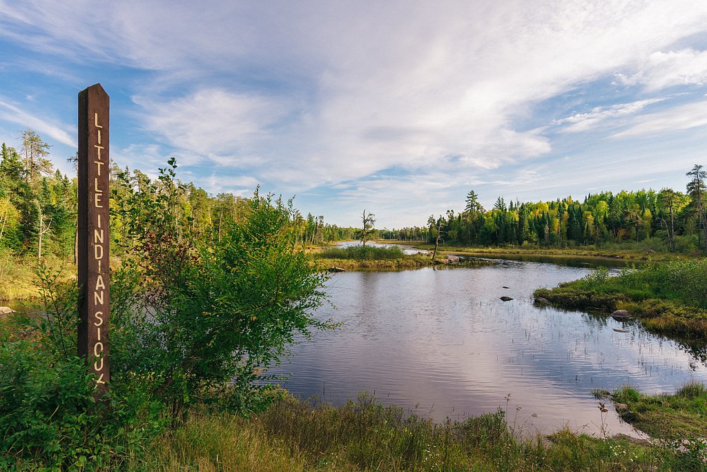
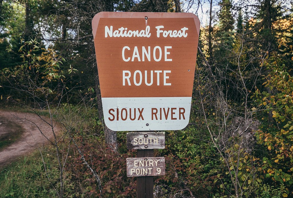
Sioux Falls is a scenic waterfall set within lands managed by the U.S. Forest Service’s Superior National Forest. Reached via the SIOUX RIVER SOUTH ENTRY (USFS Trail #6087), the falls offer a compact, photogenic cascade framed by classic northern forest — an inviting day destination for hikers and photographers who want a short outing with a rewarding view. Camping is conveniently close: Jeanette Lake Campground sits about 6.7 km from the trailhead, making an easy option for overnight stays or extended exploration of the area. Expect a relatively short but moderately steep approach on the official route, which is well suited to hikers looking for a brisk out-and-back excursion rather than a long backcountry trek.
The Setting
Sioux Falls sits at 1,365 feet within Superior National Forest, in the foothills of Minnesota.
Trail & Hike Details
The Approach
The moderate hike follows Sioux River South Entry (#6087), a 2.4-mile out-and-back trail over natural surface. Expect 350 feet of elevation gain with grades of 20-30%. The trail is developed (Class 3).
USFS Trail
SIOUX RIVER SOUTH ENTRY #6087
Trail Class
Developed
Surface
Avg Grade
USFS Segment
0.03 miTrail Description
USFS Trail: SIOUX RIVER SOUTH ENTRY (Trail #6087). Trail type: out-and-back; total listed length: 2.4 miles with approximately 350 ft of elevation gain and a moderate difficulty rating. USFS trail specifications: Surface = NATIVE MATERIAL; Class = 3; Typical grade = 20–30%. Note: USFS GIS records also list a segment length of 0.03 miles for the recorded trail feature. The route is best treated as a short, moderately steep hike with native-surface footing; nearby Jeanette Lake Campground (~6.69 km) provides convenient camping access.
What to Expect
Dogs are welcome.
Accessibility
The trail is not wheelchair accessible. Uneven terrain and elevation changes require steady footing.
Frequently Asked Questions
🐶 Are Dogs Allowed at Sioux Falls?
✅ Dogs are allowed
Are There Any Fees or Permits Required?
🆖 No fees required
🏊 Is There Swimming at Sioux Falls?
❌ Swimming is not allowed
When to Visit
Spring and summer are the best times to visit for lush greenery and higher water flow, though the falls are also beautiful in winter when partially frozen.
Seasonal Access
The best time to visit is Spring, Summer, Fall, and Winter. Check with Superior National Forest for seasonal road closures.
Safety Information
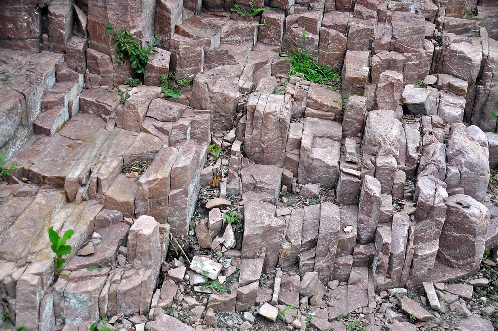
Stay on designated paths and viewing platforms. The rocks near the falls can be slippery and dangerous. Avoid entering the water as currents can be strong.
Know when to go.
Get a free email alert when waterfalls near Soudan hit peak flow. We only send when conditions are worth the trip — no weekly newsletters, no spam.
Weather Forecast
Location & Access
Getting There
Falls Park is located in Sioux Falls, South Dakota, and is easily accessible by car. The park is situated near downtown Sioux Falls, with clear signage leading to the location.
Get Directions on Google MapsParking
Ample parking is available at Falls Park, including spaces for cars and larger vehicles. Parking is free for visitors.
Elevation
1,365 feet above sea level
Coordinates
48.104071° N, -92.216252° W
Land Management
Managed by USFS
Visitor Tips & Gear
Visit early in the morning or during weekdays to avoid crowds. Bring a camera to capture the scenic views, and wear comfortable shoes if you plan to explore the trails around the park.
As an Amazon Associate, we earn from qualifying purchases.
With 2.4 miles and 350 ft of elevation gain, sturdy boots and trekking poles will help on this moderate trail. Icy conditions are common in winter — traction cleats are a smart addition.

Columbia Watertight II Rain Jacket
Packs into its own pocket, seam-sealed, and keeps you dry from spray and surprise rain.

Polarized Sunglasses (Knockaround)
Cuts glare off the water so you actually see the falls — and your photos turn out better too.

Earth Pak Waterproof Dry Bag
Keeps your phone and gear dry when waterfall mist soaks everything else.

Waterproof Phone Pouch (AiRunTech)
Cheap insurance — take photos right next to the falls without killing your phone.

Timberland Euro Sprint Mid Waterproof
Trusted waterproof boot with premium leather and grippy rubber sole — reliable on rocky, wet trails.

TrailBuddy Trekking Poles
Lightweight aluminum, cork grips, and flip-locks that actually hold — a best-seller for good reason.
Where to Stay

Stay Inn Ely

Garden Lake Resort

Grand Ely Lodge

Adventure Inn
Browse vacation cabins and private rentals nearby
Unique outdoor stays — tents, yurts, and treehouses
Rent a campervan or RV for your waterfall road trip
Some links are affiliate links. We may earn a commission at no extra cost to you.
Nearby Campground
JEANETTE LAKE
4.2 miles away · 14 sites
Overview Jeanette Lake Campground is a small, single-loop campground on a peninsula reaching out onto the glacier-carved Lake Jeanette in Superior National Forest. Originally built by the Civilian Conservation Corps in the 1930s, this sweet, picturesque campground is well worth the drive. The facility provides sites that are usually accessible to RVs and tent trailers along with tent-only and hike-in sites. Superior National Forest, located in northeastern Minnesota's arrowhead region, is compris
Book on Recreation.govAdditional Information
Nearby Attractions
Nearby attractions include the downtown Sioux Falls area, the SculptureWalk, and the Old Courthouse Museum.
Wildlife
Visitors may see birds, squirrels, and other small wildlife in the park.
Cities near Sioux Falls
Nearby Waterfalls
Other waterfalls named Sioux Falls
1 other waterfall shares this name across the U.S.
Writing about Sioux Falls? Embed this waterfall on your site for free.