Photo Credits (5)
Difficulty
Moderate
Trail Length
2.4 miles
Trail Type
Out And Back
Elevation Gain
350 ft
About Sids Falls
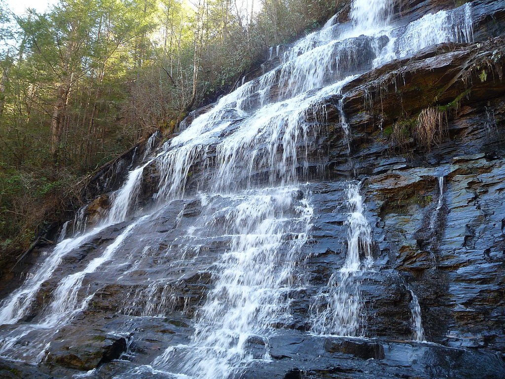
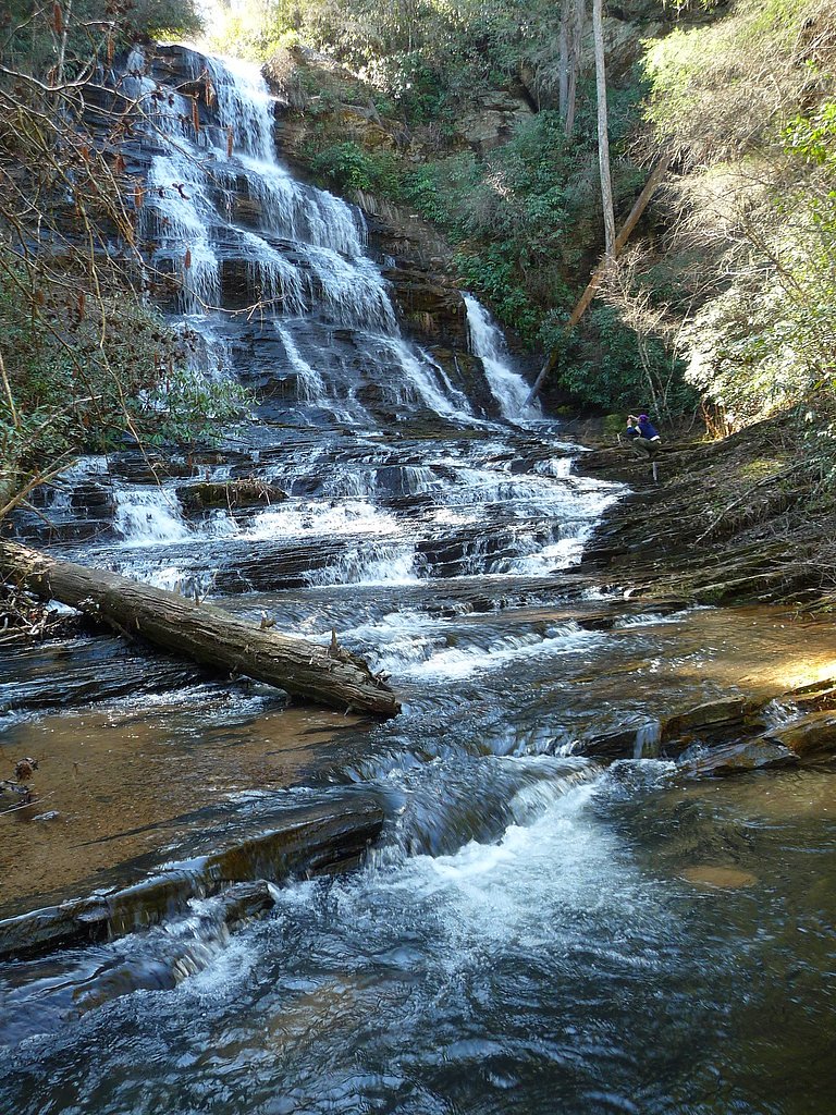
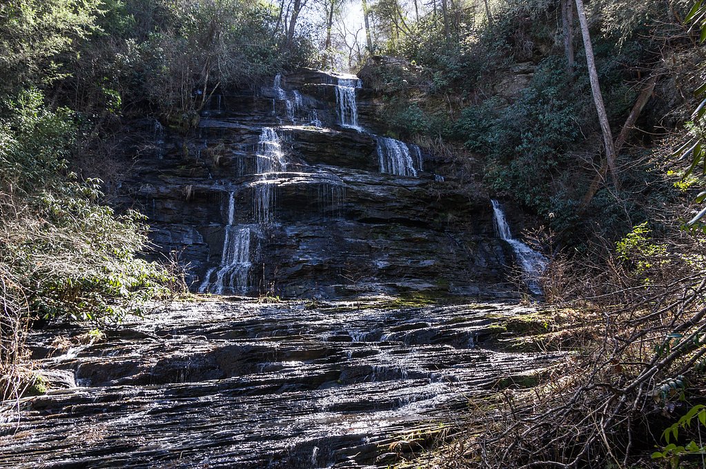
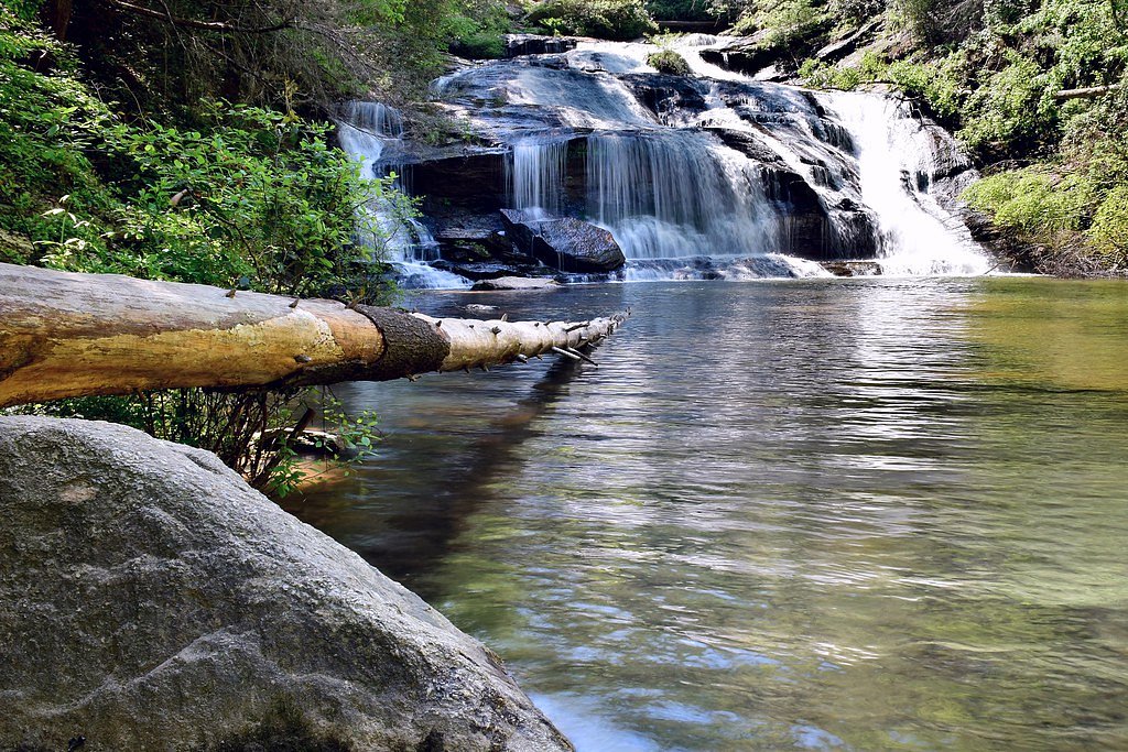
Sids Falls is a secluded, picturesque cascade in Oconee County tucked within the Sumter National Forest and managed by the U.S. Forest Service. The waterfall’s quiet, forested setting makes it a rewarding destination for hikers seeking a less-trafficked spot — the approach uses the USFS WATERGUAGE Trail (Trail #210) and feels like a true backcountry pocket of South Carolina’s national forest lands. The walk to the falls is a moderate out-and-back route of about 2.4 miles with roughly 350 feet of elevation gain, so it’s well suited to hikers who don’t mind a bit of climbing and uneven tread. Camping is available nearby at the Chattooga River District campground (about 8.12 km away), making Sids Falls a good stop on an overnight loop or a day trip from a nearby dispersed site.
The Setting
Sids Falls sits at 1,296 feet within Sumter National Forest, fed by the Chattooga River, in the foothills of South Carolina.
Trail & Hike Details
The Approach
The moderate hike follows Waterguage (#210), a 2.4-mile out-and-back trail over natural surface. Expect 350 feet of elevation gain with grades of 12-20%. The trail is developed (Class 3).
USFS Trail
WATERGUAGE #210
Trail Class
Developed
Surface
Avg Grade
USFS Segment
0.43 miTrail Description
The primary approach to Sids Falls follows the USFS WATERGUAGE (Trail #210). Overall the hike is a 2.4-mile out-and-back with about 350 feet of gain and a moderate difficulty rating. The WATERGUAGE segment shown in USFS data is 0.43 GIS miles and is recorded as native-material (NAT) surface, rated Class 3, with typical grades of 12–20%. Expect native dirt tread that can be uneven, with short steeper pitches where the grade reaches into the 12–20% range; the Class 3 rating indicates sections that require careful foot placement and sure-footedness. Sturdy footwear is recommended, and be prepared for muddy or overgrown spots near the waterfall and along connector paths.
What to Expect
Dogs are welcome.
Accessibility
The trail is not wheelchair accessible. Uneven terrain and elevation changes require steady footing.
Frequently Asked Questions
🐶 Are Dogs Allowed at Sids Falls?
✅ Dogs are allowed
Are There Any Fees or Permits Required?
🆖 No fees required
🏊 Is There Swimming at Sids Falls?
❌ Swimming is not allowed
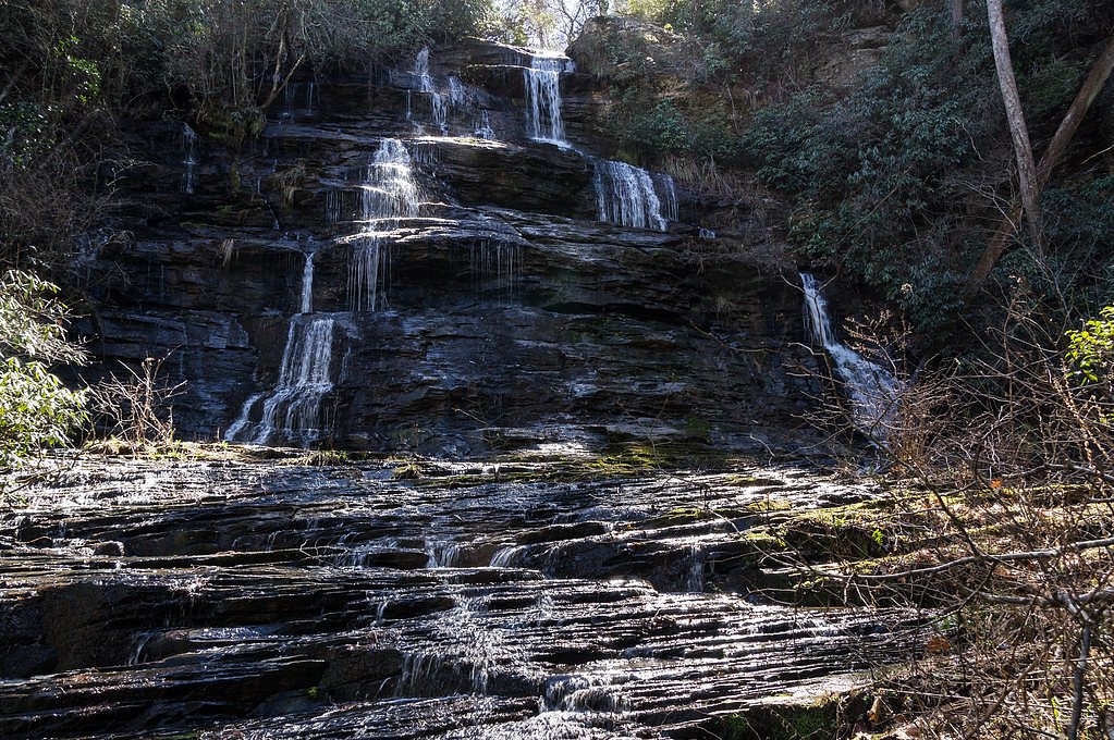
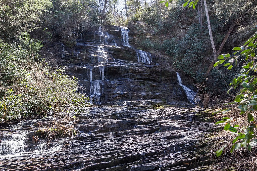
When to Visit
Spring and early summer are ideal times to visit, as the waterfall flow is typically strongest after seasonal rains.
Seasonal Access
The best time to visit is Spring, Summer, and Fall. Winter access may be limited. Check with Sumter National Forest for seasonal road closures.
Safety Information
The trail is unmarked and can be difficult to follow. Be prepared with navigation tools and avoid hiking alone. Watch for slippery rocks near the waterfall.
Current Water Conditions
258 ft³/s
Current discharge — how much water is flowing
Lower than usual for this time of year
Based on 86 years of record
1.35 ft
Water depth at gauge
7-Day Discharge Trend
What does this mean for your visit?
Flow is lower than usual for this time of year.
About This Gauge
7-Day Flow Outlook
Based on the USGS gauge CHATTOOGA RIVER NEAR CLAYTON, GA (6 km away).
Today
Low
294 cfs
3/10Tomorrow
Low
306 cfs
3/10Sun
Low
305 cfs
3/10Mon
Low
302 cfs
3/10Tue
Low
314 cfs
3/10Wed
Low
295 cfs
3/10Thu
Barely Flowing
258 cfs
5/10Best window: Thu — barely flowing flow, sunny (trip score 5/10).
Best time of year: this gauge typically runs highest from late February to late April, peaking in April.
How we calculate this
This is a transparent outlook, not a precise forecast. We take the waterfall's current flow strength (how it ranks against its historical normal for today, from the nearest USGS stream gauge), carry that ranking forward along the gauge's seasonal curve, and nudge it for forecast rain. Confidence is highest for the next day or two and falls further out. Always check official conditions and your own judgment before visiting — high flows can be dangerous.
Know when to go.
Get a free email alert when waterfalls near Longcreek hit peak flow. We only send when conditions are worth the trip — no weekly newsletters, no spam.
Weather Forecast
Location & Access
Getting There
Sids Falls is located in the Sumter National Forest. To reach the trailhead, visitors typically drive along SC Highway 107 and turn onto Burrells Ford Road. The trailhead is unmarked, so GPS coordinates or detailed directions are recommended.
Get Directions on Google MapsParking
Parking is available along the roadside near the trailhead, but it is limited and unpaved.
Elevation
1,296 feet above sea level
Coordinates
34.756111° N, -83.307778° W
Land Management
Managed by USFS
Visitor Tips & Gear
Bring a map or GPS device as the trail is unmarked and can be difficult to follow. Wear sturdy hiking boots and be prepared for muddy or uneven terrain. Cell service may be limited in the area.
As an Amazon Associate, we earn from qualifying purchases.
With 2.4 miles and 350 ft of elevation gain, sturdy boots and trekking poles will help on this moderate trail. Sun exposure on the trail makes good sun protection a must in summer.

Polarized Sunglasses (Knockaround)
Cuts glare off the water so you actually see the falls — and your photos turn out better too.

Columbia Watertight II Rain Jacket
Packs into its own pocket, seam-sealed, and keeps you dry from spray and surprise rain.

Earth Pak Waterproof Dry Bag
Keeps your phone and gear dry when waterfall mist soaks everything else.

Waterproof Phone Pouch (AiRunTech)
Cheap insurance — take photos right next to the falls without killing your phone.

Timberland Euro Sprint Mid Waterproof
Trusted waterproof boot with premium leather and grippy rubber sole — reliable on rocky, wet trails.

TrailBuddy Trekking Poles
Lightweight aluminum, cork grips, and flip-locks that actually hold — a best-seller for good reason.
Where to Stay

Mountain Aire Cottages, Inn & Glamping

Quality Inn & Suites Mt Chalet

Cute n Chic in Clayton

Mountain Valley Inn
Browse vacation cabins and private rentals nearby
Unique outdoor stays — tents, yurts, and treehouses
Rent a campervan or RV for your waterfall road trip
Some links are affiliate links. We may earn a commission at no extra cost to you.
Nearby Campground
Chattooga River District
5 miles away · 0 sites
The Chattooga River Ranger District covers 261,035 acres in the northeast part of Georgia. Terrain ranges from the Piedmont in the southern part of the district to Georgia's second highest mountain, Rabun Bald at 4,696 feet above sea level. To the east is the Chattooga Wild and Scenic River. In the central part of the district are Lake Burton, Seed Lake, and Lake Rabun where you'll find the Rabun Beach Campground. In the western part of the district are the headwaters of the Chattahoochee River a
Book on Recreation.govAdditional Information
Nearby Attractions
Other waterfalls in the area include King Creek Falls and Spoonauger Falls, both accessible via nearby trails.
Wildlife
The area is home to various wildlife, including birds, deer, and small mammals. Be cautious of snakes and other potentially hazardous animals.
Cities near Sids Falls
Nearby Waterfalls
Writing about Sids Falls? Embed this waterfall on your site for free.