Photo Credits (5)
Difficulty
Moderate
Trail Length
2.4 miles
Trail Type
Out And Back
Elevation Gain
350 ft
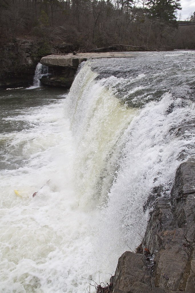
About Short Creek Falls
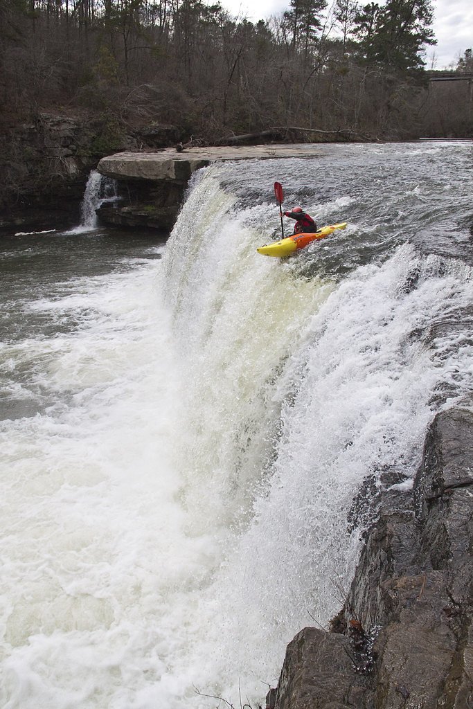
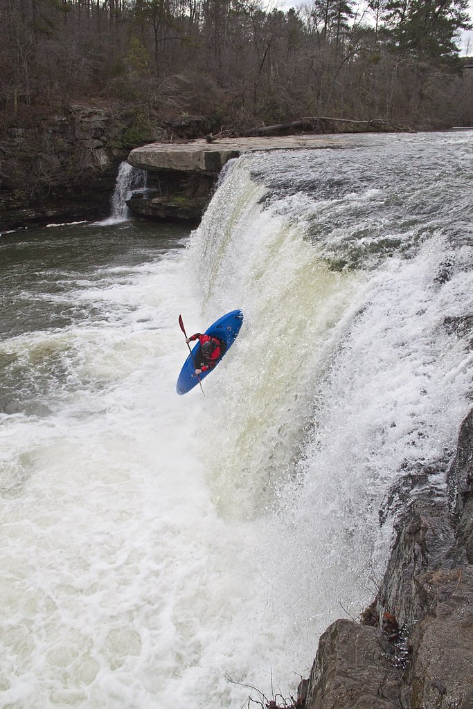
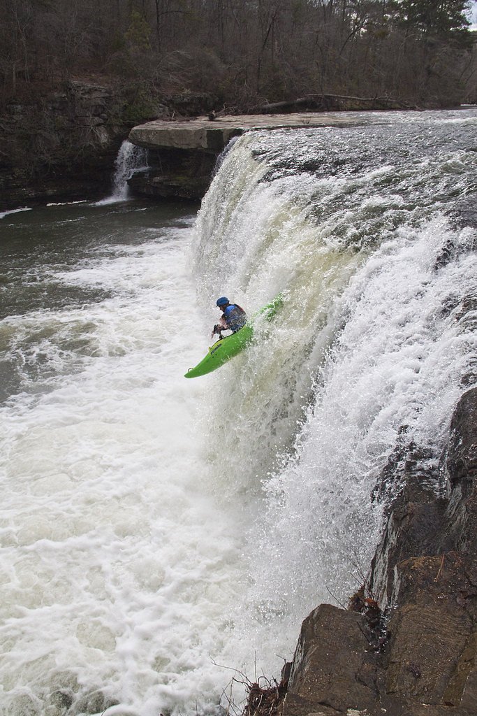
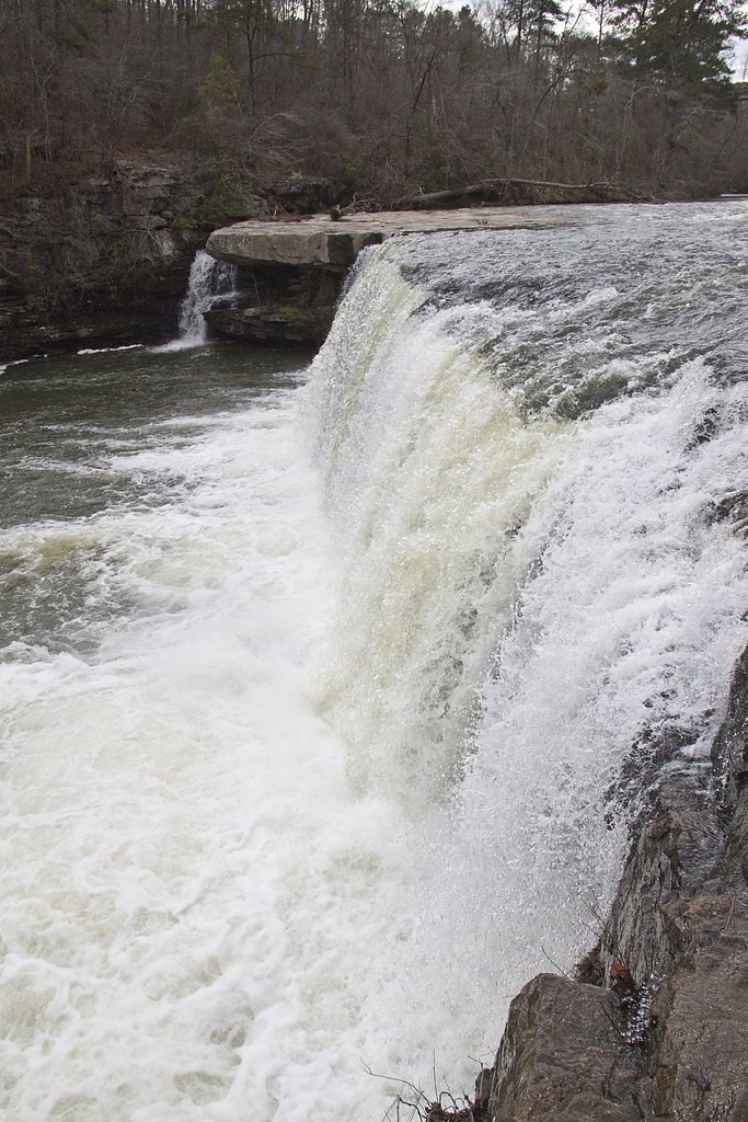
Short Creek Falls is a picturesque waterfall located near Guntersville, Alabama. It features a single drop into a scenic gorge and is a popular spot for photography and nature enthusiasts. The waterfall is known for its beauty, especially after heavy rains when the water flow is at its peak.
The Setting
Short Creek Falls sits at 774 feet along the Town Creek, in the foothills of Alabama.
Trail & Hike Details
The Approach
The moderate 2.4-mile out-and-back trail gains 350 feet of elevation on the way to the falls.
Trail Description
The trail to Short Creek Falls is very short and primarily consists of a brief walk from the roadside to a viewing area. There is no developed or maintained trail, and the terrain may be uneven or slippery, especially after rain.
What to Expect
Dogs are welcome.
Accessibility
The trail is not wheelchair accessible. Uneven terrain and elevation changes require steady footing.
Frequently Asked Questions
🐶 Are Dogs Allowed at Short Creek Falls?
✅ Dogs are allowed
Are There Any Fees or Permits Required?
🆖 No fees required
🏊 Is There Swimming at Short Creek Falls?
❌ Swimming is not allowed
When to Visit
Spring and early summer are ideal times to visit, as the water flow is typically strongest during these seasons.
Seasonal Access
The best time to visit is Spring, Summer, Fall, and Winter.
Safety Information
Exercise caution near the edge of the gorge, as there are no safety barriers. The rocks near the falls can be slippery, especially after rain. Avoid visiting during heavy rain or flooding conditions.
Current Water Conditions
13 ft³/s
Current discharge — how much water is flowing
About average for this time of year
Based on 9 years of record
0.77 ft
Water depth at gauge
7-Day Discharge Trend
What does this mean for your visit?
Flow is about average for this time of year.
About This Gauge
This gauge is on a nearby waterway and may not reflect exact conditions at the falls.
7-Day Flow Outlook
Based on the USGS gauge TOWN CREEK NEAR GERALDINE AL (21 km away).
Today
Low
14 cfs
3/10Tomorrow
Low
14 cfs
3/10Fri
Low
11 cfs
3/10Sat
Low
9 cfs
3/10Sun
Low
8 cfs
3/10Mon
Low
7 cfs
3/10Tue
Low
6 cfs
3/10Best window: Today — low flow, chance showers and thunderstorms (trip score 3/10).
Best time of year: this gauge typically runs highest from mid February to late March, peaking in February.
How we calculate this
This is a transparent outlook, not a precise forecast. We take the waterfall's current flow strength (how it ranks against its historical normal for today, from the nearest USGS stream gauge), carry that ranking forward along the gauge's seasonal curve, and nudge it for forecast rain. Confidence is highest for the next day or two and falls further out. Always check official conditions and your own judgment before visiting — high flows can be dangerous.
Know when to go.
Get a free email alert when waterfalls near Albertville hit peak flow. We only send when conditions are worth the trip — no weekly newsletters, no spam.
Weather Forecast
Location & Access
Getting There
Short Creek Falls is located off Alabama Highway 227, near Guntersville. The falls are accessible via a short walk from the roadside, but there is no official trail leading directly to the base.
Get Directions on Google MapsParking
Parking is limited and typically consists of roadside pull-offs near the falls. Visitors should exercise caution when parking and walking along the road.
Elevation
774 feet above sea level
Coordinates
34.322415° N, -86.204298° W
Visitor Tips & Gear
Visit after recent rainfall for the best water flow. Wear sturdy shoes as the terrain near the falls can be uneven. Exercise caution near the edge of the gorge, as there are no safety barriers.
As an Amazon Associate, we earn from qualifying purchases.
With 2.4 miles and 350 ft of elevation gain, sturdy boots and trekking poles will help on this moderate trail. Icy conditions are common in winter — traction cleats are a smart addition.

Columbia Watertight II Rain Jacket
Packs into its own pocket, seam-sealed, and keeps you dry from spray and surprise rain.

Polarized Sunglasses (Knockaround)
Cuts glare off the water so you actually see the falls — and your photos turn out better too.

Earth Pak Waterproof Dry Bag
Keeps your phone and gear dry when waterfall mist soaks everything else.

Waterproof Phone Pouch (AiRunTech)
Cheap insurance — take photos right next to the falls without killing your phone.

Timberland Euro Sprint Mid Waterproof
Trusted waterproof boot with premium leather and grippy rubber sole — reliable on rocky, wet trails.

TrailBuddy Trekking Poles
Lightweight aluminum, cork grips, and flip-locks that actually hold — a best-seller for good reason.
Where to Stay

Microtel Inn & Suites by Wyndham Albertville

Wyndham Garden Lake Guntersville

Fairfield by Marriott Inn & Suites Albertville

Hampton Inn Albertville, Al
Browse vacation cabins and private rentals nearby
Unique outdoor stays — tents, yurts, and treehouses
Rent a campervan or RV for your waterfall road trip
Some links are affiliate links. We may earn a commission at no extra cost to you.
Additional Information
Nearby Attractions
Guntersville Lake, Lake Guntersville State Park, and Cathedral Caverns State Park are all located nearby.
Wildlife
The area around Short Creek Falls is home to various bird species, small mammals, and aquatic life.
Cities near Short Creek Falls
Nearby Waterfalls
Writing about Short Creek Falls? Embed this waterfall on your site for free.