Shingle Mill Falls
By Armen Suny · Last verified May 2026
Difficulty
Easy
Trail Length
2.0 miles
Trail Type
Out And Back
Elevation Gain
200 ft
About Shingle Mill Falls
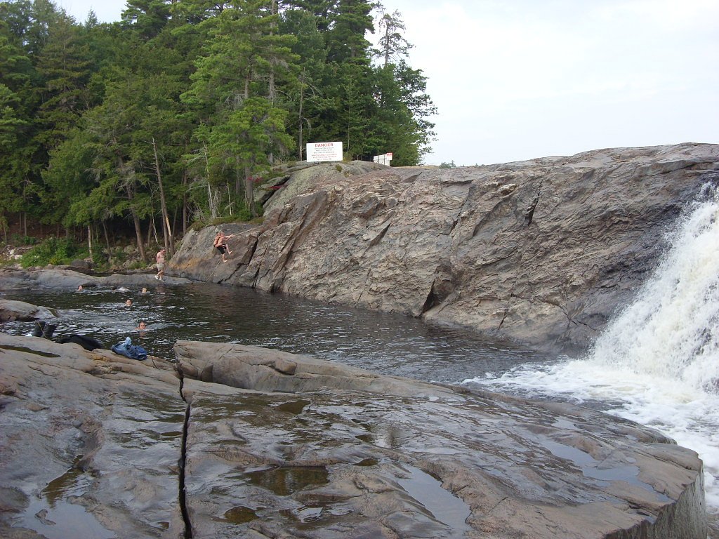
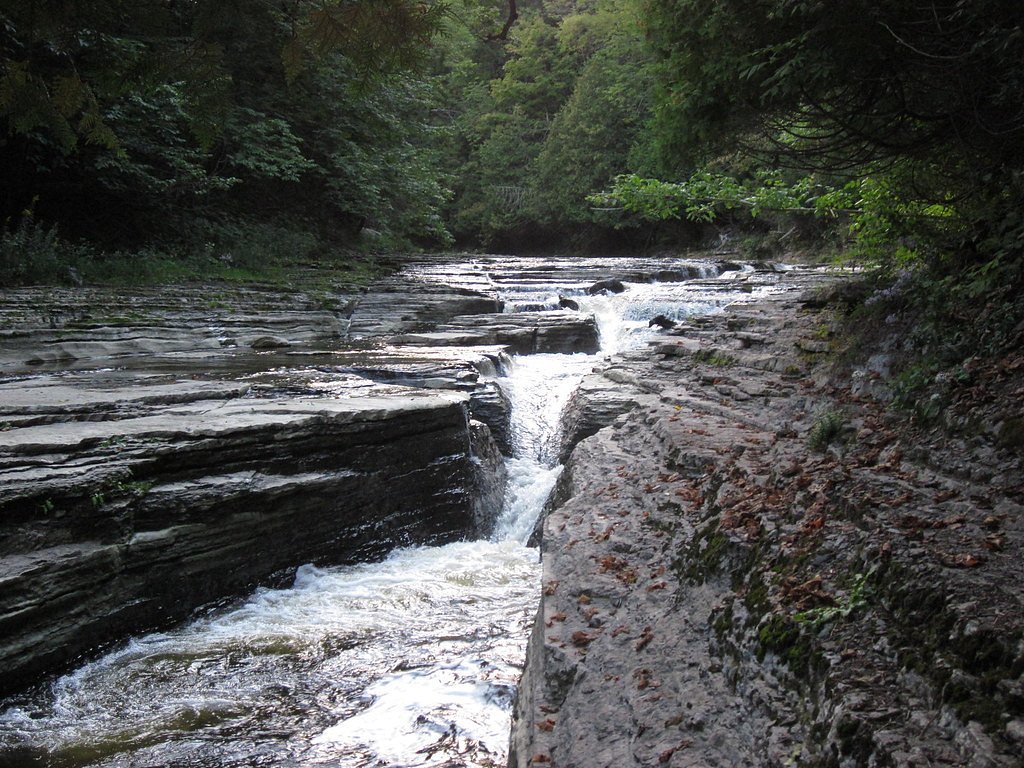
Shingle Mill Falls is a small, picturesque cascade tucked into New York's Adirondack region, set within the Independence River Wild Forest and managed by SDC under an SCA designation. The falls offer a quiet, forested setting where moss‑covered rocks and cooling spray create a peaceful spot to pause on a day hike. Its compact size and scenic character make it a nice half-day destination for walkers and photographers seeking a low‑impact outing. The approach to Shingle Mill Falls is approachable for most abilities: a short, well‑trodden route threads through mixed northern hardwoods and pine, opening at the riverbank to views of the falls. The location’s stewardship by SDC and its placement in the Independence River Wild Forest mean visitors can expect a natural, undeveloped experience that highlights the region’s classic Adirondack woodland scenery.
The Setting
Shingle Mill Falls sits at 1,191 feet within Independence River Wild Forest, fed by the Independence River, in the foothills of New York.
Trail & Hike Details
The Approach
The easy 2.0-mile out-and-back trail gains 200 feet of elevation on the way to the falls.
Trail Description
The trail to Shingle Mill Falls is an out‑and‑back of roughly 2.0 miles round trip with about 200 feet of elevation gain, rated easy. The route is generally well‑marked and follows gentle terrain through the forest, making it suitable for most visitors; many hikers describe it as a relaxed walk rather than a strenuous climb. The falls are reached along the Oswegatchie River corridor, offering a pleasant riverside destination at the end of a short hike.
What to Expect
Dogs are welcome.
Accessibility
The trail is not wheelchair accessible. Uneven terrain and elevation changes require steady footing.
Frequently Asked Questions
🐶 Are Dogs Allowed at Shingle Mill Falls?
✅ Dogs are allowed
Are There Any Fees or Permits Required?
🆖 No fees required
🏊 Is There Swimming at Shingle Mill Falls?
❌ Swimming is not allowed
When to Visit
Spring and early summer are ideal for visiting, as the water flow is typically strongest during these seasons. Fall offers beautiful foliage, while winter may provide a unique view of the frozen falls, though access could be more challenging.
Seasonal Access
The best time to visit is Spring, Summer, and Fall. Winter access may be limited.
Safety Information
Be cautious near the water, as rocks can be slippery. Carry a map or GPS device, as cell service may be limited in the area. Always let someone know your plans before heading out.
Current Water Conditions
65 ft³/s
Current discharge — how much water is flowing
About average for this time of year
Based on 84 years of record
3.60 ft
Water depth at gauge
7-Day Discharge Trend
What does this mean for your visit?
Flow is about average for this time of year.
About This Gauge
7-Day Flow Outlook
Based on the USGS gauge INDEPENDENCE RIVER AT DONNATTSBURG NY (6 km away).
Today
Roaring
74 cfs
6/10Tomorrow
Roaring
71 cfs
9/10Fri
Roaring
66 cfs
6/10Sat
Roaring
69 cfs
6/10Sun
Roaring
65 cfs
6/10Mon
Roaring
65 cfs
6/10Tue
Roaring
68 cfs
6/10Best window: Tomorrow — roaring flow, sunny (trip score 9/10).
Best time of year: this gauge typically runs highest from late March to late May, peaking in April.
How we calculate this
This is a transparent outlook, not a precise forecast. We take the waterfall's current flow strength (how it ranks against its historical normal for today, from the nearest USGS stream gauge), carry that ranking forward along the gauge's seasonal curve, and nudge it for forecast rain. Confidence is highest for the next day or two and falls further out. Always check official conditions and your own judgment before visiting — high flows can be dangerous.
Know when to go.
Get a free email alert when waterfalls near Lyons Falls hit peak flow. We only send when conditions are worth the trip — no weekly newsletters, no spam.
Weather Forecast
Location & Access
Getting There
Shingle Mill Falls is located near Wanakena, New York, within the Five Ponds Wilderness Area. Access typically involves hiking along the Cranberry Lake 50 trail system. The trailhead can be reached by driving to Wanakena and following signs for the trail.
Get Directions on Google MapsParking
Parking is available at designated trailheads near Wanakena. Visitors should ensure they park in marked areas to avoid blocking access.
Elevation
1,191 feet above sea level
Coordinates
43.721490° N, -75.265440° W
Land Management
Managed by SDC
Visitor Tips & Gear
Wear sturdy footwear as the trail may be muddy or uneven in places. Bring insect repellent, especially in the summer months, as mosquitoes and black flies can be prevalent. Check weather conditions before visiting, as rain can make the trail slippery.
As an Amazon Associate, we earn from qualifying purchases.
This easy 2.0 miles hike is straightforward — comfortable trail shoes and plenty of water should do. Sun exposure on the trail makes good sun protection a must in summer.

Columbia Watertight II Rain Jacket
Packs into its own pocket, seam-sealed, and keeps you dry from spray and surprise rain.

Earth Pak Waterproof Dry Bag
Keeps your phone and gear dry when waterfall mist soaks everything else.

Waterproof Phone Pouch (AiRunTech)
Cheap insurance — take photos right next to the falls without killing your phone.

Polarized Sunglasses (Knockaround)
Cuts glare off the water so you actually see the falls — and your photos turn out better too.

Osprey Daylite Daypack
Light, organized, and just the right size for a day hike — fits water, snacks, and layers.

OR Sombriolet Sun Hat
UPF 50+ sun protection with vents so your head doesn't cook on exposed trail sections.
Where to Stay

Mini Golf Firepit Cabin Salmon River 5 min

Adirondack Lodge Old Forge

GGgs Cabin

Tug Hill Resort
Browse vacation cabins and private rentals nearby
Unique outdoor stays — tents, yurts, and treehouses
Rent a campervan or RV for your waterfall road trip
Some links are affiliate links. We may earn a commission at no extra cost to you.
Additional Information
Nearby Attractions
Cranberry Lake, Wanakena Footbridge, and other trails in the Five Ponds Wilderness Area.
Wildlife
The area is home to a variety of wildlife, including deer, birds, and small mammals. Be cautious of black bears, which are occasionally spotted in the region.
Cities near Shingle Mill Falls
Nearby Waterfalls
Writing about Shingle Mill Falls? Embed this waterfall on your site for free.