Eatonville Falls
By Armen Suny · Last verified May 2026
Difficulty
Moderate
Trail Length
2.4 miles
Trail Type
Out And Back
Elevation Gain
350 ft
About Eatonville Falls
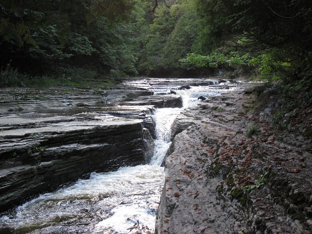
Eatonville Falls is a quaint, photogenic cascade tucked into Otter Creek State Forest in Eatonville, New York. Nestled on land managed by SDC and designated SCA, the falls sit along a small creek that threads through a quiet woodland setting—an easy-to-enjoy refuge for photographers, birdwatchers, and anyone seeking a short nature escape. The scene feels intimate rather than dramatic: mossy rocks, dappled light through hardwoods, and the steady murmur of falling water make it a lovely spot for a peaceful break from nearby roads and towns. Access is friendly but not entirely effortless—the route to the falls rewards a little effort with tranquil views and seasonal foliage. Because the site lies within Otter Creek State Forest, stewardship by SDC helps keep the trail and surroundings maintained; pack out what you bring in, and expect natural forest conditions underfoot. Eatonville Falls is a great option for half-day outings and casual day hikers who appreciate a short, scenic stop along a broader itinerary in the region.
The Setting
Eatonville Falls sits at 932 feet within Otter Creek State Forest, fed by the Independence River, in the foothills of New York.
Trail & Hike Details
The Approach
The moderate 2.4-mile out and back trail gains 350 feet of elevation on the way to the falls.
Trail Description
This is a 2.4-mile out-and-back trail with about 350 feet of elevation gain, rated moderate. The route follows the creek toward the falls and includes mostly natural tread with some uneven sections—roots, rocks, and occasional mud—so sturdy footwear is recommended. Short uphill pitches account for most of the elevation gain, but overall the trail is approachable for hikers accustomed to moderate grades. (No USFS surface/grade/class data were provided; trail specifics above reflect available local management information.)
What to Expect
Dogs are welcome.
Accessibility
The trail is not wheelchair accessible. Uneven terrain and elevation changes require steady footing.
Frequently Asked Questions
🐶 Are Dogs Allowed at Eatonville Falls?
✅ Dogs are allowed
Are There Any Fees or Permits Required?
🆖 No fees required
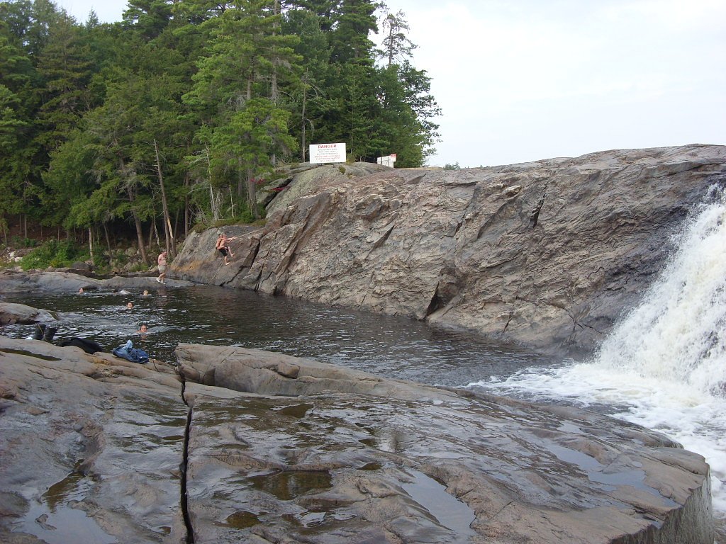
🏊 Is There Swimming at Eatonville Falls?
❌ Swimming is not allowed
When to Visit
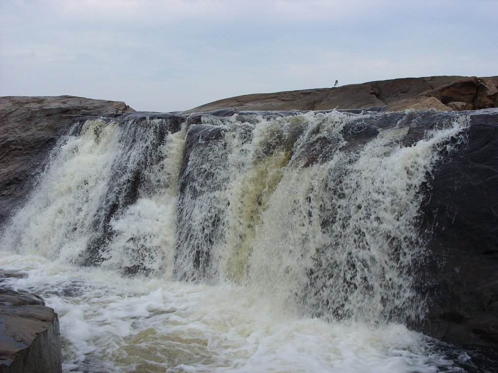
Spring and early summer are the best times to visit, as the water flow is typically strongest during these seasons.
Seasonal Access
The best time to visit is Spring, Summer, and Fall. Winter access may be limited.
Safety Information
Exercise caution near the waterfall, as rocks may be slippery. Be aware of ticks and other insects in the area. Avoid visiting during heavy rain or icy conditions, as the trail may become hazardous.
Current Water Conditions
47 ft³/s
Current discharge — how much water is flowing
Lower than usual for this time of year
Based on 83 years of record
3.50 ft
Water depth at gauge
7-Day Discharge Trend
What does this mean for your visit?
Flow is lower than usual for this time of year.
About This Gauge
7-Day Flow Outlook
Based on the USGS gauge INDEPENDENCE RIVER AT DONNATTSBURG NY (4 km away).
Today
Barely Flowing
47 cfs
5/10Tomorrow
Barely Flowing
43 cfs
5/10Tue
Low
49 cfs
3/10Wed
Low
55 cfs
3/10Thu
Barely Flowing
50 cfs
5/10Fri
Low
48 cfs
3/10Sat
Low
49 cfs
3/10Best window: Today — barely flowing flow, sunny (trip score 5/10).
Best time of year: this gauge typically runs highest from late March to late May, peaking in April.
How we calculate this
This is a transparent outlook, not a precise forecast. We take the waterfall's current flow strength (how it ranks against its historical normal for today, from the nearest USGS stream gauge), carry that ranking forward along the gauge's seasonal curve, and nudge it for forecast rain. Confidence is highest for the next day or two and falls further out. Always check official conditions and your own judgment before visiting — high flows can be dangerous.
Know when to go.
Get a free email alert when waterfalls near Lyons Falls hit peak flow. We only send when conditions are worth the trip — no weekly newsletters, no spam.
Weather Forecast
Location & Access
Getting There
Eatonville Falls is located near the town of Eatonville in New York. The falls can be accessed via local roads, but specific directions may vary depending on your starting location. It is recommended to use a GPS or map for navigation.
Get Directions on Google MapsParking
Parking availability is limited and may consist of roadside parking or small pull-off areas near the trailhead.
Hours
Elevation
932 feet above sea level
Coordinates
43.714450° N, -75.343310° W
Land Management
Managed by SDC
Visitor Tips & Gear
Visit during the spring or after rainfall for the best water flow. Bring sturdy shoes as the trail may be muddy or uneven. Be mindful of limited parking and plan your visit during off-peak hours if possible.
As an Amazon Associate, we earn from qualifying purchases.
With 2.4 miles and 350 ft of elevation gain, sturdy boots and trekking poles will help on this moderate trail. Sun exposure on the trail makes good sun protection a must in summer.

Columbia Watertight II Rain Jacket
Packs into its own pocket, seam-sealed, and keeps you dry from spray and surprise rain.

Earth Pak Waterproof Dry Bag
Keeps your phone and gear dry when waterfall mist soaks everything else.

Waterproof Phone Pouch (AiRunTech)
Cheap insurance — take photos right next to the falls without killing your phone.

Timberland Euro Sprint Mid Waterproof
Trusted waterproof boot with premium leather and grippy rubber sole — reliable on rocky, wet trails.

TrailBuddy Trekking Poles
Lightweight aluminum, cork grips, and flip-locks that actually hold — a best-seller for good reason.

Polarized Sunglasses (Knockaround)
Cuts glare off the water so you actually see the falls — and your photos turn out better too.
Where to Stay

Mini Golf Firepit Cabin Salmon River 5 min

Adirondack Lodge Old Forge

GGgs Cabin

Tug Hill Resort
Browse vacation cabins and private rentals nearby
Unique outdoor stays — tents, yurts, and treehouses
Rent a campervan or RV for your waterfall road trip
Some links are affiliate links. We may earn a commission at no extra cost to you.
Additional Information
Nearby Attractions
Nearby attractions include other small waterfalls and hiking trails in the Eatonville area, as well as local parks and nature reserves.
Wildlife
The area is home to various bird species, small mammals, and aquatic life. Visitors may also encounter insects such as mosquitoes, especially in warmer months.
Cities near Eatonville Falls
Nearby Waterfalls
Writing about Eatonville Falls? Embed this waterfall on your site for free.