Photo Credits (5)
Difficulty
Moderate
Trail Length
2.5 miles
Trail Type
Out And Back
Elevation Gain
500 ft
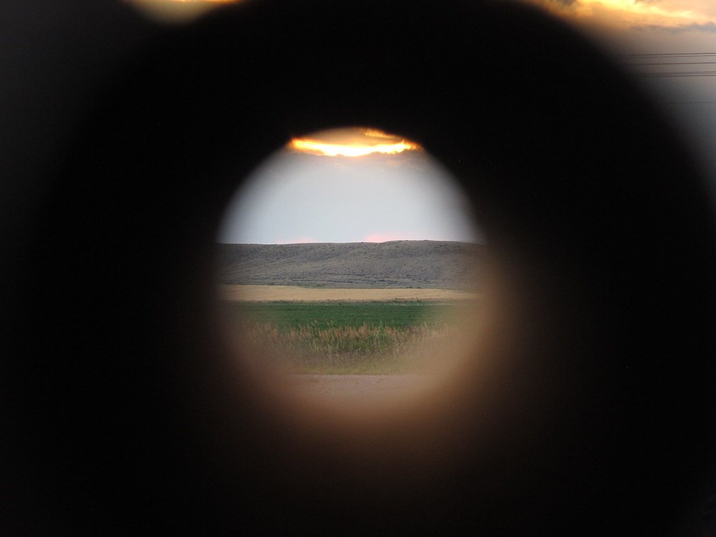
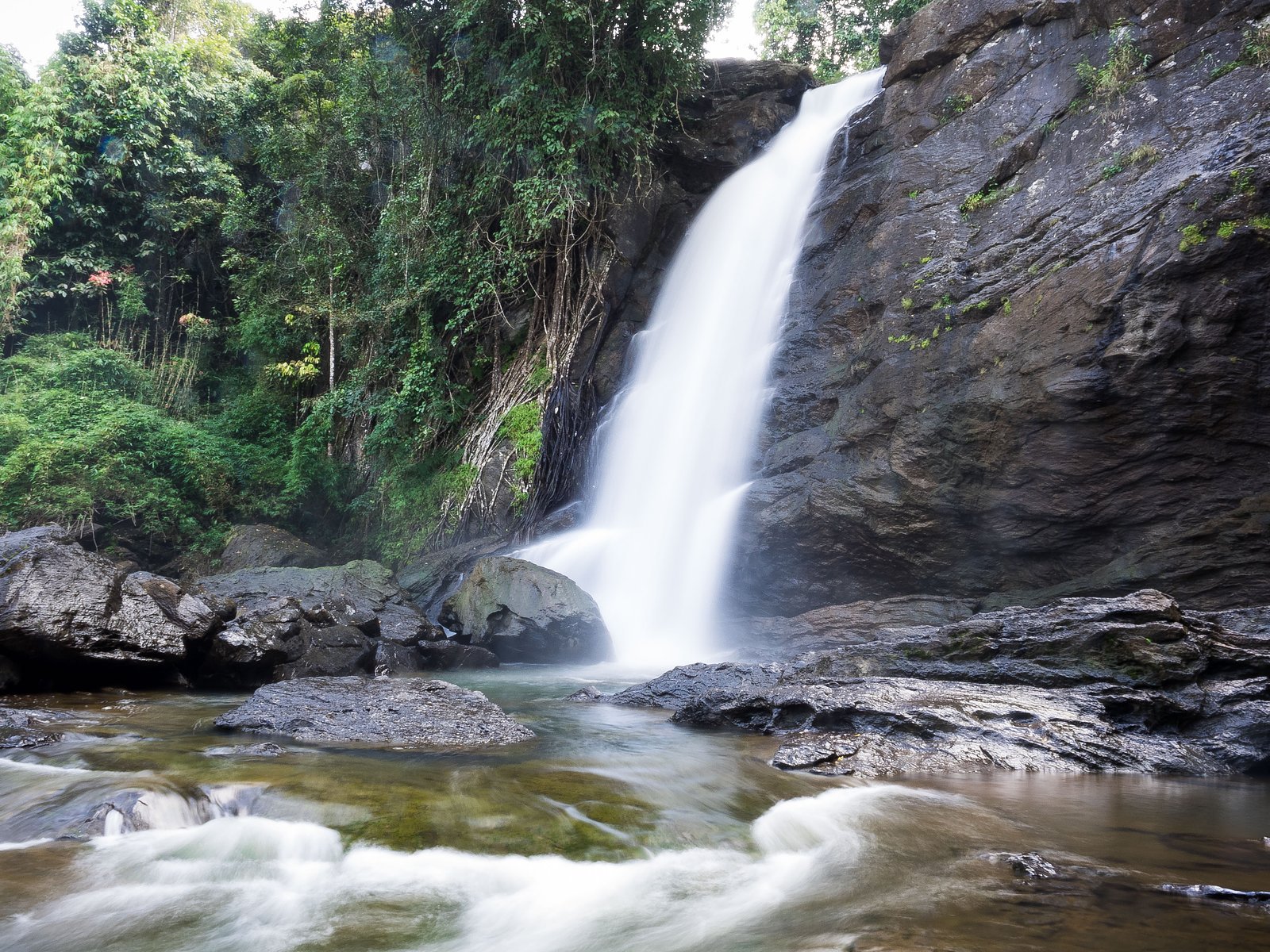
About Sentinel Falls
Sentinel Falls is a quietly scenic waterfall tucked into the forested slopes of Custer National Forest, managed by the U.S. Forest Service. The falls are most commonly reached from the Senia Creek route—USFS Trail SENIA CREEK (Trail #16)—which threads through classic Northern Plains forest and mountain terrain. For visitors looking to make a night of it, the Cascade Campground sits about 6.37 km from the trailhead, making overnight stays and early starts convenient. The setting is inviting for a half-day outing: many hikers use the well-established Senia Creek corridor to reach the falls, enjoying a mix of shaded forest and open viewpoints along the way. The area’s federal management by the USFS helps keep the trail maintained and signage consistent, so it’s a straightforward choice for hikers who want a moderately paced route with a rewarding water feature at the turnaround.
The Setting
Sentinel Falls sits at 8,369 feet within Custer National Forest, in the high alpine of Montana.
Trail & Hike Details
The Approach
The moderate hike follows Senia Creek (#16), a 2.5-mile out and back trail over natural surface. Expect 500 feet of elevation gain. The trail is developed (Class 3).
USFS Trail
SENIA CREEK #16
Trail Class
Developed
Surface
USFS Segment
6.02 miTrail Description
Access to Sentinel Falls follows USFS Trail SENIA CREEK (Trail #16). According to USFS data the trail is mapped at 6.02 GIS miles; the commonly hiked segment to the falls is listed as about 2.5 miles (out-and-back) with roughly 500 feet of elevation gain and a moderate difficulty rating. The trail is a Class 3 route with a native material surface, meaning you’ll encounter natural tread (dirt, roots, rock) rather than paved or gravel surfaces. Expect an out-and-back route where footing can be uneven in places; the Class 3 designation indicates some short, steeper sections or rocky steps that require careful footing but do not need technical gear. Sturdy footwear and standard day-hike preparations are recommended. The trail is managed by the U.S. Forest Service within Custer National Forest; Cascade Campground lies about 6.37 km away for those planning to camp.
What to Expect
Visitors can expect a serene and picturesque hike with opportunities to see wildlife and enjoy breathtaking views of the falls and surrounding landscapes. The falls are most impressive in late spring and early summer when snowmelt is at its peak.
Accessibility
The trail is not wheelchair accessible. Uneven terrain and elevation changes require steady footing.
Frequently Asked Questions
🐶 Are Dogs Allowed at Sentinel Falls?
❌ Dogs are not allowed
Are There Any Fees or Permits Required?
🤑 Fee: $35.00
Permit required
A reservation is required to access the Going-to-the-Sun Road during peak season (May through September). Visitors must also pay the park entrance fee.
🏊 Is There Swimming at Sentinel Falls?
❌ Swimming is not allowed
When to Visit
The best time to visit Sentinel Falls is in late spring or early summer when the snowmelt is at its peak, and the waterfall is flowing strongly.
Seasonal Access
The best time to visit is Spring, Summer, and Fall. Access roads and trails may close during winter due to snow. Check with Custer National Forest for seasonal road closures.
Safety Information
Water temperature is currently 45°F — cold enough to cause numbness quickly. Avoid prolonged water contact and use caution near the falls.
Be cautious of slippery rocks near the falls and stay on designated trails. Carry bear spray and know how to use it, as bears are common in the area. Check weather conditions before your hike, as sudden storms can occur.
Current Water Conditions
93 ft³/s
Current discharge — how much water is flowing
About average for this time of year
Based on 19 years of record
1.72 ft
Water depth at gauge
45°F
Very coldExpect numbness within minutes
7-Day Discharge Trend
What does this mean for your visit?
Flow is about average for this time of year. Water temperature is very cold at 45 degrees F, expect numbness within minutes.
About This Gauge
This gauge is on a nearby waterway and may not reflect exact conditions at the falls.
Know when to go.
Get a free email alert when waterfalls near Roscoe hit peak flow. We only send when conditions are worth the trip — no weekly newsletters, no spam.
Weather Forecast
Location & Access
Getting There
Sentinel Falls is located within Glacier National Park. Access typically requires entering the park via the Going-to-the-Sun Road. The falls are visible from certain viewpoints along the road, but reaching closer views may require hiking.
Get Directions on Google MapsParking
Parking is available at designated areas along the Going-to-the-Sun Road. During peak seasons, parking may be limited, and visitors are encouraged to arrive early.
Hours
Elevation
8369 feet above sea level
Coordinates
45.156462° N, -109.528499° W
Land Management
Managed by USFS
Visitor Tips & Gear
Arrive early to secure parking and avoid crowds. Bring plenty of water, sunscreen, and layers, as weather conditions can change rapidly in the mountains. Check trail conditions and park alerts before your visit.
This trail sits at 8,369 ft — the air is noticeably thinner
High AltitudeSome visitors experience headaches, fatigue, or shortness of breath at this elevation. Take it slow, stay hydrated, and consider supplemental oxygen if you're coming from a lower altitude.
As an Amazon Associate, we earn from qualifying purchases.

Coppertone Sport SPF 50 Sunscreen
UV intensity jumps ~4% per 1,000 ft — at this elevation you can burn in half the time.

Sun Bum SPF 30 Lip Balm (3-Pack)
Lips have almost no natural UV protection and burn fast in thin, dry mountain air.

Liquid I.V. Electrolyte Packets
You lose moisture ~2x faster at elevation — electrolytes help you absorb water efficiently.

ROCKNIGHT Polarized UV400 Sunglasses
High-altitude glare off rock and water is intense — UV400 lenses block 99%+ of UVA/UVB.

Boost Oxygen 10L Canister (2-Pack)
Portable supplemental oxygen for quick relief from headaches and shortness of breath.

Altitude Rx OxyBoost Complex
Antioxidant formula designed to support your body's natural altitude acclimation.
As an Amazon Associate, we earn from qualifying purchases.
With 2.5 miles and 500 ft of elevation gain, sturdy boots and trekking poles will help on this moderate trail. Sun exposure on the trail makes good sun protection a must in summer.

Polarized Sunglasses (Knockaround)
Cuts glare off the water so you actually see the falls — and your photos turn out better too.

Columbia Watertight II Rain Jacket
Packs into its own pocket, seam-sealed, and keeps you dry from spray and surprise rain.

Earth Pak Waterproof Dry Bag
Keeps your phone and gear dry when waterfall mist soaks everything else.

Waterproof Phone Pouch (AiRunTech)
Cheap insurance — take photos right next to the falls without killing your phone.

Timberland Euro Sprint Mid Waterproof
Trusted waterproof boot with premium leather and grippy rubber sole — reliable on rocky, wet trails.

TrailBuddy Trekking Poles
Lightweight aluminum, cork grips, and flip-locks that actually hold — a best-seller for good reason.
Where to Stay

Beartooth Hideaway Inn & Cabins

Hotel Expedition

Rock Creek Resort

Red Lodge Vacation Rental with Mountain Views!
Browse vacation cabins and private rentals nearby
Unique outdoor stays — tents, yurts, and treehouses
Rent a campervan or RV for your waterfall road trip
Some links are affiliate links. We may earn a commission at no extra cost to you.
Nearby Campground
CASCADE
4.0 miles away · 30 sites
Overview Cascade Campground is located 11 miles west of Red Lodge, in southern Montana. It conveniently sits along Forest Road 2071, which is paved for most of the route. The area is a popular location for hiking, backpacking and fishing. Recreation Fishing is a popular activity along the West Fork of Rock Creek and at nearby Wild Bill Lake. The small lake is open to kayaking and canoeing, and an accessible fishing dock is located on the shore. The Basin Lakes Trailhead is three miles away, acros
Book on Recreation.govNearby Hot Springs
Hot springs near Roscoe, Montana
Hot Springs
This warm spring emerges at 7,948 feet elevation in Yellowstone's northeastern wilderness, 11.5 miles from Northeast Entrance R...
Hot, On Lamar River
A warm spring emerges along the Lamar River at 6,777 feet elevation in Yellowstone's renowned wildlife corridor, approximately ...
Hot Springs
Perched at 8,683 feet in Yellowstone's alpine backcountry, this warm spring sits 12.2 miles from Hoodoo Basin Trail, making it ...

Buffalo Bill Reservoir Springs
Buffalo Bill Reservoir Springs flows at 5,390 feet elevation along the southern margins of Buffalo Bill Reservoir, classified a...
Anderson Springs
Anderson Springs flows at 77°F in Sweet Grass County, Montana, at 5,540 feet elevation along the East Boulder River drainage. U...

Buffalo Bill Reservoir Springs
Buffalo Bill Reservoir Springs emerges at 5,530 feet along the shores of Buffalo Bill Reservoir in Park County, classified as w...
Looking for a soak after your hike? Explore more hot springs near Roscoe, Montana on SoakingSprings.
Explore Montana springsAdditional Information
Nearby Attractions
Nearby attractions include Lake McDonald, Avalanche Lake, and the iconic Going-to-the-Sun Road.
Wildlife
Visitors may encounter wildlife such as mountain goats, marmots, and bears. Always maintain a safe distance and follow park guidelines for wildlife encounters.
Cities near Sentinel Falls
Nearby Waterfalls
Writing about Sentinel Falls? Embed this waterfall on your site for free.