Photo Credits (3)
Difficulty
Moderate
Trail Length
3.0 miles
Trail Type
Out And Back
Elevation Gain
500 ft
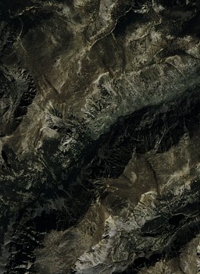
About Charlie Falls
Charlie Falls is a quiet, scenic cascade tucked into the forested slopes of Custer National Forest, managed by the U.S. Forest Service. Framed by dense trees, the falls make for a peaceful destination for hikers and photographers looking for a lesser-known natural highlight away from busier tourist corridors. Most visitors reach Charlie Falls via the USFS East Rosebud Trail (Trail #15). The approach is a moderate, out-and-back hike of about 3.0 miles round trip with roughly 500 feet of elevation gain; the route is listed as Class 3 on USFS records and follows native-material tread, so expect a natural, sometimes rugged forest path that rewards you with close-up views and a tranquil streamside setting at the falls.
The Setting
Charlie Falls sits at 8,445 feet within Custer National Forest, fed by the West Rosebud Creek, in the high alpine of Montana.
Trail & Hike Details
The Approach
The moderate hike follows East Rosebud (#15), a 3.0-mile out-and-back trail over natural surface. Expect 500 feet of elevation gain. The trail is developed (Class 3).
USFS Trail
EAST ROSEBUD #15
Trail Class
Developed
Surface
USFS Segment
15.74 miTrail Description
USFS trail: EAST ROSEBUD (Trail #15). Trail type: out-and-back, approximately 3.0 miles round trip with about 500 ft of elevation gain and rated moderate. Surface: NATIVE MATERIAL. USFS class: 3. The trail winds through dense forest with a mix of flat sections and moderate inclines; the native-material tread can be uneven in places with roots and rocks, so sturdy footwear is recommended. The final approach opens onto the falls and offers close, photogenic views and a peaceful atmosphere.
What to Expect
Visitors can expect a moderately challenging hike through scenic forested terrain, culminating in a beautiful waterfall surrounded by natural beauty. The area is typically quiet and less crowded than more popular destinations.
Accessibility
The trail is not wheelchair accessible. Uneven terrain and elevation changes require steady footing.
Frequently Asked Questions
🐶 Are Dogs Allowed at Charlie Falls?
❌ Dogs are not allowed
Are There Any Fees or Permits Required?
🆖 No fees required
🏊 Is There Swimming at Charlie Falls?
❌ Swimming is not allowed
When to Visit
The best time to visit Charlie Falls is during late spring or early summer when water flow is at its peak due to snowmelt. Fall also offers beautiful foliage, while summer provides warmer weather for hiking.
Seasonal Access
The best time to visit is Spring, Summer, and Fall. Access roads and trails may close during winter due to snow. Check with Custer National Forest for seasonal road closures.
Safety Information
Visitors should exercise caution on the trail, especially near the waterfall, as rocks may be slippery. Be prepared for changing weather conditions and carry a first aid kit. Cell service may be limited in the area.
Current Water Conditions
196 ft³/s
Current discharge — how much water is flowing
About average for this time of year
Based on 59 years of record
1.32 ft
Water depth at gauge
7-Day Discharge Trend
What does this mean for your visit?
Flow is about average for this time of year.
About This Gauge
This gauge is on a nearby waterway and may not reflect exact conditions at the falls.
7-Day Flow Outlook
Based on the USGS gauge West Rosebud Creek near Roscoe MT (13 km away).
Today
Moderate
223 cfs
6/10Tomorrow
Moderate
247 cfs
6/10Mon
Moderate
300 cfs
6/10Tue
Moderate
333 cfs
6/10Wed
Moderate
374 cfs
6/10Thu
Moderate
397 cfs
6/10Fri
Moderate
400 cfs
6/10Best window: Today — moderate flow, chance t-storms (trip score 6/10).
Best time of year: this gauge typically runs highest from early June to early September, peaking in July.
How we calculate this
This is a transparent outlook, not a precise forecast. We take the waterfall's current flow strength (how it ranks against its historical normal for today, from the nearest USGS stream gauge), carry that ranking forward along the gauge's seasonal curve, and nudge it for forecast rain. Confidence is highest for the next day or two and falls further out. Always check official conditions and your own judgment before visiting — high flows can be dangerous.
Know when to go.
Get a free email alert when waterfalls near Cooke City hit peak flow. We only send when conditions are worth the trip — no weekly newsletters, no spam.
Weather Forecast
Location & Access
Getting There
Charlie Falls is located in a remote area of Montana. Access typically requires driving on unpaved roads, and directions may vary depending on the starting point. Visitors are advised to consult local maps or GPS for the most accurate route.
Get Directions on Google MapsParking
Parking availability is limited and may consist of a small dirt lot or roadside pull-off near the trailhead.
Elevation
8,445 feet above sea level
Coordinates
45.122165° N, -109.724340° W
Land Management
Managed by USFS
Visitor Tips & Gear
Start your hike early to avoid potential crowds and ensure you have enough daylight for the return trip. Bring plenty of water, snacks, and appropriate footwear. Check weather conditions before heading out, as trails may become muddy or slippery after rain.
This trail sits at 8,445 ft — the air is noticeably thinner
High AltitudeSome visitors experience headaches, fatigue, or shortness of breath at this elevation. Take it slow, stay hydrated, and consider supplemental oxygen if you're coming from a lower altitude.
As an Amazon Associate, we earn from qualifying purchases.

Coppertone Sport SPF 50 Sunscreen
UV intensity jumps ~4% per 1,000 ft — at this elevation you can burn in half the time.

Sun Bum SPF 30 Lip Balm (3-Pack)
Lips have almost no natural UV protection and burn fast in thin, dry mountain air.

Liquid I.V. Electrolyte Packets
You lose moisture ~2x faster at elevation — electrolytes help you absorb water efficiently.

ROCKNIGHT Polarized UV400 Sunglasses
High-altitude glare off rock and water is intense — UV400 lenses block 99%+ of UVA/UVB.

Boost Oxygen 10L Canister (2-Pack)
Portable supplemental oxygen for quick relief from headaches and shortness of breath.

Altitude Rx OxyBoost Complex
Antioxidant formula designed to support your body's natural altitude acclimation.
As an Amazon Associate, we earn from qualifying purchases.
With 3.0 miles and 500 ft of elevation gain, sturdy boots and trekking poles will help on this moderate trail. Sun exposure on the trail makes good sun protection a must in summer.

Polarized Sunglasses (Knockaround)
Cuts glare off the water so you actually see the falls — and your photos turn out better too.

Columbia Watertight II Rain Jacket
Packs into its own pocket, seam-sealed, and keeps you dry from spray and surprise rain.

Earth Pak Waterproof Dry Bag
Keeps your phone and gear dry when waterfall mist soaks everything else.

Waterproof Phone Pouch (AiRunTech)
Cheap insurance — take photos right next to the falls without killing your phone.

Timberland Euro Sprint Mid Waterproof
Trusted waterproof boot with premium leather and grippy rubber sole — reliable on rocky, wet trails.

TrailBuddy Trekking Poles
Lightweight aluminum, cork grips, and flip-locks that actually hold — a best-seller for good reason.
Where to Stay

Alpine Motel of Cooke City

Antlers Lodge

Elk Horn Lodge Motel and Cabins

Soda Butte Lodge
Browse vacation cabins and private rentals nearby
Unique outdoor stays — tents, yurts, and treehouses
Rent a campervan or RV for your waterfall road trip
Some links are affiliate links. We may earn a commission at no extra cost to you.
Nearby Campground
East Rosebud Campground
6.9 miles away · 0 sites
East Rosebud Campground is nestled in the trees, not far from East Rosebud Lake. East Rosebud is considered one of the more scenic drainages in the Beartooths and the campground is a short distance from the East Rosebud Trail (#15), Spread Creek Trail (#13), and Phantom Creek Trail (#17). Jimmy Joe Campground and Sand Dunes Picnic Ground also located in the East Rosebud drainage.*Please be advised that much of the area directly around East Rosebud Lake is private property. Fishing or boat access
Book on Recreation.govNearby Hot Springs
Hot springs near Cooke City, Montana
Hot Springs
This warm spring emerges at 7,948 feet elevation in Yellowstone's northeastern wilderness, 11.5 miles from Northeast Entrance R...
Hot, On Lamar River
A warm spring emerges along the Lamar River at 6,777 feet elevation in Yellowstone's renowned wildlife corridor, approximately ...
Hot Springs
Perched at 8,683 feet in Yellowstone's alpine backcountry, this warm spring sits 12.2 miles from Hoodoo Basin Trail, making it ...
Anderson Springs
Anderson Springs flows at 77°F in Sweet Grass County, Montana, at 5,540 feet elevation along the East Boulder River drainage. U...

Calcite Springs
Calcite Springs emerges at 201 degrees Fahrenheit along the walls of the Grand Canyon of the Yellowstone, where superheated wat...
Rainbow Springs
Rainbow Springs discharges at 190 degrees Fahrenheit—157 degrees above the frigid 32-degree ambient—in Yellowstone's remote bac...
Looking for a soak after your hike? Explore more hot springs near Cooke City, Montana on SoakingSprings.
Explore Montana springsAdditional Information
Nearby Attractions
Nearby attractions may include other hiking trails, scenic viewpoints, and local wildlife areas.
Wildlife
The area around Charlie Falls is home to a variety of wildlife, including deer, birds, and small mammals. Visitors should be cautious of bears and carry bear spray if hiking in the region.
Cities near Charlie Falls
Nearby Waterfalls
Writing about Charlie Falls? Embed this waterfall on your site for free.