
Photo Credits (5)
Difficulty
Moderate
Trail Length
2.4 miles
Trail Type
Out And Back
Elevation Gain
350 ft
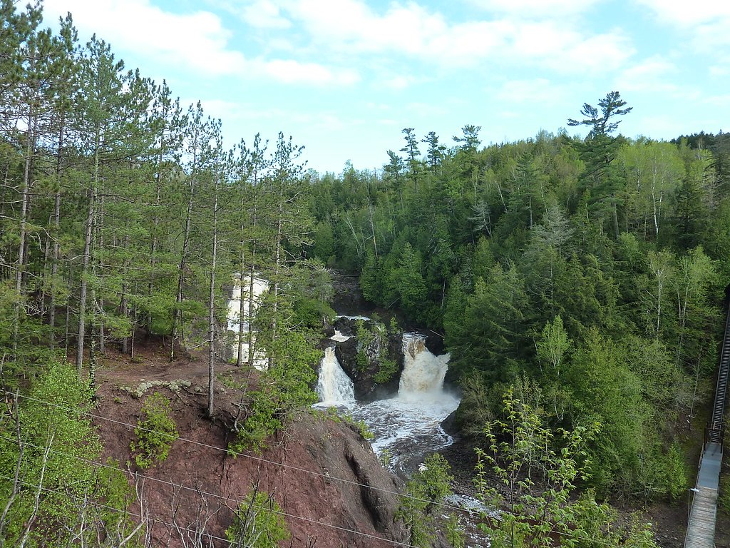
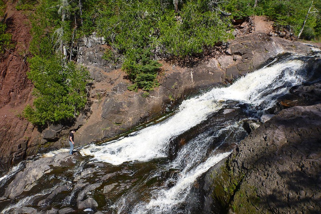
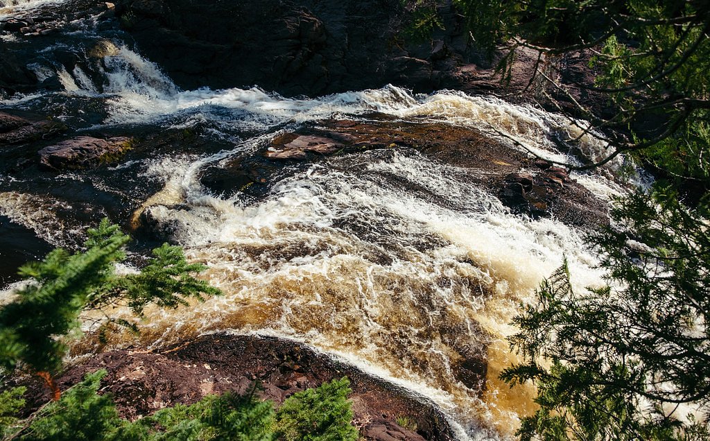
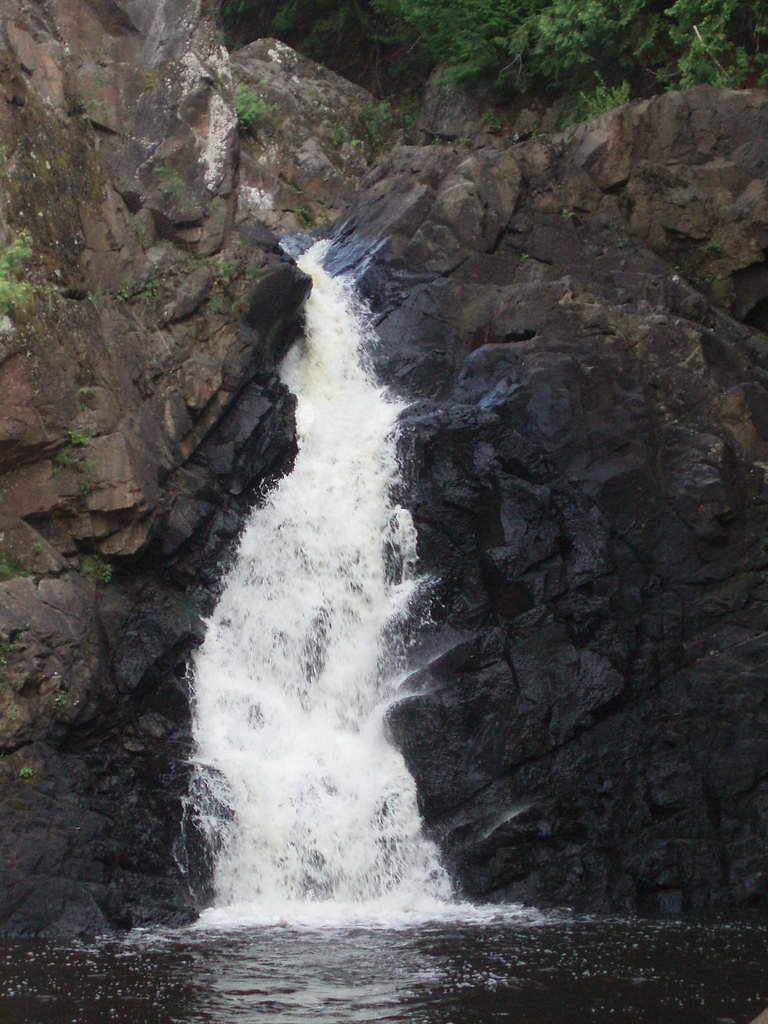
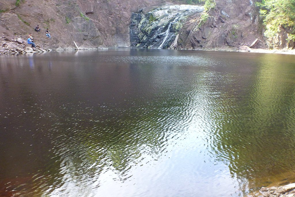
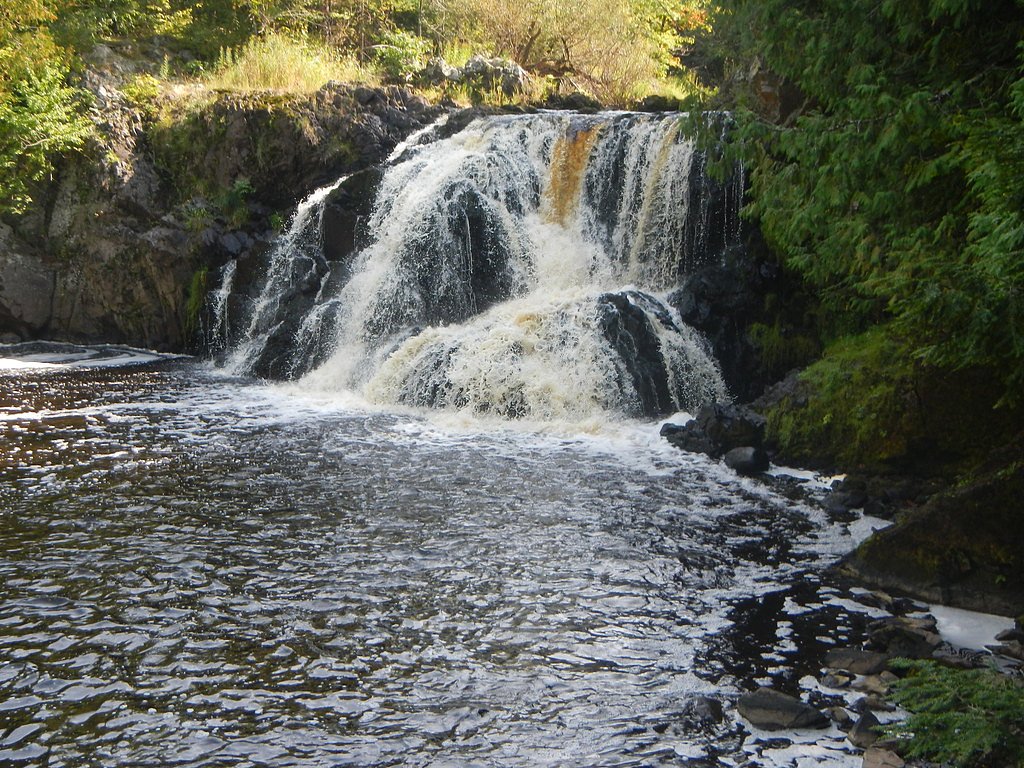
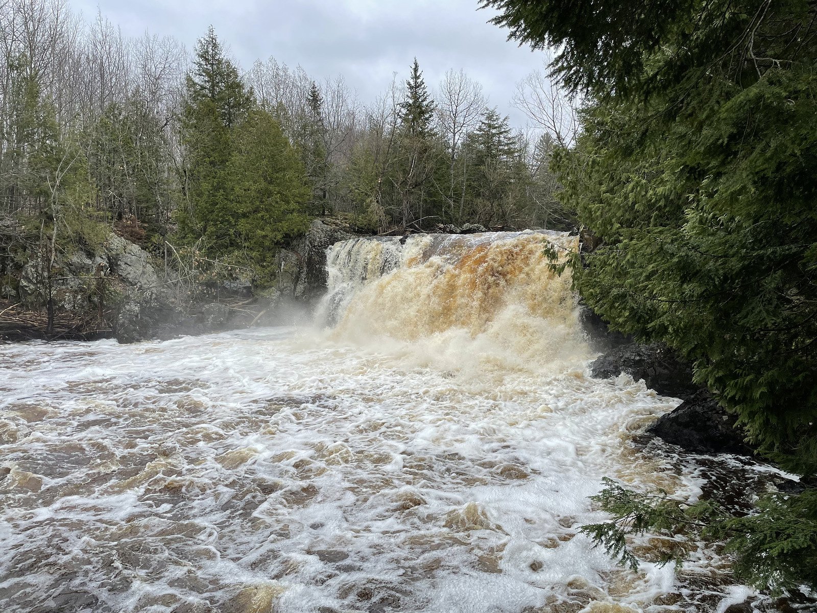
About Saxon Falls
Saxon Falls sits on the Montreal River where the water carves a scenic stretch of whitewater along the Michigan–Wisconsin line. The cascade is framed by forested banks and a viewing platform that makes it easy to take in the rugged drop; flows can vary because the falls are part of a hydroelectric dam system upriver. The Montreal River itself runs about 47.8 miles to Lake Superior and drains roughly 270 square miles of largely forested terrain — its Ojibwe name, Gaa-waasijiwaang, fittingly means “where there is whitewater.” The site is a favorite for photographers and day hikers wanting a relatively quick nature outing with dramatic river scenery. If you’re planning an overnight trip, the nearest developed camping is Black River Harbor Pavilion, roughly 29.3 km away, so most visitors treat Saxon Falls as a half-day stop while exploring the Upper Peninsula’s lakes and rivers.
The Setting
Saxon Falls sits at 879 feet along the Black River, in the foothills of Michigan.
Nearby Falls Worth Visiting
Superior Falls (90 ft) lies 2.5 miles to the northwest. Also nearby: Potato River Falls (90 ft, 8.8 mi) and Interstate Falls (18 ft, 9.6 mi).
Trail & Hike Details
The Approach
The moderate 2.4-mile out-and-back trail gains 350 feet of elevation on the way to the falls.
Trail Description
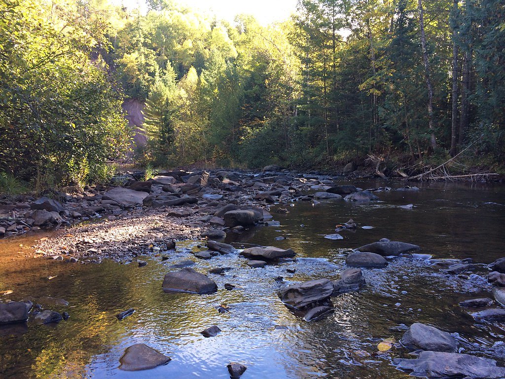
The approach to Saxon Falls is an out-and-back trail of about 2.4 miles total with roughly 350 feet of elevation gain; the route is rated moderate. The path leads through mixed woods to a dedicated viewing platform above the falls, with some uneven sections and short climbs that account for the elevation change. Good footwear is recommended, and the trail’s manageable length makes it a pleasant half-day hike for most moderately fit visitors.
What to Expect
Dogs are welcome.
Accessibility
The trail is not wheelchair accessible. Uneven terrain and elevation changes require steady footing.
Frequently Asked Questions
🐶 Are Dogs Allowed at Saxon Falls?
✅ Dogs are allowed
Are There Any Fees or Permits Required?
🆖 No fees required
🏊 Is There Swimming at Saxon Falls?
❌ Swimming is not allowed
When to Visit
Spring and early summer are ideal for visiting Saxon Falls due to higher water flow. Fall offers beautiful foliage, while winter provides a unique view of the frozen waterfall.
Seasonal Access
The best time to visit is Spring, Summer, and Fall. Winter access may be limited.
Safety Information
Exercise caution near the water and stay on marked trails. Rocks can be slippery, and water levels may rise unexpectedly due to dam operations.
Current Water Conditions
35 ft³/s
Current discharge — how much water is flowing
Lower than usual for this time of year
Based on 53 years of record
2.08 ft
Water depth at gauge
7-Day Discharge Trend
What does this mean for your visit?
Flow is lower than usual for this time of year.
About This Gauge
This gauge is on a nearby waterway and may not reflect exact conditions at the falls.
7-Day Flow Outlook
Based on the USGS gauge BLACK RIVER NEAR BESSEMER, MI (24 km away).
Today
Low
35 cfs
6/10Tomorrow
Low
31 cfs
6/10Sun
Moderate
33 cfs
5/10Mon
Moderate
40 cfs
4/10Tue
Moderate
39 cfs
4/10Wed
Moderate
41 cfs
4/10Thu
Moderate
32 cfs
4/10Best window: Today — low flow, mostly sunny (trip score 6/10).
Best time of year: this gauge typically runs highest from late March to late May, peaking in April.
How we calculate this
This is a transparent outlook, not a precise forecast. We take the waterfall's current flow strength (how it ranks against its historical normal for today, from the nearest USGS stream gauge), carry that ranking forward along the gauge's seasonal curve, and nudge it for forecast rain. Confidence is highest for the next day or two and falls further out. Always check official conditions and your own judgment before visiting — high flows can be dangerous.
Know when to go.
Get a free email alert when waterfalls near Saxon hit peak flow. We only send when conditions are worth the trip — no weekly newsletters, no spam.
Weather Forecast
Location & Access
Getting There
Saxon Falls can be accessed via a short drive from Ironwood, Michigan. Visitors typically park near the Saxon Falls Hydroelectric Dam and follow a trail to the viewing area. The trailhead is located off Saxon Falls Road.
Get Directions on Google MapsParking
Parking is available near the hydroelectric dam, but spaces may be limited.
Elevation
879 feet above sea level
Coordinates
46.536058° N, -90.379624° W
Visitor Tips & Gear
Visit after heavy rainfall or during spring snowmelt for the most impressive water flow. Bring insect repellent during summer months, as mosquitoes can be prevalent. Be cautious near the water, as rocks can be slippery.
As an Amazon Associate, we earn from qualifying purchases.
With 2.4 miles and 350 ft of elevation gain, sturdy boots and trekking poles will help on this moderate trail. Sun exposure on the trail makes good sun protection a must in summer.

Polarized Sunglasses (Knockaround)
Cuts glare off the water so you actually see the falls — and your photos turn out better too.

Columbia Watertight II Rain Jacket
Packs into its own pocket, seam-sealed, and keeps you dry from spray and surprise rain.

Earth Pak Waterproof Dry Bag
Keeps your phone and gear dry when waterfall mist soaks everything else.

Waterproof Phone Pouch (AiRunTech)
Cheap insurance — take photos right next to the falls without killing your phone.

Timberland Euro Sprint Mid Waterproof
Trusted waterproof boot with premium leather and grippy rubber sole — reliable on rocky, wet trails.

TrailBuddy Trekking Poles
Lightweight aluminum, cork grips, and flip-locks that actually hold — a best-seller for good reason.
Where to Stay

Snow Otter Haus - 2

Quality Inn Ironwood

Snow Otter Haus - 1

Quality Inn Ashland - Lake Superior
Browse vacation cabins and private rentals nearby
Unique outdoor stays — tents, yurts, and treehouses
Rent a campervan or RV for your waterfall road trip
Some links are affiliate links. We may earn a commission at no extra cost to you.
Nearby Campground
BLACK RIVER HARBOR PAVILION
18.2 miles away · 1 sites
Overview Planning a visit to the Black River Harbor Pavilion? Watch for Alerts at the top of the page for any Alerts regarding this facility. The Black River Harbor Pavilion is located within the Black Harbor Recreation Area on Lake Superior in Michigans Upper Peninsula. The historic stone and wood pavilion was constructed by the Civilian Conservation Corps in the 1930s. Recreation Lake Superior offers great opportunities for boating, fishing, and swimming. The North Country National Scenic Trail
Book on Recreation.govAdditional Information
Nearby Attractions
Nearby attractions include Superior Falls, Black River Harbor, and the Porcupine Mountains Wilderness State Park.
Wildlife
The area is home to various wildlife, including deer, birds, and small mammals. Be cautious of ticks during warmer months.
Cities near Saxon Falls
Nearby Waterfalls
Writing about Saxon Falls? Embed this waterfall on your site for free.