
Photo Credits (5)
Difficulty
Moderate
Trail Length
2.4 miles
Trail Type
Out And Back
Elevation Gain
350 ft
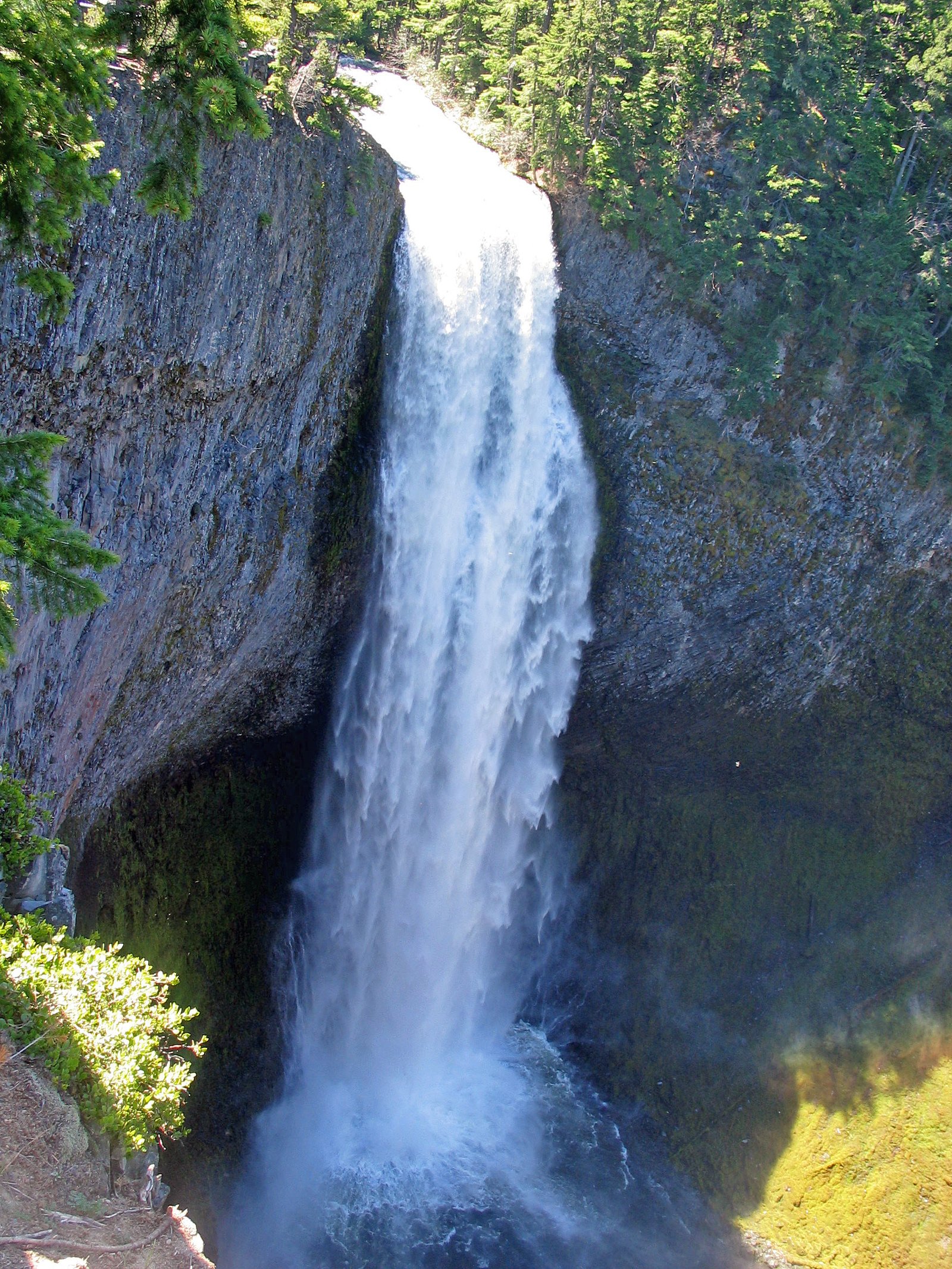
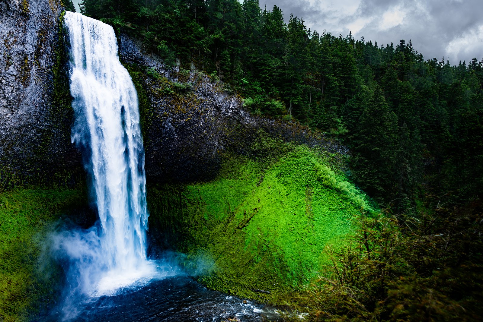
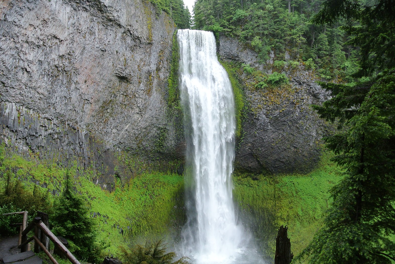
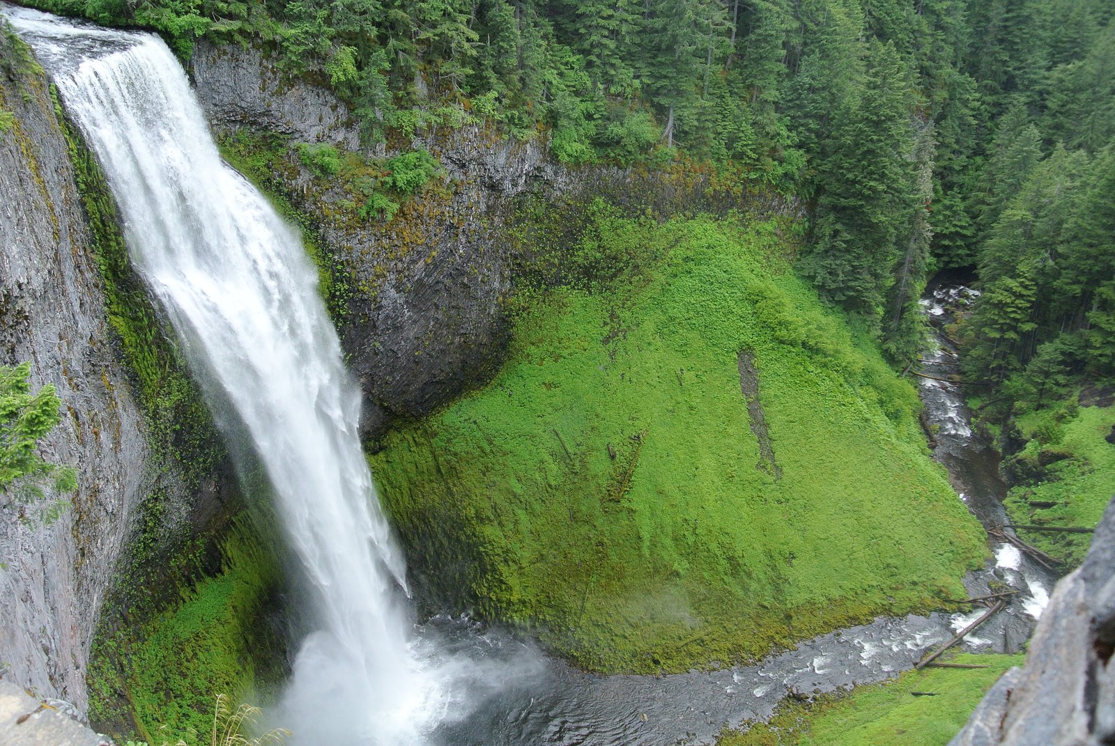
About Salt Creek Falls
Salt Creek Falls sits within Talladega National Forest and is managed by the U.S. Forest Service, offering a quiet woodland waterfall experience that draws hikers and photographers seeking a peaceful nature outing. The setting is inviting year-round for a stroll and a few good photo opportunities amid mature forest; the USFS stewardship helps keep the area accessible and conserved for visitors. Access to the falls is via a moderate out-and-back hike, and overnight options are nearby — Turnipseed Campground lies about 8.88 km away for those who want to turn a day visit into a camping trip. Pack sturdy shoes and a camera and plan for a moderate effort on the approach to fully enjoy the fall and surrounding forest.
The Setting
Salt Creek Falls sits at 728 feet within Talladega National Forest, fed by the Choccolocco Creek, in the foothills of Alabama.
Trail & Hike Details
The Approach
The moderate 2.4-mile out-and-back trail gains 350 feet of elevation on the way to the falls.
Trail Description
This USFS-managed route in Talladega National Forest is an out-and-back trail of 2.4 miles with approximately 350 feet of elevation gain and a moderate difficulty rating. The available trail data lists length, elevation gain, difficulty, and type (out-and-back); specific surface, grade, and technical class details are not specified in the provided data. Expect a moderate hike that can be combined with camping at Turnipseed Campground roughly 8.88 km from the trailhead.
What to Expect
Dogs are welcome.
Accessibility
The trail is not wheelchair accessible. Uneven terrain and elevation changes require steady footing.
Frequently Asked Questions
🐶 Are Dogs Allowed at Salt Creek Falls?
✅ Dogs are allowed
Are There Any Fees or Permits Required?
🆖 No fees required
🏊 Is There Swimming at Salt Creek Falls?
❌ Swimming is not allowed
When to Visit
Spring and early summer are the best times to visit, as the waterfall is typically at its fullest due to seasonal rainfall.
Seasonal Access
The best time to visit is Spring, Summer, and Fall. Winter access may be limited. Check with Talladega National Forest for seasonal road closures.
Safety Information
Exercise caution near the waterfall, as rocks can be slippery. Be aware of your surroundings and stay on marked trails.
Current Water Conditions
99 ft³/s
Current discharge — how much water is flowing
About average for this time of year
Based on 19 years of record
3.62 ft
Water depth at gauge
7-Day Discharge Trend
What does this mean for your visit?
Flow is about average for this time of year.
About This Gauge
This gauge is on a nearby waterway and may not reflect exact conditions at the falls.
7-Day Flow Outlook
Based on the USGS gauge CHOCCOLOCCO CREEK NEAR BOILING SPRING, ALABAMA (16 km away).
Today
Low
113 cfs
3/10Tomorrow
Moderate
113 cfs
4/10Fri
Low
94 cfs
6/10Sat
Low
102 cfs
3/10Sun
Moderate
104 cfs
4/10Mon
Moderate
103 cfs
4/10Tue
Moderate
109 cfs
4/10Best window: Fri — low flow, sunny (trip score 6/10).
Best time of year: this gauge typically runs highest from early February to mid April, peaking in February.
How we calculate this
This is a transparent outlook, not a precise forecast. We take the waterfall's current flow strength (how it ranks against its historical normal for today, from the nearest USGS stream gauge), carry that ranking forward along the gauge's seasonal curve, and nudge it for forecast rain. Confidence is highest for the next day or two and falls further out. Always check official conditions and your own judgment before visiting — high flows can be dangerous.
Know when to go.
Get a free email alert when waterfalls near Munford hit peak flow. We only send when conditions are worth the trip — no weekly newsletters, no spam.
Weather Forecast
Location & Access
Getting There
Salt Creek Falls is located near Munford, Alabama, within the Talladega National Forest. It can be accessed via local roads, and visitors should follow signs or use GPS for navigation.
Get Directions on Google MapsParking
There is a small parking area near the trailhead, but availability may be limited during peak seasons.
Elevation
728 feet above sea level
Coordinates
33.501496° N, -85.904688° W
Land Management
Managed by USFS
Visitor Tips & Gear
Visit early in the day to avoid crowds and ensure parking availability. Wear sturdy shoes as the trail may be uneven in some areas. Bring water and snacks, especially during warmer months.
As an Amazon Associate, we earn from qualifying purchases.
With 2.4 miles and 350 ft of elevation gain, sturdy boots and trekking poles will help on this moderate trail. Sun exposure on the trail makes good sun protection a must in summer.

Polarized Sunglasses (Knockaround)
Cuts glare off the water so you actually see the falls — and your photos turn out better too.

Columbia Watertight II Rain Jacket
Packs into its own pocket, seam-sealed, and keeps you dry from spray and surprise rain.

Earth Pak Waterproof Dry Bag
Keeps your phone and gear dry when waterfall mist soaks everything else.

Waterproof Phone Pouch (AiRunTech)
Cheap insurance — take photos right next to the falls without killing your phone.

Timberland Euro Sprint Mid Waterproof
Trusted waterproof boot with premium leather and grippy rubber sole — reliable on rocky, wet trails.

TrailBuddy Trekking Poles
Lightweight aluminum, cork grips, and flip-locks that actually hold — a best-seller for good reason.
Where to Stay

Comfort Suites Oxford I-20 exit 188

Comfort Inn & Suites Lincoln I-20

Hilton Garden Inn Oxford/Anniston, AL

Comfort Suites Pell City near Logan Martin Lake
Browse vacation cabins and private rentals nearby
Unique outdoor stays — tents, yurts, and treehouses
Rent a campervan or RV for your waterfall road trip
Some links are affiliate links. We may earn a commission at no extra cost to you.
Nearby Campground
Turnipseed Campground
5.5 miles away · 0 sites
Enjoy nature at its best especially during the fall when mother nature dazzles you with an array of vibrant colors. This primitive camp is located near the Cheaha Wilderness Area and offers camping and hiking. Turnipseed Camp has sanitary facilities.
Book on Recreation.govAdditional Information
Nearby Attractions
Nearby attractions include Cheaha State Park and other hiking trails within the Talladega National Forest.
Wildlife
The area is home to various wildlife, including birds, deer, and small mammals. Visitors should be cautious and respectful of the natural habitat.
Cities near Salt Creek Falls
Other waterfalls named Salt Creek Falls
1 other waterfall shares this name across the U.S.
Writing about Salt Creek Falls? Embed this waterfall on your site for free.