Photo Credits (5)
Difficulty
Moderate
Trail Length
2.4 miles
Trail Type
Out And Back
Elevation Gain
350 ft
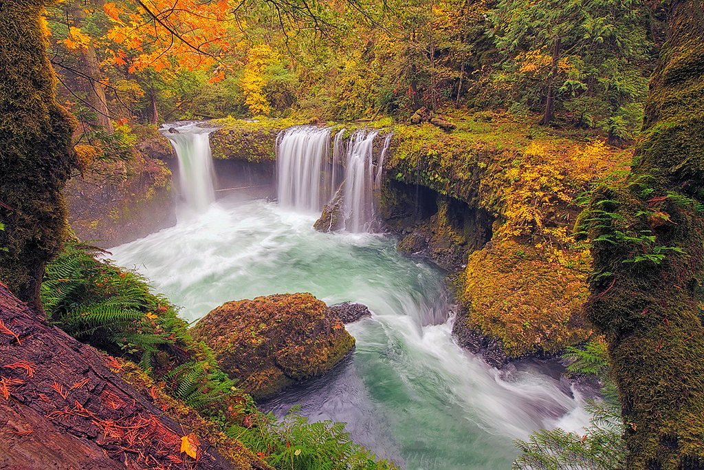
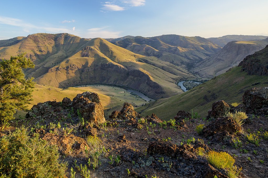
About Salmon Falls
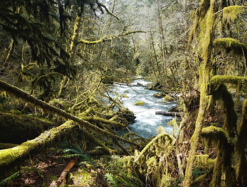
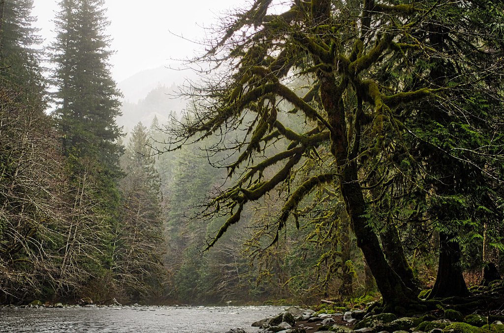
Salmon Falls sits tucked into the mossy, forested slopes of the Willamette National Forest and is managed by the U.S. Forest Service. The falls are reached via Salmon Creek and reward hikers with a peaceful cascade framed by mature conifers and ferns — an easy-to-love spot for photographers and anyone wanting a quick immersion in Oregon’s Cascade woodlands. Note that “Salmon Falls” is a name used elsewhere (for example on the Snake River and in New England); this entry refers to the Salmon Falls found on Salmon Creek in the Willamette National Forest. Access to the waterfall is via the USFS Salmon Creek Trail (Trail #4365), a popular short outing that feels remote despite its forest-road approach. The setting is quintessential Cascades — shady corridor, native understory, and the steady sound of falling water — all managed and maintained by the Forest Service for day-use hikers and nature lovers.
The Setting
Salmon Falls sits at 1,480 feet within Willamette National Forest, fed by the Mf Willamette River Abv Salt Crk,, in the foothills of Oregon.
Trail & Hike Details
The Approach
The moderate hike follows Salmon Creek (#4365), a 2.4-mile out-and-back trail over natural surface. Expect 350 feet of elevation gain with grades of 12-20%. The trail is developed (Class 3).
USFS Trail
SALMON CREEK #4365
Trail Class
Developed
Surface
Avg Grade
USFS Segment
1.48 miTrail Description
The route to Salmon Falls follows the USFS Salmon Creek Trail (Trail #4365). According to Forest Service trail data the tread is native material and the trail is rated Class 3, with typical grades in the 12–20% range. USFS GIS data lists the trail at about 1.48 miles (mapped mileage); local route information commonly describes the outing as an out-and-back totaling roughly 2.4 miles with about 350 feet of elevation gain, and a moderate difficulty rating. Expect a natural dirt tread that can get slick or muddy in wet weather, some short, steeper pitches, and singletrack-style footing — sturdy shoes and attention on steeper sections are recommended.
What to Expect
Dogs are welcome.
Accessibility
The trail is not wheelchair accessible. Uneven terrain and elevation changes require steady footing.
Frequently Asked Questions
🐶 Are Dogs Allowed at Salmon Falls?
✅ Dogs are allowed
Are There Any Fees or Permits Required?
🆖 No fees required
🏊 Is There Swimming at Salmon Falls?
❌ Swimming is not allowed
When to Visit
Spring and early summer are ideal times to visit, as the waterfall flow is typically strongest due to snowmelt and rainfall.
Seasonal Access
The best time to visit is Spring, Summer, and Fall. Winter access may be limited. Check with Willamette National Forest for seasonal road closures.
Safety Information
Visitors should exercise caution near the waterfall, as rocks can be slippery. Be prepared for changing weather conditions, and carry a map or GPS device as cell service may be unreliable.
Current Water Conditions
572 ft³/s
Current discharge — how much water is flowing
Lower than usual for this time of year
Based on 91 years of record
2.92 ft
Water depth at gauge
53°F
ColdBracing — limit time in water
7-Day Discharge Trend
What does this mean for your visit?
Flow is lower than usual for this time of year. Water temperature is a bracing 53 degrees F, limit your time in the water.
About This Gauge
7-Day Flow Outlook
Based on the USGS gauge MF WILLAMETTE RIVER ABV SALT CRK, NEAR OAKRIDGE,OR (7 km away).
Today
Barely Flowing
572 cfs
5/10Tomorrow
Barely Flowing
560 cfs
5/10Tue
Barely Flowing
552 cfs
5/10Wed
Barely Flowing
553 cfs
5/10Thu
Low
596 cfs
4/10Fri
Low
622 cfs
4/10Sat
Low
619 cfs
4/10Best window: Today — barely flowing flow, sunny (trip score 5/10).
Best time of year: this gauge typically runs highest from mid November to late December, peaking in January.
How we calculate this
This is a transparent outlook, not a precise forecast. We take the waterfall's current flow strength (how it ranks against its historical normal for today, from the nearest USGS stream gauge), carry that ranking forward along the gauge's seasonal curve, and nudge it for forecast rain. Confidence is highest for the next day or two and falls further out. Always check official conditions and your own judgment before visiting — high flows can be dangerous.
Know when to go.
Get a free email alert when waterfalls near Oakridge hit peak flow. We only send when conditions are worth the trip — no weekly newsletters, no spam.
Weather Forecast
Location & Access
Getting There
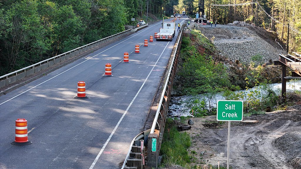
Salmon Falls is located near the town of Oakridge, Oregon. Access is typically via forest roads, and directions may vary depending on the season and road conditions. Visitors are advised to check local maps and trail guides for the most accurate route.
Get Directions on Google MapsParking
There is a small parking area near the trailhead, but availability may be limited during peak seasons.
Elevation
1,480 feet above sea level
Coordinates
43.761512° N, -122.374490° W
Land Management
Managed by USFS
Visitor Tips & Gear
Arrive early during weekends or holidays to secure parking. Bring sturdy shoes, especially if visiting during or after rain. Cell service may be limited, so download maps or directions in advance.
As an Amazon Associate, we earn from qualifying purchases.
With 2.4 miles and 350 ft of elevation gain, sturdy boots and trekking poles will help on this moderate trail. Sun exposure on the trail makes good sun protection a must in summer.

Polarized Sunglasses (Knockaround)
Cuts glare off the water so you actually see the falls — and your photos turn out better too.

Columbia Watertight II Rain Jacket
Packs into its own pocket, seam-sealed, and keeps you dry from spray and surprise rain.

Earth Pak Waterproof Dry Bag
Keeps your phone and gear dry when waterfall mist soaks everything else.

Waterproof Phone Pouch (AiRunTech)
Cheap insurance — take photos right next to the falls without killing your phone.

Timberland Euro Sprint Mid Waterproof
Trusted waterproof boot with premium leather and grippy rubber sole — reliable on rocky, wet trails.

TrailBuddy Trekking Poles
Lightweight aluminum, cork grips, and flip-locks that actually hold — a best-seller for good reason.
Where to Stay

Cascade Motel

Oakridge Inn & Suites

La Quinta Inn & Suites by Wyndham Springfield

Holiday Inn Express : Eugene - Springfield by IHG
Browse vacation cabins and private rentals nearby
Unique outdoor stays — tents, yurts, and treehouses
Rent a campervan or RV for your waterfall road trip
Some links are affiliate links. We may earn a commission at no extra cost to you.
Nearby Campground
Middle Fork Ranger District (Hwy 58)
7.9 miles away · 0 sites
Middle Fork Ranger District (US Highway 58)Middle Fork Ranger District is the southern part of the forest, bordering the Deschutes and Umpqua National Forests. Accessible from the west on Highway 58 from Eugene, OR, or from the south via Highway 58.Spend some time exploring Waldo Lake, one of the gems of the forest, but don’t forget to get out on some of the great mountain biking, hiking, and horse trails in this area.HikingBackpacking and day hikes can be found all over the district including, F
Book on Recreation.govNearby Hot Springs
Hot springs near Oakridge, Oregon
Kitson Hot Springs
Kitson Hot Springs flows at 109°F within Willamette National Forest at 1,664 feet elevation, positioned just 17 meters from For...
Wall Creek Warm Springs
Wall Creek Warm Springs flows at 106°F deep within Willamette National Forest at 2,362 feet elevation on the western Cascades s...

Mccredie Springs
McCredie Springs flows at 163°F along Salt Creek in the Willamette National Forest, creating one of western Oregon's most popul...

Cougar Reservoir Hot Springs
Cougar Reservoir Hot Springs, widely known as Terwilliger Hot Springs, flows at 111 degrees Fahrenheit with roadside access req...

Umpqua Hot Springs
Umpqua Hot Springs flows at 117°F from multiple geothermal sources along the North Umpqua River in Lane County, forming cascadi...
Foley Springs
Foley Springs emerges at 178°F in the Cascade Range of Lane County, making it one of Oregon's hottest thermal features with rec...
Looking for a soak after your hike? Explore more hot springs near Oakridge, Oregon on SoakingSprings.
Explore Oregon springsAdditional Information
Nearby Attractions
Nearby attractions include Salt Creek Falls and the Willamette National Forest, which offer additional hiking and sightseeing opportunities.
Wildlife
The area is home to various wildlife, including birds, deer, and small mammals. Visitors should be cautious of ticks and other insects during warmer months.
Cities near Salmon Falls
Nearby Waterfalls
Other waterfalls named Salmon Falls
6 other waterfalls share this name across the U.S.
Writing about Salmon Falls? Embed this waterfall on your site for free.