
Saint Johns Falls
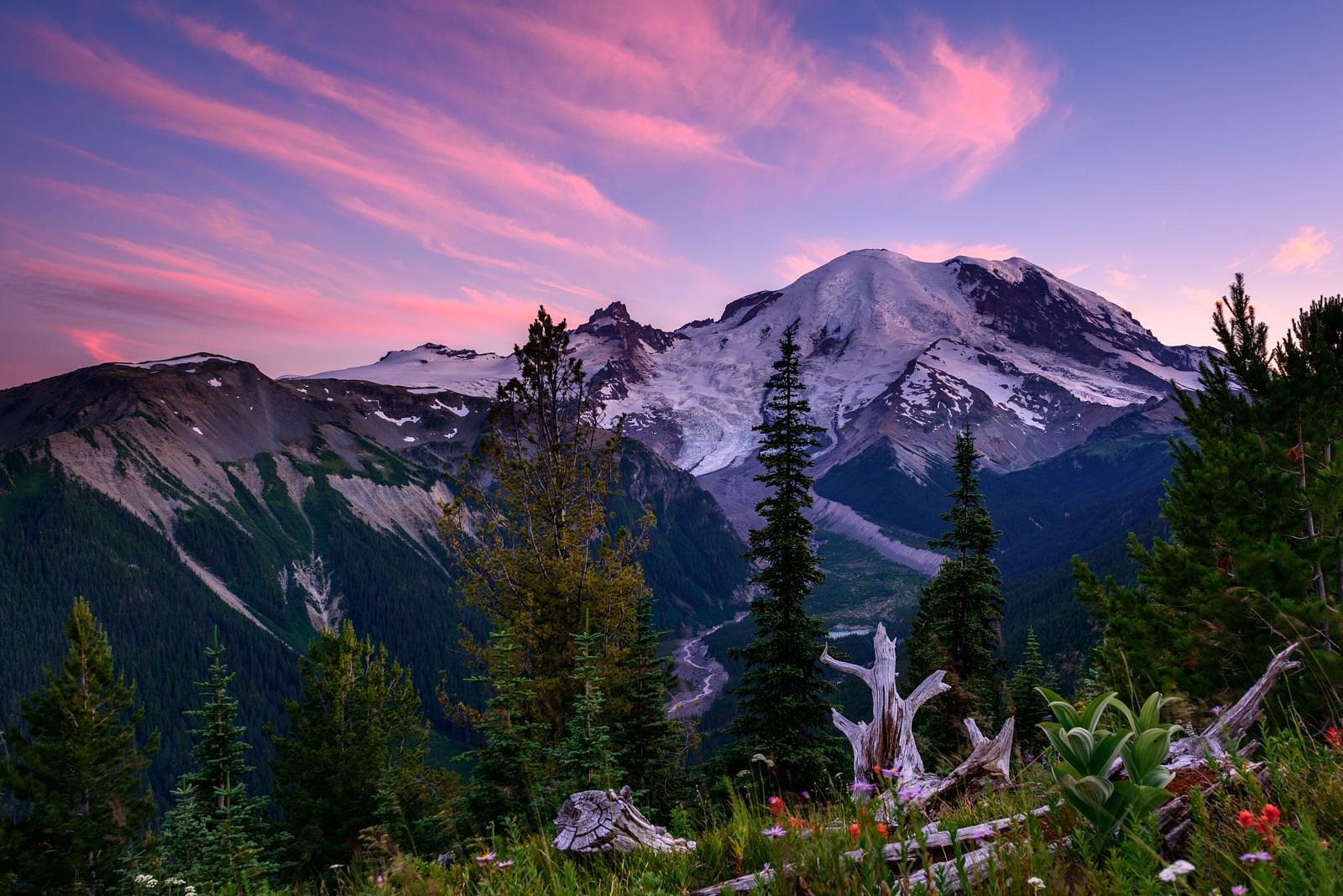
Washington • Mount Rainier National Park
By Armen Suny · Last verified Mar 2026


Photo Credits (5)
Difficulty
Moderate
Trail Length
2.4 miles
Trail Type
Out And Back
Elevation Gain
350 ft
About Saint Johns Falls
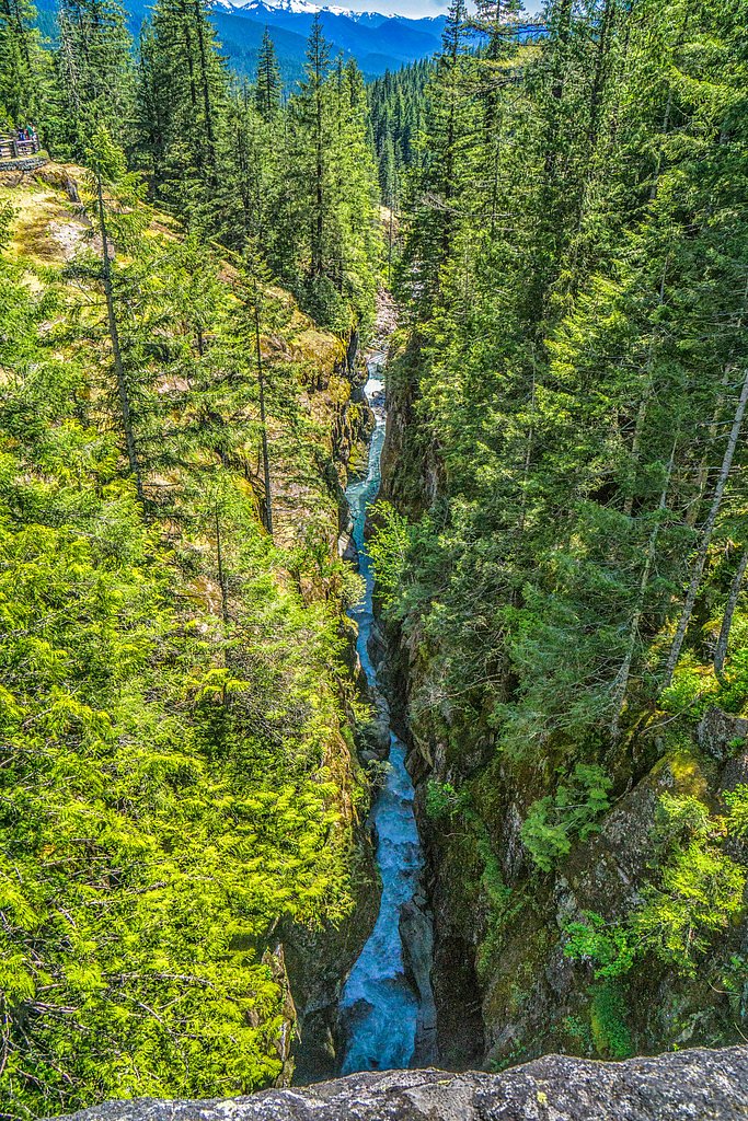
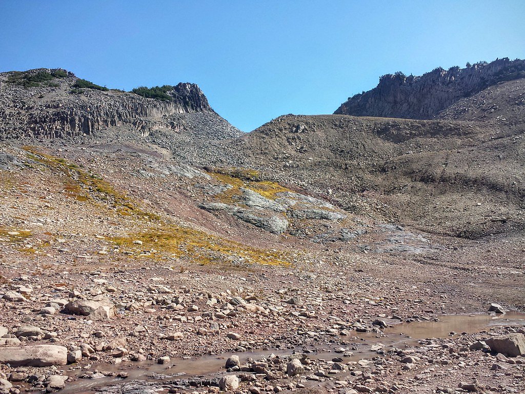
Saint Johns Falls tumbles along Saint Johns Creek inside Mount Rainier National Park, managed by the National Park Service. Nestled in a lush, forested pocket of the park, the falls are a quieter, more secluded destination compared with the park’s better-known waterfalls, making them ideal for hikers seeking a peaceful nature break. Flow varies seasonally—expect the highest volumes in spring and early summer during snowmelt. Access to the falls follows a moderate, out-and-back route of about 2.4 miles with roughly 350 feet of elevation gain. Trail details are not heavily documented, so come prepared for potentially faint or unmarked sections and rugged forest terrain. The nearest developed campground is La Wis Wis Campground, approximately 12.4 km away; always follow NPS regulations while visiting this area of Mount Rainier National Park.
The Setting
Saint Johns Falls sits at 3,714 feet within Mount Rainier National Park, fed by the Cowlitz River, in the mountains of Washington.
Trail & Hike Details
The Approach
The moderate 2.4-mile out-and-back trail gains 350 feet of elevation on the way to the falls.
Trail Description
This route to Saint Johns Falls is an out-and-back hike of approximately 2.4 miles round trip, climbing about 350 feet and commonly rated moderate in difficulty. Official surface, grade, and technical class data from USFS trail listings are not available for this route; expect typical undeveloped forest trails—dirt tread, roots, and occasional uneven sections—rather than paved or heavily improved surfaces. Because detailed trail information is limited, hikers should be prepared for faint or unmarked stretches and possible off-trail navigation. Good footwear, a topo map or park map, and basic navigation skills are recommended. As the falls lie within Mount Rainier National Park, check current conditions and any access advisories with the National Park Service before you go.
What to Expect
Visitors can expect a peaceful and natural setting with the sound of cascading water. The falls are surrounded by dense forest, providing opportunities for photography and wildlife observation. Seasonal flow variations may affect the appearance of the falls.
Accessibility
The trail is not wheelchair accessible. Uneven terrain and elevation changes require steady footing.
Frequently Asked Questions
🐶 Are Dogs Allowed at Saint Johns Falls?
❌ Dogs are not allowed
Are There Any Fees or Permits Required?
🆖 No fees required
🏊 Is There Swimming at Saint Johns Falls?
❌ Swimming is not allowed
When to Visit
Spring and early summer are typically the best times to visit, as the waterfall is likely to have a stronger flow due to snowmelt.
Seasonal Access
The best time to visit is Spring, Summer, and Fall. Winter access may be limited. Check with Mount Rainier National Park for current conditions.
Safety Information
Visitors should be cautious of slippery rocks, strong currents, and potential wildlife encounters. Cell phone reception may be limited, so inform someone of your plans before visiting.
Current Water Conditions
1,150 ft³/s
Current discharge — how much water is flowing
Much lower than usual for this time of year
Based on 96 years of record
1.64 ft
Water depth at gauge
7-Day Discharge Trend
What does this mean for your visit?
Flow is well below normal for this time of year, so the waterfall may be a trickle.
About This Gauge
This gauge is on a nearby waterway and may not reflect exact conditions at the falls.
7-Day Flow Outlook
Based on the USGS gauge COWLITZ RIVER AT PACKWOOD, WA (19 km away).
Today
Moderate
1242 cfs
6/10Tomorrow
Moderate
1247 cfs
6/10Sat
Moderate
1236 cfs
6/10Sun
Moderate
1164 cfs
6/10Mon
Moderate
1128 cfs
6/10Tue
Moderate
1038 cfs
9/10Wed
Moderate
1002 cfs
9/10Best window: Tue — moderate flow, partly sunny (trip score 9/10).
Best time of year: this gauge typically runs highest from mid April to mid July, peaking in June.
How we calculate this
This is a transparent outlook, not a precise forecast. We take the waterfall's current flow strength (how it ranks against its historical normal for today, from the nearest USGS stream gauge), carry that ranking forward along the gauge's seasonal curve, and nudge it for forecast rain. Confidence is highest for the next day or two and falls further out. Always check official conditions and your own judgment before visiting — high flows can be dangerous.
Know when to go.
Get a free email alert when waterfalls near Packwood hit peak flow. We only send when conditions are worth the trip — no weekly newsletters, no spam.
Weather Forecast
Location & Access
Getting There
Specific directions to Saint Johns Falls are not widely documented. Visitors are advised to consult local maps or contact nearby ranger stations for guidance. The falls may be located in a remote area, so ensure your vehicle is prepared for unpaved or rugged roads.
Get Directions on Google MapsParking
Parking availability is unclear. Visitors should plan for limited or informal parking options near the trailhead or access point.
Elevation
3,714 feet above sea level
Coordinates
46.782874° N, -121.621750° W
Land Management
Managed by NPS
Visitor Tips & Gear
Bring a detailed map or GPS device as the area may lack clear signage. Wear sturdy footwear and be prepared for uneven terrain. Check weather conditions before visiting, as rain can make trails slippery.
As an Amazon Associate, we earn from qualifying purchases.
With 2.4 miles and 350 ft of elevation gain, sturdy boots and trekking poles will help on this moderate trail. Sun exposure on the trail makes good sun protection a must in summer.
America the Beautiful Annual Pass
Covers entrance fees at 2,000+ federal recreation sites — required at most National Parks.

Polarized Sunglasses (Knockaround)
Cuts glare off the water so you actually see the falls — and your photos turn out better too.

Columbia Watertight II Rain Jacket
Packs into its own pocket, seam-sealed, and keeps you dry from spray and surprise rain.

Earth Pak Waterproof Dry Bag
Keeps your phone and gear dry when waterfall mist soaks everything else.

Waterproof Phone Pouch (AiRunTech)
Cheap insurance — take photos right next to the falls without killing your phone.

Timberland Euro Sprint Mid Waterproof
Trusted waterproof boot with premium leather and grippy rubber sole — reliable on rocky, wet trails.

TrailBuddy Trekking Poles
Lightweight aluminum, cork grips, and flip-locks that actually hold — a best-seller for good reason.
Where to Stay

Tiny Timber

Lafa Cabin - Luxe A Frame Retreat with Hot Tub, Sauna, Firepit- 5 Min to Mt Rainier

Packwood Lodge & Cabins

Gateway Inn & Cabins
Browse vacation cabins and private rentals nearby
Unique outdoor stays — tents, yurts, and treehouses
Rent a campervan or RV for your waterfall road trip
Some links are affiliate links. We may earn a commission at no extra cost to you.
Nearby Campground
La Wis Wis Campground
7.7 miles away · 113 sites
Overview Situated at the confluence of three waterways near Mount Rainier, La Wis Wis is nestled under a canopy of towering Douglas firs and red cedars. The handful of sites that dot the riverbank enjoy the most sunshine. With an abundance of activities nearby, La Wis Wis is a popular destination for long-stay camping. Its proximity to Mount Rainier National Park makes it an excellent base for exploring all of the area's natural wonders. Recreation Hikers can easily access the Blue Hole Trail and
Book on Recreation.govNearby Hot Springs
Hot springs near Packwood, Washington

Ohanapecosh Hot Springs
Ohanapecosh Hot Springs flows at 122 degrees within Mount Rainier National Park at 1,920 feet elevation, emerging 74.5 degrees ...

Mt Rainier Fumaroles
Mount Rainier fumaroles reach 162 degrees at 14,217 feet elevation, emerging 154.8 degrees above ambient at Washington's highes...

Longmire Mineral Springs
Longmire Mineral Springs flows at 77 degrees within Mount Rainier National Park at 2,758 feet elevation, emerging 31.9 degrees ...
Packwood Hot Spring
Packwood Hot Spring flows at 100 degrees at 1,002 feet elevation in the lower Cascade foothills near Morton, emerging 49.8 degr...
Orr Creek Warm Springs
Orr Creek Warm Springs emerges at 72 degrees in the Gifford Pinchot National Forest at 2,910 feet elevation, flowing 26.5 degre...
Lester Hot Springs
This 120-degree spring sits within the City of Tacoma Watershed at 1,582 feet elevation, emerging 72.3 degrees above ambient in...
Looking for a soak after your hike? Explore more hot springs near Packwood, Washington on SoakingSprings.
Explore Washington springsAdditional Information
Nearby Attractions
Nearby attractions are not well-documented, but the surrounding forested areas may offer additional hiking or nature exploration opportunities.
Wildlife
The area may be home to various wildlife, including birds, deer, and small mammals. Visitors should be cautious of potential encounters with bears or other larger animals.
Cities near Saint Johns Falls
Nearby Waterfalls
Writing about Saint Johns Falls? Embed this waterfall on your site for free.