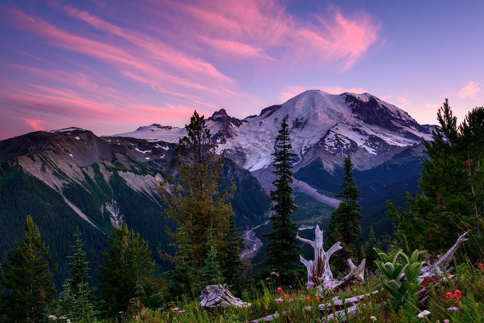
Basaltic Falls
Washington • Mount Rainier National Park
By Armen Suny · Last verified Mar 2026
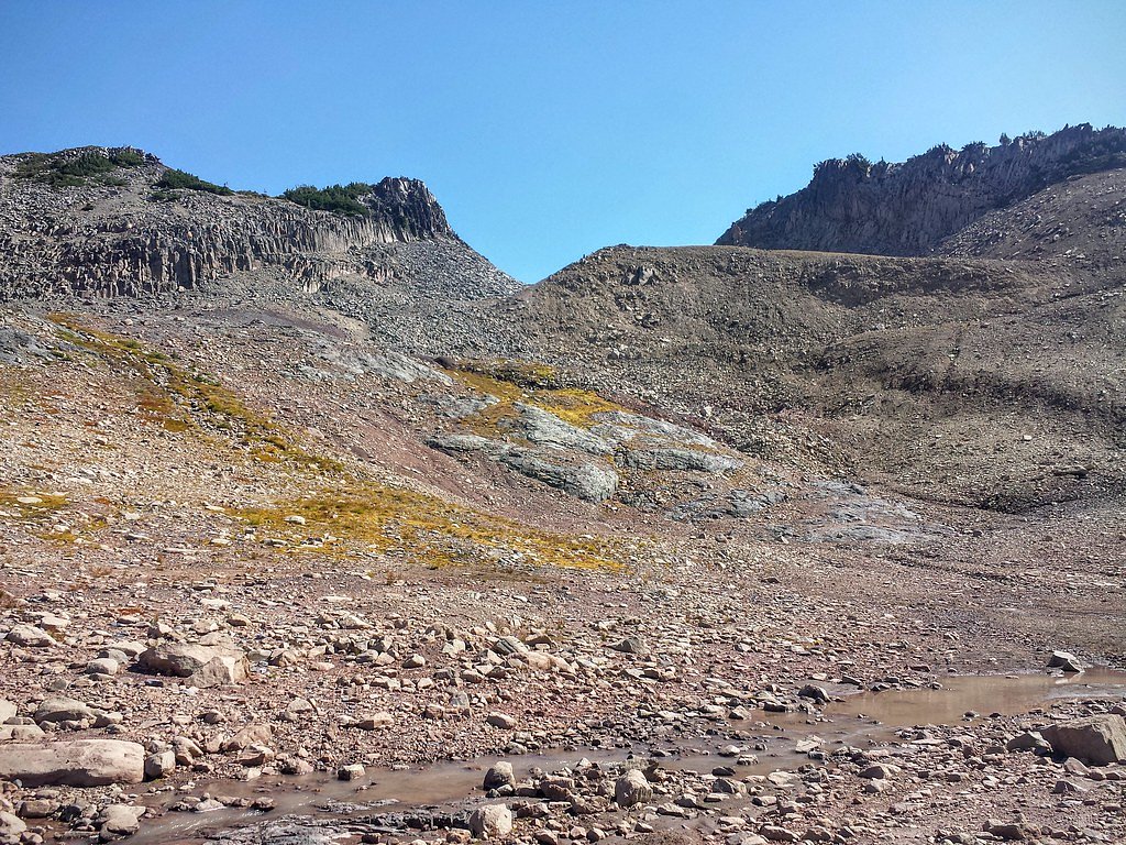
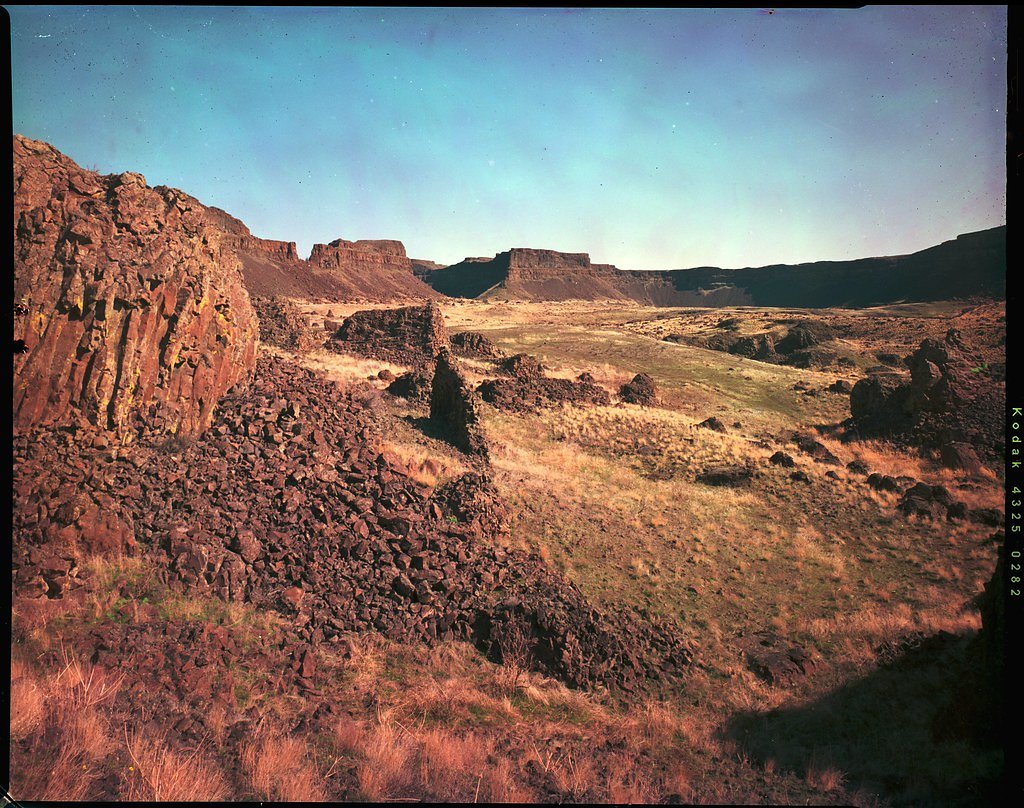
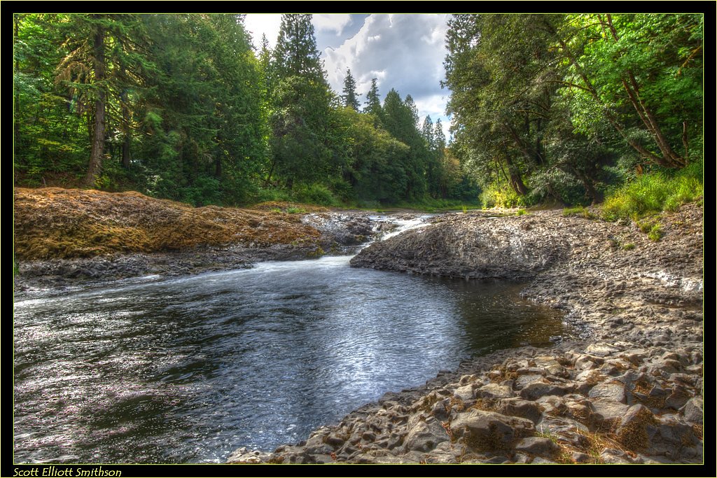
Photo Credits (5)
Difficulty
Moderate
Trail Length
2.4 miles
Trail Type
Out And Back
Elevation Gain
350 ft
About Basaltic Falls
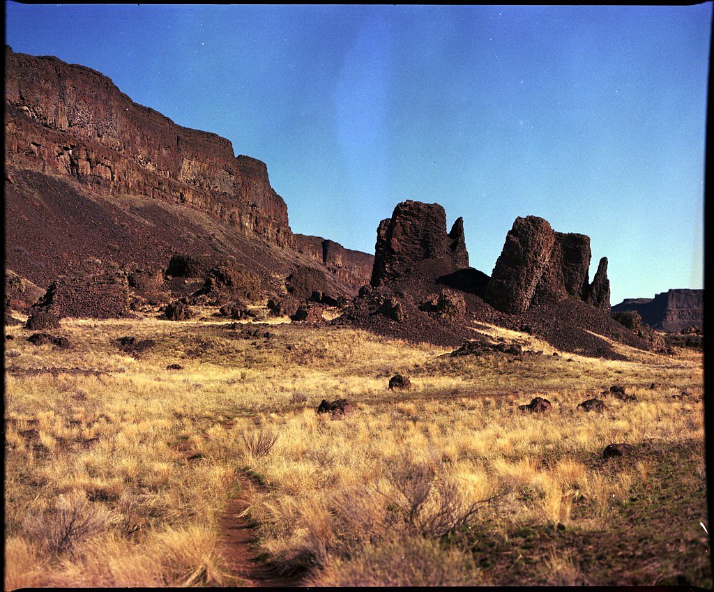
Basaltic Falls is a tucked-away cascade sculpted against striking basalt formations, offering a photogenic drop set within the forested landscape of Mount Rainier National Park. Managed by the National Park Service, the falls tend to be less crowded than many park highlights, making them a rewarding destination for hikers and photographers looking for a quieter, more intimate nature experience. The approach to the falls follows a moderate, out-and-back route of 2.4 miles with about 350 feet of elevation gain. The trail threads through park woodlands and opens to close-up views of the basalt columns and falling water; because the site is inside Mount Rainier National Park, plan your visit around seasonal conditions and park guidelines to get the most out of this serene spot.
The Setting
Basaltic Falls sits at 5,417 feet within Mount Rainier National Park, fed by the Cowlitz River, in the high mountains of Washington.
Trail & Hike Details
The Approach
The moderate 2.4-mile out-and-back trail gains 350 feet of elevation on the way to the falls.
Trail Description
The trail to Basaltic Falls is an out-and-back route approximately 2.4 miles in length with roughly 350 feet of elevation gain and is rated moderate. This approach provides a relatively short hike from the parking/approach area into the park woods to reach the waterfall viewpoint. Specific details on trail surface, grade profile, and technical trail class are not available in the provided data. The route lies within Mount Rainier National Park and is managed by the National Park Service; hikers should be prepared for typical park-trail conditions and seasonal changes in footing and access.
What to Expect
Visitors can expect a peaceful setting with a waterfall surrounded by basalt rock formations and dense greenery. The area may be less crowded due to its relative obscurity.
Accessibility
The trail is not wheelchair accessible. Uneven terrain and elevation changes require steady footing.
Frequently Asked Questions
🐶 Are Dogs Allowed at Basaltic Falls?
❌ Dogs are not allowed
Are There Any Fees or Permits Required?
🆖 No fees required
🏊 Is There Swimming at Basaltic Falls?
❌ Swimming is not allowed
When to Visit
Spring and early summer are ideal times to visit, as the waterfall is likely to have the most water flow due to snowmelt.
Seasonal Access
The best time to visit is Spring, Summer, and Fall. Access roads and trails may close during winter due to snow. Check with Mount Rainier National Park for current conditions.
Safety Information
Trails may be slippery or uneven, especially after rain. Visitors should exercise caution and wear appropriate footwear. Cell service may be limited in the area.
Current Water Conditions
1,080 ft³/s
Current discharge — how much water is flowing
Much lower than usual for this time of year
Based on 96 years of record
1.56 ft
Water depth at gauge
7-Day Discharge Trend
What does this mean for your visit?
Flow is well below normal for this time of year, so the waterfall may be a trickle.
About This Gauge
This gauge is on a nearby waterway and may not reflect exact conditions at the falls.
7-Day Flow Outlook
Based on the USGS gauge COWLITZ RIVER AT PACKWOOD, WA (22 km away).
Today
Low
1177 cfs
4/10Tomorrow
Moderate
1245 cfs
4/10Sat
Moderate
1203 cfs
5/10Sun
Moderate
1103 cfs
5/10Mon
Moderate
1069 cfs
5/10Tue
Moderate
1059 cfs
5/10Wed
Moderate
1064 cfs
5/10Best window: Sat — moderate flow, rain and snow likely (trip score 5/10).
Best time of year: this gauge typically runs highest from mid April to mid July, peaking in June.
How we calculate this
This is a transparent outlook, not a precise forecast. We take the waterfall's current flow strength (how it ranks against its historical normal for today, from the nearest USGS stream gauge), carry that ranking forward along the gauge's seasonal curve, and nudge it for forecast rain. Confidence is highest for the next day or two and falls further out. Always check official conditions and your own judgment before visiting — high flows can be dangerous.
Know when to go.
Get a free email alert when waterfalls near Packwood hit peak flow. We only send when conditions are worth the trip — no weekly newsletters, no spam.
Weather Forecast
Location & Access
Getting There
The exact location and access details for Basaltic Falls are not well-documented. It is recommended to consult local hiking resources or park services for directions.
Get Directions on Google MapsParking
Parking availability is unclear. Visitors should prepare for limited or roadside parking near the trailhead.
Elevation
5,417 feet above sea level
Coordinates
46.809554° N, -121.648148° W
Land Management
Managed by NPS
Visitor Tips & Gear
Check weather conditions before visiting, as trails in Washington can become muddy or slippery after rain. Bring a map or GPS device, as the trail may not be well-marked.
This trail sits at 5,417 ft above sea level
Elevated TrailUV radiation is roughly 22% stronger at this elevation than at sea level, and the dry air accelerates dehydration. Extra sun protection and fluids go a long way.
As an Amazon Associate, we earn from qualifying purchases.

Coppertone Sport SPF 50 Sunscreen
UV intensity jumps ~4% per 1,000 ft — at this elevation you can burn in half the time.

Sun Bum SPF 30 Lip Balm (3-Pack)
Lips have almost no natural UV protection and burn fast in thin, dry mountain air.

Liquid I.V. Electrolyte Packets
You lose moisture ~2x faster at elevation — electrolytes help you absorb water efficiently.

ROCKNIGHT Polarized UV400 Sunglasses
High-altitude glare off rock and water is intense — UV400 lenses block 99%+ of UVA/UVB.
As an Amazon Associate, we earn from qualifying purchases.
With 2.4 miles and 350 ft of elevation gain, sturdy boots and trekking poles will help on this moderate trail. Sun exposure on the trail makes good sun protection a must in summer.
America the Beautiful Annual Pass
Covers entrance fees at 2,000+ federal recreation sites — required at most National Parks.

Polarized Sunglasses (Knockaround)
Cuts glare off the water so you actually see the falls — and your photos turn out better too.

Columbia Watertight II Rain Jacket
Packs into its own pocket, seam-sealed, and keeps you dry from spray and surprise rain.

Earth Pak Waterproof Dry Bag
Keeps your phone and gear dry when waterfall mist soaks everything else.

Waterproof Phone Pouch (AiRunTech)
Cheap insurance — take photos right next to the falls without killing your phone.

Timberland Euro Sprint Mid Waterproof
Trusted waterproof boot with premium leather and grippy rubber sole — reliable on rocky, wet trails.

TrailBuddy Trekking Poles
Lightweight aluminum, cork grips, and flip-locks that actually hold — a best-seller for good reason.
Where to Stay

Tiny Timber

Lafa Cabin - Luxe A Frame Retreat with Hot Tub, Sauna, Firepit- 5 Min to Mt Rainier

Packwood Lodge & Cabins

Gateway Inn & Cabins
Browse vacation cabins and private rentals nearby
Unique outdoor stays — tents, yurts, and treehouses
Rent a campervan or RV for your waterfall road trip
Some links are affiliate links. We may earn a commission at no extra cost to you.
Nearby Campground
COUGAR ROCK CAMPGROUND
7.5 miles away · 184 sites
Overview Cougar Rock Campground, on the southwest side of Mt. Rainier National Park, is conveniently located near Paradise. Individual campsites are reservable on this page. Group campsite reservations can be made via Cougar Rock Group Campground. Paradise is the most popular destination in the park, with a lodge and visitor center, many miles of hiking trails and a commanding view of the mountain-the highest in the state and Cascade range. The main attraction at Mount Rainier National Park is t
Book on Recreation.govNearby Hot Springs
Hot springs near Packwood, Washington

Mt Rainier Fumaroles
Mount Rainier fumaroles reach 162 degrees at 14,217 feet elevation, emerging 154.8 degrees above ambient at Washington's highes...

Ohanapecosh Hot Springs
Ohanapecosh Hot Springs flows at 122 degrees within Mount Rainier National Park at 1,920 feet elevation, emerging 74.5 degrees ...

Longmire Mineral Springs
Longmire Mineral Springs flows at 77 degrees within Mount Rainier National Park at 2,758 feet elevation, emerging 31.9 degrees ...
Packwood Hot Spring
Packwood Hot Spring flows at 100 degrees at 1,002 feet elevation in the lower Cascade foothills near Morton, emerging 49.8 degr...
Lester Hot Springs
This 120-degree spring sits within the City of Tacoma Watershed at 1,582 feet elevation, emerging 72.3 degrees above ambient in...
Orr Creek Warm Springs
Orr Creek Warm Springs emerges at 72 degrees in the Gifford Pinchot National Forest at 2,910 feet elevation, flowing 26.5 degre...
Looking for a soak after your hike? Explore more hot springs near Packwood, Washington on SoakingSprings.
Explore Washington springsAdditional Information
Nearby Attractions
Nearby attractions are not well-documented, but the surrounding forest may offer additional hiking opportunities.
Wildlife
The area may be home to typical Washington wildlife, such as birds, deer, and small mammals. Be cautious of potential encounters with bears or other larger animals.
Cities near Basaltic Falls
Nearby Waterfalls
Writing about Basaltic Falls? Embed this waterfall on your site for free.