
Photo Credits (5)
Difficulty
Easy
Trail Length
0.5 miles
Trail Type
Out And Back
Elevation Gain
75 ft
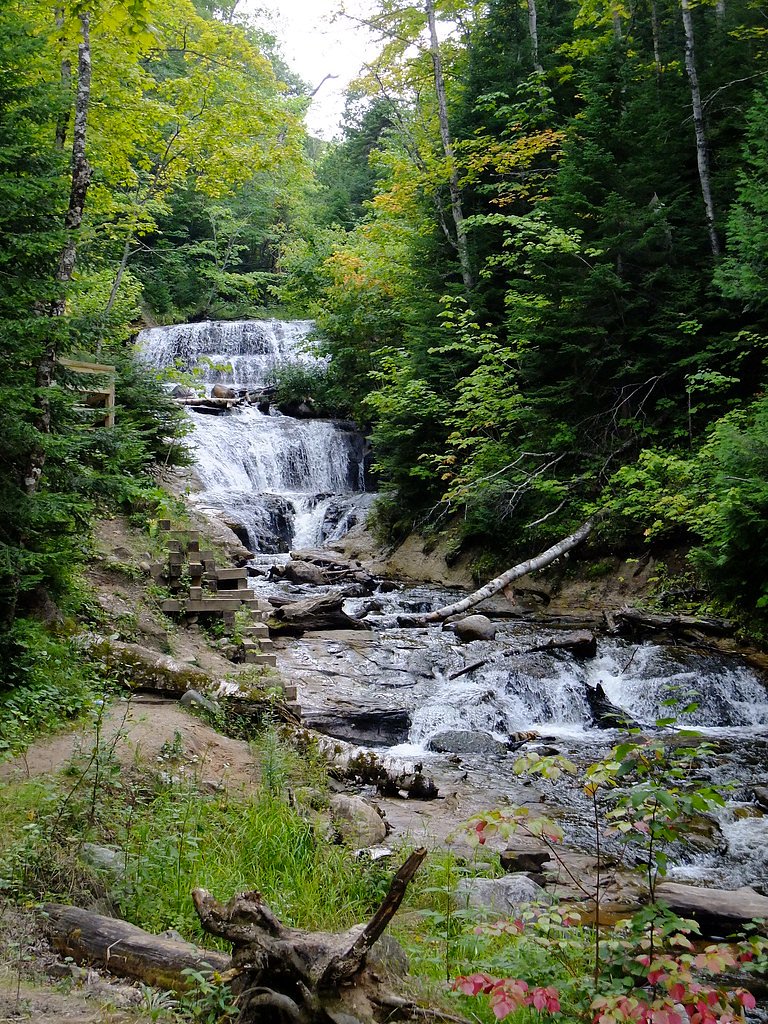
About Sable Falls
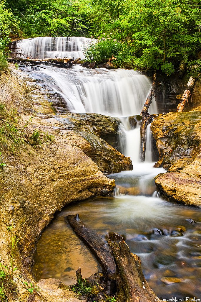
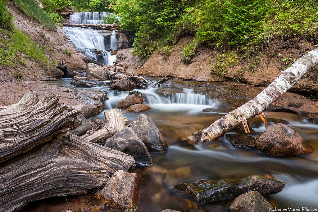
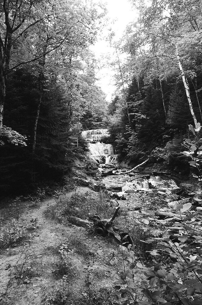
Sable Falls is a picturesque waterfall located in the Pictured Rocks National Lakeshore in Michigan. The falls cascade approximately 75 feet over a series of sandstone steps, surrounded by lush forest scenery.
The Setting
Sable Falls sits at 633 feet within Pictured Rocks National Lakeshore, in the foothills of Michigan. The falls drop 75 feet.
Height: 75 feet
Trail & Hike Details
The Approach
The easy 0.5-mile out-and-back trail gains 75 feet of elevation on the way to the falls.
Trail Description
The trail to Sable Falls is short and well-maintained, with a series of stairs leading down to the base of the falls. The path is surrounded by dense forest, offering a serene and scenic experience.
What to Expect
The falls drop 75 feet. Dogs are welcome.
Accessibility
The trail is short and relatively flat, but the surface may be uneven. Contact the managing agency for accessibility details.
Frequently Asked Questions
🐶 Are Dogs Allowed at Sable Falls?
✅ Dogs are allowed
Are There Any Fees or Permits Required?
🤑 Fee: $10.00
🏊 Is There Swimming at Sable Falls?
❌ Swimming is not allowed
When to Visit
Spring and early summer are ideal for visiting Sable Falls, as the water flow is typically strongest during these times. Fall offers beautiful foliage, while summer provides warmer weather for exploring.
Seasonal Access
The best time to visit is Spring, Summer, and Fall. Winter access may be limited.
Safety Information
The stairs can be slippery when wet, and visitors should stay on designated paths to avoid erosion and injury. Be cautious of wildlife and carry bug spray to deter mosquitoes.
Know when to go.
Get a free email alert when waterfalls near Grand Marais hit peak flow. We only send when conditions are worth the trip — no weekly newsletters, no spam.
Weather Forecast
Location & Access
Getting There
Sable Falls is located near the town of Grand Marais, Michigan, within the Pictured Rocks National Lakeshore. The falls are accessible via H-58, with clear signage directing visitors to the parking area.
Get Directions on Google MapsParking
There is a designated parking area near the trailhead for Sable Falls. Parking is typically sufficient, but it may fill up during peak seasons.
Elevation
633 feet above sea level
Coordinates
46.668866° N, -86.013500° W
Land Management
Managed by NPS
Visitor Tips & Gear
Wear sturdy shoes as the stairs can be slippery, especially after rain. Visit early in the morning or late afternoon to avoid crowds during peak seasons.
As an Amazon Associate, we earn from qualifying purchases.
For this easy 0.5 miles trail, lightweight trail shoes and a water bottle are usually sufficient. Sun exposure on the trail makes good sun protection a must in summer.

Polarized Sunglasses (Knockaround)
Cuts glare off the water so you actually see the falls — and your photos turn out better too.

Columbia Watertight II Rain Jacket
Packs into its own pocket, seam-sealed, and keeps you dry from spray and surprise rain.

Earth Pak Waterproof Dry Bag
Keeps your phone and gear dry when waterfall mist soaks everything else.

Waterproof Phone Pouch (AiRunTech)
Cheap insurance — take photos right next to the falls without killing your phone.

JOBY GorillaPod Starter Kit
Wraps around railings and rocks for long-exposure waterfall shots — no flat surface needed.

Osprey Daylite Daypack
Light, organized, and just the right size for a day hike — fits water, snacks, and layers.
Where to Stay


Browse vacation cabins and private rentals nearby
Unique outdoor stays — tents, yurts, and treehouses
Rent a campervan or RV for your waterfall road trip
Some links are affiliate links. We may earn a commission at no extra cost to you.
Nearby Campground
Hurricane River Campground
7.2 miles away · 22 sites
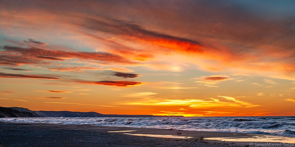
Overview Pictured Rocks National Lakeshore hugs the Lake Superior shoreline for more than 40 miles along Michigan's northern coast. Lake Superior is the largest, deepest, coldest, and most pristine of all the Great Lakes. Camping at Pictured Rocks National Lakeshore is a great way to relax and enjoy the beauties the lakeshore has to offer. Campgrounds are rustic, and do not provide electric or sewer hookups. Campers, trailers, and RVs are welcome, note there are generator free areas. Cell phone r
Book on Recreation.govAdditional Information
Nearby Attractions
Nearby attractions include the Grand Sable Dunes, Pictured Rocks cliffs, and the town of Grand Marais.
Wildlife
The area is home to a variety of wildlife, including birds, deer, and small mammals. Be cautious of black bears, which may occasionally be spotted in the region.
Cities near Sable Falls
Nearby Waterfalls

Writing about Sable Falls? Embed this waterfall on your site for free.