Rose Falls (West)
By Armen Suny · Last verified May 2026
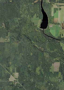

Photo Credits (4)
Difficulty
Easy
Trail Length
0.8 miles
Trail Type
Out And Back
Elevation Gain
100 ft
About Rose Falls (West)
Rose Falls (West) is a quiet, tucked-away waterfall in Michigan that rewards visitors with a peaceful forest setting and a chance to escape the busier parks. Framed by mature trees and mossy rock, the falls are favored by hikers who appreciate a short, scenic stop rather than a long, strenuous trek. The site’s lesser-known status makes it a good pick for a reflective break in nature. Access to the falls is straightforward: a short out-and-back trail leads from the parking area to the outlook. The path’s brevity and gentle climb make Rose Falls (West) an easy choice for families and casual hikers looking for a quick nature outing without committing to a long hike.
The Setting
Rose Falls (West) sits at 909 feet along the Escanaba River, in the foothills of Michigan.
Trail & Hike Details
The Approach
The easy 0.8-mile out-and-back trail gains 100 feet of elevation on the way to the falls.
Trail Description
Trail type: out-and-back. Length: ~0.8 miles. Elevation gain: ~100 feet. Difficulty: easy. The approach to Rose Falls (West) is a short, well-suited walk for most abilities—expect a brief, gently rolling forest path. Surface, grade, and official USFS trail class/name/number data are not available for this route; hikers should wear sturdy shoes and be prepared for natural trail conditions (roots, rocks, and seasonal mud).
What to Expect
Expect a quiet and secluded waterfall surrounded by dense forest. The area may be remote, so plan accordingly for limited amenities.
Accessibility
The trail is short and relatively flat, but the surface may be uneven. Contact the managing agency for accessibility details.
Frequently Asked Questions
🐶 Are Dogs Allowed at Rose Falls (West)?
❌ Dogs are not allowed
Are There Any Fees or Permits Required?
🆖 No fees required
🏊 Is There Swimming at Rose Falls (West)?
❌ Swimming is not allowed
When to Visit
Spring and early summer are ideal for visiting, as the waterfall is likely to have higher water flow due to snowmelt and rainfall.
Seasonal Access
The best time to visit is Spring, Summer, and Fall. Winter access may be limited.
Safety Information
The trail may be unmarked or poorly maintained. Be cautious of slippery rocks near the waterfall and prepare for remote conditions. Cell service may be limited.
Current Water Conditions
529 ft³/s
Current discharge — how much water is flowing
About average for this time of year
Based on 84 years of record
1.68 ft
Water depth at gauge
62°F
CoolRefreshing for swimming
7-Day Discharge Trend
What does this mean for your visit?
Flow is about average for this time of year. Water temperature is a refreshing 62 degrees F, good for a quick swim.
About This Gauge
This gauge is on a nearby waterway and may not reflect exact conditions at the falls.
7-Day Flow Outlook
Based on the USGS gauge ESCANABA RIVER AT CORNELL, MI (8 km away).
Today
Low
529 cfs
6/10Tomorrow
Low
476 cfs
6/10Mon
Low
572 cfs
3/10Tue
Moderate
645 cfs
4/10Wed
Moderate
644 cfs
4/10Thu
Moderate
684 cfs
4/10Fri
Moderate
614 cfs
4/10Best window: Today — low flow, sunny (trip score 6/10).
Best time of year: this gauge typically runs highest from late March to mid June, peaking in April.
How we calculate this
This is a transparent outlook, not a precise forecast. We take the waterfall's current flow strength (how it ranks against its historical normal for today, from the nearest USGS stream gauge), carry that ranking forward along the gauge's seasonal curve, and nudge it for forecast rain. Confidence is highest for the next day or two and falls further out. Always check official conditions and your own judgment before visiting — high flows can be dangerous.
Know when to go.
Get a free email alert when waterfalls near Rock hit peak flow. We only send when conditions are worth the trip — no weekly newsletters, no spam.
Weather Forecast
Location & Access
Getting There
Rose Falls (West) is located in Michigan's Upper Peninsula. Access may require navigating forest roads, so a reliable map or GPS is recommended. Specific directions to the trailhead are not widely documented.
Get Directions on Google MapsParking
Parking availability is unclear, but visitors may need to park along nearby forest roads or at a designated trailhead if available.
Elevation
909 feet above sea level
Coordinates
45.973056° N, -87.270000° W
Visitor Tips & Gear
Bring a detailed map or GPS device as the trail and access points may not be well-marked. Wear sturdy footwear and be prepared for potential muddy or uneven terrain.
As an Amazon Associate, we earn from qualifying purchases.
For this easy 0.8 miles trail, lightweight trail shoes and a water bottle are usually sufficient. Sun exposure on the trail makes good sun protection a must in summer.

Polarized Sunglasses (Knockaround)
Cuts glare off the water so you actually see the falls — and your photos turn out better too.

Columbia Watertight II Rain Jacket
Packs into its own pocket, seam-sealed, and keeps you dry from spray and surprise rain.

Earth Pak Waterproof Dry Bag
Keeps your phone and gear dry when waterfall mist soaks everything else.

Waterproof Phone Pouch (AiRunTech)
Cheap insurance — take photos right next to the falls without killing your phone.

JOBY GorillaPod Starter Kit
Wraps around railings and rocks for long-exposure waterfall shots — no flat surface needed.

Osprey Daylite Daypack
Light, organized, and just the right size for a day hike — fits water, snacks, and layers.
Where to Stay

Cornell Home w/ Fire Pit & Hunting Access!

Terrace Bay Hotel - Lakefront

#7 Kipling Cottages Last Resort on Lake Michigan

Hillcrest Motel
Browse vacation cabins and private rentals nearby
Unique outdoor stays — tents, yurts, and treehouses
Rent a campervan or RV for your waterfall road trip
Some links are affiliate links. We may earn a commission at no extra cost to you.
Nearby Campground
West Zone
14.5 miles away · 0 sites
The West Unit is located in the central of the Upper Peninsula, bordering two of the Great Lakes - Lake Superior and Lake Michigan. The western portion of the Hiawatha extends from the towns of Rapid River and Manistique, along Lake Michigan, to the town of Munising on the Lake Superior shore. For information about free educational campground programs on these three Ranger Districts, visit the Events page.
Book on Recreation.govAdditional Information
Nearby Attractions
The Upper Peninsula of Michigan offers numerous waterfalls, hiking trails, and scenic views. Nearby attractions may include other waterfalls or state parks.
Wildlife
The area is home to a variety of wildlife, including birds, deer, and small mammals. Be cautious of ticks and other insects.
Cities near Rose Falls (West)
Nearby Waterfalls
Writing about Rose Falls (West)? Embed this waterfall on your site for free.