Rock Dam Falls
By Armen Suny · Last verified Mar 2026
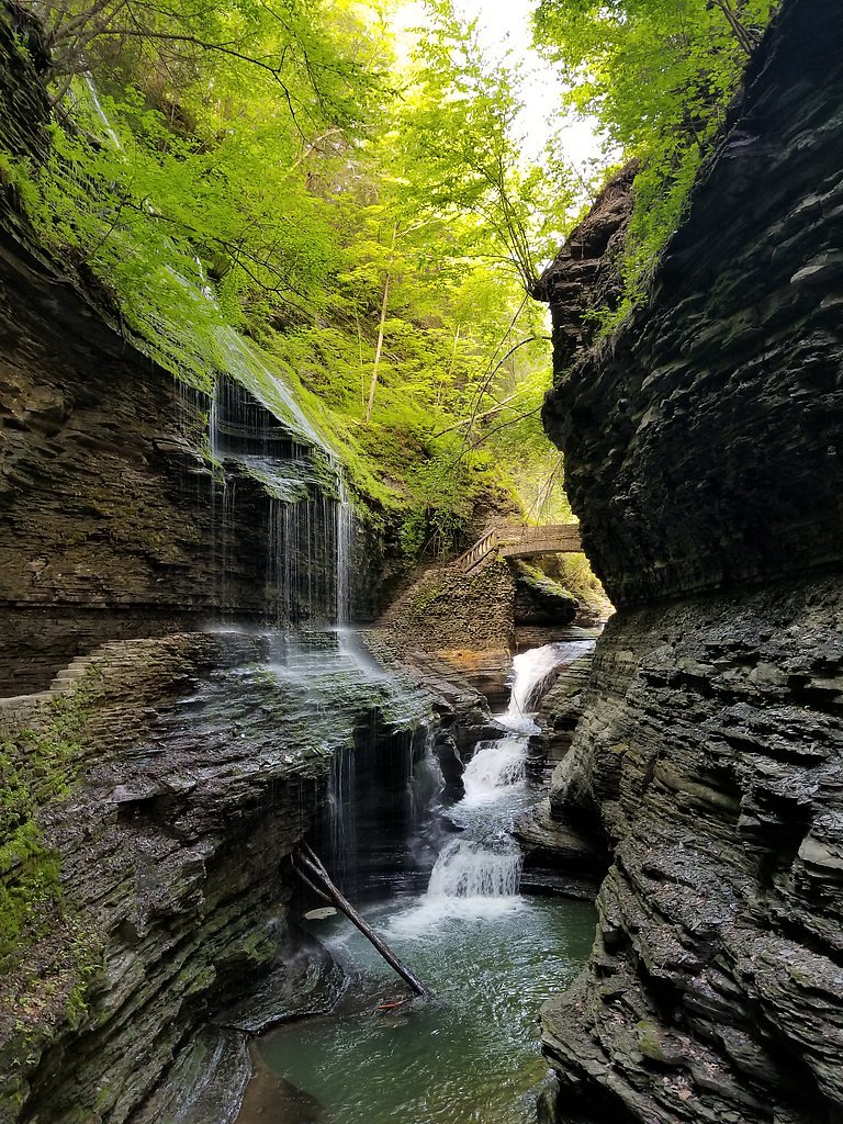
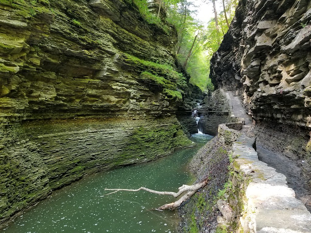
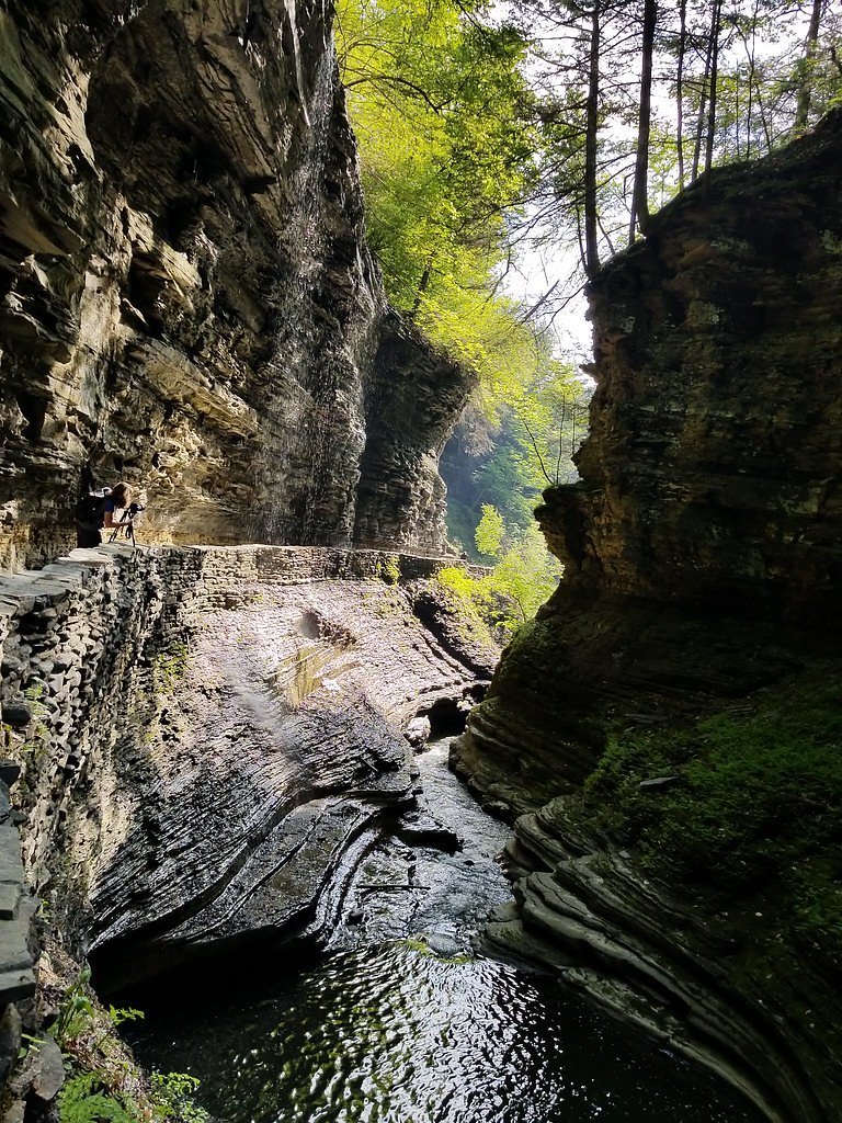
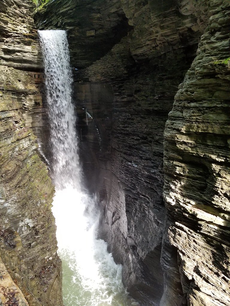
Photo Credits (5)
Difficulty
Moderate
Trail Length
2.4 miles
Trail Type
Out And Back
Elevation Gain
350 ft
About Rock Dam Falls
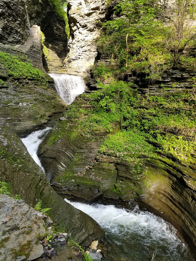
Rock Dam Falls is a small but picturesque waterfall located in the Adirondack region of New York. It is part of the Moose River Plains Wild Forest, known for its serene wilderness and natural beauty.
The Setting
Rock Dam Falls sits at 876 feet along the Oswegatchie River, in the foothills of New York.
Trail & Hike Details
The Approach
The moderate 2.4-mile out-and-back trail gains 350 feet of elevation on the way to the falls.
Trail Description
The trail to Rock Dam Falls is a short and relatively flat hike through a forested area. The path is well-marked and suitable for most visitors, though it may be muddy after rain. The waterfall itself is a small cascade over rocks, creating a tranquil and scenic spot.
What to Expect
Dogs are welcome.
Accessibility
The trail is not wheelchair accessible. Uneven terrain and elevation changes require steady footing.
Frequently Asked Questions
🐶 Are Dogs Allowed at Rock Dam Falls?
✅ Dogs are allowed
Are There Any Fees or Permits Required?
🆖 No fees required
🏊 Is There Swimming at Rock Dam Falls?
❌ Swimming is not allowed
When to Visit
Spring and early summer are ideal times to visit, as the waterfall is typically more active due to snowmelt and rainfall.
Seasonal Access
The best time to visit is Spring, Summer, and Fall. Winter access may be limited.
Safety Information
Visitors should be cautious of slippery rocks near the waterfall. During wet or icy conditions, the trail may become hazardous. Always check weather and trail conditions before visiting.
Current Water Conditions
471 ft³/s
Current discharge — how much water is flowing
Higher than usual for this time of year
Based on 82 years of record
3.06 ft
Water depth at gauge
7-Day Discharge Trend
What does this mean for your visit?
The water is flowing higher than usual for this time of year.
About This Gauge
This gauge is on a nearby waterway and may not reflect exact conditions at the falls.
7-Day Flow Outlook
Based on the USGS gauge OSWEGATCHIE RIVER NEAR OSWEGATCHIE NY (9 km away).
Today
Barely Flowing
471 cfs
5/10Tomorrow
Low
569 cfs
3/10Wed
Moderate
612 cfs
4/10Thu
Moderate
584 cfs
4/10Fri
Moderate
546 cfs
4/10Sat
Moderate
434 cfs
4/10Sun
Moderate
534 cfs
4/10Best window: Today — barely flowing flow, sunny (trip score 5/10).
Best time of year: this gauge typically runs highest from early March to mid May, peaking in April.
How we calculate this
This is a transparent outlook, not a precise forecast. We take the waterfall's current flow strength (how it ranks against its historical normal for today, from the nearest USGS stream gauge), carry that ranking forward along the gauge's seasonal curve, and nudge it for forecast rain. Confidence is highest for the next day or two and falls further out. Always check official conditions and your own judgment before visiting — high flows can be dangerous.
Know when to go.
Get a free email alert when waterfalls near Star Lake hit peak flow. We only send when conditions are worth the trip — no weekly newsletters, no spam.
Weather Forecast
Location & Access
Getting There
Rock Dam Falls is located within the Moose River Plains Wild Forest. Access is typically via Rock Dam Road, which may require a high-clearance vehicle depending on road conditions. Visitors should check with the New York State Department of Environmental Conservation (DEC) for the latest access information.
Get Directions on Google MapsParking
Parking is available at designated areas along Rock Dam Road. Space may be limited, especially during peak seasons.
Elevation
876 feet above sea level
Coordinates
44.245576° N, -75.175984° W
Visitor Tips & Gear
Wear sturdy shoes as the trail may be muddy in spots. Bring bug spray during the summer months to protect against mosquitoes and other insects. Check road conditions before visiting, especially in spring or after heavy rains.
As an Amazon Associate, we earn from qualifying purchases.
With 2.4 miles and 350 ft of elevation gain, sturdy boots and trekking poles will help on this moderate trail. Sun exposure on the trail makes good sun protection a must in summer.

Polarized Sunglasses (Knockaround)
Cuts glare off the water so you actually see the falls — and your photos turn out better too.

Columbia Watertight II Rain Jacket
Packs into its own pocket, seam-sealed, and keeps you dry from spray and surprise rain.

Earth Pak Waterproof Dry Bag
Keeps your phone and gear dry when waterfall mist soaks everything else.

Waterproof Phone Pouch (AiRunTech)
Cheap insurance — take photos right next to the falls without killing your phone.

Timberland Euro Sprint Mid Waterproof
Trusted waterproof boot with premium leather and grippy rubber sole — reliable on rocky, wet trails.

TrailBuddy Trekking Poles
Lightweight aluminum, cork grips, and flip-locks that actually hold — a best-seller for good reason.
Where to Stay

Oswegatchie River Cabin with Kayaks and Fire Pit!

HARRISVILLE Love Shack

Norwegian Woods - Private Waterfront,66 Acres!

Waterfront Harrisville Home with Outdoor Fireplace!
Browse vacation cabins and private rentals nearby
Unique outdoor stays — tents, yurts, and treehouses
Rent a campervan or RV for your waterfall road trip
Some links are affiliate links. We may earn a commission at no extra cost to you.
Additional Information
Nearby Attractions
The Moose River Plains Wild Forest offers additional hiking trails, camping opportunities, and scenic views. The nearby town of Inlet provides amenities and dining options.
Wildlife
The area is home to a variety of wildlife, including deer, birds, and occasionally black bears. Visitors should practice proper wildlife safety.
Cities near Rock Dam Falls
Nearby Waterfalls

Writing about Rock Dam Falls? Embed this waterfall on your site for free.