Photo Credits (5)
Difficulty
Moderate
Trail Length
2.0 miles
Trail Type
Out And Back
Elevation Gain
300 ft
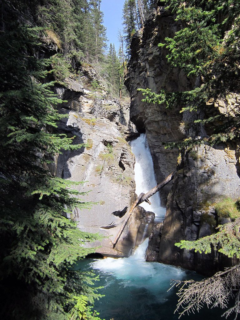
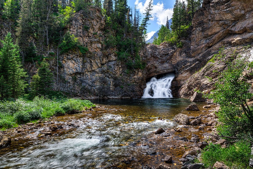
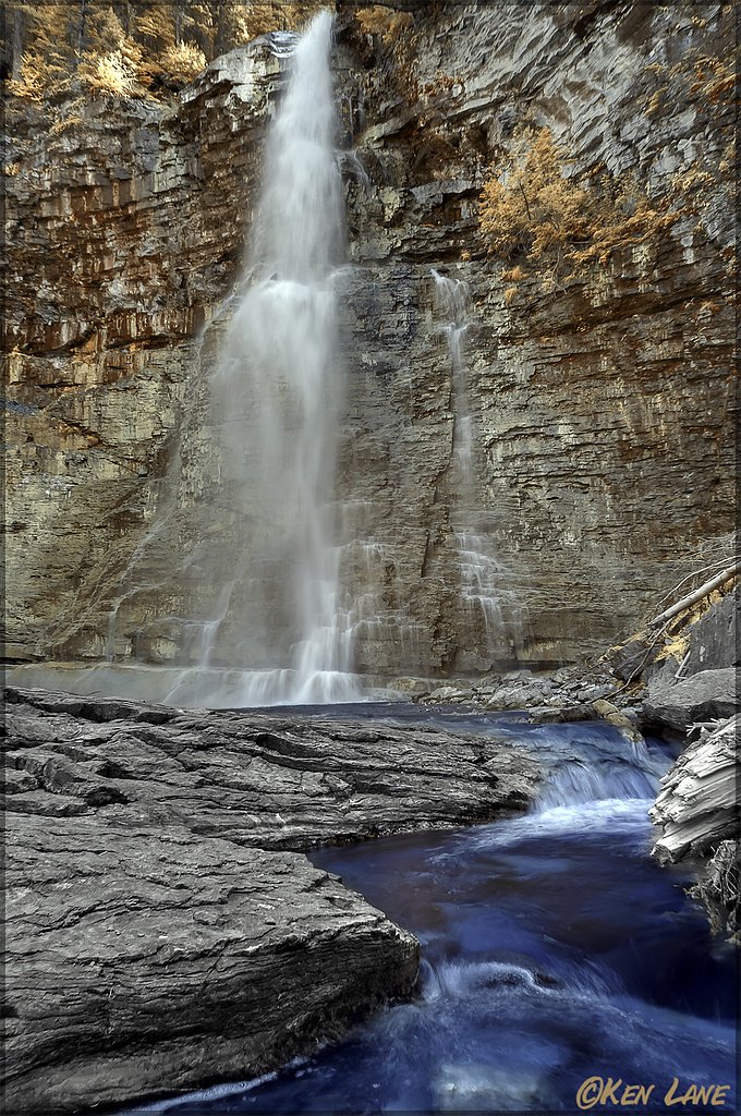
About Rock Creek Falls
Rock Creek Falls is a scenic waterfall located in Montana, known for its serene surroundings and natural beauty. It is a popular destination for hikers and nature enthusiasts seeking a peaceful retreat.
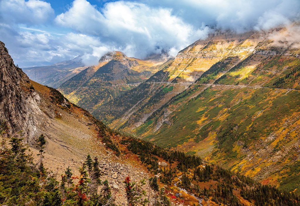
The Setting
Rock Creek Falls sits at 6,053 feet within Deerlodge National Forest, fed by the Clark Fork, in the high mountains of Montana.
Trail & Hike Details
The Approach
The moderate hike follows Rock Creek (#8053), a 2.0-mile out-and-back trail over n/a. Expect 300 feet of elevation gain with grades of N/A.
USFS Trail
ROCK CREEK #8053
Trail Class
Class 0
Surface
Avg Grade
USFS Segment
5.37 miTrail Description
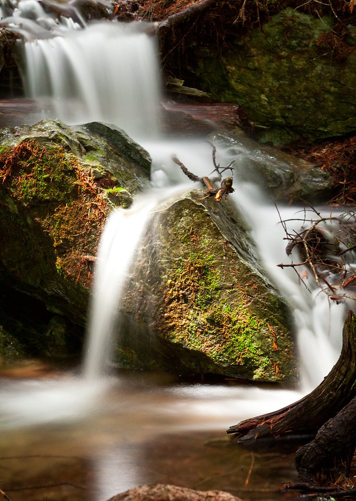
The trail to Rock Creek Falls winds through a forested area, offering a mix of shaded paths and open views of the surrounding landscape. The trail may include some rocky or uneven sections, so sturdy footwear is recommended.
What to Expect
Dogs are welcome.
Accessibility
The trail is not wheelchair accessible. Uneven terrain and elevation changes require steady footing.
Frequently Asked Questions
🐶 Are Dogs Allowed at Rock Creek Falls?
✅ Dogs are allowed
Are There Any Fees or Permits Required?
🆖 No fees required
🏊 Is There Swimming at Rock Creek Falls?
❌ Swimming is not allowed
When to Visit
Spring and early summer are ideal for visiting Rock Creek Falls, as the water flow is typically at its peak during this time.
Seasonal Access
The best time to visit is Spring, Summer, and Fall. Access roads and trails may close during winter due to snow. Check with Deerlodge National Forest for seasonal road closures.
Safety Information
Be cautious of slippery rocks near the falls, especially after rain. Carry bear spray and make noise while hiking to avoid surprising wildlife. Check weather conditions before your visit, as the trail can become muddy or icy.
Current Water Conditions
226 ft³/s
Current discharge — how much water is flowing
About average for this time of year
Based on 47 years of record
2.78 ft
Water depth at gauge
53°F
ColdBracing — limit time in water
7-Day Discharge Trend
What does this mean for your visit?
Flow is about average for this time of year. Water temperature is a bracing 53 degrees F, limit your time in the water. Expect very murky conditions with low visibility. Mineral content is typical.
Water Quality
Water Clarity
Slightly cloudyMinor sediment present
Conductance
Dissolved minerals in the water
About This Gauge
This gauge is on a nearby waterway and may not reflect exact conditions at the falls.
7-Day Flow Outlook
Based on the USGS gauge Clark Fork at Deer Lodge MT (17 km away).
Today
Roaring
244 cfs
6/10Tomorrow
Roaring
275 cfs
6/10Wed
Roaring
255 cfs
6/10Thu
Roaring
247 cfs
6/10Fri
Roaring
246 cfs
6/10Sat
Roaring
203 cfs
9/10Sun
Roaring
193 cfs
9/10Best window: Sat — roaring flow, sunny (trip score 9/10).
Best time of year: this gauge typically runs highest from early April to late June, peaking in June.
How we calculate this
This is a transparent outlook, not a precise forecast. We take the waterfall's current flow strength (how it ranks against its historical normal for today, from the nearest USGS stream gauge), carry that ranking forward along the gauge's seasonal curve, and nudge it for forecast rain. Confidence is highest for the next day or two and falls further out. Always check official conditions and your own judgment before visiting — high flows can be dangerous.
Know when to go.
Get a free email alert when waterfalls near Goldcreek hit peak flow. We only send when conditions are worth the trip — no weekly newsletters, no spam.
Weather Forecast
Location & Access
Getting There
Rock Creek Falls is located near the Rock Creek drainage area in Montana. Access typically involves driving along Rock Creek Road, which is a gravel road that may require a high-clearance vehicle depending on conditions.
Get Directions on Google MapsParking
Parking is available at designated pullouts or trailheads along Rock Creek Road. Availability may vary depending on the season and visitor volume.
Elevation
6,053 feet above sea level
Coordinates
46.410205° N, -112.962548° W
Land Management
Managed by USFS
Visitor Tips & Gear
Visit during the spring or early summer for the best water flow. Bring insect repellent during warmer months, as mosquitoes can be present. Check road and trail conditions before heading out, especially during winter or after heavy rains.
This trail sits at 6,053 ft above sea level
Elevated TrailUV radiation is roughly 24% stronger at this elevation than at sea level, and the dry air accelerates dehydration. Extra sun protection and fluids go a long way.
As an Amazon Associate, we earn from qualifying purchases.

Coppertone Sport SPF 50 Sunscreen
UV intensity jumps ~4% per 1,000 ft — at this elevation you can burn in half the time.

Sun Bum SPF 30 Lip Balm (3-Pack)
Lips have almost no natural UV protection and burn fast in thin, dry mountain air.

Liquid I.V. Electrolyte Packets
You lose moisture ~2x faster at elevation — electrolytes help you absorb water efficiently.

ROCKNIGHT Polarized UV400 Sunglasses
High-altitude glare off rock and water is intense — UV400 lenses block 99%+ of UVA/UVB.
As an Amazon Associate, we earn from qualifying purchases.
With 2.0 miles and 300 ft of elevation gain, sturdy boots and trekking poles will help on this moderate trail. Sun exposure on the trail makes good sun protection a must in summer.

Polarized Sunglasses (Knockaround)
Cuts glare off the water so you actually see the falls — and your photos turn out better too.

Columbia Watertight II Rain Jacket
Packs into its own pocket, seam-sealed, and keeps you dry from spray and surprise rain.

Earth Pak Waterproof Dry Bag
Keeps your phone and gear dry when waterfall mist soaks everything else.

Waterproof Phone Pouch (AiRunTech)
Cheap insurance — take photos right next to the falls without killing your phone.

Timberland Euro Sprint Mid Waterproof
Trusted waterproof boot with premium leather and grippy rubber sole — reliable on rocky, wet trails.

TrailBuddy Trekking Poles
Lightweight aluminum, cork grips, and flip-locks that actually hold — a best-seller for good reason.
Where to Stay

The Vonnie Louise Inn

Last Best Loft - A cozy loft cabin stunning views

Old Montana Inn

The Forge Hotel BW Signature Collection
Browse vacation cabins and private rentals nearby
Unique outdoor stays — tents, yurts, and treehouses
Rent a campervan or RV for your waterfall road trip
Some links are affiliate links. We may earn a commission at no extra cost to you.
Nearby Campground
DONEY CABIN
2.6 miles away · 1 sites
Overview This cabin is currently undergoing some repairs and will be rented again in the near future. Recreation Facilities Natural Features Nearby Attractions
Book on Recreation.govNearby Hot Springs
Hot springs near Goldcreek, Montana
Deerlodge Prison Ranch Springs
Deerlodge Prison Ranch Springs flows at 79°F on the grounds of the Deer Lodge State Prison Ranch, a state conservation area in ...

Anaconda Hot Springs
Anaconda Hot Springs emerges at a reported 72°F in Deer Lodge County, Montana, at 5,760 feet elevation. A recent USGS reading o...
Garrison Warm Springs
Garrison Warm Springs emerges at 77°F in Powell County, Montana, at 5,124 feet elevation, placing it in the warm-spring categor...
Warm Springs (State Hospital)
Warm Springs discharges at 172 degrees Fahrenheit, one of the hottest recorded springs in Montana. Located on state-owned land ...

Gregson Hot Springs
Gregson Hot Springs, also known as Fairmont Hot Springs, discharges at 158°F — among the hottest thermal features in Montana. T...
Avon Warm Spring
Avon Warm Spring flows at 79°F in Powell County, Montana, at 4,876 feet elevation near Deer Lodge. At just 3.3 feet from the ro...
Looking for a soak after your hike? Explore more hot springs near Goldcreek, Montana on SoakingSprings.
Explore Montana springsAdditional Information
Nearby Attractions
The Rock Creek area is known for its excellent fishing opportunities and scenic drives. Nearby, you can also explore other hiking trails and campgrounds.
Wildlife
The area is home to a variety of wildlife, including deer, elk, and birds. Be cautious of bears and carry bear spray if hiking in the region.
Cities near Rock Creek Falls
Other waterfalls named Rock Creek Falls
4 other waterfalls share this name across the U.S.
Writing about Rock Creek Falls? Embed this waterfall on your site for free.