Photo Credits (5)
Difficulty
Moderate
Trail Length
3.0 miles
Trail Type
Out And Back
Elevation Gain
300 ft
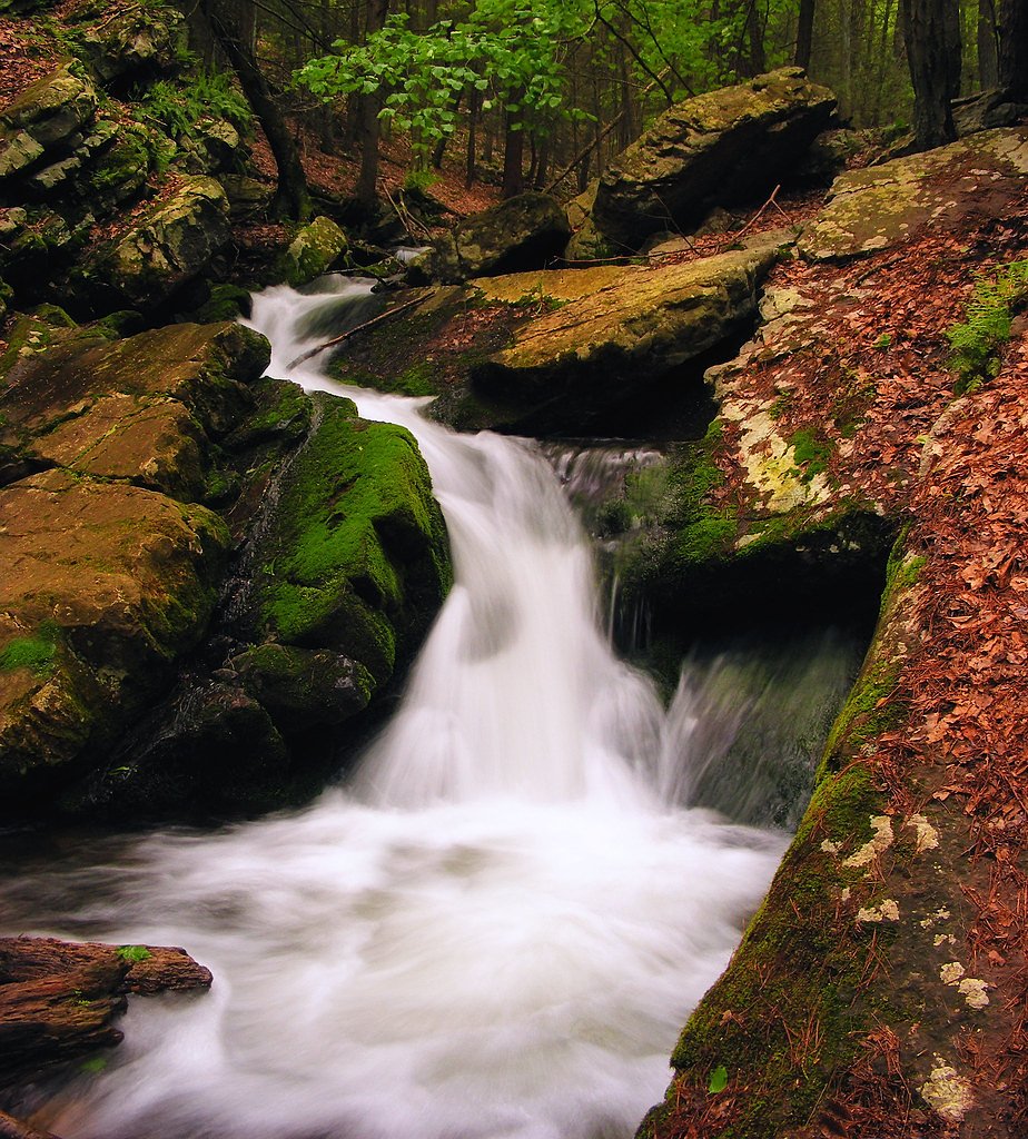
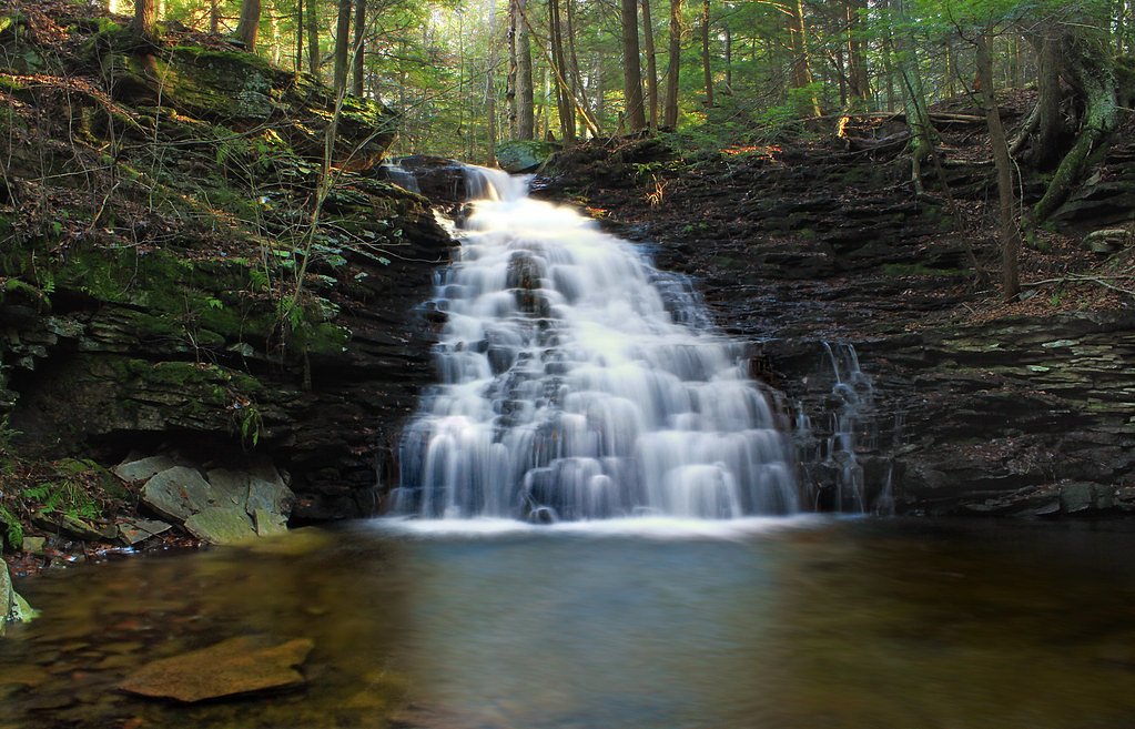
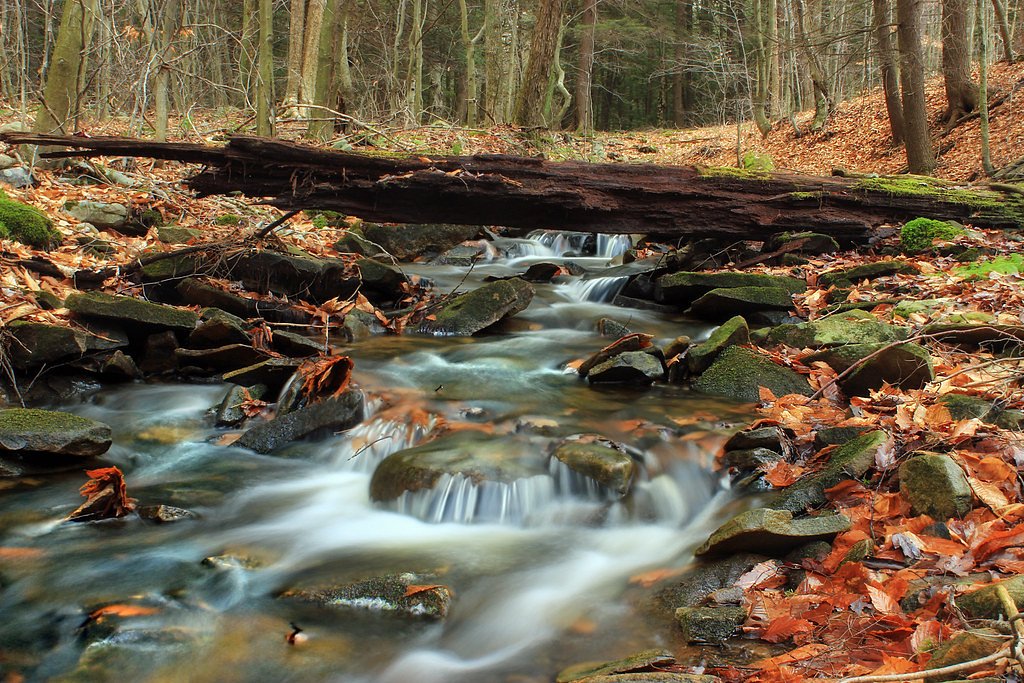
About Rock Creek Falls
Tucked into Pennsylvania woodlands, Rock Creek Falls rewards a relatively short outing with a peaceful cascade framed by mature hardwoods and evergreen stands. The falls are an ideal destination for hikers and photographers looking for a compact nature escape—the trail to the viewpoint is a 3.0-mile round-trip that climbs roughly 300 feet, making it a satisfying half-day excursion for those comfortable with a moderate effort. The route is an out-and-back that offers a mix of shaded forest walking and occasional open views along the creek. Because the path includes uneven and rocky stretches plus a few small stream crossings, sturdy footwear and a steady pace will make the visit more enjoyable. The moderate distance and elevation gain mean Rock Creek Falls is accessible to many day hikers who want a scenic payoff without committing to a long backpacking route.
The Setting
Rock Creek Falls sits at 1,283 feet along the French Creek, in the foothills of Pennsylvania.
Trail & Hike Details
The Approach
The moderate 3.0-mile out-and-back trail gains 300 feet of elevation on the way to the falls.
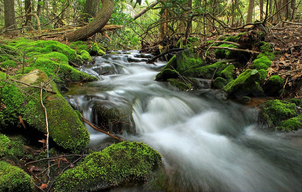
Trail Description
Trail type: out-and-back; distance: 3.0 miles round-trip; elevation gain: ~300 feet; difficulty: moderate. The trail surface is a natural singletrack with packed dirt, exposed roots and rocky sections winding through mixed hardwood and evergreen forest. The grade is generally moderate with short steeper pitches near the creek; several small stream crossings require careful footing. The route is well-marked but uneven in places, offering intermittent scenic viewpoints of the creek and falls—expect a typical backcountry surface rather than paved or heavily improved tread.
What to Expect
Dogs are welcome.
Accessibility
The trail is not wheelchair accessible. Uneven terrain and elevation changes require steady footing.
Frequently Asked Questions
🐶 Are Dogs Allowed at Rock Creek Falls?
✅ Dogs are allowed
Are There Any Fees or Permits Required?
🆖 No fees required
🏊 Is There Swimming at Rock Creek Falls?
❌ Swimming is not allowed
When to Visit
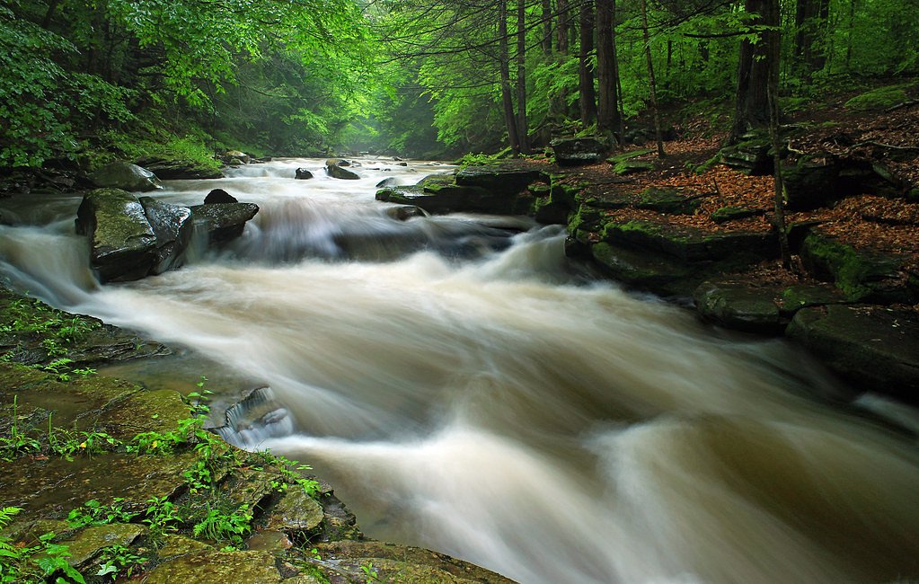
Spring and early summer are ideal for visiting Rock Creek Falls, as the water flow is typically strongest during these seasons. Fall offers beautiful foliage, while winter may provide a unique frozen waterfall experience.
Seasonal Access
The best time to visit is Spring, Summer, and Fall. Winter access may be limited.
Safety Information
Exercise caution on wet or slippery rocks near the falls. Be aware of changing weather conditions and avoid hiking during heavy rain or storms. Cell service may be limited in the area.
Current Water Conditions
232 ft³/s
Current discharge — how much water is flowing
About average for this time of year
Based on 37 years of record
2.01 ft
Water depth at gauge
7-Day Discharge Trend
What does this mean for your visit?
Flow is about average for this time of year.
About This Gauge
This gauge is on a nearby waterway and may not reflect exact conditions at the falls.
7-Day Flow Outlook
Based on the USGS gauge French Creek at Meadville, PA (12 km away).
Today
Barely Flowing
232 cfs
5/10Tomorrow
Barely Flowing
229 cfs
5/10Sat
Low
242 cfs
3/10Sun
Low
242 cfs
3/10Mon
Low
235 cfs
3/10Tue
Low
300 cfs
3/10Wed
Low
282 cfs
3/10Best window: Today — barely flowing flow, sunny (trip score 5/10).
Best time of year: this gauge typically runs highest from late March to mid April, peaking in March.
How we calculate this
This is a transparent outlook, not a precise forecast. We take the waterfall's current flow strength (how it ranks against its historical normal for today, from the nearest USGS stream gauge), carry that ranking forward along the gauge's seasonal curve, and nudge it for forecast rain. Confidence is highest for the next day or two and falls further out. Always check official conditions and your own judgment before visiting — high flows can be dangerous.
Know when to go.
Get a free email alert when waterfalls near Geneva hit peak flow. We only send when conditions are worth the trip — no weekly newsletters, no spam.
Weather Forecast
Location & Access
Getting There
Rock Creek Falls is located within the Loyalsock State Forest in Pennsylvania. The trailhead can typically be accessed via Rock Run Road, but visitors should check local conditions for road closures or detours.
Get Directions on Google MapsParking
Parking is available near the trailhead, but spaces may be limited during peak seasons. Visitors are advised to arrive early to secure a spot.
Elevation
1,283 feet above sea level
Coordinates
41.523387° N, -80.168117° W
Visitor Tips & Gear
Wear sturdy hiking shoes as the trail can be rocky and slippery, especially after rain. Bring insect repellent during warmer months and dress in layers during cooler seasons. Arrive early to avoid crowds and secure parking.
As an Amazon Associate, we earn from qualifying purchases.
With 3.0 miles and 300 ft of elevation gain, sturdy boots and trekking poles will help on this moderate trail. Sun exposure on the trail makes good sun protection a must in summer.

Polarized Sunglasses (Knockaround)
Cuts glare off the water so you actually see the falls — and your photos turn out better too.

Columbia Watertight II Rain Jacket
Packs into its own pocket, seam-sealed, and keeps you dry from spray and surprise rain.

Earth Pak Waterproof Dry Bag
Keeps your phone and gear dry when waterfall mist soaks everything else.

Waterproof Phone Pouch (AiRunTech)
Cheap insurance — take photos right next to the falls without killing your phone.

Timberland Euro Sprint Mid Waterproof
Trusted waterproof boot with premium leather and grippy rubber sole — reliable on rocky, wet trails.

TrailBuddy Trekking Poles
Lightweight aluminum, cork grips, and flip-locks that actually hold — a best-seller for good reason.
Where to Stay

Cobblestone Hotel & Suites - Greenville

Quality Inn Meadville

Conneaut Lake Apartment Less Than 1 Mi to Waterfront!

Holiday Inn Express Meadville (I-79 Exit 147a) by IHG
Browse vacation cabins and private rentals nearby
Unique outdoor stays — tents, yurts, and treehouses
Rent a campervan or RV for your waterfall road trip
Some links are affiliate links. We may earn a commission at no extra cost to you.
Nearby Campground
Woodcock Creek Lake Park & Campground
12.3 miles away · 0 sites
This recreation area is part of Woodcock Creek Lake
Book on Recreation.govAdditional Information
Nearby Attractions
Nearby attractions include Loyalsock Creek, Worlds End State Park, and other hiking trails within Loyalsock State Forest.
Wildlife
The area is home to a variety of wildlife, including deer, birds, and small mammals. Visitors may also encounter salamanders and other amphibians near the streams.
Cities near Rock Creek Falls
Other waterfalls named Rock Creek Falls
4 other waterfalls share this name across the U.S.
Writing about Rock Creek Falls? Embed this waterfall on your site for free.