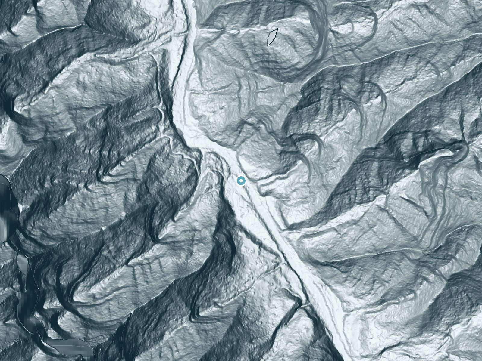
 LiDAR terrain view · USGS 3DEP
Pūwainui Falls
By Armen Suny · Last verified Sep 2026
LiDAR & 3D terrainAbout Pūwainui Falls
Pūwainui Falls is a secluded, picture-postcard cascade tucked into the Halele'a Forest Reserve on the island of Hawaiʻi. Surrounded by lush native vegetation, the falls reward visitors who make the effort with a tranquil setting and the sense of getting off the beaten path. The parcel is designated PCON and is privately owned and managed (PVT), so visitors should be mindful that access is more restricted than at public parks and confirm permission before planning a visit. The approach to the falls follows a moderately rated out-and-back route of about 2.4 miles with roughly 350 feet of elevation gain, making it a satisfying half-day outing for hikers comfortable with uneven, less-maintained trails. Because the land is privately managed, consider contacting local stewards, guides, or tour operators for the most current access information and route guidance before heading out.
The Setting
Pūwainui Falls sits at 984 feet within Halele'a Forest Reserve, fed by the Wainiha River, in the foothills of Hawaii.
Nearby Falls Worth Visiting
Hanakāpīʻai Falls (300 ft) lies 4.2 miles to the northwest.
Trail & Hike Details
Trail Description
Trail type: out-and-back; length: 2.4 miles; elevation gain: ~350 feet; difficulty: moderate. Specific USFS trail surface, grade, and class data are not available for this route. Hikers can expect a less-developed path that may be uneven and lightly maintained, so sturdy footwear and basic navigation skills are recommended. Because the falls lie within a privately owned portion of the Halele'a Forest Reserve (designation PCON, manager PVT), verify access and any permission requirements in advance.
What to Expect
Visitors can expect a serene and secluded waterfall surrounded by dense tropical vegetation. Due to its remote location, the falls are not heavily trafficked, offering a peaceful experience for those who make the journey.
Accessibility
The falls are not easily accessible and may require traversing rugged terrain or private property. Accessibility for individuals with mobility challenges is unlikely.
Frequently Asked Questions
🐶 Are Dogs Allowed at Pūwainui Falls?
❌ Dogs are not allowed
Are There Any Fees or Permits Required?
🆖 No fees required
🏊 Is There Swimming at Pūwainui Falls?
❌ Swimming is not allowed
When to Visit
The falls can be visited year-round, but weather conditions may vary. Dry seasons typically offer safer hiking conditions.
Seasonal Access
The best time to visit is Spring, Summer, Fall, and Winter. Heavy rains during wet season (November through March) bring higher flow but can make trails slippery.
Safety Information
Visitors should be aware of potential hazards such as slippery rocks, flash flooding, and challenging terrain. Always check weather conditions and consult with local experts before visiting.
Current Water Conditions
98 ft³/s
Current discharge — how much water is flowing
About average for this time of year
Based on 72 years of record
2.84 ft
Water depth at gauge
7-Day Discharge Trend
What does this mean for your visit?
Flow is about average for this time of year.
About This Gauge
7-Day Flow Outlook
Based on the USGS gauge Wainiha River nr Hanalei, Kauai, HI (0 km away).
Today
Moderate
110 cfs
5/10Tomorrow
Moderate
113 cfs
6/10Wed
Moderate
104 cfs
6/10Thu
Moderate
96 cfs
6/10Fri
Moderate
98 cfs
6/10Sat
Moderate
92 cfs
6/10Sun
Moderate
94 cfs
6/10Best window: Tomorrow — moderate flow, scattered rain showers then mostly sunny (trip score 6/10).
Best time of year: this gauge typically runs highest from late March to late April, peaking in April.
How we calculate this
This is a transparent outlook, not a precise forecast. We take the waterfall's current flow strength (how it ranks against its historical normal for today, from the nearest USGS stream gauge), carry that ranking forward along the gauge's seasonal curve, and nudge it for forecast rain. Confidence is highest for the next day or two and falls further out. Always check official conditions and your own judgment before visiting — high flows can be dangerous.
Know when to go.
Get a free email alert when waterfalls near Wainiha hit peak flow. We only send when conditions are worth the trip — no weekly newsletters, no spam.
Weather Forecast
The Terrain, Seen by LiDAR
Aircraft-mounted lasers measured this ground to within inches. Trees and buildings are digitally stripped away, leaving the bare shape of the land the water has carved.
1-meter lidar measures about 91 feet of descent through Pūwainui Falls, a steep tiered drop rather than a single free fall. The brink sits at about 984 feet above sea level.
The whole reach is steep: about 166 feet of descent in the 500 feet above the falls and another 88 feet in the 500 feet below. The falls face west and glow in afternoon and evening light.
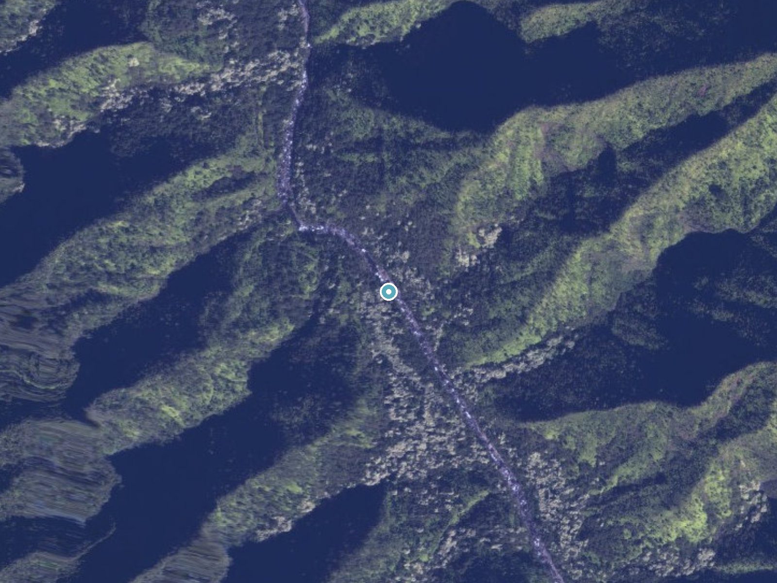
Drag to compare. The dot marks the waterfall. The frame is about a mile across.
- Ground elevation
- 984 feet
- Measured by 1-meter lidar
- Drop at the falls
- About 91 feet
- Change in ground height within ~250 feet of the falls
- Faces
- West
- Glows in afternoon and evening light.
A slice through the lidar ground surface, from above the falls to downstream (heading west).
Elevation data: USGS 3D Elevation Program. Aerial imagery: USGS The National Map. Public domain.
Location & Access
Getting There
Access to Pūwainui Falls is challenging and typically requires a guided tour or permission to cross private land. The falls are located in a remote area, and visitors should plan accordingly.
Get Directions on Google MapsParking
Parking availability is unclear, as access to the falls may involve private property or off-road travel. Visitors should confirm parking options with local guides or tour operators.
Elevation
984 feet above sea level
Coordinates
22.135782° N, -159.557793° W
Land Management
Managed by PVT
Visitor Tips & Gear
Plan ahead and confirm access requirements before visiting. Bring appropriate footwear, water, and supplies for a potentially challenging hike. Consider hiring a local guide for safe and legal access.
Where to Stay

Hanalei Bay Resort

Makai Club Resort

Kauai Shores Hotel

Poipu Plantation Vacation Rentals
Browse vacation cabins and private rentals nearby
Unique outdoor stays — tents, yurts, and treehouses
Rent a campervan or RV for your waterfall road trip
Some links are affiliate links. We may earn a commission at no extra cost to you.
Additional Information
Nearby Attractions
Nearby attractions may include other waterfalls, hiking trails, and scenic viewpoints on the island of Hawaii.
Wildlife
The area around Pūwainui Falls is home to diverse tropical wildlife, including native birds and insects.
Cities near Pūwainui Falls
Nearby Waterfalls
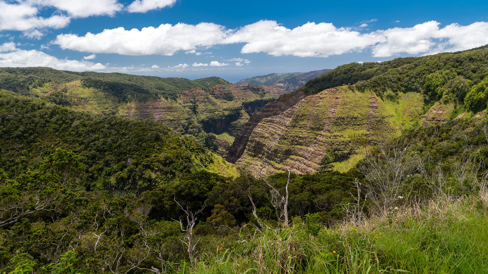
 Aerial

Writing about Pūwainui Falls? Embed this waterfall on your site for free.