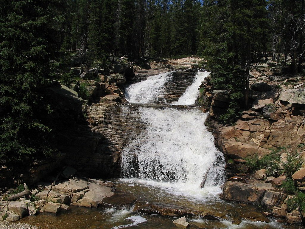
Provo River Falls
By Armen Suny · Last verified Mar 2026
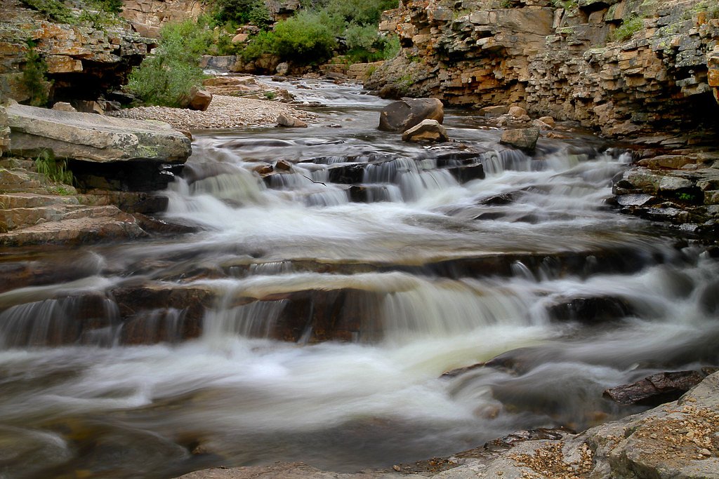
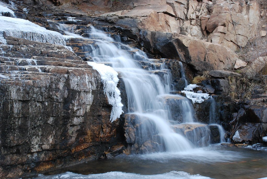
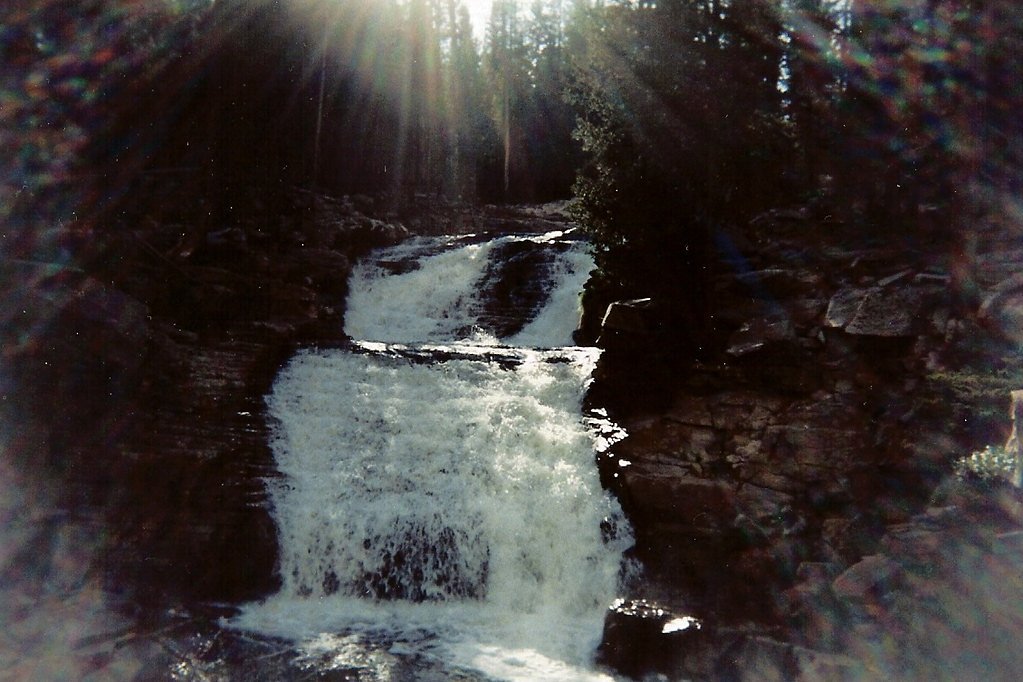
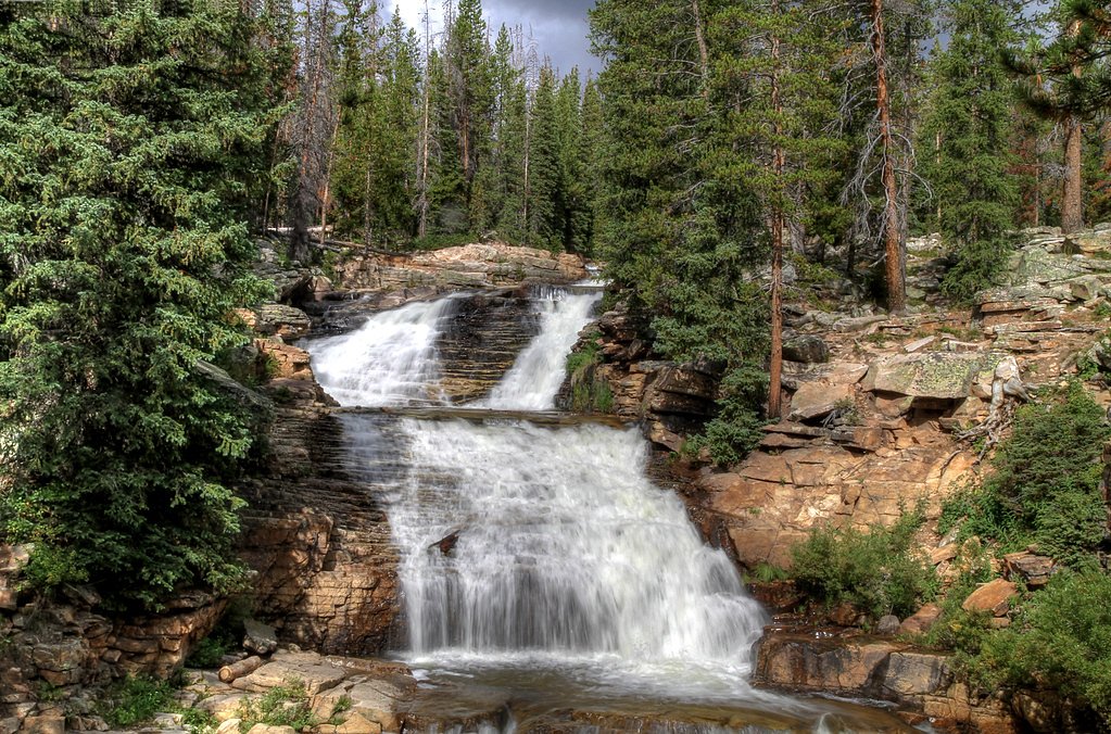
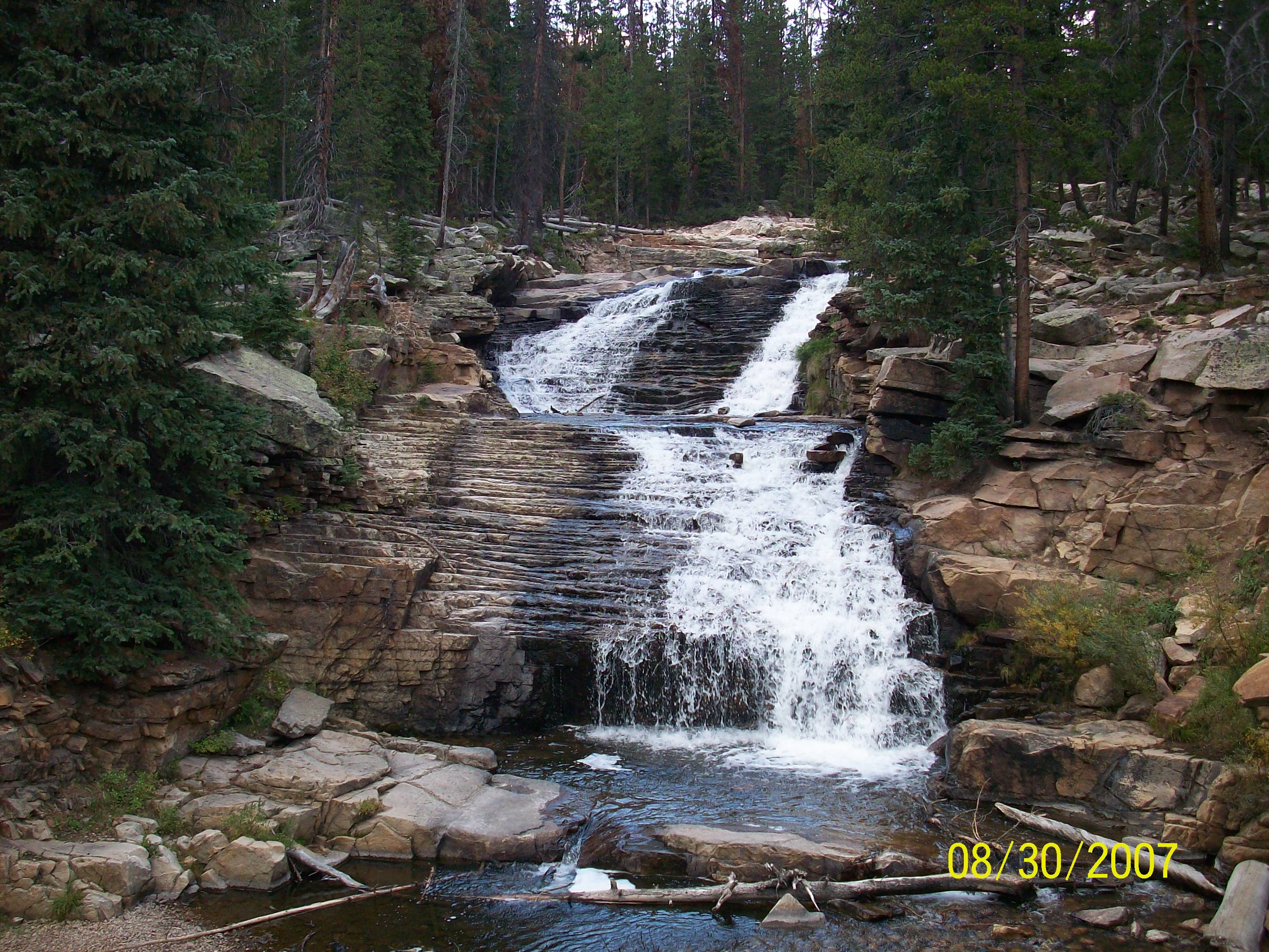
Photo Credits (5)
Difficulty
Moderate
Trail Length
2.4 miles
Trail Type
Out And Back
Elevation Gain
350 ft
About Provo River Falls
Provo River Falls is a scenic series of cascades on the Provo River tucked into the Wasatch National Forest and managed by the U.S. Forest Service. The falls are especially photogenic in spring and early summer when snowmelt swells the river, creating broad, tumbling flows and misty viewpoints framed by native forest. The area sits on National Forest land, and a very short USFS-maintained spur (Meadow Park ATV, Trail #3323) provides direct access to close-in viewing spots. The hike to the falls is an inviting out-and-back route of about 2.4 miles round trip with roughly 350 feet of elevation gain and a moderate rating—great for hikers who want a relatively short outing with rewarding water views. If you’re camping, Lost Creek Campground is approximately 2.7 km away, making overnight stays convenient for early-morning or evening visits when light and crowds are best.
The Setting
Provo River Falls sits at 9,311 feet within Wasatch National Forest, fed by the Provo River, in the high alpine of Utah.
Trail & Hike Details
The Approach
The moderate hike follows Meadow Park Atv (#3323), a 2.4-mile out-and-back trail over natural surface. Expect 350 feet of elevation gain. The trail is developed (Class 3).
USFS Trail
MEADOW PARK ATV #3323
Trail Class
Developed
Surface
USFS Segment
0.05 miTrail Description
Out-and-back hike, 2.4 miles total with about 350 ft elevation gain; difficulty: moderate. The route includes a very short USFS ATV spur—Meadow Park ATV (Trail #3323)—listed as Class 3 with a native material surface and a GIS length of 0.05 miles; use that spur for the closest viewpoints of the falls. Overall trail footing is mostly native surface and the climb is steady but not steep. Managed by the U.S. Forest Service within Wasatch National Forest; nearest developed camping at Lost Creek Campground (≈2.7 km).
What to Expect
Dogs are welcome.
Accessibility
The trail is not wheelchair accessible. Uneven terrain and elevation changes require steady footing.
Frequently Asked Questions
🐶 Are Dogs Allowed at Provo River Falls?
✅ Dogs are allowed
Are There Any Fees or Permits Required?
🤑 Fee: $6.00
🏊 Is There Swimming at Provo River Falls?
❌ Swimming is not allowed
When to Visit
The best time to visit is in late spring or early summer when the water flow is strongest due to snowmelt. Fall also offers beautiful foliage, while winter access may be limited.
Seasonal Access
The best time to visit is Spring, Summer, and Fall. Access roads and trails may close during winter due to snow. Watch for flash flood warnings during monsoon season (July through September). Check with Wasatch National Forest for seasonal road closures.
Safety Information
Exercise caution near the water as the rocks can be slippery, and the currents are strong. Keep children and pets supervised at all times.
Current Water Conditions
58 ft³/s
Current discharge — how much water is flowing
Much lower than usual for this time of year
Based on 62 years of record
2.60 ft
Water depth at gauge
7-Day Discharge Trend
What does this mean for your visit?
Flow is well below normal for this time of year, so the waterfall may be a trickle.
About This Gauge
This gauge is on a nearby waterway and may not reflect exact conditions at the falls.
7-Day Flow Outlook
Based on the USGS gauge PROVO RIVER NEAR WOODLAND, UT (22 km away).
Today
Moderate
58 cfs
8/10Tomorrow
Moderate
62 cfs
6/10Mon
Moderate
65 cfs
6/10Tue
Moderate
58 cfs
6/10Wed
Moderate
56 cfs
8/10Thu
Moderate
52 cfs
8/10Fri
Moderate
48 cfs
8/10Best window: Today — moderate flow, sunny (trip score 8/10).
Best time of year: this gauge typically runs highest from mid April to mid July, peaking in June.
How we calculate this
This is a transparent outlook, not a precise forecast. We take the waterfall's current flow strength (how it ranks against its historical normal for today, from the nearest USGS stream gauge), carry that ranking forward along the gauge's seasonal curve, and nudge it for forecast rain. Confidence is highest for the next day or two and falls further out. Always check official conditions and your own judgment before visiting — high flows can be dangerous.
Know when to go.
Get a free email alert when waterfalls near Samak hit peak flow. We only send when conditions are worth the trip — no weekly newsletters, no spam.
Weather Forecast
Location & Access
Getting There
Provo River Falls is located along the Mirror Lake Scenic Byway (Highway 150), approximately 24 miles east of Kamas, Utah. The falls are easily accessible by car, with a short walk from the parking area to the viewing points.
Get Directions on Google MapsParking
There is a designated parking area near the falls, which is typically sufficient for visitors. However, it may fill up during peak seasons or weekends.
Elevation
9,311 feet above sea level
Coordinates
40.656613° N, -110.945448° W
Land Management
Managed by USFS
Visitor Tips & Gear
Visit early in the day or during weekdays to avoid crowds. Bring a camera to capture the stunning views, and wear sturdy shoes as the rocks near the falls can be slippery.
This trail sits at 9,311 ft — the air is noticeably thinner
High AltitudeSome visitors experience headaches, fatigue, or shortness of breath at this elevation. Take it slow, stay hydrated, and consider supplemental oxygen if you're coming from a lower altitude.
As an Amazon Associate, we earn from qualifying purchases.

Coppertone Sport SPF 50 Sunscreen
UV intensity jumps ~4% per 1,000 ft — at this elevation you can burn in half the time.

Sun Bum SPF 30 Lip Balm (3-Pack)
Lips have almost no natural UV protection and burn fast in thin, dry mountain air.

Liquid I.V. Electrolyte Packets
You lose moisture ~2x faster at elevation — electrolytes help you absorb water efficiently.

ROCKNIGHT Polarized UV400 Sunglasses
High-altitude glare off rock and water is intense — UV400 lenses block 99%+ of UVA/UVB.

Boost Oxygen 10L Canister (2-Pack)
Portable supplemental oxygen for quick relief from headaches and shortness of breath.

Altitude Rx OxyBoost Complex
Antioxidant formula designed to support your body's natural altitude acclimation.
As an Amazon Associate, we earn from qualifying purchases.
With 2.4 miles and 350 ft of elevation gain, sturdy boots and trekking poles will help on this moderate trail. Sun exposure on the trail makes good sun protection a must in summer.

Polarized Sunglasses (Knockaround)
Cuts glare off the water so you actually see the falls — and your photos turn out better too.

Columbia Watertight II Rain Jacket
Packs into its own pocket, seam-sealed, and keeps you dry from spray and surprise rain.

Earth Pak Waterproof Dry Bag
Keeps your phone and gear dry when waterfall mist soaks everything else.

Waterproof Phone Pouch (AiRunTech)
Cheap insurance — take photos right next to the falls without killing your phone.

Timberland Euro Sprint Mid Waterproof
Trusted waterproof boot with premium leather and grippy rubber sole — reliable on rocky, wet trails.

TrailBuddy Trekking Poles
Lightweight aluminum, cork grips, and flip-locks that actually hold — a best-seller for good reason.
Where to Stay

Holiday Inn Express Heber City by IHG

Heber Senator Bed and Breakfast

Mountain House PC, Snowy Lake Views Private Hot Tub, New Build, Jordanelle Lake!

Grand Hyatt Deer Valley
Browse vacation cabins and private rentals nearby
Unique outdoor stays — tents, yurts, and treehouses
Rent a campervan or RV for your waterfall road trip
Some links are affiliate links. We may earn a commission at no extra cost to you.
Nearby Campground
LOST CREEK CAMPGROUND
1.7 miles away · 37 sites
Overview Lost Creek Campground is located just off the Mirror Lake Scenic Byway on the shores of Lost Lake at an elevation of 9,900 feet. The byway cuts through the Uinta Mountains, which are known for their abundant recreational opportunities and scenic beauty.Recreation Lost Lake offers rainbow trout fishing, canoeing and kayaking in a beautiful setting. The lake is open only to non-motorized watercraft. Many hiking, biking, horse and off-road vehicle trails crisscross this beautiful region, in
Book on Recreation.govNearby Hot Springs
Hot springs near Samak, Utah
Warm Springs
Emerging at 79 degrees Fahrenheit on the Uintah and Ouray Reservation, this thermal spring rises 36.7 degrees above ambient tem...
Unnamed Spring Summit County
This unnamed 70°F spring flows in Summit County near Snyderville, emerging 27.8 degrees above the 42.2°F ambient temperature at...

Warm Ditch Spring
A 115-degree spring in Wasatch County's Heber Valley, emerging 67.8 degrees above ambient temperature just 64 meters from Jerry...

Midway Hot Springs
Midway Hot Springs flows at 104°F along Mountain Spa Lane, emerging 88 meters from the road at 5,650 feet elevation in the Hebe...

Midway Hot Spring
Midway Hot Spring flows at 115°F in Wasatch County's Heber Valley, running 67.4°F above ambient temperatures at 5,650 feet elev...
Midway Hot Springs
Midway Hot Springs at the Homestead Crater flows at 100°F inside a beehive-shaped limestone dome created by millennia of minera...
Looking for a soak after your hike? Explore more hot springs near Samak, Utah on SoakingSprings.
Explore Utah springsAdditional Information
Nearby Attractions
Mirror Lake, Bald Mountain Trail, and other scenic spots along the Mirror Lake Scenic Byway.
Wildlife
The area is home to various wildlife, including deer, birds, and small mammals. Be cautious and respectful of the natural habitat.
Cities near Provo River Falls
Nearby Waterfalls
Writing about Provo River Falls? Embed this waterfall on your site for free.