Porcupine Creek Falls
By Armen Suny · Last verified May 2026
Photo Credits (1)
Difficulty
Moderate
Trail Length
2.0 miles
Trail Type
Out And Back
Elevation Gain
500 ft
About Porcupine Creek Falls
Porcupine Creek Falls tumbles through the Bighorn Mountains on USFS-managed land, nestled within Bridger National Forest. The falls sit in a rugged, forested drainage and are most commonly reached via the USFS NEW FORK/PORCUPINE Trail (#7137). The approach threads through mixed forest and rocky benches, offering the kind of dramatic mountain scenery that makes a short outing feel remote and satisfying. Practical details from the Forest Service make this an easy hike to plan: the route to the falls is an out-and-back of about 2.0 miles with roughly 500 feet of elevation gain and a moderate difficulty rating. The trail is listed in USFS records as Trail #7137 (NEW FORK/PORCUPINE) with 8.29 GIS miles in the system and is managed by the USFS. If you want to camp nearby, Green River Lake Lodge is about 4.29 km away, making an overnight stay or a longer exploration of the area convenient.
The Setting
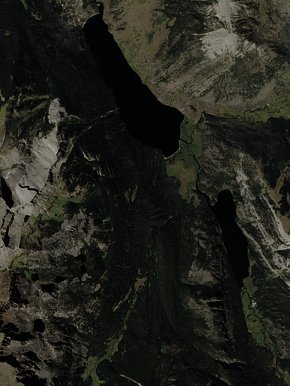
Porcupine Creek Falls sits at 8,274 feet within Bridger National Forest, fed by the New Fork River, in the high alpine of Wyoming.
Trail & Hike Details
The Approach
The moderate hike follows New Fork/Porcupine (#7137), a 2.0-mile out-and-back trail over natural surface. Expect 500 feet of elevation gain. The trail is developed (Class 3).
USFS Trail
NEW FORK/PORCUPINE #7137
Trail Class
Developed
Surface
USFS Segment
8.29 miTrail Description
The NEW FORK/PORCUPINE Trail (USFS Trail #7137) is an out-and-back of approximately 2.0 miles with about 500 feet of elevation gain and a moderate difficulty rating. The tread is native material (natural surface) and the Forest Service classifies the route as Class 3, so expect uneven, rocky sections and short steeper pitches that require sure footing. The trail winds through dense forest and along rugged terrain with intermittent mountain views; footwear with good traction is recommended and hikers should be prepared for native-surface conditions and variable grade.
What to Expect
Dogs are welcome.
Accessibility
The trail is not wheelchair accessible. Uneven terrain and elevation changes require steady footing.
Frequently Asked Questions
🐶 Are Dogs Allowed at Porcupine Creek Falls?
✅ Dogs are allowed
Are There Any Fees or Permits Required?
🆖 No fees required
🏊 Is There Swimming at Porcupine Creek Falls?
❌ Swimming is not allowed
When to Visit
The best time to visit Porcupine Creek Falls is during late spring through early fall when the trail is most accessible, and the water flow is strong.
Seasonal Access
The best time to visit is Spring, Summer, and Fall. Access roads and trails may close during winter due to snow. Check with Bridger National Forest for seasonal road closures.
Safety Information
Visitors should be cautious of slippery rocks near the falls and be prepared for sudden weather changes. Carry bear spray and know how to use it, as black bears are present in the area.
Current Water Conditions
188 ft³/s
Current discharge — how much water is flowing
About average for this time of year
Based on 2 years of record
3.78 ft
Water depth at gauge
7-Day Discharge Trend
What does this mean for your visit?
Flow is about average for this time of year.
About This Gauge
This gauge is on a nearby waterway and may not reflect exact conditions at the falls.
7-Day Flow Outlook
Based on the USGS gauge New Fork River ab New Fork Lakes, nr Cora, WY (17 km away).
Today
Moderate
169 cfs
8/10Tomorrow
Moderate
169 cfs
8/10Wed
Moderate
208 cfs
6/10Thu
Moderate
190 cfs
6/10Fri
Moderate
180 cfs
6/10Sat
Moderate
200 cfs
6/10Sun
Moderate
158 cfs
6/10Best window: Today — moderate flow, sunny (trip score 8/10).
Best time of year: this gauge typically runs highest from late April to late July, peaking in June.
How we calculate this
This is a transparent outlook, not a precise forecast. We take the waterfall's current flow strength (how it ranks against its historical normal for today, from the nearest USGS stream gauge), carry that ranking forward along the gauge's seasonal curve, and nudge it for forecast rain. Confidence is highest for the next day or two and falls further out. Always check official conditions and your own judgment before visiting — high flows can be dangerous.
Know when to go.
Get a free email alert when waterfalls near Dubois hit peak flow. We only send when conditions are worth the trip — no weekly newsletters, no spam.
Weather Forecast
Location & Access
Getting There
Porcupine Creek Falls is located in the Bighorn National Forest. The falls can be accessed via Forest Service roads, but the exact route may vary depending on seasonal conditions. Visitors are advised to check with the local ranger station for the most up-to-date information on road access.
Get Directions on Google MapsParking
Parking is available at trailheads within the Bighorn National Forest. Specific parking locations depend on the chosen trail to access the falls.
Elevation
8,274 feet above sea level
Coordinates
43.276336° N, -109.838492° W
Land Management
Managed by USFS
Visitor Tips & Gear
Check weather conditions before your visit, as the trail can become muddy or slippery after rain. Bring plenty of water, snacks, and a map or GPS device, as cell service may be limited in the area.
This trail sits at 8,274 ft — the air is noticeably thinner
High AltitudeSome visitors experience headaches, fatigue, or shortness of breath at this elevation. Take it slow, stay hydrated, and consider supplemental oxygen if you're coming from a lower altitude.
As an Amazon Associate, we earn from qualifying purchases.

Coppertone Sport SPF 50 Sunscreen
UV intensity jumps ~4% per 1,000 ft — at this elevation you can burn in half the time.

Sun Bum SPF 30 Lip Balm (3-Pack)
Lips have almost no natural UV protection and burn fast in thin, dry mountain air.

Liquid I.V. Electrolyte Packets
You lose moisture ~2x faster at elevation — electrolytes help you absorb water efficiently.

ROCKNIGHT Polarized UV400 Sunglasses
High-altitude glare off rock and water is intense — UV400 lenses block 99%+ of UVA/UVB.

Boost Oxygen 10L Canister (2-Pack)
Portable supplemental oxygen for quick relief from headaches and shortness of breath.

Altitude Rx OxyBoost Complex
Antioxidant formula designed to support your body's natural altitude acclimation.
As an Amazon Associate, we earn from qualifying purchases.
With 2.0 miles and 500 ft of elevation gain, sturdy boots and trekking poles will help on this moderate trail. Sun exposure on the trail makes good sun protection a must in summer.

Polarized Sunglasses (Knockaround)
Cuts glare off the water so you actually see the falls — and your photos turn out better too.

Columbia Watertight II Rain Jacket
Packs into its own pocket, seam-sealed, and keeps you dry from spray and surprise rain.

Earth Pak Waterproof Dry Bag
Keeps your phone and gear dry when waterfall mist soaks everything else.

Waterproof Phone Pouch (AiRunTech)
Cheap insurance — take photos right next to the falls without killing your phone.

Timberland Euro Sprint Mid Waterproof
Trusted waterproof boot with premium leather and grippy rubber sole — reliable on rocky, wet trails.

TrailBuddy Trekking Poles
Lightweight aluminum, cork grips, and flip-locks that actually hold — a best-seller for good reason.
Where to Stay

Trails end motel

Chinook Winds Lodge

Stagecoach Inn & Suites

Crooked Creek Guest Ranch
Browse vacation cabins and private rentals nearby
Unique outdoor stays — tents, yurts, and treehouses
Rent a campervan or RV for your waterfall road trip
Some links are affiliate links. We may earn a commission at no extra cost to you.
Nearby Campground
Green River Lake Lodge
2.7 miles away · 1 sites
Overview The Green River Lakes Lodge is located 50 miles north of Pinedale, Wyoming. The lodge is available as a rental for day use events such as weddings, family reunions, or meetings for up to 50 guests, or as an overnight rental for smaller groups of up to 12 guests. Recreation During the summer months, hiking and horseback riding into the Bridger Wilderness and Wind River Range are popular activities enjoyed by visitors to the area. The lake is open to small watercraft only, making it an exc
Book on Recreation.govNearby Hot Springs
Hot springs near Dubois, Wyoming
Kendall Warm Spring
Kendall Warm Spring emerges at 86 degrees with pH 7.8 and high sulfate content (650 mg/L) at 7,820 feet in Bridger National For...
Geyser (Warm Spring Creek Springs)
This thermal feature produces 84-degree Fahrenheit water on Bureau of Land Management lands at 7,260 feet elevation, emerging i...
Little Warm Spring
Little Warm Spring discharges at 77 degrees Fahrenheit just 42 meters from Three Spear Ranch Access Road at 7,403 feet elevatio...
Jakeys Fork Spring
Jakeys Fork Spring emerges at 68 degrees Fahrenheit at 7,176 feet elevation in Sublette County near Pinedale, located 540 feet ...
Granite Falls Hot Springs
This Forest Service-maintained spring produces 112-degree Fahrenheit water at 6,882 feet elevation, accessible via 625-foot wal...

Granite Hot Spring
This spring produces 106-degree Fahrenheit water at 7,035 feet elevation on Forest Service land, emerging 750 feet from the roa...
Looking for a soak after your hike? Explore more hot springs near Dubois, Wyoming on SoakingSprings.
Explore Wyoming springsAdditional Information
Nearby Attractions
Other attractions in the Bighorn National Forest include Shell Falls, Medicine Wheel National Historic Landmark, and Cloud Peak Wilderness.
Wildlife
The area is home to a variety of wildlife, including deer, elk, black bears, and numerous bird species. Visitors should exercise caution and follow wildlife safety guidelines.
Cities near Porcupine Creek Falls
Nearby Waterfalls
Writing about Porcupine Creek Falls? Embed this waterfall on your site for free.