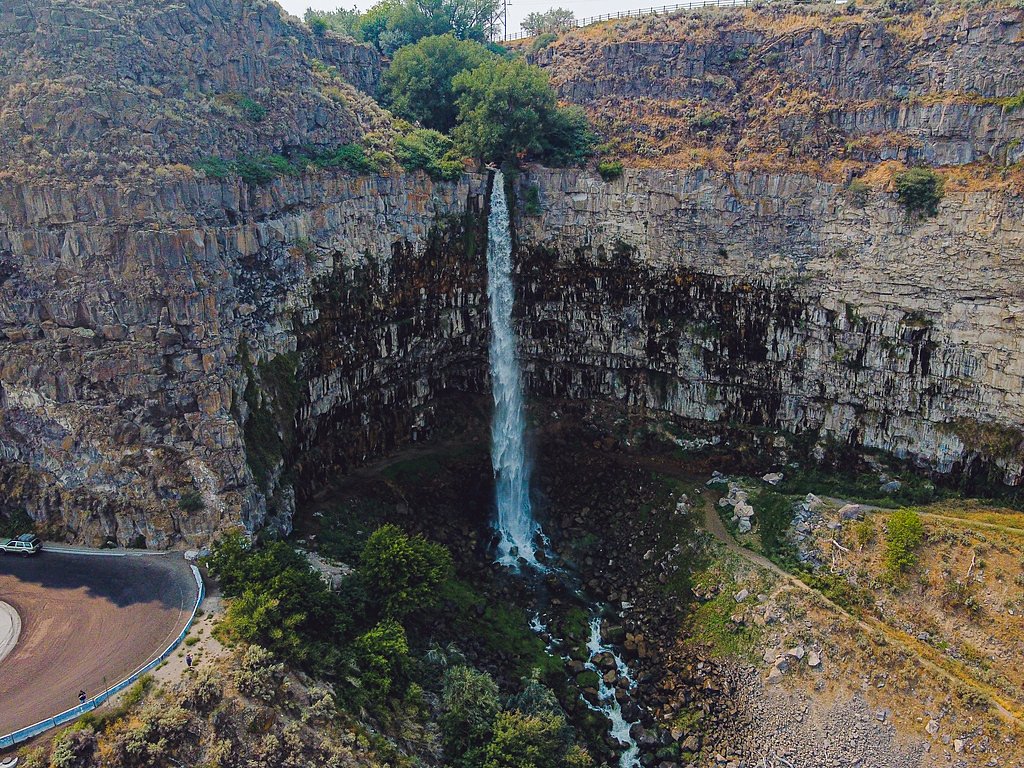
Perrine Coulee Falls
Idaho • 200 ft
By Armen Suny · Last verified Sep 2026
LiDAR & 3D terrain
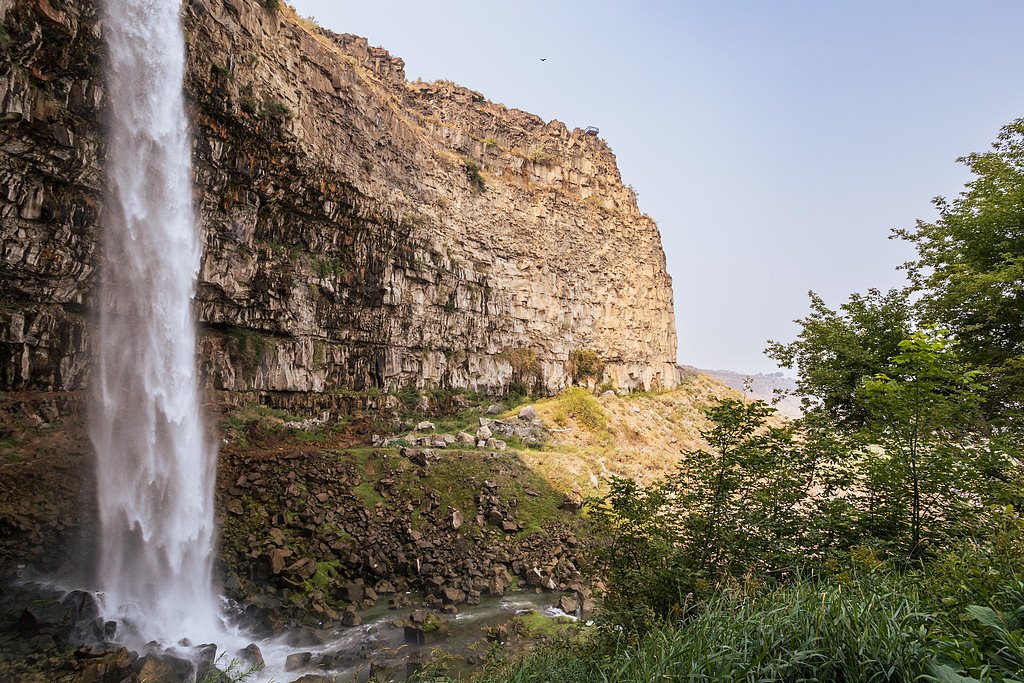
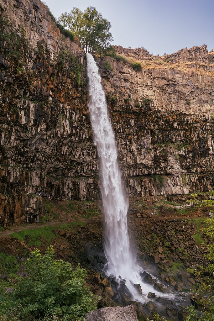
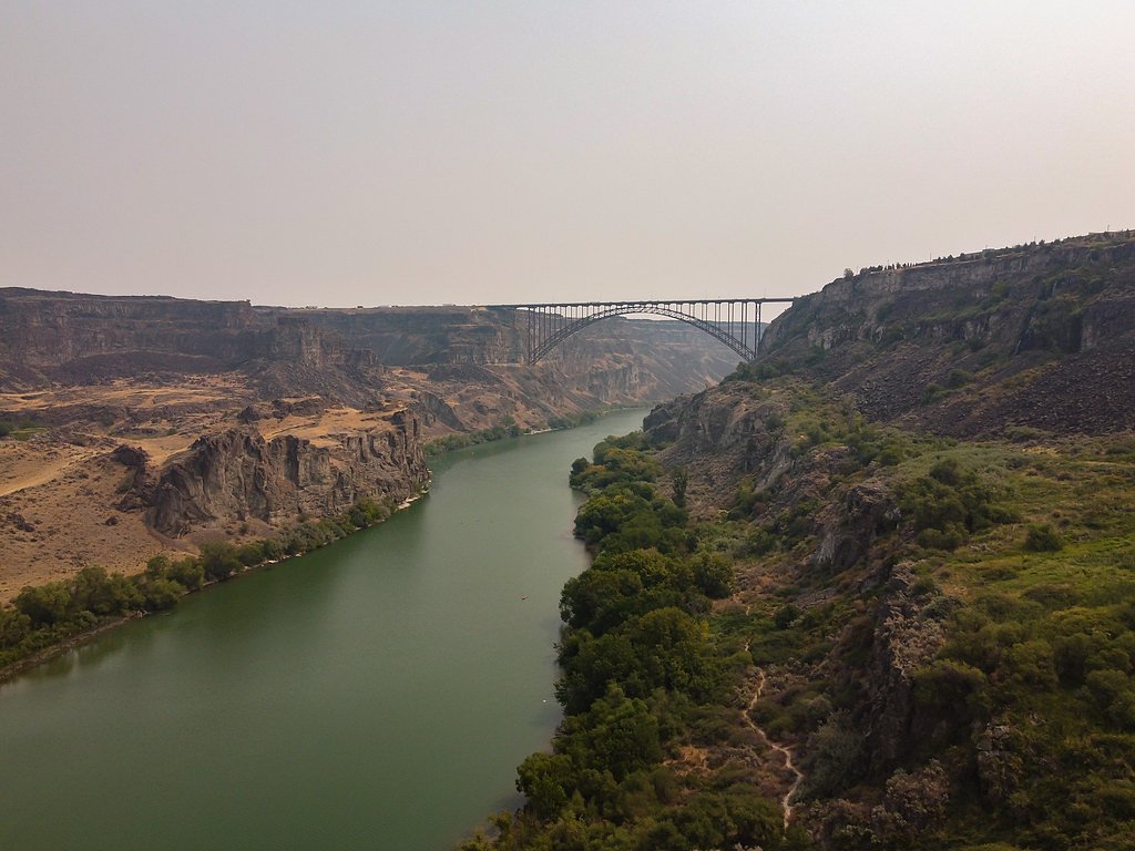

Photo Credits (5)
Difficulty
Easy
Trail Length
0.5 miles
Trail Type
Out And Back
About Perrine Coulee Falls
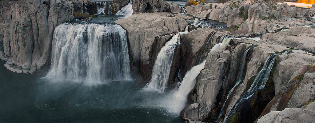
Perrine Coulee Falls is a stunning 200-foot waterfall located near Twin Falls, Idaho. It flows year-round and is fed by irrigation runoff, creating a picturesque cascade that visitors can view from multiple angles, including from behind the waterfall.
The Setting
Perrine Coulee Falls sits at 3,573 feet along the Snake River, in the mountains of Idaho. At 200 feet, it is among the taller waterfalls in Idaho.
Height: 200 feet
Nearby Falls Worth Visiting
Shoshone Falls, the tallest waterfall in Idaho at 212 feet, lies 3.6 miles to the east.
Trail & Hike Details
Trail Description
The trail to Perrine Coulee Falls is short and easy, making it accessible for most visitors. It leads to the base of the falls, where you can walk behind the cascading water for a unique perspective. The trail may be muddy or slippery, especially in spring or after rainfall.
What to Expect
The falls plunge 200 feet. Dogs are welcome.
Accessibility
The trail is short and relatively flat, but the surface may be uneven. Contact the managing agency for accessibility details.
Frequently Asked Questions
🐶 Are Dogs Allowed at Perrine Coulee Falls?
✅ Dogs are allowed
Are There Any Fees or Permits Required?
🆖 No fees required
🏊 Is There Swimming at Perrine Coulee Falls?
❌ Swimming is not allowed
When to Visit
Spring and early summer are the best times to visit, as the water flow is strongest during these seasons. However, the falls are accessible and beautiful year-round.
Seasonal Access
The best time to visit is Spring, Summer, Fall, and Winter.
Safety Information
Be cautious of slippery rocks, especially when walking behind the falls. Avoid getting too close to the edge of the cliffs. Supervise children closely.
Current Water Conditions
501 ft³/s
Current discharge — how much water is flowing
Much lower than usual for this time of year
Based on 51 years of record
1.82 ft
Water depth at gauge
7-Day Discharge Trend
What does this mean for your visit?
Flow is well below normal for this time of year, so the waterfall may be a trickle.
About This Gauge
7-Day Flow Outlook
Based on the USGS gauge SNAKE RIVER NR TWIN FALLS ID (1 km away).
Today
Barely Flowing
501 cfs
4/10Tomorrow
Barely Flowing
464 cfs
4/10Mon
Barely Flowing
483 cfs
5/10Tue
Barely Flowing
487 cfs
5/10Wed
Barely Flowing
497 cfs
5/10Thu
Barely Flowing
508 cfs
5/10Fri
Barely Flowing
562 cfs
5/10Best window: Mon — barely flowing flow, mostly sunny (trip score 5/10).
Best time of year: this gauge typically runs highest from late March to late April, peaking in April.
How we calculate this
This is a transparent outlook, not a precise forecast. We take the waterfall's current flow strength (how it ranks against its historical normal for today, from the nearest USGS stream gauge), carry that ranking forward along the gauge's seasonal curve, and nudge it for forecast rain. Confidence is highest for the next day or two and falls further out. Always check official conditions and your own judgment before visiting — high flows can be dangerous.
Know when to go.
Get a free email alert when waterfalls near Twin Falls hit peak flow. We only send when conditions are worth the trip — no weekly newsletters, no spam.
Weather Forecast
The Terrain, Seen by LiDAR
Aircraft-mounted lasers measured this ground to within inches. Trees and buildings are digitally stripped away, leaving the bare shape of the land the water has carved.
Along the line through the falls, the bare ground drops about 306 feet, most of it in one sheer step, the signature of a plunge waterfall. The falls are listed at 200 feet; the extra comes from the ravine that continues below the base. The ground at the falls is roughly 3,617 feet above sea level.
Water arrives on almost flat ground and leaves through a ravine that loses about 348 feet in the first 500 feet below the falls. Facing north, the falls stay mostly shaded, with soft, even light all day.
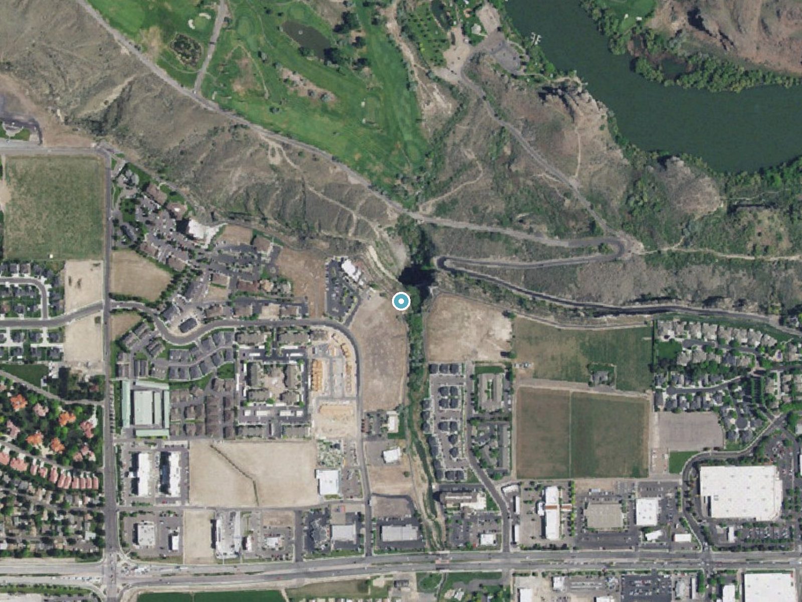
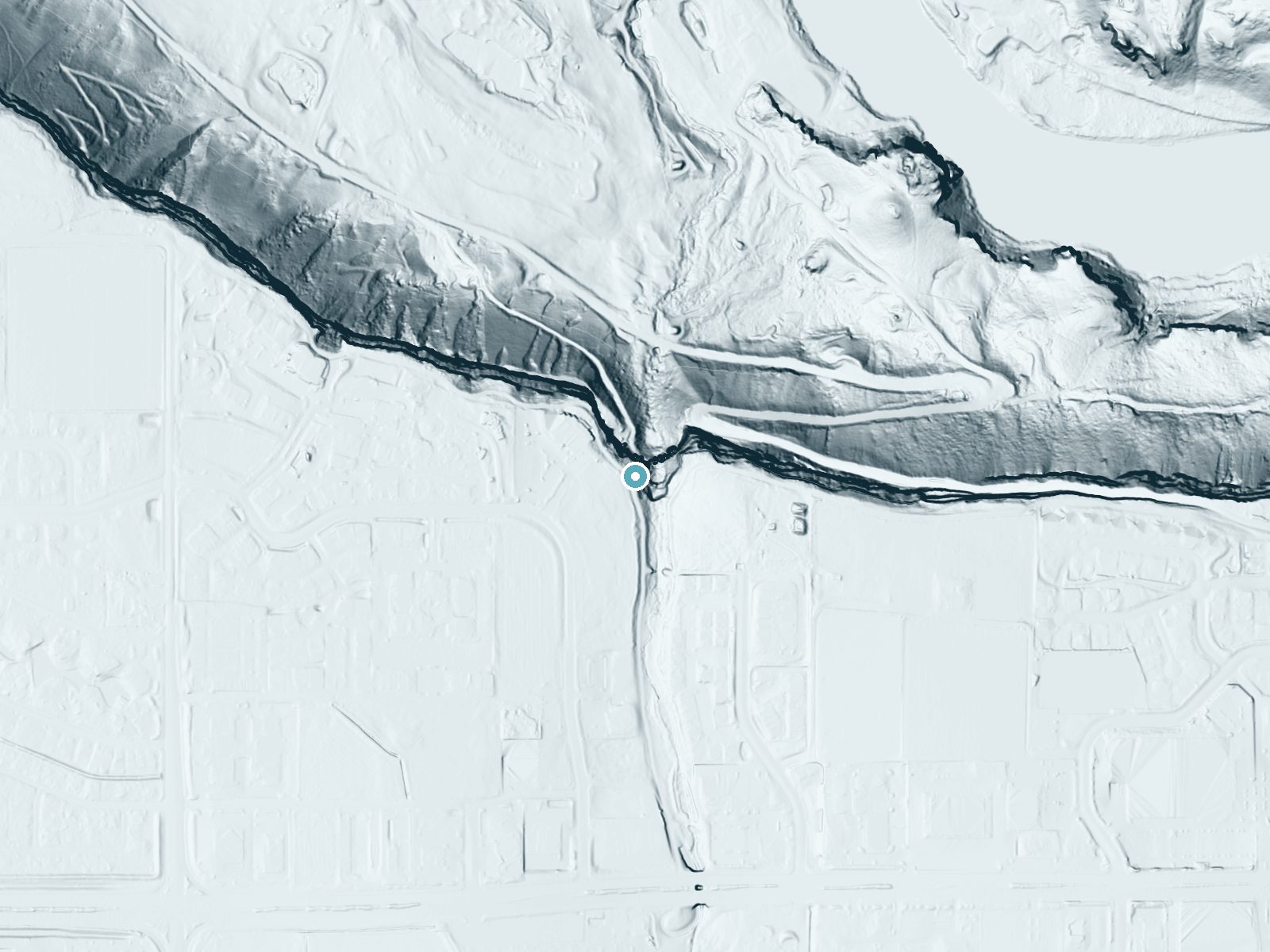
Drag to compare. The dot marks the waterfall. The frame is about a mile across.
- Ground elevation
- 3,617 feet
- Measured by 1-meter lidar
- Drop at the falls
- About 303 feet
- Change in ground height within ~250 feet of the falls
- Faces
- North
- Mostly shaded, so the light stays soft and even all day.
A slice through the lidar ground surface, from above the falls to downstream (heading north).
Elevation data: USGS 3D Elevation Program. Aerial imagery: USGS The National Map. Public domain.
Location & Access
Getting There
Perrine Coulee Falls is located just off US-93 near the Perrine Bridge in Twin Falls, Idaho. Visitors can park nearby and access the falls via a short walk.
Get Directions on Google MapsParking
There is a small parking area near the falls, and additional parking may be available near the Snake River Canyon Rim Trail.
Elevation
3,573 feet above sea level
Coordinates
42.596577° N, -114.472539° W
Visitor Tips & Gear
Wear sturdy shoes with good traction, as the trail can be slippery. Bring a camera to capture the stunning views. Be cautious when walking behind the falls, as the rocks may be wet and slick.
Where to Stay

La Quinta by Wyndham Twin Falls

SureStay Hotel by Best Western Twin Falls

Holiday Inn Twin Falls by IHG

Comfort Inn & Suites Jerome - Twin Falls
Browse vacation cabins and private rentals nearby
Unique outdoor stays — tents, yurts, and treehouses
Rent a campervan or RV for your waterfall road trip
Some links are affiliate links. We may earn a commission at no extra cost to you.
Nearby Hot Springs
Hot springs near Twin Falls, Idaho
Nat Soo Pah Warm Spring
Nat-Soo-Pah Warm Spring flows at a body-friendly 97°F in Twin Falls County, Idaho, on BLM land just 550 feet from Hoppers Gulch...
Banbury Hot Spring
Banbury Hot Spring fires out at 138 degrees Fahrenheit near Buhl in Twin Falls County, one of the hottest thermal features in t...
Poison Springs
Poison Springs sits on BLM land near Buhl in Twin Falls County, Idaho, at 3,388 feet elevation. The original temperature was re...
Hot Sulphur (Miracle Hot) Springs
Known locally as Miracle Hot Springs, this Twin Falls County source flows at 131 degrees Fahrenheit near Buhl in the Snake Rive...
Salmon Falls Hot Spring
Salmon Falls Hot Spring pushes 153-degree water to the surface just six feet from North 1000 East road in Twin Falls County, on...
Artesian City Hot Springs
Artesian City Hot Springs flows at 99 degrees Fahrenheit in the agricultural flatlands of Twin Falls County, one of several geo...
Looking for a soak after your hike? Explore more hot springs near Twin Falls, Idaho on SoakingSprings.
Explore Idaho springsAdditional Information
Nearby Attractions
Nearby attractions include the Snake River Canyon Rim Trail, Shoshone Falls, and the Perrine Bridge.
Wildlife
Visitors may see birds, small mammals, and other wildlife typical of the Snake River Canyon area.
Cities near Perrine Coulee Falls
Nearby Waterfalls
Writing about Perrine Coulee Falls? Embed this waterfall on your site for free.