
Peepee Falls
By Armen Suny · Last verified Sep 2026
LiDAR & 3D terrain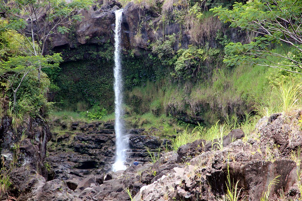


Photo Credits (5)
Difficulty
Easy
Trail Length
0.2 miles
Trail Type
Out And Back
About Peepee Falls
Peepee Falls, located near Hilo on the Big Island of Hawaii, is a picturesque waterfall known for its cascading waters and proximity to the popular Boiling Pots area. The falls are part of the Wailuku River State Park and are a popular spot for visitors seeking natural beauty.
Trail & Hike Details
Trail Description
The trail to Peepee Falls is a short and easy walk from the parking area. It is well-maintained and suitable for most visitors, including families with children. The trail provides scenic views of the surrounding lush vegetation and leads to a viewpoint overlooking the falls.
What to Expect
Visitors can expect a serene and scenic experience at Peepee Falls. The falls are surrounded by tropical greenery, and the nearby Boiling Pots area adds to the natural beauty of the location. The sound of cascading water creates a peaceful atmosphere.
Accessibility
The trail is short and relatively flat, but the surface may be uneven. Contact the managing agency for accessibility details.
Frequently Asked Questions
🐶 Are Dogs Allowed at Peepee Falls?
❌ Dogs are not allowed
Are There Any Fees or Permits Required?
🆖 No fees required
🏊 Is There Swimming at Peepee Falls?
❌ Swimming is not allowed
When to Visit
The falls can be visited year-round, but mornings are typically less crowded. Visiting after rainfall may enhance the flow of the waterfall, but exercise caution as trails may be slippery.
Seasonal Access
The best time to visit is Spring, Summer, Fall, and Winter. Heavy rains during wet season (November through March) bring higher flow but can make trails slippery.
Safety Information
Exercise caution near the water as currents can be strong and unpredictable. The rocks around the falls may be slippery, especially after rain. Stay on designated trails and observe all posted safety signs.
Current Water Conditions
These readings come from the USGS gauge on Wailuku River, 1.1 miles away, not on Peepee Falls's own stream. Use them as a sign of whether the area is running wet or dry.
255 ft³/s
Current discharge — how much water is flowing
Higher than usual for this time of year
Based on 97 years of record
4.22 ft
Water depth at gauge
7-Day Discharge Trend
What does this mean for your visit?
The water is flowing higher than usual for this time of year.
About This Gauge
7-Day Flow Outlook
Based on the USGS gauge Wailuku River at Piihonua, HI (2 km away).
Today
Moderate
255 cfs
8/10Tomorrow
Moderate
248 cfs
5/10Fri
Moderate
272 cfs
5/10Sat
Moderate
261 cfs
5/10Sun
Moderate
282 cfs
5/10Mon
Moderate
272 cfs
5/10Tue
Moderate
328 cfs
5/10Best window: Today — moderate flow, mostly sunny (trip score 8/10).
Best time of year: this gauge typically runs highest from late March to mid May, peaking in April.
How we calculate this
This is a transparent outlook, not a precise forecast. We take the waterfall's current flow strength (how it ranks against its historical normal for today, from the nearest USGS stream gauge), carry that ranking forward along the gauge's seasonal curve, and nudge it for forecast rain. Confidence is highest for the next day or two and falls further out. Always check official conditions and your own judgment before visiting — high flows can be dangerous.
Know when to go.
Get a free email alert when waterfalls near Wainaku hit peak flow. We only send when conditions are worth the trip — no weekly newsletters, no spam.
Is Peepee Falls Frozen?
Updated about 16 hours agoNot frozen highs above freezing lately strong flow slows freezing
Peepee Falls is not frozen right now; highs have been above freezing. Yesterday ran 76°F to 68°F.
- Days below freezing
- 0 of the last 14
- Current cold streak
- 0 days
- Freezing days ahead
- 0 of the next 7
- Flow
- 369 ft³/s
Winter safety. Frozen falls are the one waterfall trip with a documented injury pattern: falling ice, and ice-glazed rock and trail. Wear microspikes, keep well back from the base and from overhangs, and never walk out on ice over moving water.
Estimate from Open-Meteo daily temperatures at the falls, the LiDAR-measured facing direction, and the nearest stream gauge. It is a likelihood, not a report from the trail.
Weather Forecast
The Terrain, Seen by LiDAR
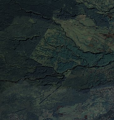
Aircraft-mounted lasers measured this ground to within inches. Trees and buildings are digitally stripped away, leaving the bare shape of the land the water has carved.
The ground through the falls loses about 108 feet in steep steps rather than one leap. The ground at the falls is roughly 844 feet above sea level.
The ground changes about 46 feet in the 500 feet above the falls and 88 feet in the 500 feet below. Facing east, the falls catch soft morning light.
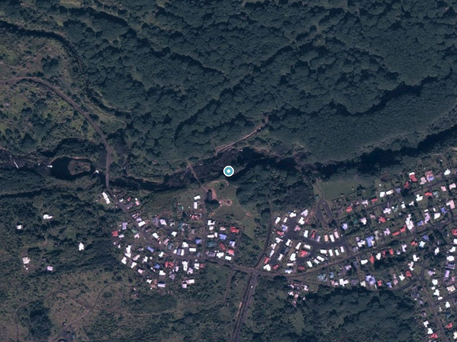
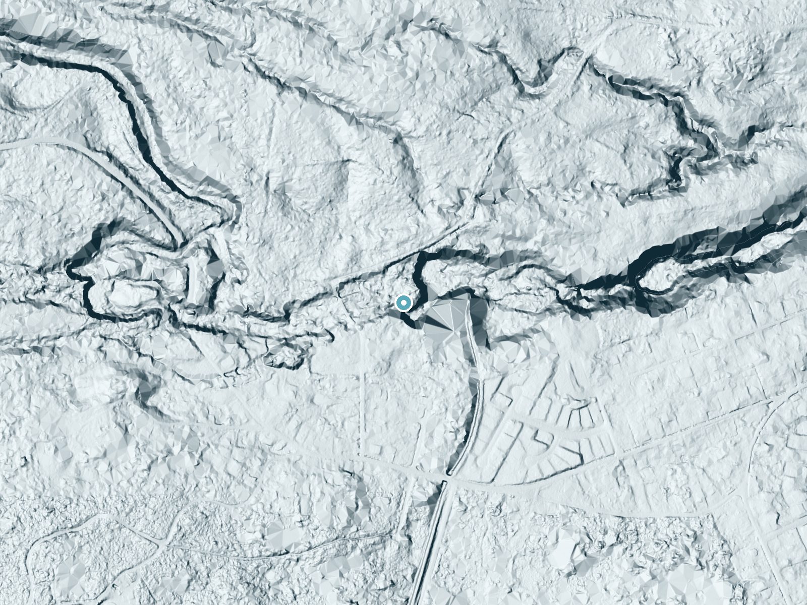
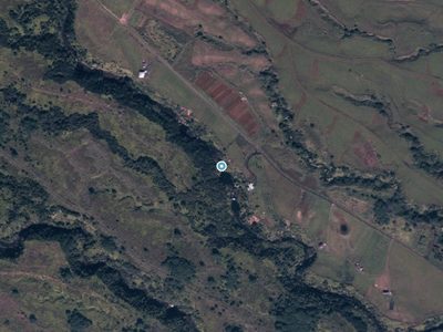
Drag to compare. The dot marks the waterfall. The frame is about a mile across.
- Ground elevation
- 844 feet
- Measured by 1-meter lidar
- Drop at the falls
- About 108 feet
- Change in ground height within ~250 feet of the falls
- Faces
- East
- Catches soft morning light.
A slice through the lidar ground surface, from above the falls to downstream (heading east).
Elevation data: USGS 3D Elevation Program. Aerial imagery: USGS The National Map. Public domain.
Location & Access
Getting There
Peepee Falls is located about 1.5 miles from downtown Hilo. Visitors can reach the falls by taking Waianuenue Avenue and following signs to Wailuku River State Park. The falls are accessible via a short walk from the parking area.
Get Directions on Google MapsParking
There is a small parking lot available near the falls, but it may fill up during peak times.
Elevation
823 feet above sea level
Coordinates
19.715226° N, -155.134232° W
Visitor Tips & Gear
Arrive early to secure parking, especially during weekends or holidays. Wear sturdy shoes as the trail may be slippery after rain. Bring a camera to capture the stunning views.
Where to Stay

Hilo Hawaiian Hotel, Trademark Collection by Wyndham

SCP Hilo Hotel

Hilo Reeds Bay Hotel

Somewhere over the Rainbow Loft with AC Hilo
Browse vacation cabins and private rentals nearby
Unique outdoor stays — tents, yurts, and treehouses
Rent a campervan or RV for your waterfall road trip
Some links are affiliate links. We may earn a commission at no extra cost to you.
Nearby Hot Springs
Hot springs near Peepee Falls, Hawaii
Akins Spring
Akins Spring flows 84°F water on Hawaii's Big Island, 11 degrees warmer than the tropical 73°F ambient, requiring a short walk ...

Steam Vents
These high-elevation steam vents rise to 13,426 feet on Mauna Loa's slopes, making them among Hawaii's highest geothermal featu...

Steam Vents
Steam vents emerge where volcanic heat meets restricted military lands on Hawaii's Big Island. These fumaroles sit at 4,003 fee...
Steam Vents
Steam Vents represent superheated geothermal manifestations on Hawaii's Big Island where steam escapes through volcanic bedrock...

Steam Vents
Steam vents at 3,620 feet emerge within Hawai'i Volcanoes National Park where volcanic heat creates dramatic fumarolic activity...

Warm Vapor
Warm Vapor emerges at low-temperature geothermal conditions near Nanawale Estates at just 422 feet elevation. The designation a...
Looking for a soak after your hike? Explore more hot springs near Peepee Falls, Hawaii on SoakingSprings.
Explore Hawaii springsAdditional Information
Nearby Attractions
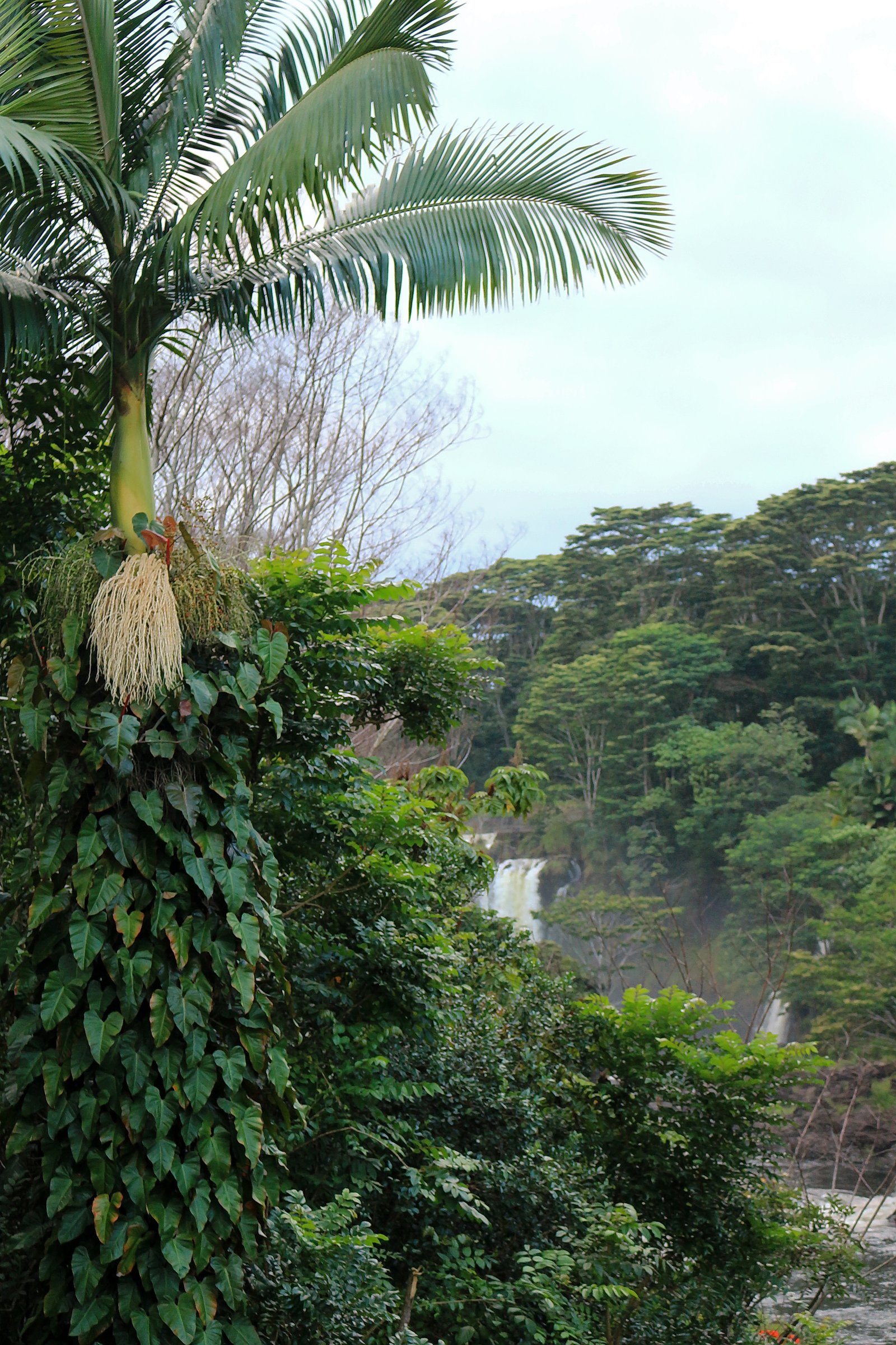
Nearby attractions include Rainbow Falls, Boiling Pots, and the town of Hilo, which offers shops, restaurants, and cultural sites.
Wildlife
The area is home to various bird species and tropical plants. Visitors may also spot fish in the river.
Nearby Waterfalls


 Aerial
Writing about Peepee Falls? Embed this waterfall on your site for free.