
Photo Credits (5)
Difficulty
Moderate
Trail Length
2.4 miles
Trail Type
Out And Back
Elevation Gain
350 ft
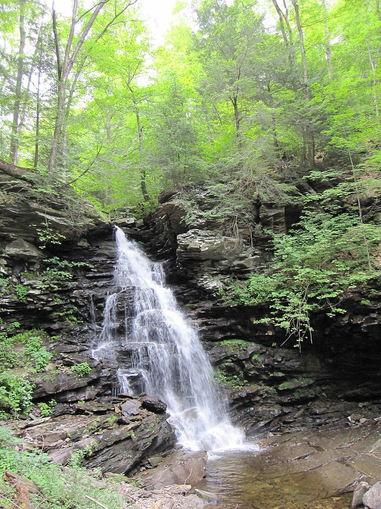
About Ozone Falls
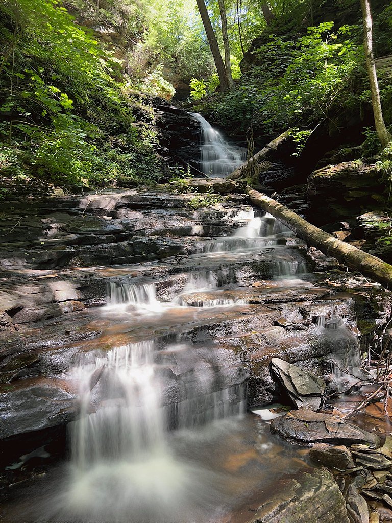
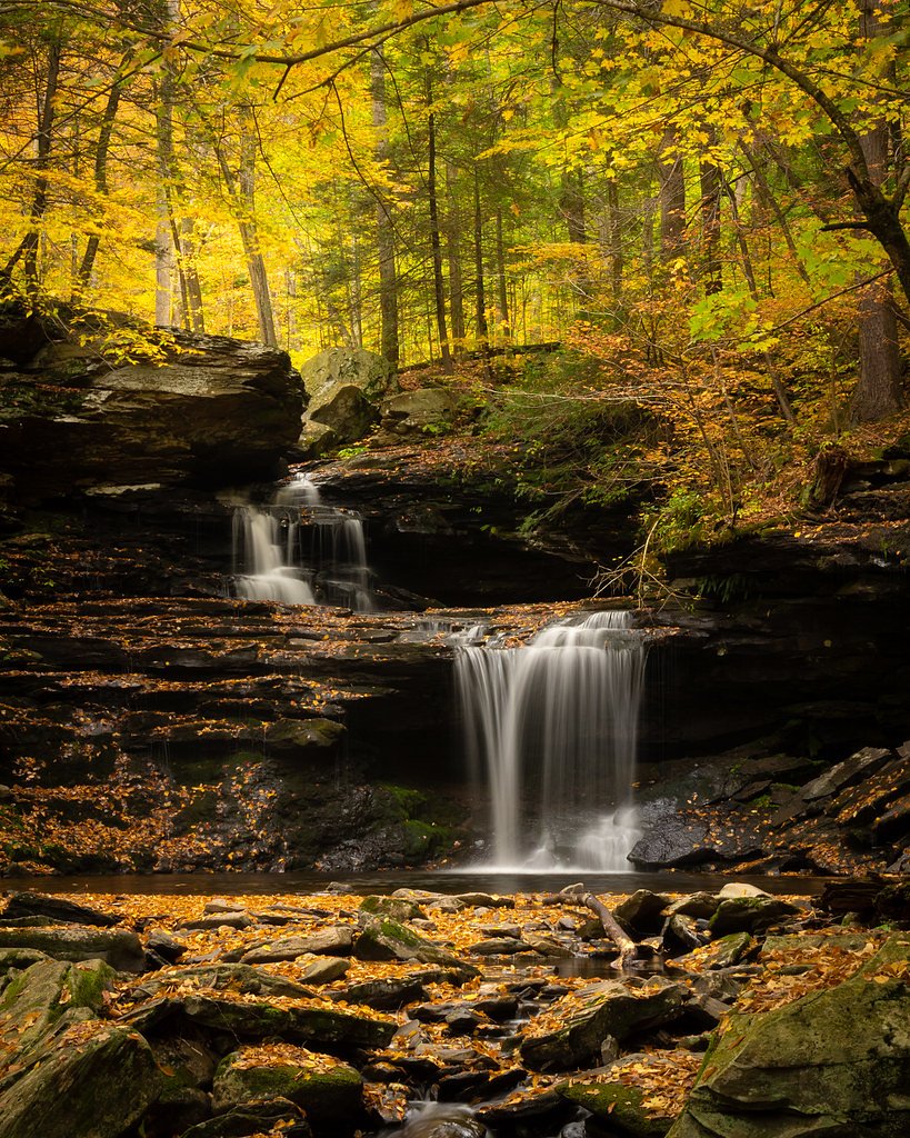
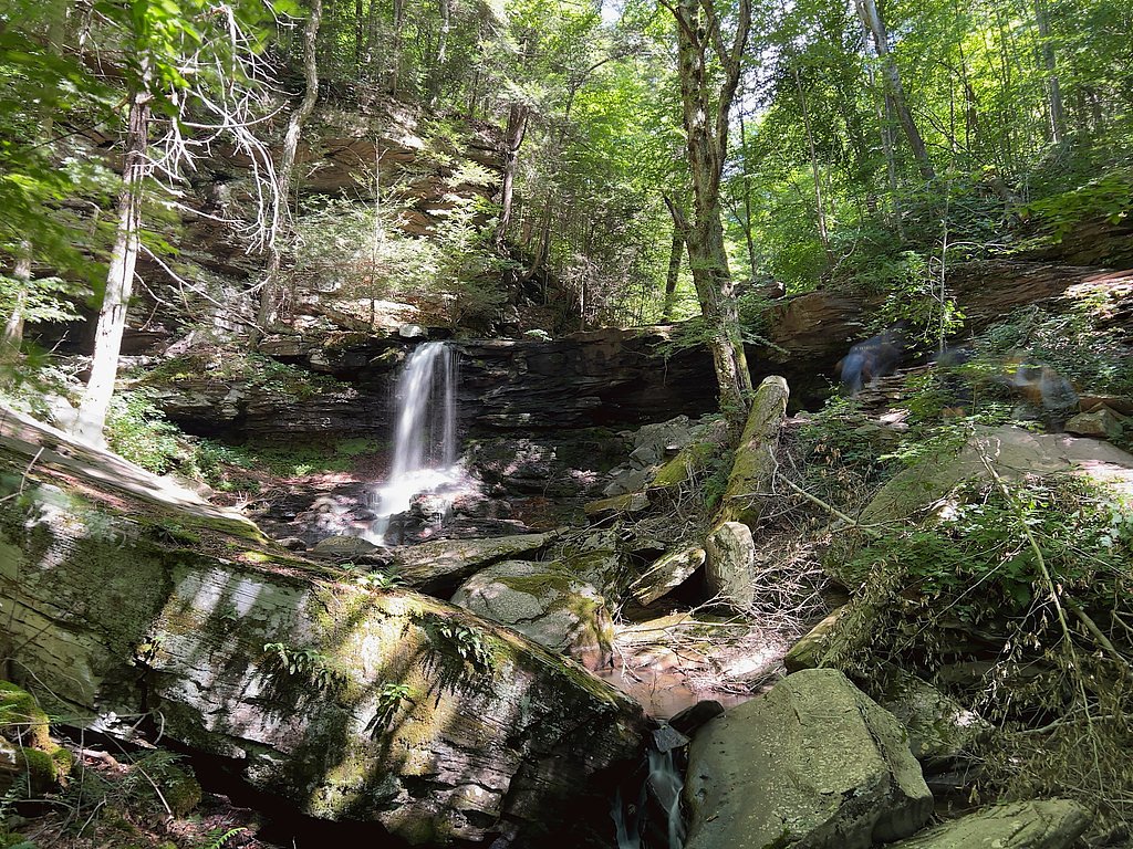
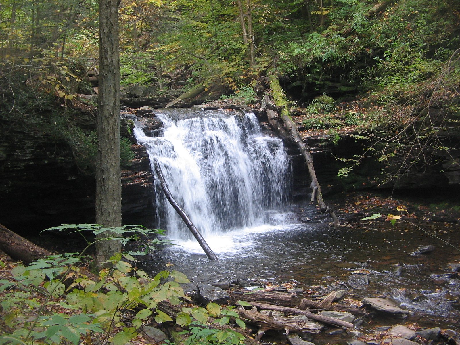
Ozone Falls is a peaceful, picture-postcard waterfall tucked inside Ricketts Glenn State Park. Nestled within this designated SP land unit, the site sits on property owned by OTHS and is managed by SPR. The falls are a favorite short-outing for hikers and photographers looking for a quick nature escape without committing to a long backcountry trip. The approach rewards a modest effort: the out-and-back route to the falls covers 2.4 miles round trip with about 350 feet of elevation gain and is generally rated moderate. The setting feels intimate and wooded, making Ozone Falls an inviting destination for day hikers who want a concise, scenic walk and a relaxing spot to pause and enjoy the cascade.
The Setting
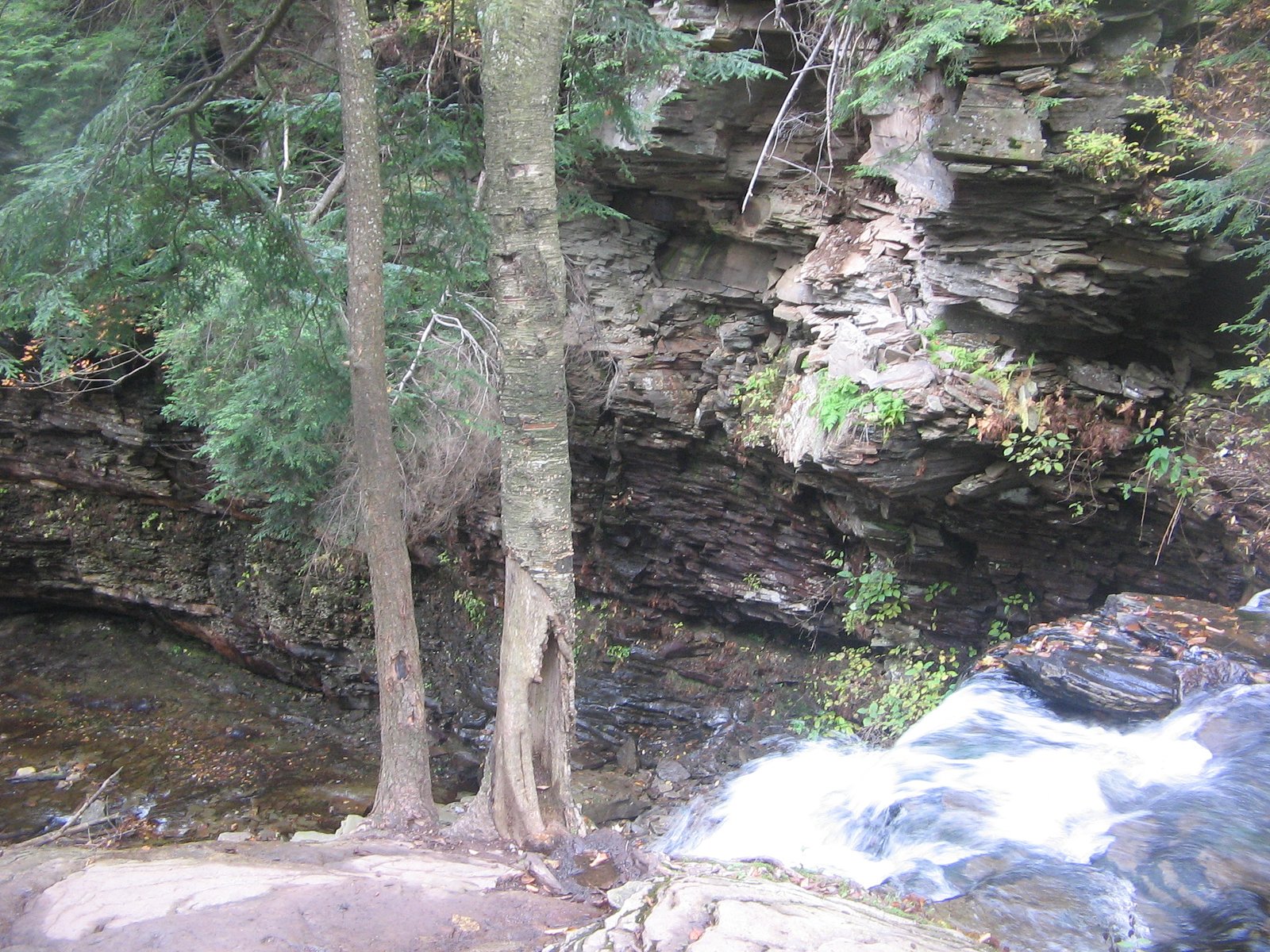
Ozone Falls sits at 1,752 feet within Ricketts Glenn State Park, fed by the Muncy Creek, in the hills of Pennsylvania.
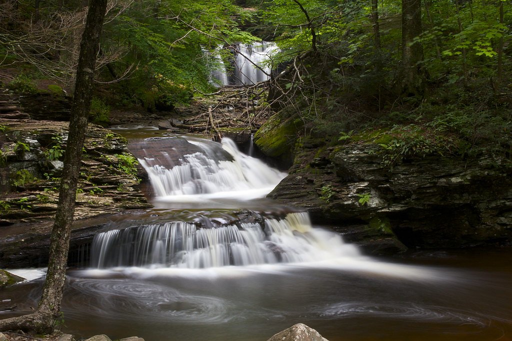
Nearby Falls Worth Visiting
Huron Falls (41 ft) lies 0.1 miles to the north. Also nearby: B Reynolds Falls (40 ft, 0.2 mi) and R B Ricketts Falls (36 ft, 0.1 mi).
Trail & Hike Details
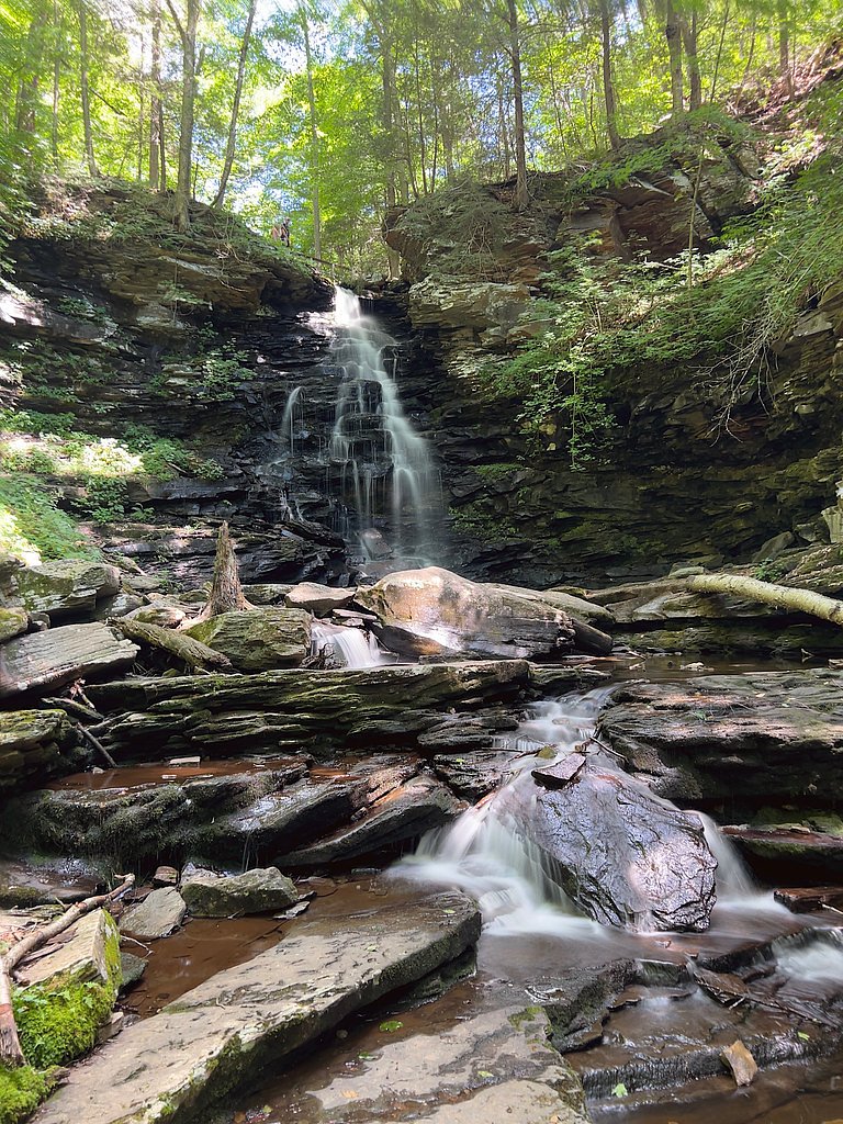
The Approach
The moderate 2.4-mile out-and-back trail gains 350 feet of elevation on the way to the falls.
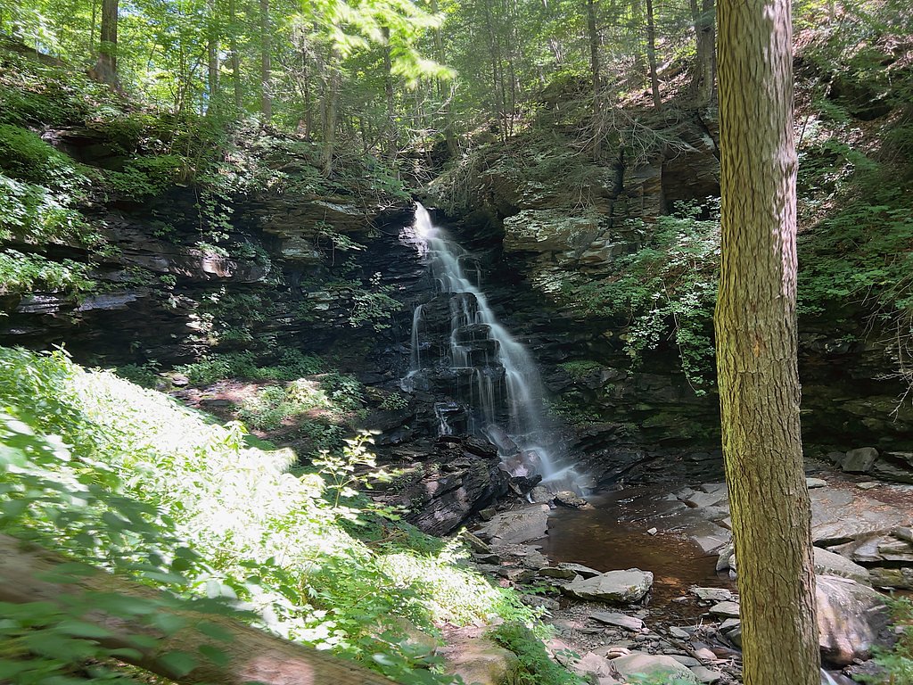
Trail Description
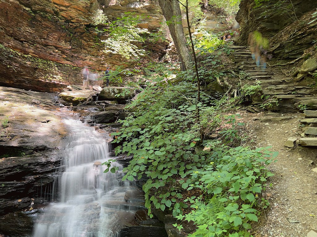
The trail to Ozone Falls is a 2.4-mile out-and-back with approximately 350 feet of elevation gain, typically rated moderate. The path is well marked and leads through wooded terrain to the waterfall; most visitors find the hike short and accessible, though the grade and some rocky sections near the falls raise the difficulty above an easy stroll. No USFS trail number is listed for this route; the trail type is out-and-back and the overall character is that of a short, moderately paced woodland hike.
What to Expect
Dogs are welcome.
Accessibility
The trail is not wheelchair accessible. Uneven terrain and elevation changes require steady footing.
Frequently Asked Questions
🐶 Are Dogs Allowed at Ozone Falls?
✅ Dogs are allowed
Are There Any Fees or Permits Required?
🆖 No fees required
🏊 Is There Swimming at Ozone Falls?
❌ Swimming is not allowed
When to Visit
Spring and fall are ideal times to visit Ozone Falls, as the water flow is typically stronger and the surrounding foliage is vibrant.
Seasonal Access
The best time to visit is Spring, Summer, and Fall. Winter access may be limited.
Safety Information
The area around the falls can be slippery, especially after rain. Visitors should exercise caution and stay on marked trails. Be aware of ticks and other insects in the area.
Current Water Conditions
6 ft³/s
Current discharge — how much water is flowing
About average for this time of year
Based on 85 years of record
1.59 ft
Water depth at gauge
7-Day Discharge Trend
What does this mean for your visit?
Flow is about average for this time of year.
About This Gauge
This gauge is on a nearby waterway and may not reflect exact conditions at the falls.
7-Day Flow Outlook
Based on the USGS gauge Muncy Creek near Sonestown, PA (22 km away).
Today
Barely Flowing
6 cfs
5/10Tomorrow
Barely Flowing
6 cfs
5/10Fri
Low
7 cfs
3/10Sat
Low
8 cfs
3/10Sun
Low
8 cfs
3/10Mon
Low
8 cfs
3/10Tue
Low
7 cfs
3/10Best window: Today — barely flowing flow, mostly sunny (trip score 5/10).
Best time of year: this gauge typically runs highest from late February to early May, peaking in April.
How we calculate this
This is a transparent outlook, not a precise forecast. We take the waterfall's current flow strength (how it ranks against its historical normal for today, from the nearest USGS stream gauge), carry that ranking forward along the gauge's seasonal curve, and nudge it for forecast rain. Confidence is highest for the next day or two and falls further out. Always check official conditions and your own judgment before visiting — high flows can be dangerous.
Know when to go.
Get a free email alert when waterfalls near Jamison City hit peak flow. We only send when conditions are worth the trip — no weekly newsletters, no spam.
Weather Forecast
Location & Access
Getting There
Ozone Falls is located in the Hickory Run State Park area in Pennsylvania. Visitors can access the falls via nearby trails within the park.
Get Directions on Google MapsParking
Parking is available at designated areas within Hickory Run State Park. Visitors should follow park signage to locate the nearest parking lot to the trailhead.
Elevation
1,752 feet above sea level
Coordinates
41.325636° N, -76.274657° W
Land Management
Managed by SPR
Visitor Tips & Gear
Wear sturdy shoes with good traction, especially if visiting after rain. Bring water and a camera to capture the beautiful scenery. Arrive early during peak seasons to secure parking.
As an Amazon Associate, we earn from qualifying purchases.
With 2.4 miles and 350 ft of elevation gain, sturdy boots and trekking poles will help on this moderate trail. Sun exposure on the trail makes good sun protection a must in summer.

Polarized Sunglasses (Knockaround)
Cuts glare off the water so you actually see the falls — and your photos turn out better too.

Columbia Watertight II Rain Jacket
Packs into its own pocket, seam-sealed, and keeps you dry from spray and surprise rain.

Earth Pak Waterproof Dry Bag
Keeps your phone and gear dry when waterfall mist soaks everything else.

Waterproof Phone Pouch (AiRunTech)
Cheap insurance — take photos right next to the falls without killing your phone.

Timberland Euro Sprint Mid Waterproof
Trusted waterproof boot with premium leather and grippy rubber sole — reliable on rocky, wet trails.

TrailBuddy Trekking Poles
Lightweight aluminum, cork grips, and flip-locks that actually hold — a best-seller for good reason.
Where to Stay

Paper Mill Pines Bed and Breakfast

Cozy 3BR Octagon Cabin-Near Ricketts Glen

CHARMING EXECUTIVE VICTORIAN MANSION w/ FREE PARKING - near Bucknell

Quality Inn New Columbia-Lewisburg
Browse vacation cabins and private rentals nearby
Unique outdoor stays — tents, yurts, and treehouses
Rent a campervan or RV for your waterfall road trip
Some links are affiliate links. We may earn a commission at no extra cost to you.
Additional Information
Nearby Attractions
Other attractions in Hickory Run State Park include Boulder Field, Hawk Falls, and various hiking trails.
Wildlife
The area is home to a variety of wildlife, including birds, deer, and small mammals. Visitors may also encounter insects such as mosquitoes and ticks.
Cities near Ozone Falls
Nearby Waterfalls
Other waterfalls named Ozone Falls
1 other waterfall shares this name across the U.S.
Writing about Ozone Falls? Embed this waterfall on your site for free.