Photo Credits (1)
Difficulty
Moderate
Trail Length
2.4 miles
Trail Type
Out And Back
Elevation Gain
350 ft
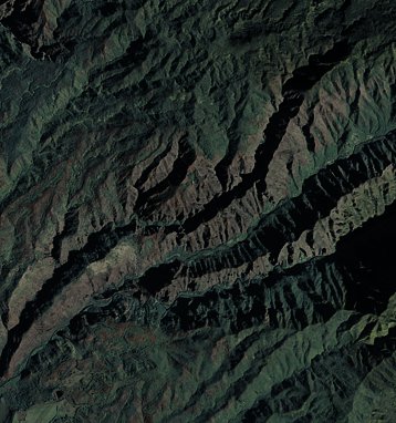
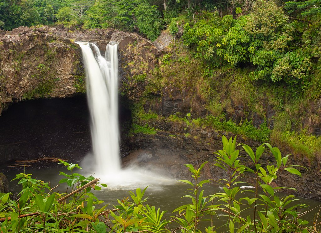
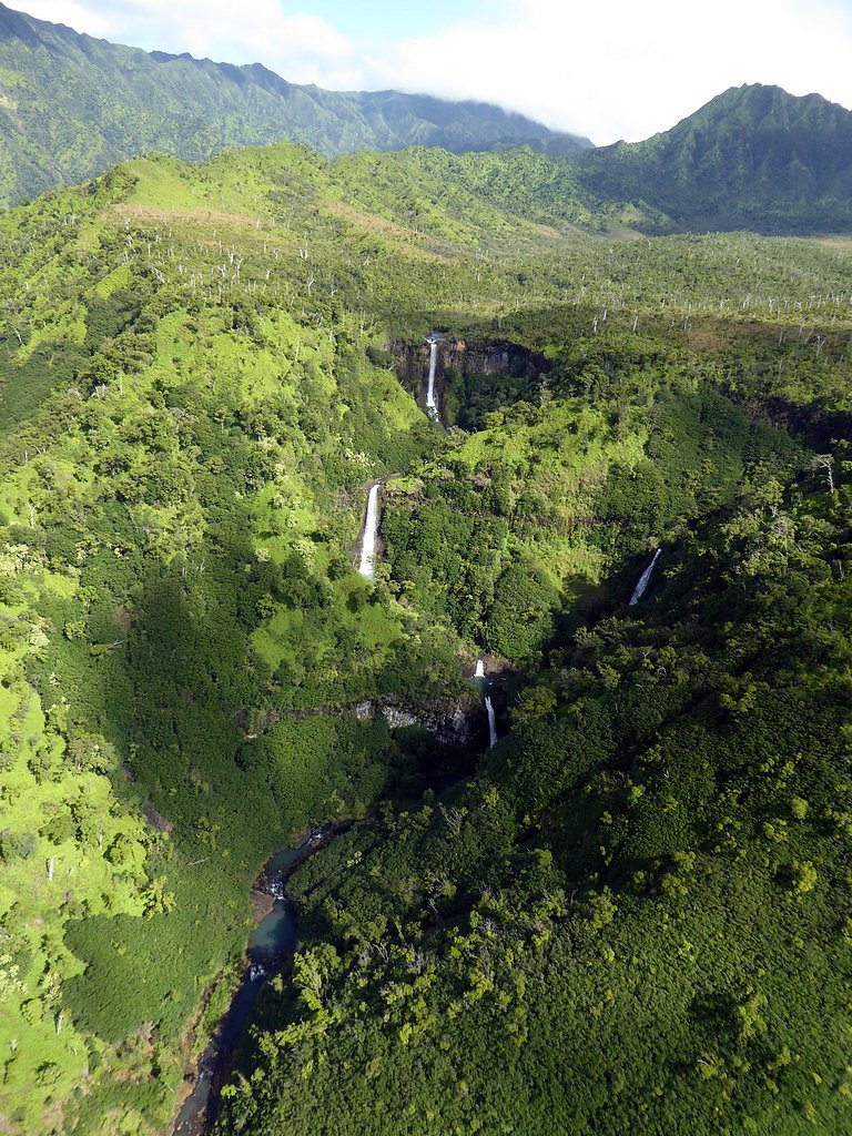
About ʻOʻopulele Falls
ʻOʻopulele Falls is a lesser-known waterfall located on the island of Maui, Hawaii. It is part of the lush and remote landscapes of the island, offering visitors a serene and picturesque experience. The waterfall is surrounded by dense vegetation and is often visited by those seeking a more secluded natural attraction.
Trail & Hike Details
The Approach
The moderate 2.4-mile out-and-back trail gains 350 feet of elevation on the way to the falls.
Trail Description
The trail to ʻOʻopulele Falls is not well-documented and may involve navigating through unmarked paths or private property. Visitors should exercise caution and ensure they have permission to access the area.
What to Expect
Visitors can expect a secluded and tranquil waterfall surrounded by lush Hawaiian vegetation. The area may be challenging to access and is best suited for experienced hikers or those familiar with Maui's terrain.
Accessibility
The trail is not wheelchair accessible. Uneven terrain and elevation changes require steady footing.
Frequently Asked Questions
🐶 Are Dogs Allowed at ʻOʻopulele Falls?
❌ Dogs are not allowed
Are There Any Fees or Permits Required?
🆖 No fees required
🏊 Is There Swimming at ʻOʻopulele Falls?
❌ Swimming is not allowed
When to Visit
ʻOʻopulele Falls can be visited year-round, but the best time to visit is typically during the dry season (spring and summer) to avoid heavy rains and muddy conditions.
Seasonal Access
The best time to visit is Spring, Summer, Fall, and Winter. Heavy rains during wet season (November through March) bring higher flow but can make trails slippery.
Safety Information
Visitors should be aware of potential hazards, including slippery rocks, flash flooding during heavy rains, and unmarked trails. Always check weather conditions before visiting and exercise caution.
Current Water Conditions
5 ft³/s
Current discharge — how much water is flowing
About average for this time of year
Based on 86 years of record
0.97 ft
Water depth at gauge
7-Day Discharge Trend
What does this mean for your visit?
Flow is about average for this time of year.
About This Gauge
7-Day Flow Outlook
Based on the USGS gauge Waialae Str at alt 3,820 ft nr Waimea, Kauai, HI (6 km away).
Today
Barely Flowing
5 cfs
3/10Tomorrow
Low
6 cfs
4/10Tue
Low
5 cfs
4/10Wed
Low
5 cfs
4/10Thu
Low
6 cfs
4/10Fri
Low
7 cfs
4/10Sat
Low
6 cfs
4/10Best window: Tomorrow — low flow, scattered rain showers (trip score 4/10).
Best time of year: this gauge typically runs highest from late March to late April, peaking in December.
How we calculate this
This is a transparent outlook, not a precise forecast. We take the waterfall's current flow strength (how it ranks against its historical normal for today, from the nearest USGS stream gauge), carry that ranking forward along the gauge's seasonal curve, and nudge it for forecast rain. Confidence is highest for the next day or two and falls further out. Always check official conditions and your own judgment before visiting — high flows can be dangerous.
Know when to go.
Get a free email alert when waterfalls near Hanapepe hit peak flow. We only send when conditions are worth the trip — no weekly newsletters, no spam.
Weather Forecast
Location & Access
Getting There
ʻOʻopulele Falls is located in a remote area of Maui. Access typically requires navigating unpaved roads and potentially hiking through dense vegetation. Visitors should research the exact location and access routes before attempting to visit.
Get Directions on Google MapsParking
Parking availability is unclear and may be limited. Visitors should plan accordingly and be prepared for roadside parking or parking at a distance.
Elevation
1,841 feet above sea level
Coordinates
22.037789° N, -159.590368° W
Visitor Tips & Gear
Bring sturdy footwear, plenty of water, and a map or GPS device. Be prepared for potentially muddy or slippery conditions. Research access routes thoroughly before visiting.
As an Amazon Associate, we earn from qualifying purchases.
With 2.4 miles and 350 ft of elevation gain, sturdy boots and trekking poles will help on this moderate trail. Icy conditions are common in winter — traction cleats are a smart addition.

Columbia Watertight II Rain Jacket
Packs into its own pocket, seam-sealed, and keeps you dry from spray and surprise rain.

Polarized Sunglasses (Knockaround)
Cuts glare off the water so you actually see the falls — and your photos turn out better too.

Earth Pak Waterproof Dry Bag
Keeps your phone and gear dry when waterfall mist soaks everything else.

Waterproof Phone Pouch (AiRunTech)
Cheap insurance — take photos right next to the falls without killing your phone.

Timberland Euro Sprint Mid Waterproof
Trusted waterproof boot with premium leather and grippy rubber sole — reliable on rocky, wet trails.

TrailBuddy Trekking Poles
Lightweight aluminum, cork grips, and flip-locks that actually hold — a best-seller for good reason.
Where to Stay

Poipu Plantation Vacation Rentals

Kauai Shores Hotel

Hanalei Bay Resort

Banyan Harbor Resort
Browse vacation cabins and private rentals nearby
Unique outdoor stays — tents, yurts, and treehouses
Rent a campervan or RV for your waterfall road trip
Some links are affiliate links. We may earn a commission at no extra cost to you.
Additional Information
Nearby Attractions
Nearby attractions may include other waterfalls and natural landmarks on Maui, such as the Hana Highway and Haleakalā National Park.
Wildlife
The area around ʻOʻopulele Falls is home to native Hawaiian flora and fauna. Visitors may encounter birds, insects, and other wildlife typical of Maui's ecosystems.
Cities near ʻOʻopulele Falls
Nearby Waterfalls

Writing about ʻOʻopulele Falls? Embed this waterfall on your site for free.