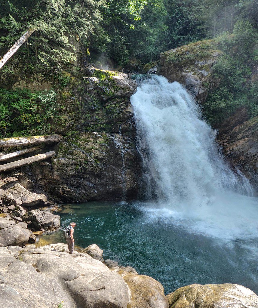
North Fork Falls
By Armen Suny · Last verified Mar 2026
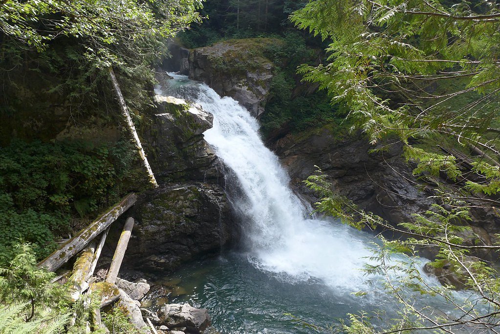
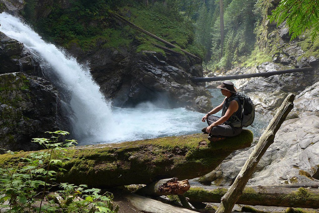
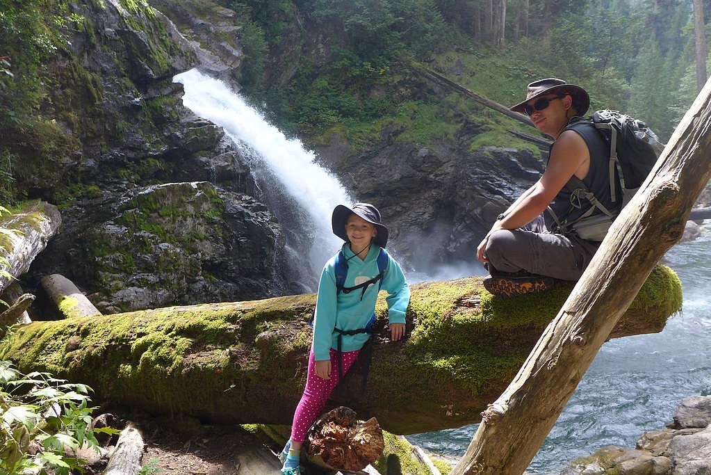
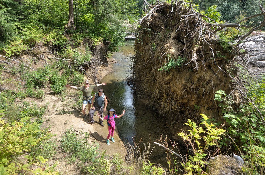
Photo Credits (5)
Difficulty
Moderate
Trail Length
2.4 miles
Trail Type
Out And Back
Elevation Gain
350 ft
About North Fork Falls
Tucked into USFS land within Mount Baker National Forest, North Fork Falls is a quietly scenic cascade framed by dense northwest forest. The approach follows the North Fork Sauk Falls Trail (Trail #660), and the setting feels pleasantly secluded thanks to the national forest designation and forested corridor that leads to the falls. The trail and falls are managed by the U.S. Forest Service, making this a great choice for hikers looking for a less-crowded outing on public land. The hike to the falls is moderately paced and rewarding: the route climbs gently overall with some steeper pitches, opening occasionally to mossy benches and creekside viewpoints before you reach the cascade. Bring sturdy footwear and expect a classic native-surface forest tread; pack out what you bring in and enjoy the peaceful atmosphere that Mount Baker National Forest preserves around this small but charming waterfall.
The Setting
North Fork Falls sits at 1,519 feet within Mt. Baker National Forest, fed by the Sauk River, in the hills of Washington.
Trail & Hike Details
The Approach
The moderate hike follows North Fork Sauk Falls Trail (#660), a 2.4-mile out-and-back trail over natural surface. Expect 350 feet of elevation gain with grades of 12-20%. The trail is highly developed (Class 4).
USFS Trail
NORTH FORK SAUK FALLS TRAIL #660
Trail Class
Highly Developed
Surface
Avg Grade
USFS Segment
0.13 miTrail Description
North Fork Sauk Falls Trail (USFS Trail #660) is an out-and-back route of about 2.4 miles round trip with roughly 350 feet of elevation gain and is rated moderate. The tread is native material (NAT) and the trail is classified by the Forest Service as Class 4; typical grade ranges from about 12–20%, so you’ll encounter short, steeper sections along otherwise gentle forested trail. Expect natural surfaces—roots, rocks, and singletrack—and wear sturdy shoes. The trail’s official data are maintained by the U.S. Forest Service in Mount Baker National Forest.
What to Expect
Dogs are welcome.
Accessibility
The trail is not wheelchair accessible. Uneven terrain and elevation changes require steady footing.
Frequently Asked Questions
🐶 Are Dogs Allowed at North Fork Falls?
✅ Dogs are allowed
Are There Any Fees or Permits Required?
🆖 No fees required
🏊 Is There Swimming at North Fork Falls?
❌ Swimming is not allowed
When to Visit
Spring and early summer are ideal for visiting, as the waterfall flow is strongest due to snowmelt.
Seasonal Access
The best time to visit is Spring, Summer, and Fall. Winter access may be limited. Check with Mt. Baker National Forest for seasonal road closures.
Safety Information
Exercise caution near the waterfall, as rocks can be slippery. Check weather conditions before visiting, as heavy rain can make the trail muddy and hazardous.
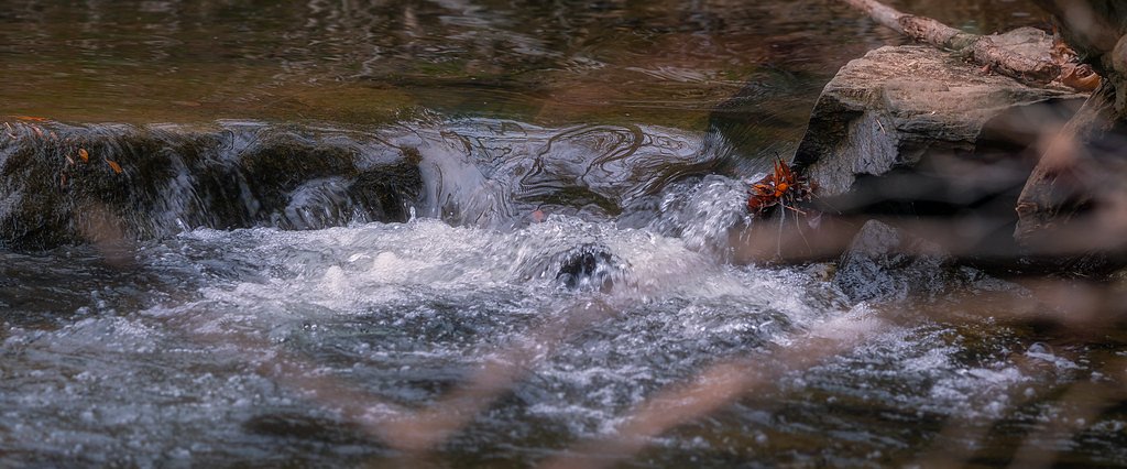
Current Water Conditions
639 ft³/s
Current discharge — how much water is flowing
Much lower than usual for this time of year
Based on 102 years of record
3.32 ft
Water depth at gauge
51°F
ColdBracing — limit time in water
7-Day Discharge Trend
What does this mean for your visit?
Flow is well below normal for this time of year, so the waterfall may be a trickle. Water temperature is a bracing 51 degrees F, limit your time in the water.
About This Gauge
This gauge is on a nearby waterway and may not reflect exact conditions at the falls.
7-Day Flow Outlook
Based on the USGS gauge SAUK RIVER AB WHITE CHUCK RIVER NR DARRINGTON, WA (11 km away).
Today
Low
729 cfs
3/10Tomorrow
Low
684 cfs
4/10Sun
Low
655 cfs
4/10Mon
Low
636 cfs
4/10Tue
Low
625 cfs
4/10Wed
Low
613 cfs
4/10Thu
Low
625 cfs
4/10Best window: Tomorrow — low flow, light rain likely (trip score 4/10).
Best time of year: this gauge typically runs highest from late April to mid July, peaking in June.
How we calculate this
This is a transparent outlook, not a precise forecast. We take the waterfall's current flow strength (how it ranks against its historical normal for today, from the nearest USGS stream gauge), carry that ranking forward along the gauge's seasonal curve, and nudge it for forecast rain. Confidence is highest for the next day or two and falls further out. Always check official conditions and your own judgment before visiting — high flows can be dangerous.
Know when to go.
Get a free email alert when waterfalls near Verlot hit peak flow. We only send when conditions are worth the trip — no weekly newsletters, no spam.
Weather Forecast
Location & Access
Getting There
North Fork Falls is located off the North Fork Road near the Snoqualmie region in Washington. Access may require driving on gravel or forest service roads, so a high-clearance vehicle is recommended.
Get Directions on Google MapsParking
Parking is limited and may be located along the roadside or at small pullouts near the trailhead.
Elevation
1,519 feet above sea level
Coordinates
48.097609° N, -121.369277° W
Land Management
Managed by USFS
Visitor Tips & Gear
Visit early in the day to avoid crowds and secure parking. Bring bug spray during warmer months, as mosquitoes may be present. Be cautious of slippery rocks near the waterfall.
As an Amazon Associate, we earn from qualifying purchases.
With 2.4 miles and 350 ft of elevation gain, sturdy boots and trekking poles will help on this moderate trail. Sun exposure on the trail makes good sun protection a must in summer.

Polarized Sunglasses (Knockaround)
Cuts glare off the water so you actually see the falls — and your photos turn out better too.

Columbia Watertight II Rain Jacket
Packs into its own pocket, seam-sealed, and keeps you dry from spray and surprise rain.

Earth Pak Waterproof Dry Bag
Keeps your phone and gear dry when waterfall mist soaks everything else.

Waterproof Phone Pouch (AiRunTech)
Cheap insurance — take photos right next to the falls without killing your phone.

Timberland Euro Sprint Mid Waterproof
Trusted waterproof boot with premium leather and grippy rubber sole — reliable on rocky, wet trails.

TrailBuddy Trekking Poles
Lightweight aluminum, cork grips, and flip-locks that actually hold — a best-seller for good reason.
Where to Stay

PNW River Cabin

Dutch Cup Motel

Unique Stylish Place Downtown Monroe! #104

Cozy Darrington Cottage w/ Grill, Near Trails
Browse vacation cabins and private rentals nearby
Unique outdoor stays — tents, yurts, and treehouses
Rent a campervan or RV for your waterfall road trip
Some links are affiliate links. We may earn a commission at no extra cost to you.
Nearby Campground
Coal Creek Group Camp
8.7 miles away · 1 sites
Overview Coal Creek Group Campground sits along the scenic Mountain Loop Road in the Mt. Baker-Snoqualmie National Forest. Surrounded by stands of old-growth forest and located near the confluence the of the tranquil Stillaguamish River and bubbling Coal Creek, this site is ideal for small group or family camping excursions.Recreation Coal Creek is a prime location for hiking, fishing, picnicking and horseback riding in summer and early fall, and offers excellent skiing and snowshoeing in the win
Book on Recreation.govNearby Hot Springs
Hot springs near Verlot, Washington
Kennedy Hot Spring
Kennedy Hot Spring flows at 100 degrees at 3,520 feet elevation in the Mt. Baker National Forest, emerging 58.7 degrees above a...
Garland Mineral Springs
Garland Mineral Springs flows at 84 degrees in the Snoqualmie National Forest, producing water 39.6 degrees above ambient tempe...
Gamma Hot Springs
Gamma Hot Springs produces 140-degree water at 5,397 feet elevation in the Mt. Baker National Forest, emerging 104.6 degrees ab...
Sulphur Creek Hot Springs
Sulphur Creek Hot Springs flows at 99 degrees Fahrenheit at 2,973 feet elevation in Mount Baker National Forest's remote backco...
Scenic Hot Springs
Scenic Hot Springs delivers genuinely hot water at 122 degrees Fahrenheit at 2,246 feet elevation in the Cascade Mountains near...
Goldmeyer Hot Springs
Goldmeyer Hot Springs emerges at 127 degrees in the central Cascades, producing water 78.9 degrees above ambient temperature at...
Looking for a soak after your hike? Explore more hot springs near Verlot, Washington on SoakingSprings.
Explore Washington springsAdditional Information
Nearby Attractions
Nearby attractions include Snoqualmie Falls and other hiking trails in the Snoqualmie region.
Wildlife
The area is home to various wildlife, including birds, deer, and small mammals. Be cautious of bears and carry bear spray if hiking in the region.
Cities near North Fork Falls
Nearby Waterfalls
Other waterfalls named North Fork Falls
5 other waterfalls share this name across the U.S.
Writing about North Fork Falls? Embed this waterfall on your site for free.