Photo Credits (5)
Difficulty
Moderate
Trail Length
2.4 miles
Trail Type
Out And Back
Elevation Gain
350 ft
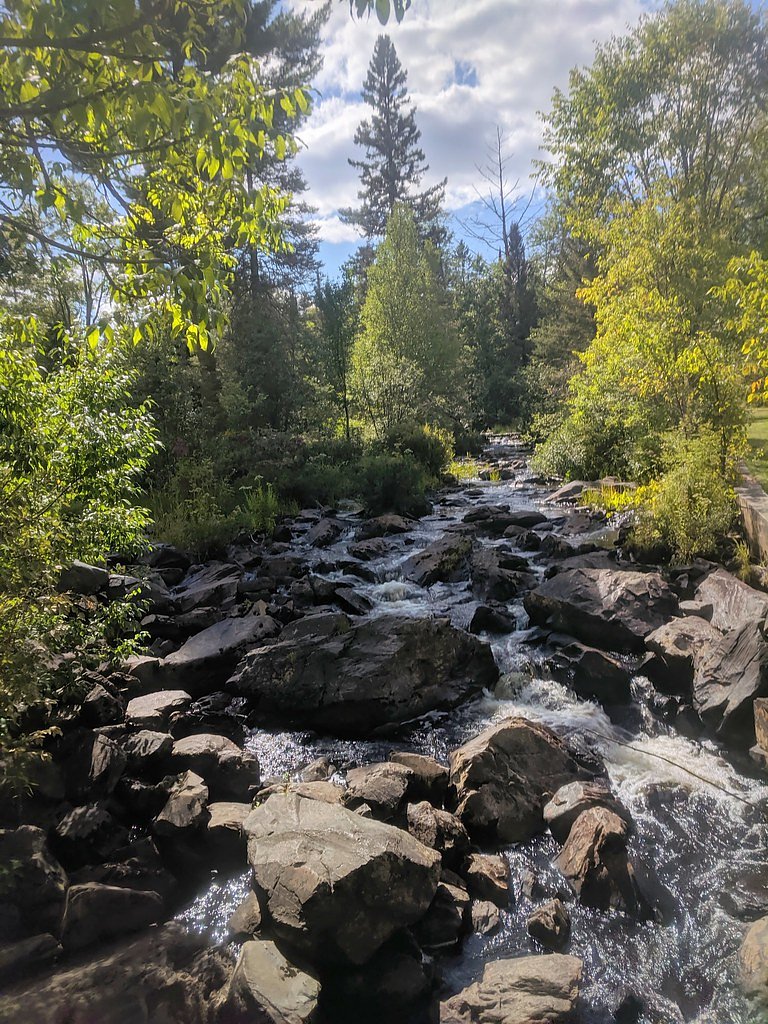
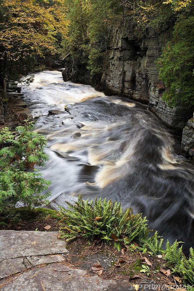
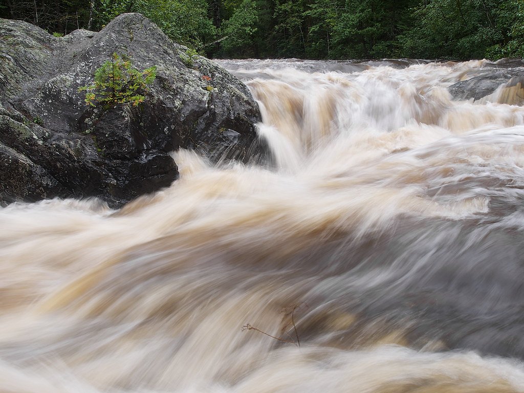
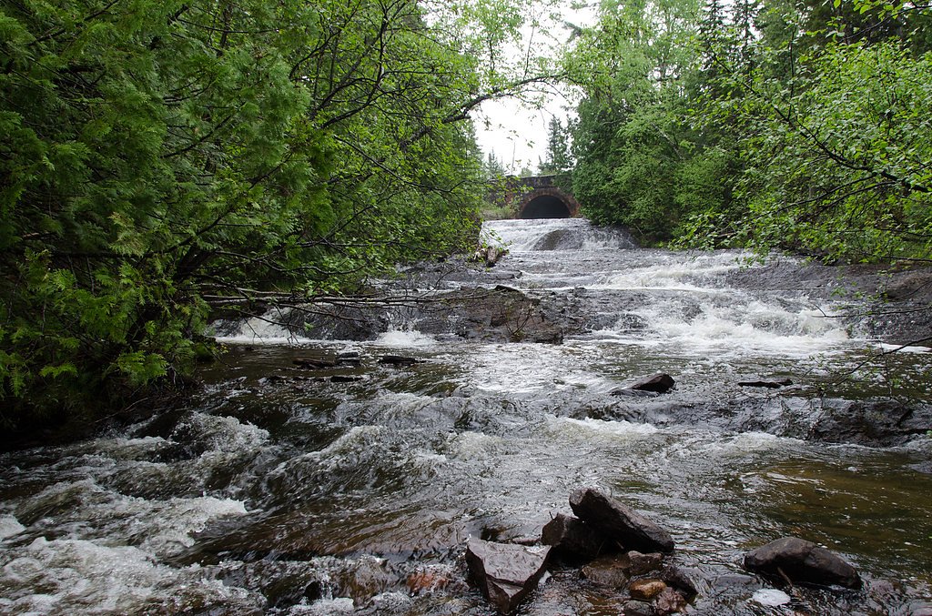
About No Name Falls
Tucked into Michigan’s forested hills, No Name Falls is a quiet, low-profile cascade that feels like a private discovery for hikers who seek a peaceful retreat. The waterfall is reached via a moderate out-and-back route and is surrounded by mature woods, offering nice photo opportunities and a calming spot to pause on a half-day outing. The approach to the falls is a 2.4-mile round-trip (out-and-back) hike with roughly 350 feet of elevation gain, so it’s well suited to hikers comfortable with a moderate climb. Signage and managed-trail details are limited for this site, so come prepared with a map, sturdy footwear, and water—the secluded setting is part of the appeal, but also why navigation readiness helps ensure a smooth visit.
The Setting
No Name Falls sits at 1,719 feet along the Falls River, in the hills of Michigan.
Trail & Hike Details
The Approach
The moderate 2.4-mile out-and-back trail gains 350 feet of elevation on the way to the falls.
Trail Description
Route type: Out-and-back. Distance: 2.4 miles (round-trip). Elevation gain: ~350 feet. Difficulty: Moderate. USFS trail name/number: Not provided. Surface/grade/class: No USFS surface, grade, or trail-class data available for this approach. Note that the route to No Name Falls is not widely documented and some sources report limited or unmarked sections, so expect to rely on maps and route-finding rather than extensive trail infrastructure.
What to Expect
Visitors can expect a peaceful and natural environment with minimal crowds. The falls may vary in flow depending on the season, with spring and early summer typically offering the best water levels.
Accessibility
The trail is not wheelchair accessible. Uneven terrain and elevation changes require steady footing.
Frequently Asked Questions
🐶 Are Dogs Allowed at No Name Falls?
❌ Dogs are not allowed
Are There Any Fees or Permits Required?
🆖 No fees required
🏊 Is There Swimming at No Name Falls?
❌ Swimming is not allowed
When to Visit
Spring and early summer are typically the best times to visit, as water flow is likely to be at its peak.
Seasonal Access
The best time to visit is Spring, Summer, and Fall. Winter access may be limited.
Safety Information
Visitors should be cautious of slippery rocks, uneven terrain, and potential for getting lost due to the lack of clear trails. Always inform someone of your plans before visiting.
Current Water Conditions
31 ft³/s
Current discharge — how much water is flowing
About average for this time of year
Based on 11 years of record
4.26 ft
Water depth at gauge
61°F
CoolRefreshing for swimming
7-Day Discharge Trend
What does this mean for your visit?
Flow is about average for this time of year. Water temperature is a refreshing 61 degrees F, good for a quick swim. Mineral content is typical.
Water Quality
Conductance
Dissolved minerals in the water
About This Gauge
This gauge is on a nearby waterway and may not reflect exact conditions at the falls.
7-Day Flow Outlook
Based on the USGS gauge FALLS RIVER NEAR L'ANSE, MI (14 km away).
Today
Moderate
37 cfs
6/10Tomorrow
Moderate
47 cfs
6/10Wed
Moderate
54 cfs
6/10Thu
Moderate
39 cfs
6/10Fri
Moderate
34 cfs
6/10Sat
Moderate
31 cfs
6/10Sun
Moderate
31 cfs
6/10Best window: Today — moderate flow, showers and thunderstorms likely then mostly cloudy (trip score 6/10).
Best time of year: this gauge typically runs highest from mid March to late May, peaking in April.
How we calculate this
This is a transparent outlook, not a precise forecast. We take the waterfall's current flow strength (how it ranks against its historical normal for today, from the nearest USGS stream gauge), carry that ranking forward along the gauge's seasonal curve, and nudge it for forecast rain. Confidence is highest for the next day or two and falls further out. Always check official conditions and your own judgment before visiting — high flows can be dangerous.
Know when to go.
Get a free email alert when waterfalls near L'Anse hit peak flow. We only send when conditions are worth the trip — no weekly newsletters, no spam.
Weather Forecast
Location & Access
Getting There
The exact location of No Name Falls is not widely documented. It may require local knowledge or guidance to locate. Visitors are encouraged to research or contact local hiking groups for directions.
Get Directions on Google MapsParking
Parking availability is unclear. Visitors should prepare for limited or no designated parking areas near the falls.
Elevation
1,719 feet above sea level
Coordinates
46.621333° N, -88.364883° W
Visitor Tips & Gear
Bring a map or GPS device as the location may be difficult to find. Wear sturdy footwear and prepare for uneven terrain. Check local conditions before visiting.
As an Amazon Associate, we earn from qualifying purchases.
With 2.4 miles and 350 ft of elevation gain, sturdy boots and trekking poles will help on this moderate trail. Sun exposure on the trail makes good sun protection a must in summer.

Polarized Sunglasses (Knockaround)
Cuts glare off the water so you actually see the falls — and your photos turn out better too.

Columbia Watertight II Rain Jacket
Packs into its own pocket, seam-sealed, and keeps you dry from spray and surprise rain.

Earth Pak Waterproof Dry Bag
Keeps your phone and gear dry when waterfall mist soaks everything else.

Waterproof Phone Pouch (AiRunTech)
Cheap insurance — take photos right next to the falls without killing your phone.

Timberland Euro Sprint Mid Waterproof
Trusted waterproof boot with premium leather and grippy rubber sole — reliable on rocky, wet trails.

TrailBuddy Trekking Poles
Lightweight aluminum, cork grips, and flip-locks that actually hold — a best-seller for good reason.
Where to Stay

Whole home, private lake, sauna, WFH office

UP Escape in the Pines

Champion Vacation Rental with Fire Pit!

Tiny Woodland Cottage Retreat with Yard in Pelkie
Browse vacation cabins and private rentals nearby
Unique outdoor stays — tents, yurts, and treehouses
Rent a campervan or RV for your waterfall road trip
Some links are affiliate links. We may earn a commission at no extra cost to you.
Nearby Campground
Sturgeon River Gorge Wilderness
15.8 miles away · 0 sites
The Wild and Scenic Sturgeon River rushes out of the northern portion of this wilderness, over the 20 foot volcanic outcroppings of Sturgeon Falls, and through a gorge that reaches 350 feet in depth and a mile in width. Throughout this rugged, steep Wilderness, the Sturgeon and Little Silver Rivers and their tributaries have carved falls, rapids, ponds, oxbows, and terraces. Stunning views are possible from the eastern rim of the gorge. Except for a few naturally bare slopes, most of the land is
Book on Recreation.govAdditional Information
Nearby Attractions
Nearby attractions may include other waterfalls or natural areas in Michigan's Upper Peninsula, depending on the exact location of No Name Falls.
Wildlife
The area may feature typical Michigan wildlife such as deer, birds, and small mammals. Be cautious of ticks and other insects.
Cities near No Name Falls
Nearby Waterfalls
Writing about No Name Falls? Embed this waterfall on your site for free.