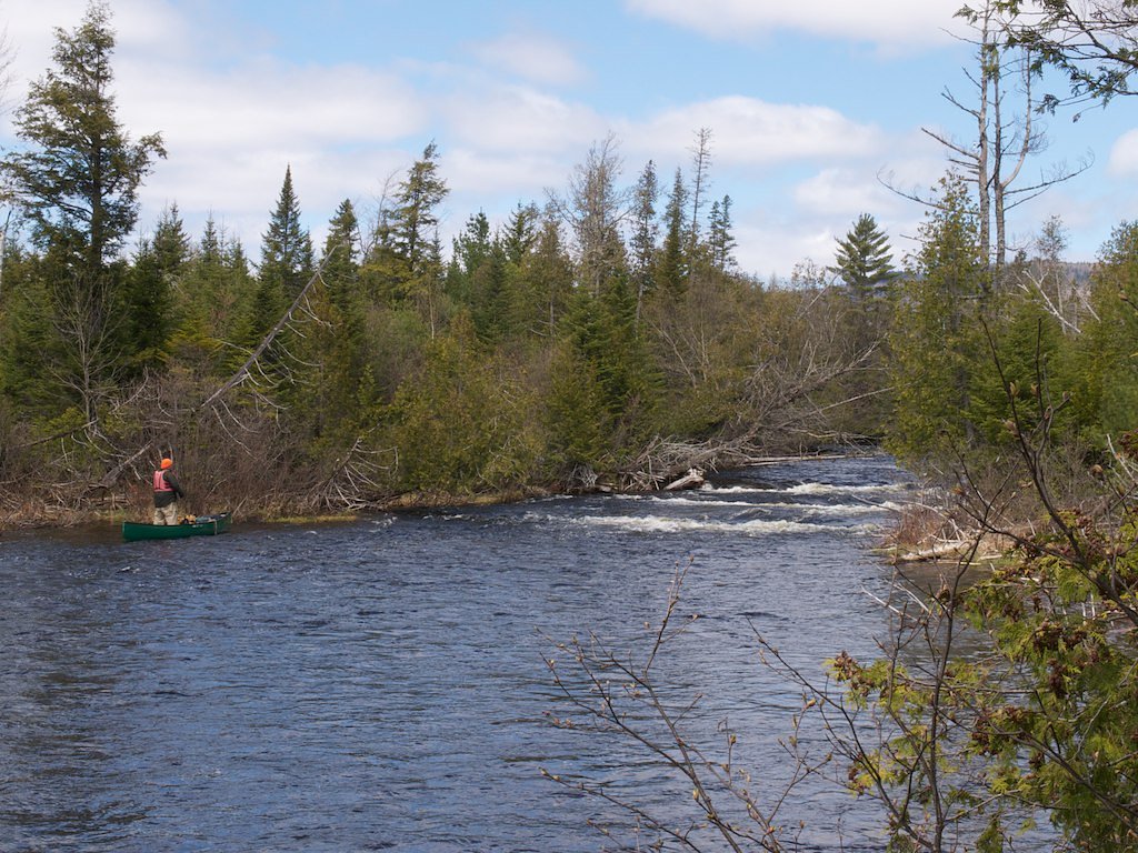
Munsungan Falls
By Armen Suny · Last verified Mar 2026
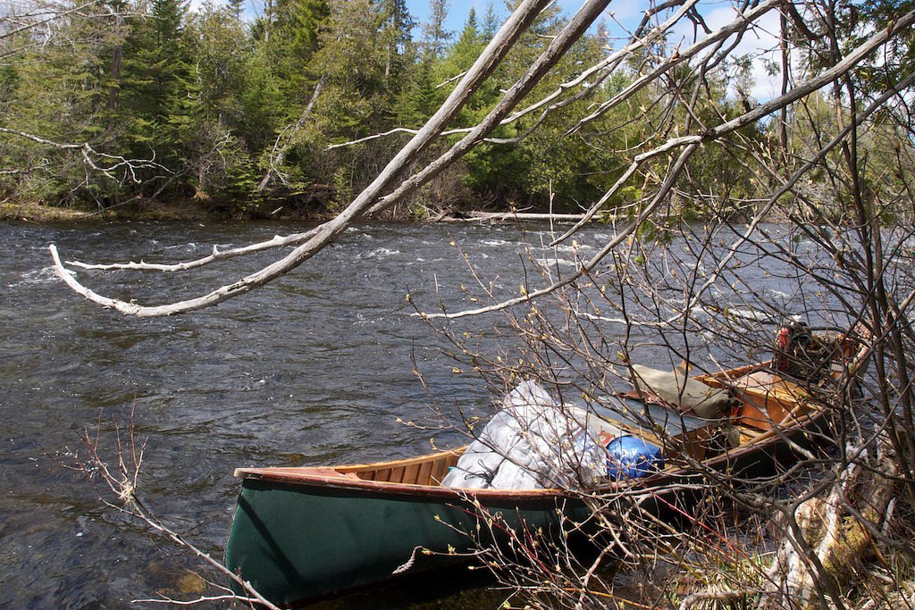
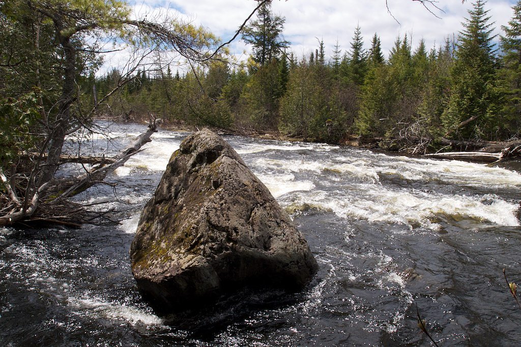
Photo Credits (3)
Difficulty
Moderate
Trail Length
2.4 miles
Trail Type
Out And Back
Elevation Gain
350 ft
About Munsungan Falls
Munsungan Falls tumbles along Munsungan Stream in a remote stretch of northern Maine, offering a quiet, picturesque reward for hikers willing to venture off the beaten path. The falls are beloved for their tranquil forest setting and the sense of solitude that comes from being well away from developed recreation areas — a true spot for those who want to listen to rushing water and soak in unspoiled woodland scenery. Accessing the falls requires a bit of commitment: the approach is a moderate out-and-back hike of about 2.4 miles with roughly 350 feet of elevation gain. Because the site lies in a remote region, visitors should plan ahead with navigation, appropriate footwear, and seasonally appropriate gear; trail conditions can vary and services are limited.
The Setting
Munsungan Falls sits at 807 feet along the E. Br. Penobscot River, in the foothills of Maine.
Trail & Hike Details
The Approach
The moderate 2.4-mile out-and-back trail gains 350 feet of elevation on the way to the falls.
Trail Description
Trail type: out-and-back. Length: 2.4 miles. Elevation gain: ~350 feet. Difficulty: moderate. Official USFS trail number/name, surface type, grade, and trail class are not documented in the provided data. Hikers should expect a backcountry route with minimal facilities and variable conditions by season—carry a map and be prepared for unmarked or lightly maintained sections.
What to Expect
Visitors can expect a peaceful and secluded experience, with the sound of cascading water and the surrounding wilderness creating a tranquil atmosphere. The falls are surrounded by dense forest, adding to the sense of isolation.
Accessibility
The trail is not wheelchair accessible. Uneven terrain and elevation changes require steady footing.
Frequently Asked Questions
🐶 Are Dogs Allowed at Munsungan Falls?
❌ Dogs are not allowed
Are There Any Fees or Permits Required?
🆖 No fees required
🏊 Is There Swimming at Munsungan Falls?
❌ Swimming is not allowed
When to Visit
Spring and early summer are ideal times to visit, as water flow is typically higher due to snowmelt and rainfall.
Seasonal Access
The best time to visit is Spring, Summer, and Fall. Winter access may be limited.
Safety Information
Visitors should be prepared for remote conditions, including limited cell service and potentially rough terrain. Carry sufficient supplies, and let someone know your plans before heading out. Be cautious of slippery rocks near the falls.
Current Water Conditions
Based on a USGS gauge 17.4 miles away
812 ft³/s
Current discharge — how much water is flowing
Lower than usual for this time of year
Based on 2 years of record
3.53 ft
Water depth at gauge
65°F
CoolRefreshing for swimming
7-Day Discharge Trend
What does this mean for your visit?
Flow is lower than usual for this time of year. Water temperature is a refreshing 65 degrees F, good for a quick swim.
About This Gauge
This gauge is on a regional waterway. Conditions at the falls may differ, especially after local rain.
7-Day Flow Outlook
Based on the USGS gauge E. Br. Penobscot River below Grand Lake Matagamon (28 km away).
Today
Moderate
926 cfs
4/10Tomorrow
Moderate
977 cfs
4/10Mon
Moderate
867 cfs
6/10Tue
Moderate
926 cfs
4/10Wed
Moderate
931 cfs
5/10Thu
Moderate
1093 cfs
4/10Fri
Moderate
1020 cfs
5/10Best window: Mon — moderate flow, patchy fog then sunny (trip score 6/10).
Best time of year: this gauge typically runs highest from mid March to mid May, peaking in May.
How we calculate this
This is a transparent outlook, not a precise forecast. We take the waterfall's current flow strength (how it ranks against its historical normal for today, from the nearest USGS stream gauge), carry that ranking forward along the gauge's seasonal curve, and nudge it for forecast rain. Confidence is highest for the next day or two and falls further out. Always check official conditions and your own judgment before visiting — high flows can be dangerous.
Know when to go.
Get a free email alert when waterfalls near Patten hit peak flow. We only send when conditions are worth the trip — no weekly newsletters, no spam.
Weather Forecast
Location & Access
Getting There
Munsungan Falls is located in a remote area of northern Maine, near the Munsungan Lake region. Access typically requires traveling on logging roads, which may be rough and unpaved. A high-clearance vehicle is recommended.
Get Directions on Google MapsParking
Parking is limited and may be informal, typically along the side of the logging roads near the trailhead or access point.
Elevation
807 feet above sea level
Coordinates
46.370041° N, -68.919770° W
Visitor Tips & Gear
Bring a detailed map or GPS device, as the area is remote and trails may not be well-marked. Be prepared for rough road conditions and carry sufficient supplies, including water and food. Cell service may be unreliable in this area.
As an Amazon Associate, we earn from qualifying purchases.
With 2.4 miles and 350 ft of elevation gain, sturdy boots and trekking poles will help on this moderate trail. Sun exposure on the trail makes good sun protection a must in summer.

Polarized Sunglasses (Knockaround)
Cuts glare off the water so you actually see the falls — and your photos turn out better too.

Columbia Watertight II Rain Jacket
Packs into its own pocket, seam-sealed, and keeps you dry from spray and surprise rain.

Earth Pak Waterproof Dry Bag
Keeps your phone and gear dry when waterfall mist soaks everything else.

Waterproof Phone Pouch (AiRunTech)
Cheap insurance — take photos right next to the falls without killing your phone.

Timberland Euro Sprint Mid Waterproof
Trusted waterproof boot with premium leather and grippy rubber sole — reliable on rocky, wet trails.

TrailBuddy Trekking Poles
Lightweight aluminum, cork grips, and flip-locks that actually hold — a best-seller for good reason.
Where to Stay
Browse vacation cabins and private rentals nearby
Unique outdoor stays — tents, yurts, and treehouses
Rent a campervan or RV for your waterfall road trip
Some links are affiliate links. We may earn a commission at no extra cost to you.
Nearby Campground
Katahdin Woods and Waters National Monument Camping and Huts
17.8 miles away · 27 sites
Overview Katahdin Woods and Waters National Monument is located in Maine’s north woods. Katahdin Woods and Waters protects part of an extraordinary natural and cultural landscape: the mountains, woods, and waters where the East Branch of the Penobscot River and its tributaries, including the Wassataquoik Stream and the Seboeis River, run freely. Campsites, lean-tos and huts located throughout the monument provide opportunities to stay overnight while hiking, biking, paddling and enjoying other re
Book on Recreation.govAdditional Information
Nearby Attractions
Munsungan Lake and the surrounding wilderness areas offer opportunities for fishing, hiking, and wildlife observation.
Wildlife
The area is home to a variety of wildlife, including moose, deer, and birds. Visitors should be cautious and respectful of the natural habitat.
Cities near Munsungan Falls
Nearby Waterfalls
Writing about Munsungan Falls? Embed this waterfall on your site for free.