McAbee Falls
By Armen Suny · Last verified May 2026
Difficulty
Moderate
Trail Length
2.4 miles
Trail Type
Out And Back
Elevation Gain
350 ft
About McAbee Falls
McAbee Falls is a quiet, lesser-known waterfall in Idaho that rewards a short effort with a peaceful, scenic setting. The cascade sits amid rocky outcrops and green riparian vegetation, making it a great destination for hikers who prefer a less-crowded spot to enjoy water, stone, and forested views. The approach is approachable but satisfying—the route to the falls is a 2.4-mile out-and-back that gains about 350 feet, so it feels like a proper little adventure rather than a roadside stop. This outing is best for people comfortable with moderate hikes: the 2.4-mile round trip and 350-foot climb make for a half-day trip at a relaxed pace, with time to linger at the falls for photos or a picnic. Expect a natural, trail-and-forest experience rather than developed amenities; bring sturdy footwear and water, and enjoy the solitude and scenic payoff that make McAbee Falls a rewarding stop for hikers exploring Idaho’s quieter corners.
The Setting
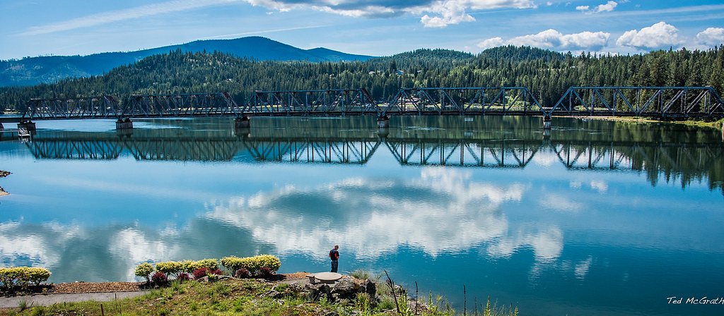
McAbee Falls sits at 2,192 feet along the Priest River, in the hills of Idaho.
Trail & Hike Details
The Approach
The moderate 2.4-mile out-and-back trail gains 350 feet of elevation on the way to the falls.
Trail Description
USFS trail data for surface, grade, and trail class are not available for the McAbee Falls route. Known trail stats: 2.4 miles (out-and-back), approximately 350 feet elevation gain, difficulty rated moderate. The trail follows natural tread through wooded and rocky terrain and can be uneven or partially unmarked in sections, so good footwear and basic navigation awareness are recommended.
What to Expect
Visitors can expect a tranquil waterfall surrounded by natural scenery. The area may be remote, so plan accordingly for a more rugged outdoor experience.
Accessibility
The trail is not wheelchair accessible. Uneven terrain and elevation changes require steady footing.
Frequently Asked Questions
🐶 Are Dogs Allowed at McAbee Falls?
❌ Dogs are not allowed
Are There Any Fees or Permits Required?
🆖 No fees required
🏊 Is There Swimming at McAbee Falls?
❌ Swimming is not allowed
When to Visit
Spring and early summer are typically the best times to visit, as water flow is likely to be at its peak due to snowmelt.
Seasonal Access
The best time to visit is Spring, Summer, and Fall. Winter access may be limited.
Safety Information
The trail to McAbee Falls may be unmarked or rugged. Visitors should exercise caution, especially in wet or icy conditions. Always inform someone of your plans before heading out.
Current Water Conditions
821 ft³/s
Current discharge — how much water is flowing
Much lower than usual for this time of year
Based on 76 years of record
1.59 ft
Water depth at gauge
7-Day Discharge Trend
What does this mean for your visit?
Flow is well below normal for this time of year, so the waterfall may be a trickle.
About This Gauge
This gauge is on a nearby waterway and may not reflect exact conditions at the falls.
7-Day Flow Outlook
Based on the USGS gauge Priest River near Priest River, ID (9 km away).
Today
Barely Flowing
887 cfs
3/10Tomorrow
Low
876 cfs
4/10Sat
Low
912 cfs
3/10Sun
Low
866 cfs
4/10Mon
Low
815 cfs
4/10Tue
Low
779 cfs
4/10Wed
Barely Flowing
599 cfs
5/10Best window: Wed — barely flowing flow, mostly sunny (trip score 5/10).
Best time of year: this gauge typically runs highest from early April to early July, peaking in May.
How we calculate this
This is a transparent outlook, not a precise forecast. We take the waterfall's current flow strength (how it ranks against its historical normal for today, from the nearest USGS stream gauge), carry that ranking forward along the gauge's seasonal curve, and nudge it for forecast rain. Confidence is highest for the next day or two and falls further out. Always check official conditions and your own judgment before visiting — high flows can be dangerous.
Know when to go.
Get a free email alert when waterfalls near Priest River hit peak flow. We only send when conditions are worth the trip — no weekly newsletters, no spam.
Weather Forecast
Location & Access
Getting There
McAbee Falls is located in Idaho, but specific directions to the falls are not widely documented. Visitors are advised to consult local maps or contact nearby ranger stations for guidance.
Get Directions on Google MapsParking
Parking availability near McAbee Falls is unclear. Visitors should prepare for limited or informal parking options.
Elevation
2,192 feet above sea level
Coordinates
48.284359° N, -116.871847° W
Visitor Tips & Gear
Bring a detailed map or GPS device, as the location may not be well-marked. Wear sturdy footwear and be prepared for varying trail conditions.
As an Amazon Associate, we earn from qualifying purchases.
With 2.4 miles and 350 ft of elevation gain, sturdy boots and trekking poles will help on this moderate trail. Sun exposure on the trail makes good sun protection a must in summer.

Columbia Watertight II Rain Jacket
Packs into its own pocket, seam-sealed, and keeps you dry from spray and surprise rain.

Earth Pak Waterproof Dry Bag
Keeps your phone and gear dry when waterfall mist soaks everything else.

Waterproof Phone Pouch (AiRunTech)
Cheap insurance — take photos right next to the falls without killing your phone.

Timberland Euro Sprint Mid Waterproof
Trusted waterproof boot with premium leather and grippy rubber sole — reliable on rocky, wet trails.

TrailBuddy Trekking Poles
Lightweight aluminum, cork grips, and flip-locks that actually hold — a best-seller for good reason.

Polarized Sunglasses (Knockaround)
Cuts glare off the water so you actually see the falls — and your photos turn out better too.
Where to Stay

Sandpoint Hotel & Suites Downtown

SpringHill Suites by Marriott Sandpoint

Baby Birch Banks Guest House on Lake Pend Oreille

Sunspot Lodge - Schweitzer Mountain
Browse vacation cabins and private rentals nearby
Unique outdoor stays — tents, yurts, and treehouses
Rent a campervan or RV for your waterfall road trip
Some links are affiliate links. We may earn a commission at no extra cost to you.
Nearby Campground
ALBENI COVE
9.1 miles away · 14 sites
Overview Albeni Cove is a small campground located just upstream from Albeni Falls Dam on the Pend Oreille. Situated amongst firs, cedars and pines, Albeni Cove provides a rustic, but incredibly beautiful location for camping and recreation on the river. Recreation Water sports are the most common activity at Albeni Cove, including swimming, fishing and boating. Campers are likely to spot wildlife in the area, including bald eagles, osprey, a wide variety of birds, and most commonly, deer. Facili
Book on Recreation.govAdditional Information
Nearby Attractions
Nearby attractions are not well-documented. Visitors may explore other natural areas in Idaho for additional outdoor activities.
Wildlife
The area around McAbee Falls may host typical Idaho wildlife, such as deer, birds, and small mammals. Be cautious of potential encounters with larger animals like bears.
Cities near McAbee Falls
Nearby Waterfalls
Writing about McAbee Falls? Embed this waterfall on your site for free.