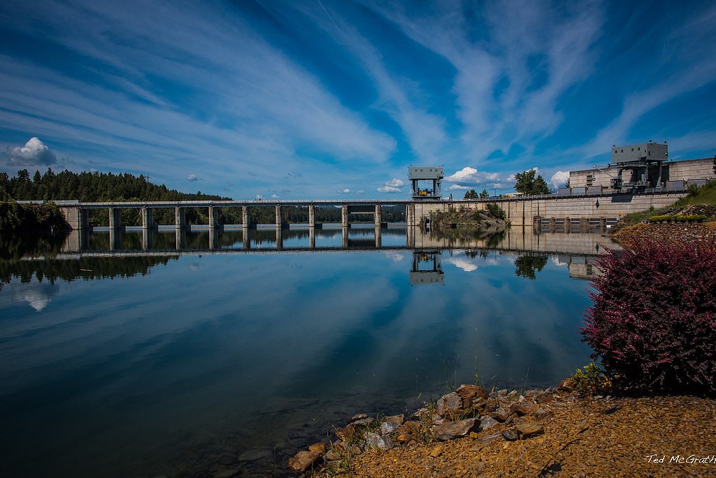
Albeni Falls
By Armen Suny · Last verified Mar 2026
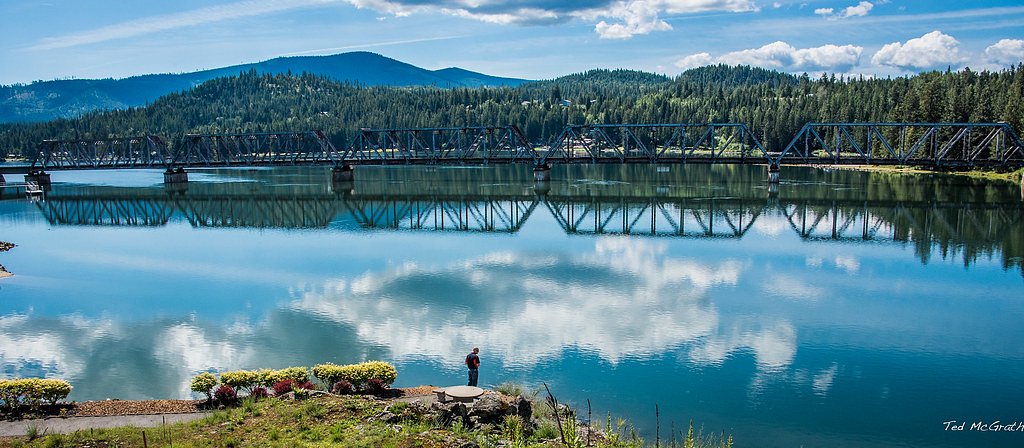
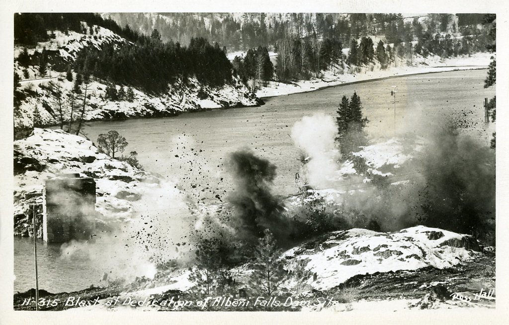
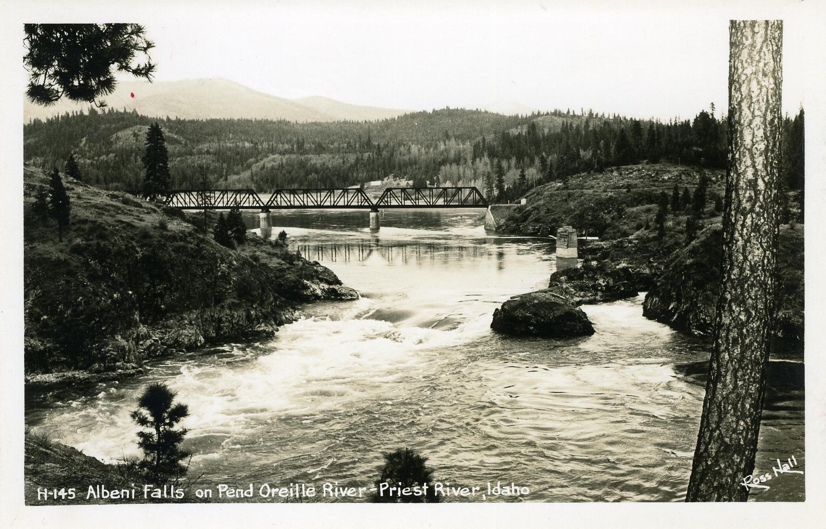
Photo Credits (5)
Difficulty
Drive Up
Trail Length
0.1 miles
Trail Type
Out And Back
Elevation Gain
50 ft
About Albeni Falls
Albeni Falls sits on the Pend Oreille River between Oldtown and Priest River, Idaho, at the site of a natural cascade named for early pioneer Albeni Poirier. The engineered Albeni Falls Dam, constructed from 1951 to 1955 and operated by the U.S. Army Corps of Engineers, replaced that natural drop. Built for flood control and power generation, the project cost about $34 million at the time (roughly $261 million in 2007 dollars) and still produces more than 200 million kilowatt‑hours of electricity each year for the Bonneville Power Administration. The dam and spillway create striking river views rather than a remote backcountry waterfall experience. Visitors come for short, scenic vantage points and a compact visitor area with overlooks that put the river and spillway close at hand. If you want to extend your visit, Albeni Cove Campground is conveniently nearby—about 0.61 km (0.4 miles)—making an easy overnight base for exploring the Pend Oreille shoreline, fishing, or nearby lakeside recreation. The site is best enjoyed as a quick, accessible stop while touring northern Idaho’s lake and river country.
The Setting
Albeni Falls sits at 2,060 feet along the Pend Oreille River, in the hills of Idaho.
Trail & Hike Details
The Approach
No hiking required. Albeni Falls is accessible by vehicle with a roadside viewing area.
Trail Description
There is no formal USFS trail or trail number to this waterfall; access is primarily via the dam visitor area and short drive‑up viewpoints maintained by the U.S. Army Corps of Engineers. Typical access is roughly 0.1 miles round‑trip with about 50 feet of elevation change, classified as an out‑and‑back, drive_up route (a short walk from parking to overlooks). USFS surface, grade, and formal trail class data are not provided for Albeni Falls—expect a brief, maintained access path from the parking/visitor area to the primary viewing points rather than a developed hiking trail.
What to Expect
Dogs are welcome.
Accessibility
This waterfall is viewable from a vehicle-accessible area. No hiking is required.
Frequently Asked Questions
🐶 Are Dogs Allowed at Albeni Falls?
✅ Dogs are allowed
Are There Any Fees or Permits Required?
🆖 No fees required
🏊 Is There Swimming at Albeni Falls?
❌ Swimming is not allowed
When to Visit
Spring and summer are the best times to visit, as the weather is pleasant and water levels may be higher due to snowmelt.
Seasonal Access
The best time to visit is Spring, Summer, Fall, and Winter.
Safety Information
Stay clear of restricted areas near the dam and spillway. Follow all posted signs and safety guidelines. Be cautious around the river, as currents can be strong.
Current Water Conditions
29,100 ft³/s
Current discharge — how much water is flowing
Lower than usual for this time of year
Based on 95 years of record
37.52 ft
Water depth at gauge
7-Day Discharge Trend
What does this mean for your visit?
Flow is lower than usual for this time of year.
About This Gauge
7-Day Flow Outlook
Based on the USGS gauge PEND OREILLE RIVER AT NEWPORT WA (2 km away).
Today
Moderate
31428 cfs
6/10Tomorrow
Moderate
31242 cfs
6/10Sun
Moderate
31561 cfs
6/10Mon
Moderate
29373 cfs
6/10Tue
Moderate
28156 cfs
6/10Wed
Moderate
28349 cfs
6/10Thu
Moderate
26384 cfs
9/10Best window: Thu — moderate flow, mostly sunny (trip score 9/10).
Best time of year: this gauge typically runs highest from mid April to mid July, peaking in June.
How we calculate this
This is a transparent outlook, not a precise forecast. We take the waterfall's current flow strength (how it ranks against its historical normal for today, from the nearest USGS stream gauge), carry that ranking forward along the gauge's seasonal curve, and nudge it for forecast rain. Confidence is highest for the next day or two and falls further out. Always check official conditions and your own judgment before visiting — high flows can be dangerous.
Know when to go.
Get a free email alert when waterfalls near Oldtown hit peak flow. We only send when conditions are worth the trip — no weekly newsletters, no spam.
Weather Forecast
Location & Access
Getting There
Albeni Falls is located near the town of Priest River, Idaho, along Highway 2. The Albeni Falls Dam Visitor Center provides access and information about the area.
Get Directions on Google MapsParking
Parking is available at the Albeni Falls Dam Visitor Center and nearby recreational areas.
Elevation
2,060 feet above sea level
Coordinates
48.177684° N, -117.001312° W
Visitor Tips & Gear
Visit during the spring or summer for the best weather and to enjoy nearby recreational activities. Bring binoculars for birdwatching and a camera for scenic photography.
As an Amazon Associate, we earn from qualifying purchases.
For this easy 0.1 miles trail, lightweight trail shoes and a water bottle are usually sufficient. Icy conditions are common in winter — traction cleats are a smart addition.

Columbia Watertight II Rain Jacket
Packs into its own pocket, seam-sealed, and keeps you dry from spray and surprise rain.

Polarized Sunglasses (Knockaround)
Cuts glare off the water so you actually see the falls — and your photos turn out better too.

Earth Pak Waterproof Dry Bag
Keeps your phone and gear dry when waterfall mist soaks everything else.

Waterproof Phone Pouch (AiRunTech)
Cheap insurance — take photos right next to the falls without killing your phone.

Kahtoola MICROspikes
Cult-favorite traction cleats that grip ice and wet rock — essential for winter waterfall hikes.

JOBY GorillaPod Starter Kit
Wraps around railings and rocks for long-exposure waterfall shots — no flat surface needed.
Where to Stay

Eagle's Nest Motel

Stoneridge Resort

Sandpoint Adventure Base Camp

Stoneridge Resort
Browse vacation cabins and private rentals nearby
Unique outdoor stays — tents, yurts, and treehouses
Rent a campervan or RV for your waterfall road trip
Some links are affiliate links. We may earn a commission at no extra cost to you.
Nearby Campground
ALBENI COVE
0.4 miles away · 14 sites
Overview Albeni Cove is a small campground located just upstream from Albeni Falls Dam on the Pend Oreille. Situated amongst firs, cedars and pines, Albeni Cove provides a rustic, but incredibly beautiful location for camping and recreation on the river. Recreation Water sports are the most common activity at Albeni Cove, including swimming, fishing and boating. Campers are likely to spot wildlife in the area, including bald eagles, osprey, a wide variety of birds, and most commonly, deer. Facili
Book on Recreation.govAdditional Information
Nearby Attractions
Nearby attractions include Priest River, Lake Pend Oreille, and Kaniksu National Forest, which offer additional recreational opportunities such as hiking, boating, and camping.
Wildlife
The area is home to a variety of wildlife, including bald eagles, ospreys, and deer. Birdwatching is particularly popular.
Cities near Albeni Falls
Nearby Waterfalls
Writing about Albeni Falls? Embed this waterfall on your site for free.