
Lower Black Bar Falls
By Armen Suny · Last verified Oct 2026
LiDAR & 3D terrain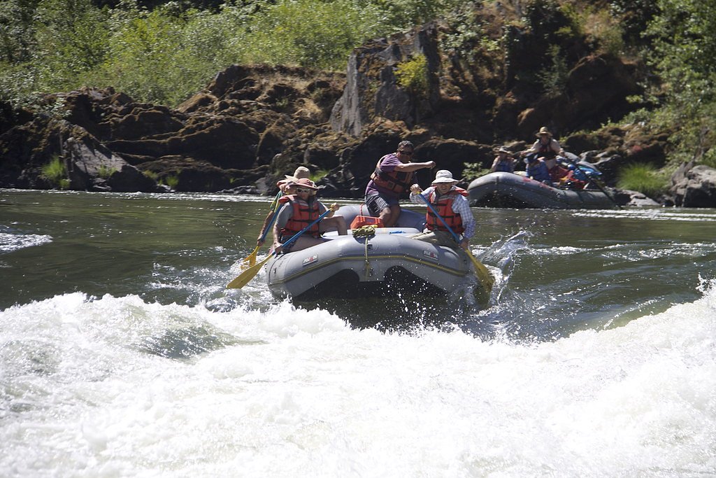

Photo Credits (3)
About Lower Black Bar Falls
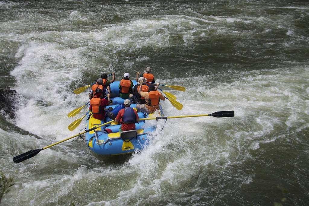
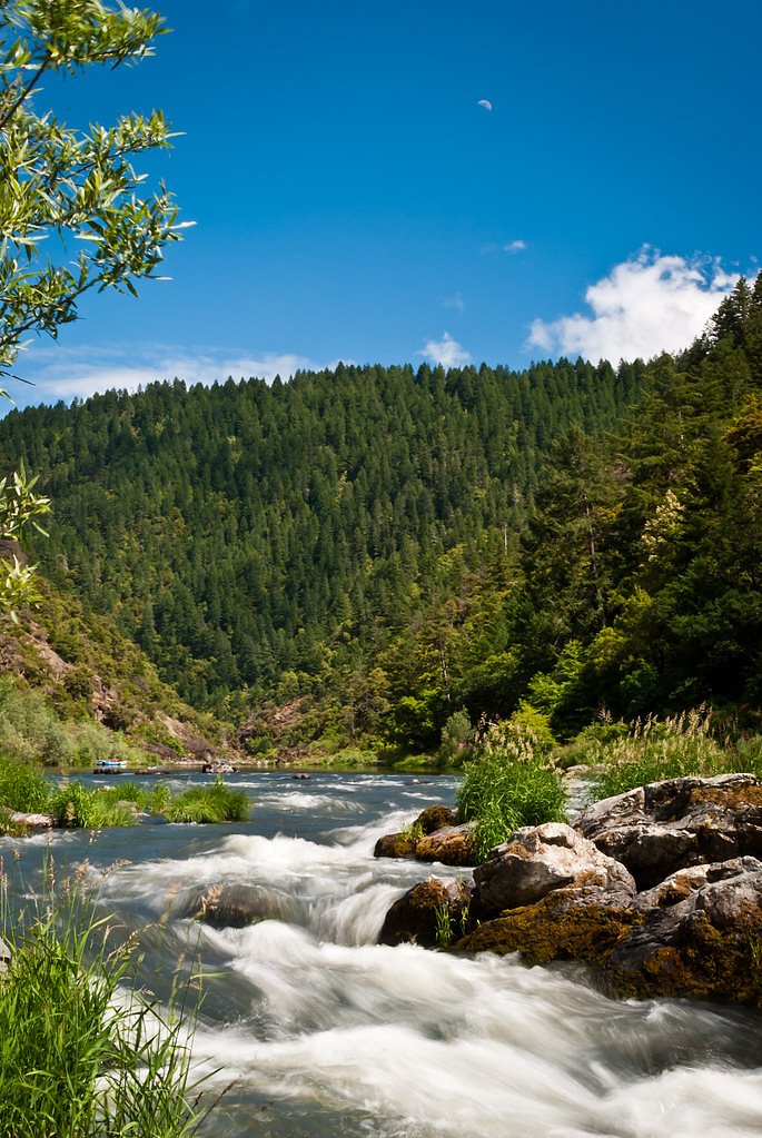
Lower Black Bar Falls is a compact but dramatic set of river rapids on the Rogue River in southern Oregon, best appreciated from a boat or river put‑in. Rather than a tall vertical drop, the feature reads as a churning, scenic rapid that draws rafters and kayakers to this stretch of river for its lively whitewater and steep, forested banks. The falls and surrounding access corridor lie on public land managed by the Bureau of Land Management’s Medford Grants Pass Field Office, so visitors should be prepared for a wild riverside experience rather than developed amenities. Water access is the most common way to enjoy the falls—the river provides the best viewpoints and is the preferred route for paddlers. Expect primitive footing and limited signage; treat the area as backcountry and pack accordingly.
The Setting
Lower Black Bar Falls sits at 505 feet within Medford Grants Pass Field Office, in the foothills of Oregon.
Trail & Hike Details
Trail Description
There is no designated, maintained trail constructed by a federal trail program directly to Lower Black Bar Falls; primary access is by watercraft on the Rogue River. The route is primitive (unpaved natural surface) and unmarked in places—use map, GPS, and river access points and be prepared for uneven terrain and limited facilities on BLM land managed by the Medford Grants Pass Field Office.
What to Expect
Visitors can expect to see a series of rapids rather than a traditional waterfall. The surrounding area features lush forests and rugged river scenery. The falls are a highlight for those rafting or kayaking the Rogue River.
Accessibility
The falls are not accessible by road or wheelchair. Access requires rafting or kayaking along the Rogue River.
Frequently Asked Questions
🐶 Are Dogs Allowed at Lower Black Bar Falls?
❌ Dogs are not allowed
Are There Any Fees or Permits Required?
🤑 Fee: $0.00
Permit required
A permit is required for rafting or kayaking the Rogue River. Permits can be obtained through the Bureau of Land Management (BLM).
🏊 Is There Swimming at Lower Black Bar Falls?
❌ Swimming is not allowed
When to Visit
Spring and summer are the best times to visit due to favorable river conditions and warmer weather.
Seasonal Access
The best time to visit is Spring, Summer, and Fall. Winter access may be limited.
Safety Information
The rapids at Lower Black Bar Falls can be dangerous. Visitors should have proper training and equipment for navigating the river. Always wear a life jacket and be aware of changing river conditions.
Current Water Conditions
These readings come from the USGS gauge on West Fork Cow Creek, 11.9 miles away, not on Lower Black Bar Falls's own stream. Use them as a sign of whether the area is running wet or dry.
5 ft³/s
Current discharge — how much water is flowing
Much lower than usual for this time of year
Based on 71 years of record
2.01 ft
Water depth at gauge
7-Day Discharge Trend
What does this mean for your visit?
Flow is well below normal for this time of year, so the waterfall may be a trickle.
About This Gauge
This gauge is on a nearby waterway and may not reflect exact conditions at the falls.
7-Day Flow Outlook
Based on the USGS gauge WEST FORK COW CREEK NEAR GLENDALE, OR (19 km away).
Today
Barely Flowing
5 cfs
5/10Tomorrow
Barely Flowing
5 cfs
5/10Sat
Barely Flowing
5 cfs
5/10Sun
Barely Flowing
6 cfs
3/10Mon
Low
7 cfs
4/10Tue
Barely Flowing
7 cfs
5/10Wed
Barely Flowing
8 cfs
5/10Best window: Today — barely flowing flow, partly sunny (trip score 5/10).
Best time of year: this gauge typically runs highest from early March to early April, peaking in January.
How we calculate this
This is a transparent outlook, not a precise forecast. We take the waterfall's current flow strength (how it ranks against its historical normal for today, from the nearest USGS stream gauge), carry that ranking forward along the gauge's seasonal curve, and nudge it for forecast rain. Confidence is highest for the next day or two and falls further out. Always check official conditions and your own judgment before visiting — high flows can be dangerous.
Know when to go.
Get a free email alert when waterfalls near Glendale hit peak flow. We only send when conditions are worth the trip — no weekly newsletters, no spam.
Weather Forecast
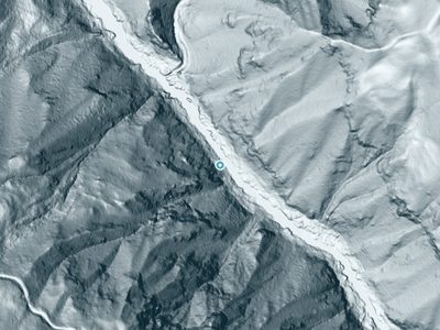
The Terrain, Seen by LiDAR
Aircraft-mounted lasers measured this ground to within inches. Trees and buildings are digitally stripped away, leaving the bare shape of the land the water has carved.
The bare-earth surface loses about 60 feet through the falls, but gradually, the profile of a cascade rather than a plunge. The ground at the falls is roughly 507 feet above sea level.
The ground changes about 25 feet in the 500 feet above the falls and 264 feet in the 500 feet below. Facing east, the falls catch soft morning light.
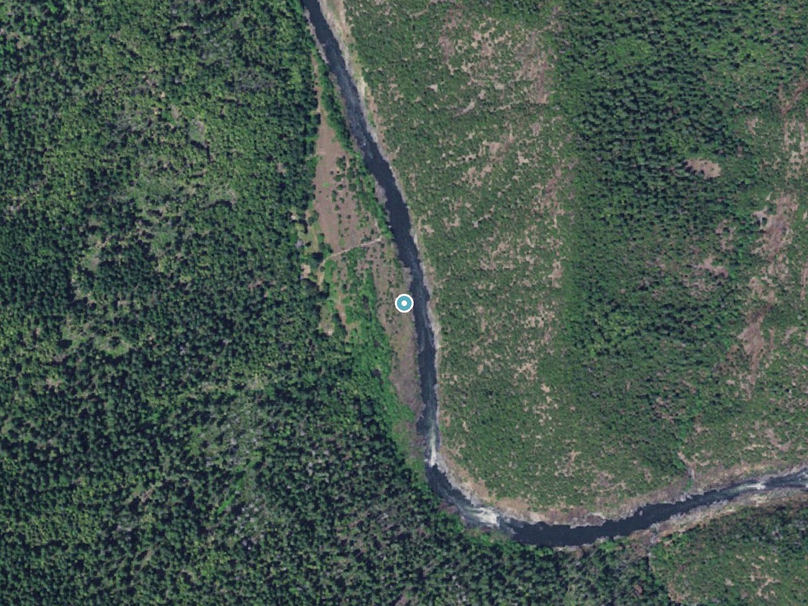
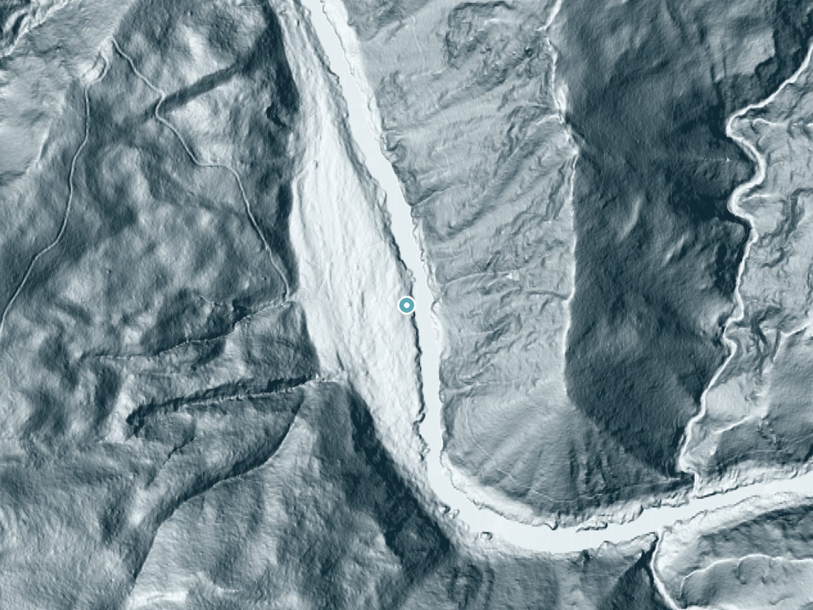
Drag to compare. The dot marks the waterfall. The frame is about a mile across.
- Ground elevation
- 507 feet
- Measured by 3-meter lidar
- Drop at the falls
- About 60 feet
- Change in ground height within ~250 feet of the falls
- Faces
- East
- Catches soft morning light.
A slice through the lidar ground surface, from above the falls to downstream (heading east).
Elevation data: USGS 3D Elevation Program. Aerial imagery: USGS The National Map. Public domain.
Location & Access
Getting There
Lower Black Bar Falls is accessible primarily by watercraft along the Rogue River. It is located near the Black Bar Lodge, which is a common stop for those rafting or kayaking the river. There is no direct road or hiking trail access to the falls.
Get Directions on Google MapsParking
Parking is available at various river access points along the Rogue River, such as the Grave Creek Boat Ramp. Visitors will need to arrange transportation or use a shuttle service to access the river.
Elevation
505 feet above sea level
Coordinates
42.655946° N, -123.731188° W
Land Management
Managed by BLM
Visitor Tips & Gear
Plan your visit as part of a rafting or kayaking trip on the Rogue River. Be prepared for changing river conditions and ensure you have the necessary permits and safety equipment. Consider hiring a guide if you are unfamiliar with the area.
Where to Stay

Blissful Solitude Cottage

Hampton Inn & Suites Grants Pass

Holiday Inn Express Grants Pass by IHG

Best Western Grants Pass Inn
Browse vacation cabins and private rentals nearby
Unique outdoor stays — tents, yurts, and treehouses
Rent a campervan or RV for your waterfall road trip
Some links are affiliate links. We may earn a commission at no extra cost to you.
Nearby Campground
ONION MOUNTAIN LOOKOUT
15.1 miles away · 0 sites
Overview THIS FACILITY IS CLOSED TO RESERVATIONS UNTIL FURTHER NOTICE Onion Mountain lookout sits atop a 12-foot tower at an elevation of 4,438 feet, offering guests expansive mountain views in southwestern Oregon. The original Onion Mountain Lookout was a raised platform, built on top of a tower in 1916. In 1924, a second lookout without a tower was built on site. The current structure was placed on site in 1952 and served as a fire lookout and Aircraft Warning Service observation station. The l
Book on Recreation.govAdditional Information
Nearby Attractions
Nearby attractions include the Rogue River Trail, Black Bar Lodge, and other rapids along the Rogue River.
Wildlife
The area is home to a variety of wildlife, including deer, black bears, river otters, and numerous bird species.
Cities near Lower Black Bar Falls
Nearby Waterfalls
Writing about Lower Black Bar Falls? Embed this waterfall on your site for free.