Photo Credits (5)
Difficulty
Moderate
Trail Length
3.0 miles
Trail Type
Out And Back
Elevation Gain
500 ft
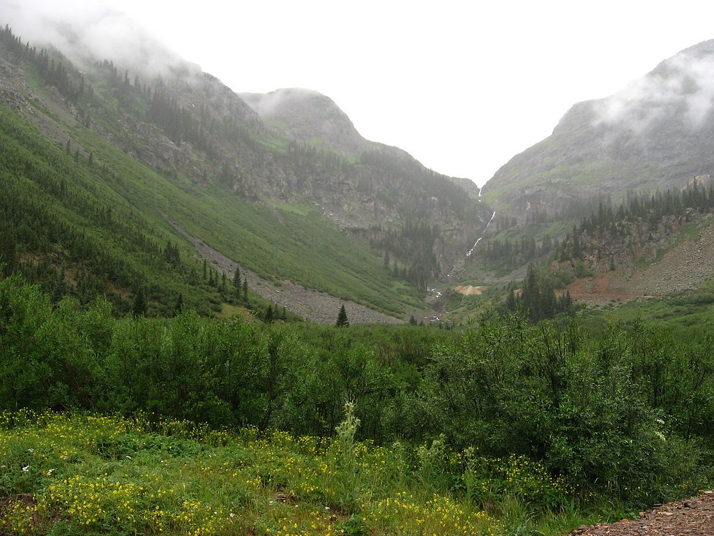
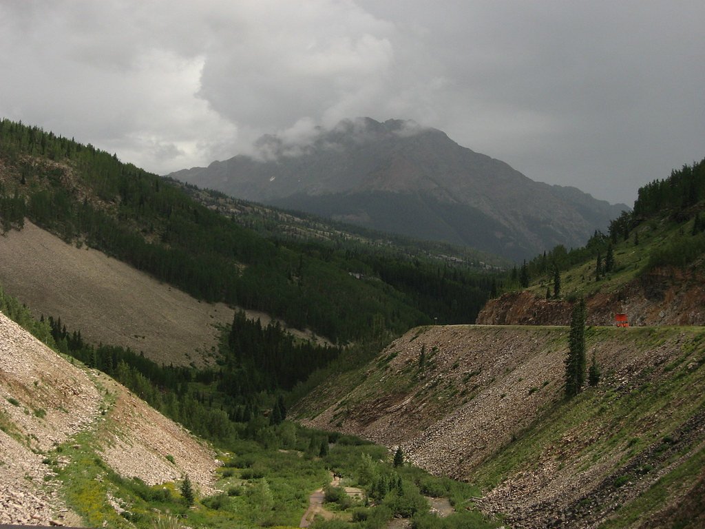
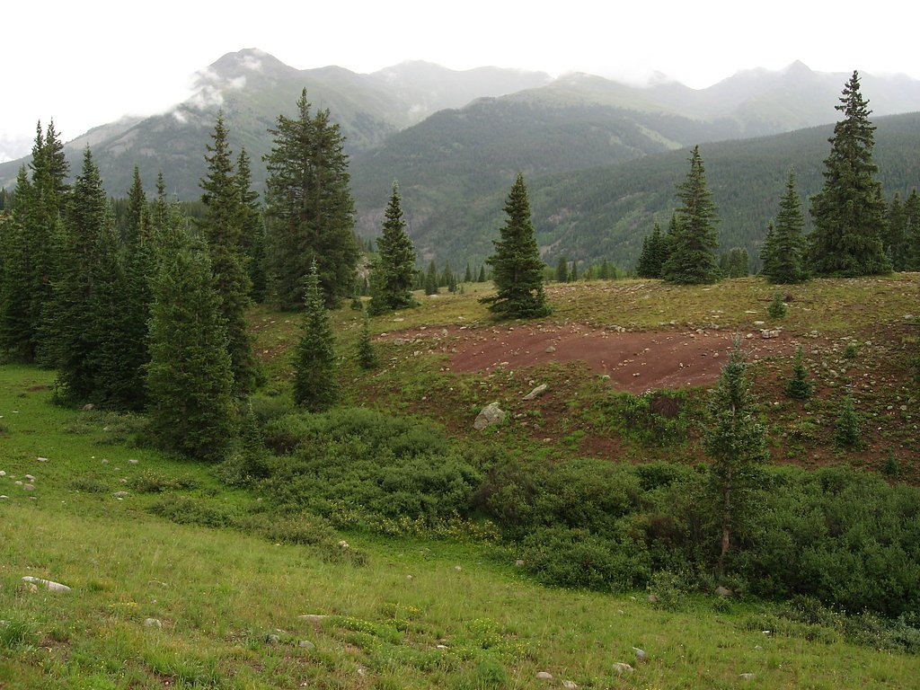
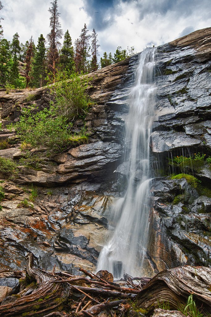
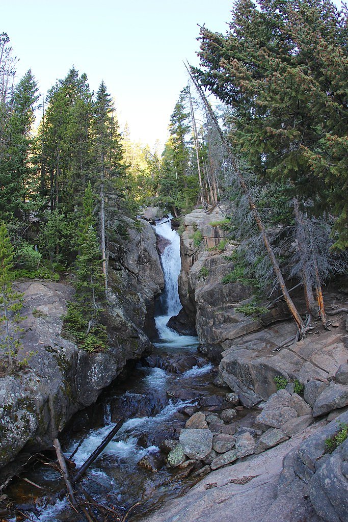
About Lost Falls
Lost Falls tumbles through a quiet, forested pocket of Rocky Mountain National Park, offering a peaceful reward after a lively mountain hike. Nestled within the park and managed by the National Park Service, the falls sit amid stands of subalpine forest and feel pleasantly remote—an inviting spot for photographers and anyone looking to trade trail noise for rushing water and dappled light. The approach to Lost Falls follows a moderate out-and-back route of about 3.0 miles round-trip with roughly 500 feet of elevation gain, so it’s well suited to hikers with some experience who want a half-day outing. If you’re planning an overnight stay, Tom Bennett Campground is nearby (about 7.98 km), making it easy to combine a campsite evening with an early- or late-day visit to the falls when crowds are smaller and the light is best.
The Setting
Lost Falls sits at 9,885 feet within Rocky Mountain National Park, in the high alpine of Colorado.
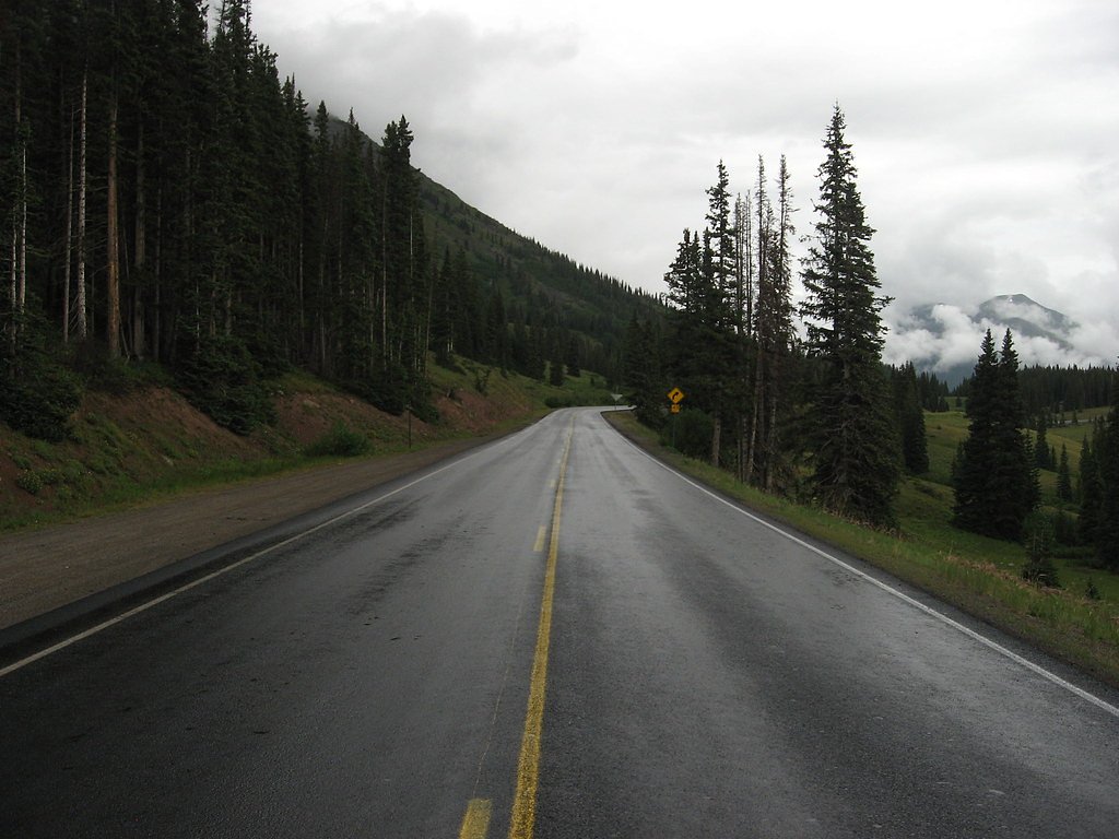
Trail & Hike Details
The Approach
The moderate 3.0-mile out-and-back trail gains 500 feet of elevation on the way to the falls.
Trail Description
3.0-mile out-and-back, moderate difficulty, ~500 ft elevation gain. The tread is primarily dirt with some rocky sections and a few short steeper pitches; the route is singletrack and well-defined. Expect a steady moderate grade rather than long, sustained climbs, and watch for roots and rocks on the approach. Managed as part of Rocky Mountain National Park by the National Park Service; prepare for typical mountain trail conditions and carry water, layers, and bear-aware precautions.
What to Expect
Dogs are welcome.
Accessibility
The trail is not wheelchair accessible. Uneven terrain and elevation changes require steady footing.
Frequently Asked Questions
🐶 Are Dogs Allowed at Lost Falls?
✅ Dogs are allowed
Are There Any Fees or Permits Required?
🆖 No fees required
🏊 Is There Swimming at Lost Falls?
❌ Swimming is not allowed
When to Visit
The best time to visit Lost Falls is during late spring or early summer when water flow is typically at its peak. Fall offers beautiful foliage, while summer provides warmer weather for hiking.
Seasonal Access
The best time to visit is Spring, Summer, and Fall. Access roads and trails may close during winter due to snow. Check with Rocky Mountain National Park for current conditions.
Safety Information
Hikers should be cautious of slippery rocks near the waterfall and be prepared for sudden weather changes. Carry a first aid kit and let someone know your hiking plans.
Know when to go.
Get a free email alert when waterfalls near Estes Park hit peak flow. We only send when conditions are worth the trip — no weekly newsletters, no spam.
Weather Forecast
Location & Access
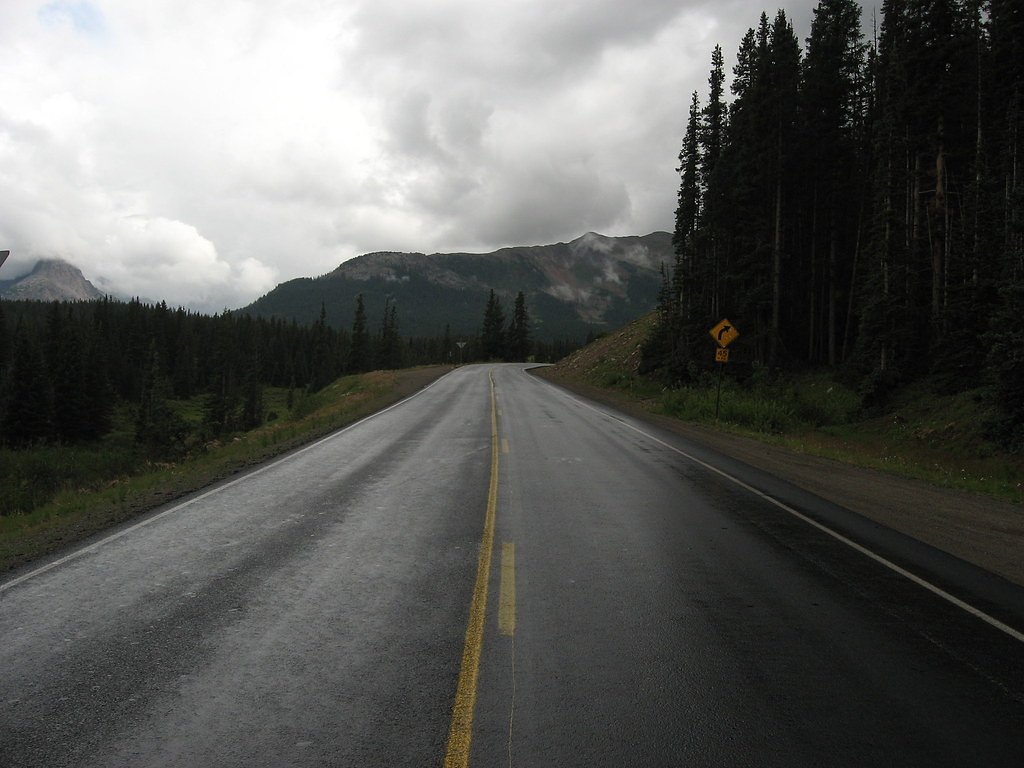
Getting There
Lost Falls is located near the town of Beulah in Colorado. Access typically involves driving to a trailhead within the San Isabel National Forest. Specific directions may vary depending on the trailhead used.
Get Directions on Google MapsParking
Parking is available at the trailhead, but spaces may be limited during peak seasons. Visitors are advised to arrive early to secure a spot.
Elevation
9,885 feet above sea level
Coordinates
40.503618° N, -105.566399° W
Land Management
Managed by NPS
Visitor Tips & Gear
Wear sturdy hiking shoes and bring plenty of water. Arrive early to secure parking and avoid crowds. Be prepared for changing weather conditions, as the area can experience sudden temperature drops or rain.
This trail sits at 9,885 ft — the air is noticeably thinner
High AltitudeSome visitors experience headaches, fatigue, or shortness of breath at this elevation. Take it slow, stay hydrated, and consider supplemental oxygen if you're coming from a lower altitude.
As an Amazon Associate, we earn from qualifying purchases.

Coppertone Sport SPF 50 Sunscreen
UV intensity jumps ~4% per 1,000 ft — at this elevation you can burn in half the time.

Sun Bum SPF 30 Lip Balm (3-Pack)
Lips have almost no natural UV protection and burn fast in thin, dry mountain air.

Liquid I.V. Electrolyte Packets
You lose moisture ~2x faster at elevation — electrolytes help you absorb water efficiently.

ROCKNIGHT Polarized UV400 Sunglasses
High-altitude glare off rock and water is intense — UV400 lenses block 99%+ of UVA/UVB.

Boost Oxygen 10L Canister (2-Pack)
Portable supplemental oxygen for quick relief from headaches and shortness of breath.

Altitude Rx OxyBoost Complex
Antioxidant formula designed to support your body's natural altitude acclimation.
As an Amazon Associate, we earn from qualifying purchases.
With 3.0 miles and 500 ft of elevation gain, sturdy boots and trekking poles will help on this moderate trail. Sun exposure on the trail makes good sun protection a must in summer.
America the Beautiful Annual Pass
Covers entrance fees at 2,000+ federal recreation sites — required at most National Parks.

Polarized Sunglasses (Knockaround)
Cuts glare off the water so you actually see the falls — and your photos turn out better too.

Columbia Watertight II Rain Jacket
Packs into its own pocket, seam-sealed, and keeps you dry from spray and surprise rain.

Earth Pak Waterproof Dry Bag
Keeps your phone and gear dry when waterfall mist soaks everything else.

Waterproof Phone Pouch (AiRunTech)
Cheap insurance — take photos right next to the falls without killing your phone.

Timberland Euro Sprint Mid Waterproof
Trusted waterproof boot with premium leather and grippy rubber sole — reliable on rocky, wet trails.

TrailBuddy Trekking Poles
Lightweight aluminum, cork grips, and flip-locks that actually hold — a best-seller for good reason.
Where to Stay

Riversong Inn Retreat

Boulder Brook on Fall River

Murphy's River Lodge

Creekside Suites 12 by Estes Park Condos
Browse vacation cabins and private rentals nearby
Unique outdoor stays — tents, yurts, and treehouses
Rent a campervan or RV for your waterfall road trip
Some links are affiliate links. We may earn a commission at no extra cost to you.
Nearby Campground
Tom Bennett Campground
5 miles away · 0 sites
Located near Pingree Park, this campground is situated adjacent to the South Fork Cache la Poudre River in a lodgepole pine forest setting. This campground provides a primitive camping experience in a remote location. There are ten sites, each with a picnic table and fire grate. This is an older facility and will not accommodate larger RVs. Popular activities include hiking and stream fishing.
Book on Recreation.govNearby Hot Springs
Hot springs near Estes Park, Colorado

Eldorado Springs
Eldorado Springs emerges at 79 degrees Fahrenheit in Boulder County's foothills as a low-mineralization thermal seep just 9 met...

Hot Sulphur Springs
Hot Sulphur Springs flows at 111°F along Parshall Divide Road in Grand County, emerging just 58 feet from the pavement in the s...
Looking for a soak after your hike? Explore more hot springs near Estes Park, Colorado on SoakingSprings.
Explore Colorado springsAdditional Information
Nearby Attractions
Nearby attractions include the San Isabel National Forest and the town of Beulah, which offers additional hiking trails and scenic views.
Wildlife
The area is home to a variety of wildlife, including deer, birds, and small mammals. Visitors should be cautious of potential encounters with bears or mountain lions.
Cities near Lost Falls
Nearby Waterfalls
Other waterfalls named Lost Falls
1 other waterfall shares this name across the U.S.
Writing about Lost Falls? Embed this waterfall on your site for free.