
Photo Credits (5)
Difficulty
Moderate
Trail Length
2.4 miles
Trail Type
Out And Back
Elevation Gain
350 ft
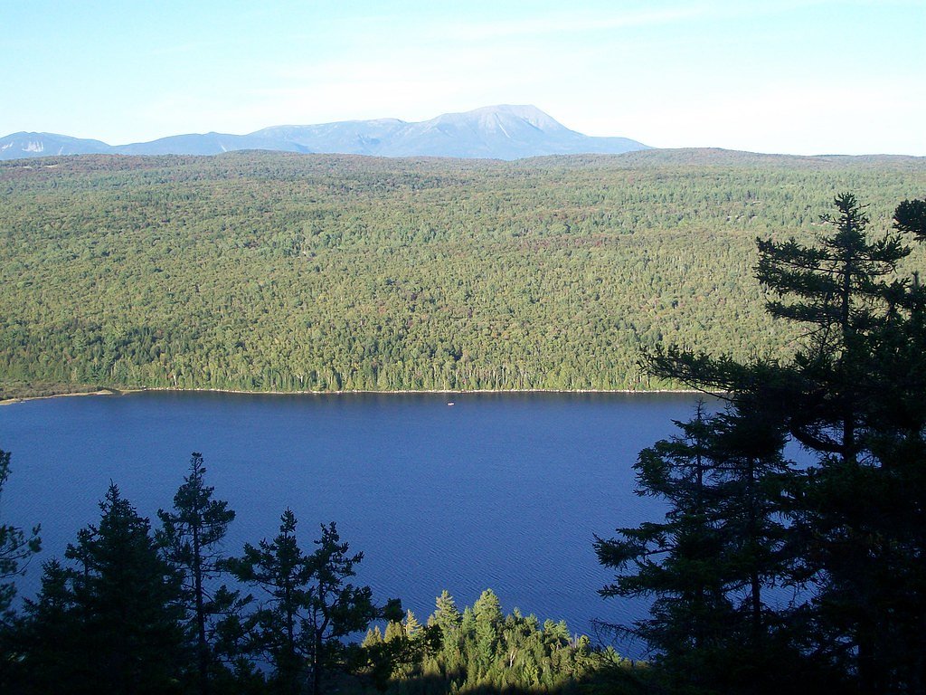
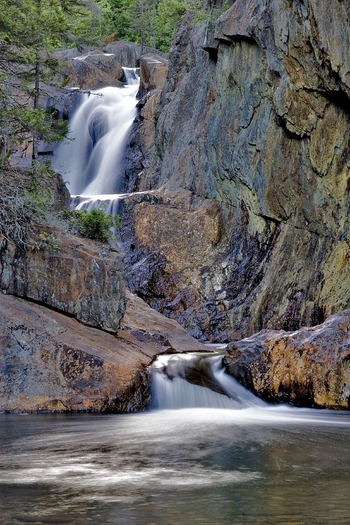
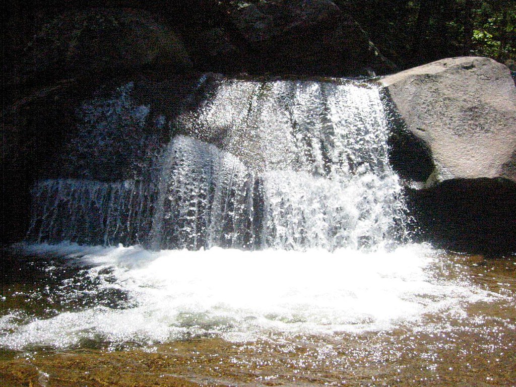
About Ledge Falls
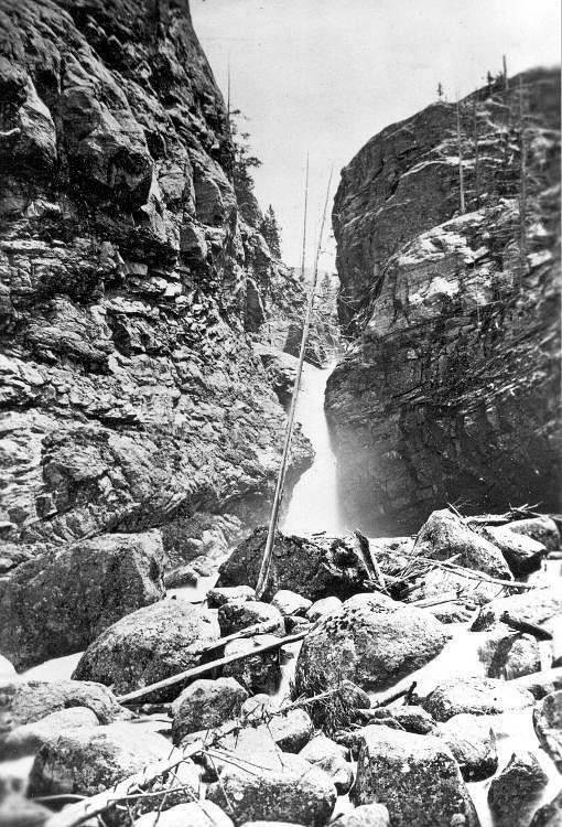
Ledge Falls is a series of cascading waterfalls located in a scenic area of Maine. It is known for its smooth rock formations and natural pools, making it a popular spot for visitors during warmer months. The falls are surrounded by forested areas, providing a serene and picturesque environment.
The Setting
Ledge Falls sits at 246 feet along the East Branch Penobscot River, in the coastal lowlands of Maine.
Trail & Hike Details
The Approach
The moderate 2.4-mile out-and-back trail gains 350 feet of elevation on the way to the falls.
Trail Description
There is limited information about the trail leading to Ledge Falls. It may involve a short walk or hike through forested terrain. Visitors should prepare for uneven ground and potential wet or slippery conditions near the falls.
What to Expect
Visitors can expect a peaceful natural setting with cascading waterfalls and smooth rock formations. The area may be suitable for wading or relaxing by the water, but caution is advised due to slippery rocks and varying water levels.
Accessibility
The trail is not wheelchair accessible. Uneven terrain and elevation changes require steady footing.
Frequently Asked Questions
🐶 Are Dogs Allowed at Ledge Falls?
❌ Dogs are not allowed
Are There Any Fees or Permits Required?
🆖 No fees required
🏊 Is There Swimming at Ledge Falls?
❌ Swimming is not allowed
When to Visit
Spring and summer are the best times to visit, as water flow is typically higher, and the weather is more favorable for outdoor activities.
Seasonal Access
The best time to visit is Spring, Summer, and Fall. Winter access may be limited.
Safety Information
Rocks near the falls can be slippery, and water levels may vary depending on recent rainfall. Visitors should exercise caution and avoid climbing on wet or unstable surfaces. Always supervise children near the water.
Current Water Conditions
2,140 ft³/s
Current discharge — how much water is flowing
About average for this time of year
Based on 104 years of record
6.26 ft
Water depth at gauge
7-Day Discharge Trend
What does this mean for your visit?
Flow is about average for this time of year.
About This Gauge
This gauge is on a nearby waterway and may not reflect exact conditions at the falls.
7-Day Flow Outlook
Based on the USGS gauge East Branch Penobscot River at Grindstone, Maine (10 km away).
Today
Barely Flowing
2311 cfs
3/10Tomorrow
Low
2362 cfs
4/10Sun
Low
2415 cfs
3/10Mon
Barely Flowing
2141 cfs
4/10Tue
Barely Flowing
2194 cfs
3/10Wed
Low
2171 cfs
4/10Thu
Low
2084 cfs
4/10Best window: Tomorrow — low flow, chance rain showers (trip score 4/10).
Best time of year: this gauge typically runs highest from late March to late June, peaking in April.
How we calculate this
This is a transparent outlook, not a precise forecast. We take the waterfall's current flow strength (how it ranks against its historical normal for today, from the nearest USGS stream gauge), carry that ranking forward along the gauge's seasonal curve, and nudge it for forecast rain. Confidence is highest for the next day or two and falls further out. Always check official conditions and your own judgment before visiting — high flows can be dangerous.
Know when to go.
Get a free email alert when waterfalls near Mattawamkeag hit peak flow. We only send when conditions are worth the trip — no weekly newsletters, no spam.
Weather Forecast
Location & Access
Getting There
Ledge Falls is located approximately 14.3 miles from Mattawamkeag, 22.2 miles from Patten, and 29.6 miles from Danforth. The falls can be accessed via local roads, but specific directions should be confirmed using a GPS or local maps. The coordinates for the falls are 45.6414, -68.5481.
Get Directions on Google MapsParking
Parking availability is unclear, but visitors may find small pull-off areas near the falls. It is recommended to plan ahead and park responsibly to avoid blocking access roads.
Elevation
246 feet above sea level
Coordinates
45.641442° N, -68.548085° W
Visitor Tips & Gear
Wear sturdy footwear with good grip, as the rocks near the falls can be slippery. Bring insect repellent during warmer months, and pack out all trash to help preserve the natural beauty of the area.
As an Amazon Associate, we earn from qualifying purchases.
With 2.4 miles and 350 ft of elevation gain, sturdy boots and trekking poles will help on this moderate trail. Sun exposure on the trail makes good sun protection a must in summer.

Polarized Sunglasses (Knockaround)
Cuts glare off the water so you actually see the falls — and your photos turn out better too.

Columbia Watertight II Rain Jacket
Packs into its own pocket, seam-sealed, and keeps you dry from spray and surprise rain.

Earth Pak Waterproof Dry Bag
Keeps your phone and gear dry when waterfall mist soaks everything else.

Waterproof Phone Pouch (AiRunTech)
Cheap insurance — take photos right next to the falls without killing your phone.

Timberland Euro Sprint Mid Waterproof
Trusted waterproof boot with premium leather and grippy rubber sole — reliable on rocky, wet trails.

TrailBuddy Trekking Poles
Lightweight aluminum, cork grips, and flip-locks that actually hold — a best-seller for good reason.
Where to Stay

First Settlers Lodge

The Whitetail Inn and Suites- Lincoln

Baxter Park Inn

Briarwood motor inn
Browse vacation cabins and private rentals nearby
Unique outdoor stays — tents, yurts, and treehouses
Rent a campervan or RV for your waterfall road trip
Some links are affiliate links. We may earn a commission at no extra cost to you.
Additional Information
Nearby Attractions
Nearby attractions include Baxter State Park and the Mattawamkeag River, which offer additional opportunities for hiking, fishing, and exploring nature.
Wildlife
The area is home to a variety of wildlife, including birds, deer, and small mammals. Visitors should be mindful of their surroundings and avoid disturbing the local fauna.
Cities near Ledge Falls
Nearby Waterfalls

Other waterfalls named Ledge Falls
3 other waterfalls share this name across the U.S.
Writing about Ledge Falls? Embed this waterfall on your site for free.