
Photo Credits (5)
Difficulty
Moderate
Trail Length
2.4 miles
Trail Type
Out And Back
Elevation Gain
350 ft
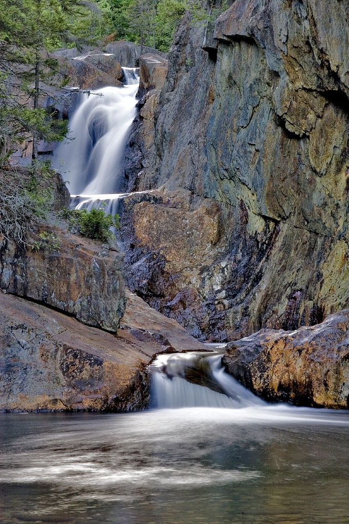
About Ledge Falls
Ledge Falls, located in Baxter State Park, Maine, is a series of cascading waterfalls and natural rock slides along the East Branch of the Penobscot River. It is a popular spot for families and visitors looking to enjoy the scenic beauty and recreational opportunities of the area.
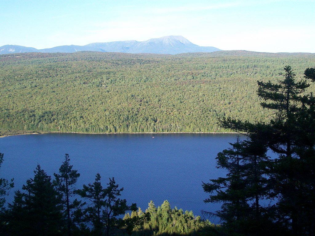
The Setting
Ledge Falls sits at 354 feet along the Wytopitlock Stream, in the coastal lowlands of Maine.
Trail & Hike Details
The Approach
The moderate 2.4-mile out-and-back trail gains 350 feet of elevation on the way to the falls.
Trail Description
The trail to Ledge Falls is short and easy, making it accessible for most visitors, including families with children. It leads through a wooded area to the falls, where visitors can enjoy the natural rock slides and pools.
What to Expect
Swimming is permitted. Dogs are welcome.
Accessibility
The trail is not wheelchair accessible. Uneven terrain and elevation changes require steady footing.
Frequently Asked Questions
🐶 Are Dogs Allowed at Ledge Falls?
✅ Dogs are allowed
Are There Any Fees or Permits Required?
🤑 Fee: $0.00
🏊 Is There Swimming at Ledge Falls?
✅ Swimming is allowed
When to Visit
The best time to visit Ledge Falls is during late spring, summer, and early fall when the weather is warm, and the water levels are suitable for wading and sliding.
Seasonal Access
The best time to visit is Spring, Summer, and Fall. Winter access may be limited.
Safety Information
Rocks around the falls can be slippery, especially when wet. Always wear appropriate footwear and supervise children closely. Be aware of changing water levels and currents.
Current Water Conditions
168 ft³/s
Current discharge — how much water is flowing
Higher than usual for this time of year
Based on 17 years of record
3.60 ft
Water depth at gauge
7-Day Discharge Trend
What does this mean for your visit?
The water is flowing higher than usual for this time of year.
About This Gauge
This gauge is on a nearby waterway and may not reflect exact conditions at the falls.
7-Day Flow Outlook
Based on the USGS gauge Wytopitlock Stream near Wytopitlock Maine (16 km away).
Today
Moderate
192 cfs
6/10Tomorrow
Moderate
494 cfs
6/10Mon
Moderate
437 cfs
6/10Tue
Moderate
396 cfs
8/10Wed
Moderate
363 cfs
5/10Thu
Moderate
340 cfs
6/10Fri
Moderate
305 cfs
6/10Best window: Tue — moderate flow, mostly sunny (trip score 8/10).
Best time of year: this gauge typically runs highest from late March to early May, peaking in April.
How we calculate this
This is a transparent outlook, not a precise forecast. We take the waterfall's current flow strength (how it ranks against its historical normal for today, from the nearest USGS stream gauge), carry that ranking forward along the gauge's seasonal curve, and nudge it for forecast rain. Confidence is highest for the next day or two and falls further out. Always check official conditions and your own judgment before visiting — high flows can be dangerous.
Know when to go.
Get a free email alert when waterfalls near Danforth hit peak flow. We only send when conditions are worth the trip — no weekly newsletters, no spam.
Weather Forecast
Location & Access
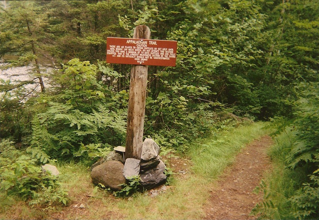
Getting There
Ledge Falls is located within Baxter State Park, which is accessible via the Togue Pond Gate or Matagamon Gate. Visitors should follow park signage to reach the falls. The area is well-marked and relatively easy to find.
Get Directions on Google MapsParking
Parking is available at designated areas within Baxter State Park, near the trailhead leading to Ledge Falls.
Elevation
354 feet above sea level
Coordinates
45.757281° N, -67.958071° W
Visitor Tips & Gear
Arrive early during summer months to secure parking and avoid crowds. Bring water shoes for better traction on the rocks, and always supervise children near the water.
As an Amazon Associate, we earn from qualifying purchases.
With 2.4 miles and 350 ft of elevation gain, sturdy boots and trekking poles will help on this moderate trail. Sun exposure on the trail makes good sun protection a must in summer.

Polarized Sunglasses (Knockaround)
Cuts glare off the water so you actually see the falls — and your photos turn out better too.

Columbia Watertight II Rain Jacket
Packs into its own pocket, seam-sealed, and keeps you dry from spray and surprise rain.

Earth Pak Waterproof Dry Bag
Keeps your phone and gear dry when waterfall mist soaks everything else.

Waterproof Phone Pouch (AiRunTech)
Cheap insurance — take photos right next to the falls without killing your phone.

Timberland Euro Sprint Mid Waterproof
Trusted waterproof boot with premium leather and grippy rubber sole — reliable on rocky, wet trails.

TrailBuddy Trekking Poles
Lightweight aluminum, cork grips, and flip-locks that actually hold — a best-seller for good reason.
Where to Stay

First Settlers Lodge

Katahdin Valley Motel

All Season Fun and Cozy Home in Island Falls, ME

Peaceful Lakefront Cabin Getaway Dock, Fire Pit!
Browse vacation cabins and private rentals nearby
Unique outdoor stays — tents, yurts, and treehouses
Rent a campervan or RV for your waterfall road trip
Some links are affiliate links. We may earn a commission at no extra cost to you.
Additional Information
Nearby Attractions
Other attractions in Baxter State Park include Katahdin Stream Falls, Sandy Stream Pond, and Mount Katahdin.
Wildlife
The area is home to a variety of wildlife, including moose, deer, and birds. Visitors should maintain a safe distance from all animals.
Cities near Ledge Falls
Other waterfalls named Ledge Falls
3 other waterfalls share this name across the U.S.
Writing about Ledge Falls? Embed this waterfall on your site for free.