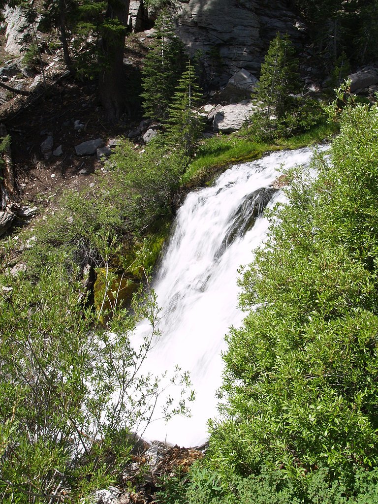
Kings Creek Falls
California • Lassen Volcanic National Park • 30 ft
By Armen Suny · Last verified Mar 2026
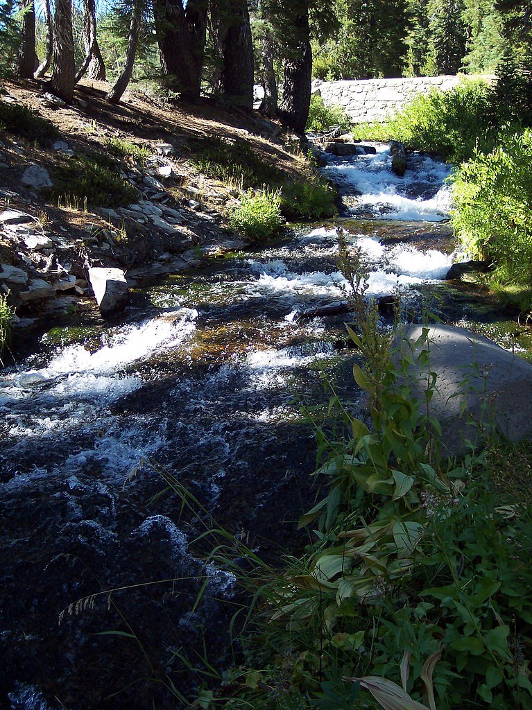
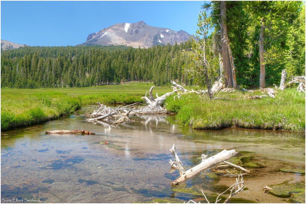
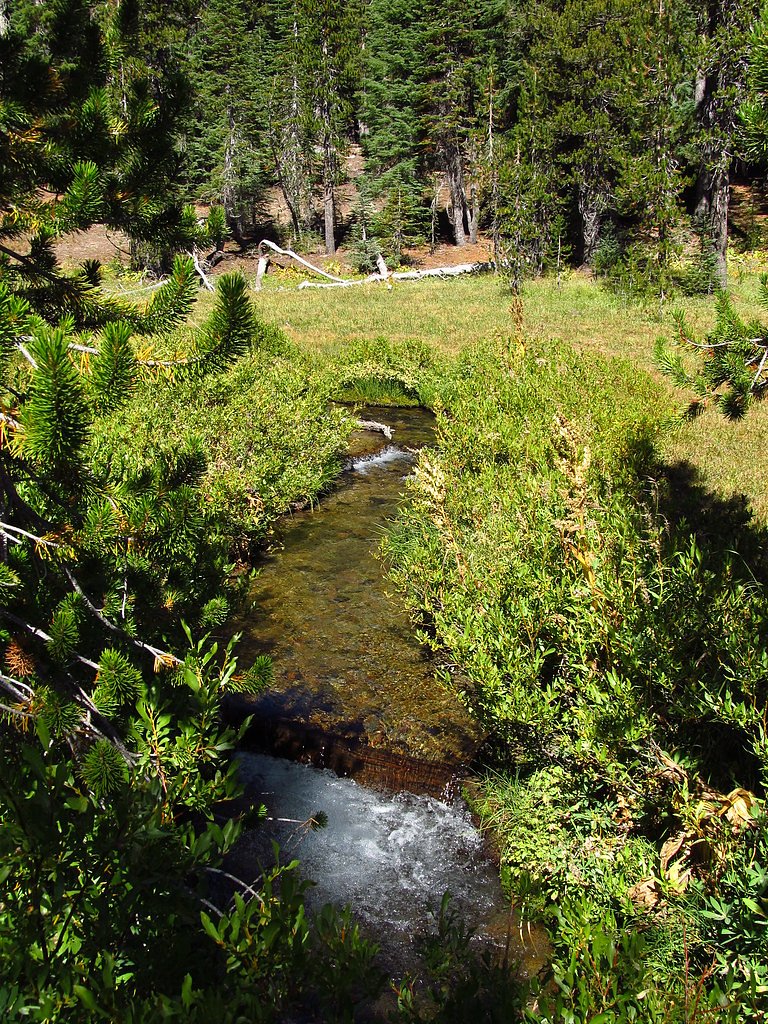
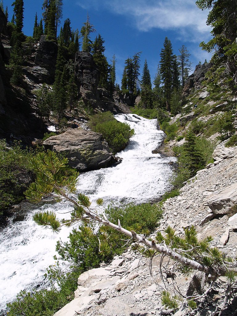

Photo Credits (5)
Difficulty
Moderate
Trail Length
2.3 miles
Trail Type
Out And Back
Elevation Gain
500 ft
About Kings Creek Falls
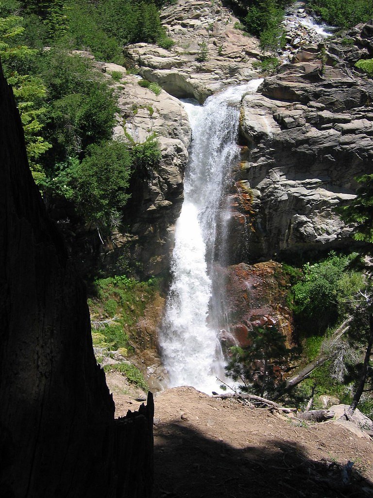
Kings Creek Falls is a stunning 30-foot waterfall located in Lassen Volcanic National Park, California. It is a popular destination for hikers and nature enthusiasts, offering picturesque views and a serene atmosphere.
The Setting
Kings Creek Falls sits at 6,850 feet within Lassen Volcanic National Park, in the high mountains of California. The falls drop 30 feet.
Height: 30 feet
Trail & Hike Details
The Approach
The moderate 2.3-mile out-and-back trail gains 500 feet of elevation on the way to the falls.
Trail Description
The trail to Kings Creek Falls is a moderately challenging hike that takes you through lush meadows, forested areas, and volcanic landscapes. The trail includes some steep sections and rocky terrain, particularly near the falls.
What to Expect
The falls drop 30 feet.
Accessibility
The trail is not wheelchair accessible. Uneven terrain and elevation changes require steady footing.
Frequently Asked Questions
🐶 Are Dogs Allowed at Kings Creek Falls?
❌ Dogs are not allowed
Are There Any Fees or Permits Required?
🤑 Fee: $30.00
🏊 Is There Swimming at Kings Creek Falls?
❌ Swimming is not allowed
When to Visit
The best time to visit Kings Creek Falls is in late spring or early summer when the snow has melted, and the waterfall is at its fullest.
Seasonal Access
The best time to visit is Spring, Summer, and Fall. Access roads and trails may close during winter due to snow. Check with Lassen Volcanic National Park for current conditions.
Safety Information
The trail can be slippery near the falls, especially after rain or snowmelt. Stay on designated paths and avoid getting too close to the edge. Be prepared for sudden weather changes, as conditions can vary in the park.
Know when to go.
Get a free email alert when waterfalls near Mineral hit peak flow. We only send when conditions are worth the trip — no weekly newsletters, no spam.
Weather Forecast
Location & Access
Getting There
Kings Creek Falls is located within Lassen Volcanic National Park. The trailhead is accessible via the Lassen Volcanic National Park Highway, with parking available at the Kings Creek Picnic Area.
Get Directions on Google MapsParking
Parking is available at the Kings Creek Picnic Area, but it can fill up quickly during peak seasons. Arrive early to secure a spot.
Elevation
6,850 feet above sea level
Coordinates
40.459327° N, -121.441088° W
Land Management
Managed by NPS
Visitor Tips & Gear
Wear sturdy hiking shoes, as the trail can be rocky and uneven. Bring plenty of water, especially during warmer months. Check weather conditions before your visit, as snow can make the trail inaccessible in winter.
This trail sits at 6,850 ft above sea level
Elevated TrailUV radiation is roughly 27% stronger at this elevation than at sea level, and the dry air accelerates dehydration. Extra sun protection and fluids go a long way.
As an Amazon Associate, we earn from qualifying purchases.

Coppertone Sport SPF 50 Sunscreen
UV intensity jumps ~4% per 1,000 ft — at this elevation you can burn in half the time.

Sun Bum SPF 30 Lip Balm (3-Pack)
Lips have almost no natural UV protection and burn fast in thin, dry mountain air.

Liquid I.V. Electrolyte Packets
You lose moisture ~2x faster at elevation — electrolytes help you absorb water efficiently.

ROCKNIGHT Polarized UV400 Sunglasses
High-altitude glare off rock and water is intense — UV400 lenses block 99%+ of UVA/UVB.
As an Amazon Associate, we earn from qualifying purchases.
With 2.3 miles and 500 ft of elevation gain, sturdy boots and trekking poles will help on this moderate trail. Sun exposure on the trail makes good sun protection a must in summer.
America the Beautiful Annual Pass
Covers entrance fees at 2,000+ federal recreation sites — required at most National Parks.

Polarized Sunglasses (Knockaround)
Cuts glare off the water so you actually see the falls — and your photos turn out better too.

Columbia Watertight II Rain Jacket
Packs into its own pocket, seam-sealed, and keeps you dry from spray and surprise rain.

Earth Pak Waterproof Dry Bag
Keeps your phone and gear dry when waterfall mist soaks everything else.

Waterproof Phone Pouch (AiRunTech)
Cheap insurance — take photos right next to the falls without killing your phone.

Timberland Euro Sprint Mid Waterproof
Trusted waterproof boot with premium leather and grippy rubber sole — reliable on rocky, wet trails.

TrailBuddy Trekking Poles
Lightweight aluminum, cork grips, and flip-locks that actually hold — a best-seller for good reason.
Where to Stay

Antlers Inn

Village at Childs Meadow

Drakesbad Guest Ranch

The Black Forest Lodge
Browse vacation cabins and private rentals nearby
Unique outdoor stays — tents, yurts, and treehouses
Rent a campervan or RV for your waterfall road trip
Some links are affiliate links. We may earn a commission at no extra cost to you.
Nearby Campground
SUMMIT LAKE SOUTH
2.3 miles away · 48 sites
Overview Summit Lake South Campground (elevation 6,700 ft.) is conveniently located on the main road of Lassen Volcanic National Park. The campground is within walking distance of the small but scenic Summit Lake and eight miles from the 10,457-ft. Lassen Peak, the largest volcano in the park. Hikers will find one of the park's major trails only 1/4-mile away from the campground and many more within a close proximity. Summit Lake South is on the opposite side of the lake from Summit Lake North Ca
Book on Recreation.govNearby Hot Springs
Hot springs near Mineral, California

Devils Kitchen
Devils Kitchen erupts at 203°F within Lassen Volcanic National Park, requiring a challenging 1.6-mile hike to reach one of the ...
Hot Springs Valley
Hot Springs Valley in Lassen Volcanic National Park sits at 5,816 feet elevation, but surface water reads only 83 degrees Fahre...

Drakesbad
Drakesbad emerges at 151°F from the Warner Valley section of Lassen Volcanic National Park, where thermal waters have supported...

Bumpass Hell
Bumpass Hell reaches a boiling 199°F at Lassen Volcanic National Park's 8,017-foot summit zone, creating the park's largest and...

Boiling Springs Lake
Boiling Springs Lake reaches a scalding 190°F within Lassen Volcanic National Park at 6,005 feet elevation, making it one of th...

Mill Creek Springs
Mill Creek Springs flows at a spectacular 150°F within Lassen Volcanic National Park, making it one of California's hottest spr...
Looking for a soak after your hike? Explore more hot springs near Mineral, California on SoakingSprings.
Explore California springsAdditional Information
Nearby Attractions
Nearby attractions include Lassen Peak, Bumpass Hell, and Manzanita Lake, all located within Lassen Volcanic National Park.
Wildlife
The area is home to a variety of wildlife, including deer, squirrels, and numerous bird species. Bears may also be present, so visitors should practice proper food storage and safety measures.
Cities near Kings Creek Falls
Nearby Waterfalls
Other waterfalls named Kings Creek Falls
1 other waterfall shares this name across the U.S.
Writing about Kings Creek Falls? Embed this waterfall on your site for free.