
Photo Credits (5)
Difficulty
Moderate
Trail Length
0.4 miles
Trail Type
Out And Back
Elevation Gain
200 ft
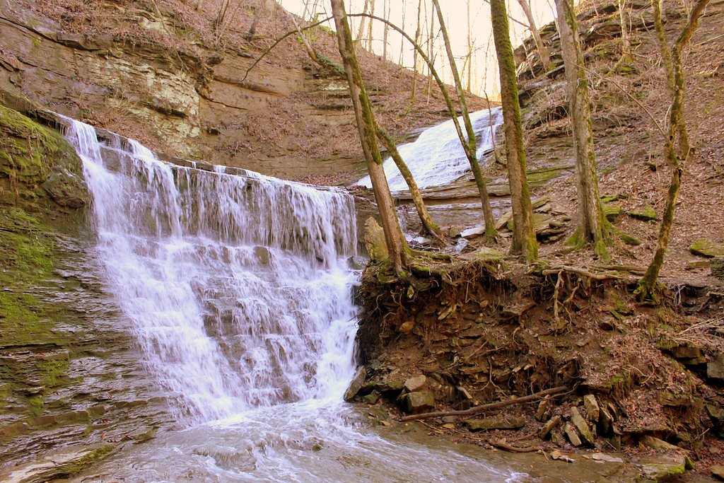
About Jackson Falls
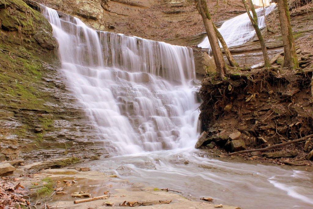
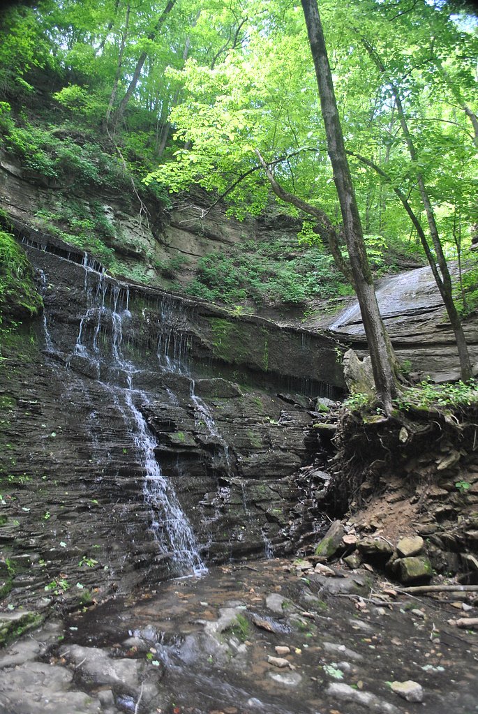
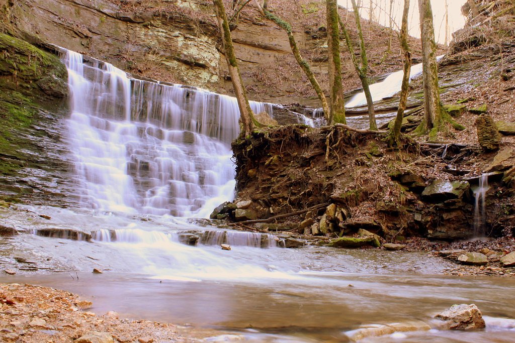
Jackson Falls is a picturesque waterfall located in the Natchez Trace Parkway in Tennessee. It is a popular spot for visitors due to its scenic beauty and relatively easy access. The waterfall cascades over a series of rock ledges, creating a serene and photogenic setting.
The Setting
Jackson Falls sits at 584 feet within Natchez Trace Parkway, fed by the Duck River, in the foothills of Tennessee.
Trail & Hike Details
The Approach
The moderate 0.4-mile out-and-back trail gains 200 feet of elevation on the way to the falls.
Trail Description
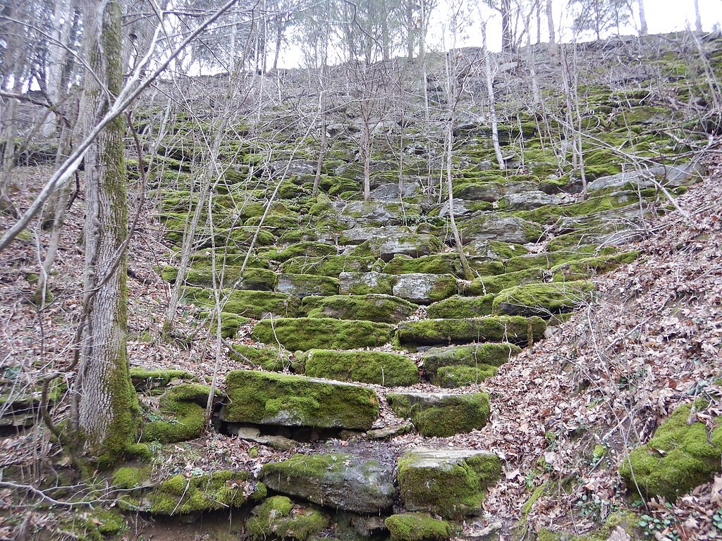
The trail to Jackson Falls is a short but moderately steep paved path that descends to the base of the falls. While the trail is well-maintained, it may be slippery when wet, so caution is advised.
What to Expect
Dogs are welcome.
Accessibility
The trail is not wheelchair accessible. Uneven terrain and elevation changes require steady footing.
Frequently Asked Questions
🐶 Are Dogs Allowed at Jackson Falls?
✅ Dogs are allowed
Are There Any Fees or Permits Required?
🆖 No fees required
🏊 Is There Swimming at Jackson Falls?
❌ Swimming is not allowed
When to Visit
Spring and early summer are the best times to visit Jackson Falls, as the water flow is typically stronger due to seasonal rainfall.
Seasonal Access
The best time to visit is Spring, Summer, and Fall. Winter access may be limited. Check the National Park Service website for current conditions.
Safety Information
The trail can be slippery when wet, and the descent to the falls is steep. Exercise caution and wear appropriate footwear. Avoid climbing on rocks near the falls, as they may be unstable or slippery.
Current Water Conditions
1,460 ft³/s
Current discharge — how much water is flowing
About average for this time of year
Based on 10 years of record
9.76 ft
Water depth at gauge
7-Day Discharge Trend
What does this mean for your visit?
Flow is about average for this time of year.
About This Gauge
7-Day Flow Outlook
Based on the USGS gauge DUCK RIVER NEAR SHADY GROVE, TN. (4 km away).
Today
Moderate
1664 cfs
6/10Tomorrow
Moderate
1324 cfs
6/10Tue
Moderate
1535 cfs
6/10Wed
Moderate
1680 cfs
6/10Thu
Moderate
1406 cfs
6/10Fri
Moderate
1066 cfs
6/10Sat
Moderate
964 cfs
6/10Best window: Today — moderate flow, showers and thunderstorms (trip score 6/10).
Best time of year: this gauge typically runs highest from early February to early March, peaking in February.
How we calculate this
This is a transparent outlook, not a precise forecast. We take the waterfall's current flow strength (how it ranks against its historical normal for today, from the nearest USGS stream gauge), carry that ranking forward along the gauge's seasonal curve, and nudge it for forecast rain. Confidence is highest for the next day or two and falls further out. Always check official conditions and your own judgment before visiting — high flows can be dangerous.
Know when to go.
Get a free email alert when waterfalls near Mount Pleasant hit peak flow. We only send when conditions are worth the trip — no weekly newsletters, no spam.
Weather Forecast
Location & Access
Getting There
Jackson Falls is located along the Natchez Trace Parkway at milepost 404.7. Visitors can park at the designated parking area and follow a short trail to the falls.
Get Directions on Google MapsParking
There is a small parking area available near the trailhead, which is free of charge.
Elevation
584 feet above sea level
Coordinates
35.696737° N, -87.295567° W
Land Management
Managed by NPS
Visitor Tips & Gear
Wear sturdy shoes with good grip, especially if visiting after rain. Arrive early during peak seasons to secure parking. Bring water and be prepared for a short uphill climb on the return trip.
As an Amazon Associate, we earn from qualifying purchases.
With 0.4 miles and 200 ft of elevation gain, sturdy boots and trekking poles will help on this moderate trail. Sun exposure on the trail makes good sun protection a must in summer.
America the Beautiful Annual Pass
Covers entrance fees at 2,000+ federal recreation sites — required at most National Parks.

Polarized Sunglasses (Knockaround)
Cuts glare off the water so you actually see the falls — and your photos turn out better too.

Columbia Watertight II Rain Jacket
Packs into its own pocket, seam-sealed, and keeps you dry from spray and surprise rain.

Earth Pak Waterproof Dry Bag
Keeps your phone and gear dry when waterfall mist soaks everything else.

Waterproof Phone Pouch (AiRunTech)
Cheap insurance — take photos right next to the falls without killing your phone.

Timberland Euro Sprint Mid Waterproof
Trusted waterproof boot with premium leather and grippy rubber sole — reliable on rocky, wet trails.

TrailBuddy Trekking Poles
Lightweight aluminum, cork grips, and flip-locks that actually hold — a best-seller for good reason.
Where to Stay

Comfort Suites Columbia I-65

Holiday Inn Express & Suites Franklin - Berry Farms by IHG

Tru By Hilton Spring Hill

Home2 Suites By Hilton Dickson
Browse vacation cabins and private rentals nearby
Unique outdoor stays — tents, yurts, and treehouses
Rent a campervan or RV for your waterfall road trip
Some links are affiliate links. We may earn a commission at no extra cost to you.
Additional Information
Nearby Attractions
Nearby attractions include the Natchez Trace Parkway Visitor Center, Fall Hollow Falls, and the Meriwether Lewis Monument.
Wildlife
Visitors may encounter birds, deer, and other small wildlife along the trail and in the surrounding area.
Cities near Jackson Falls
Nearby Waterfalls
Other waterfalls named Jackson Falls
4 other waterfalls share this name across the U.S.
Writing about Jackson Falls? Embed this waterfall on your site for free.