
Photo Credits (5)
Difficulty
Moderate
Trail Length
2.4 miles
Trail Type
Out And Back
Elevation Gain
350 ft
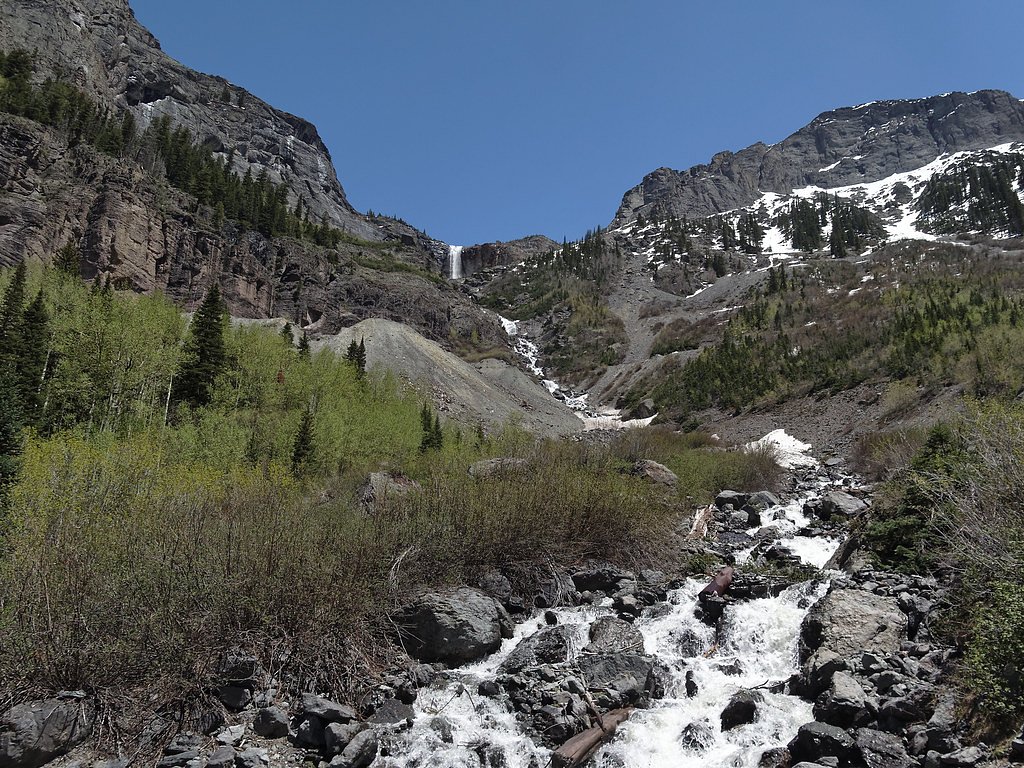
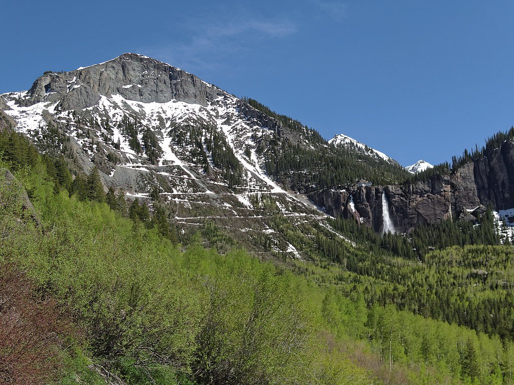
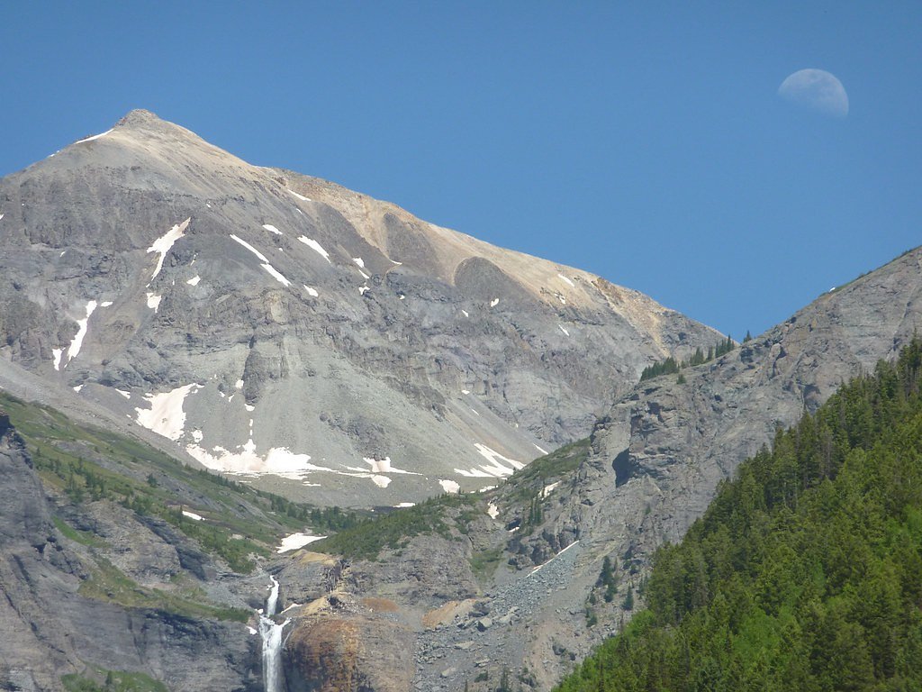
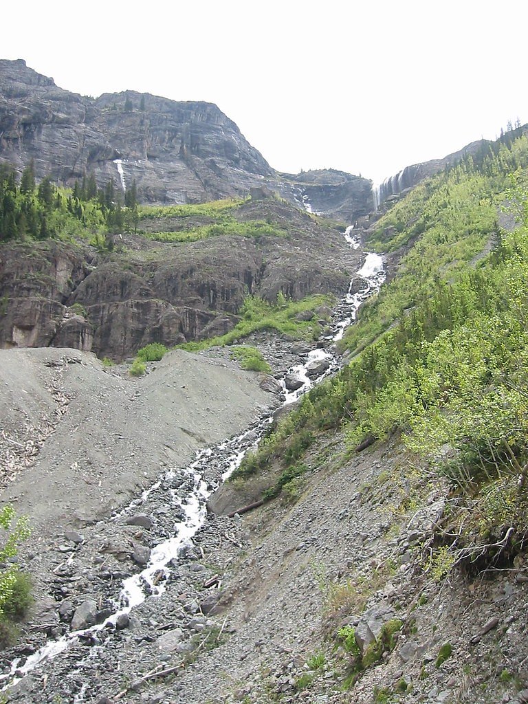
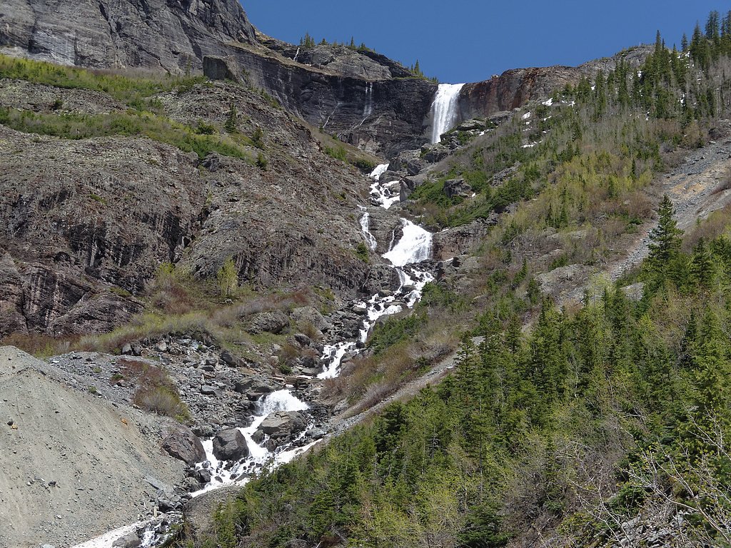
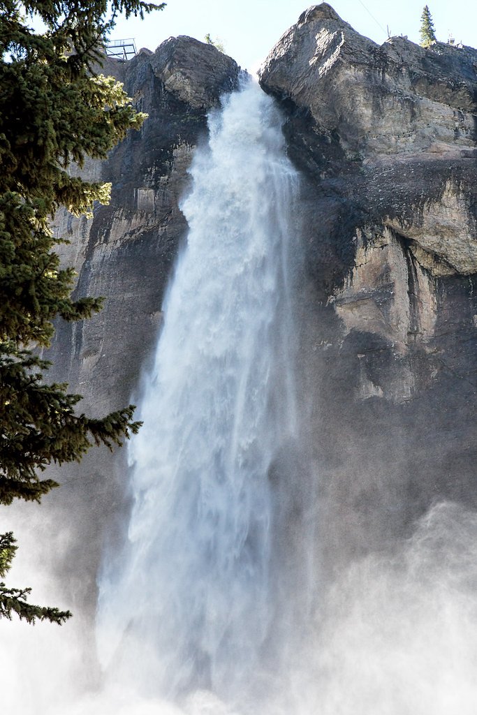
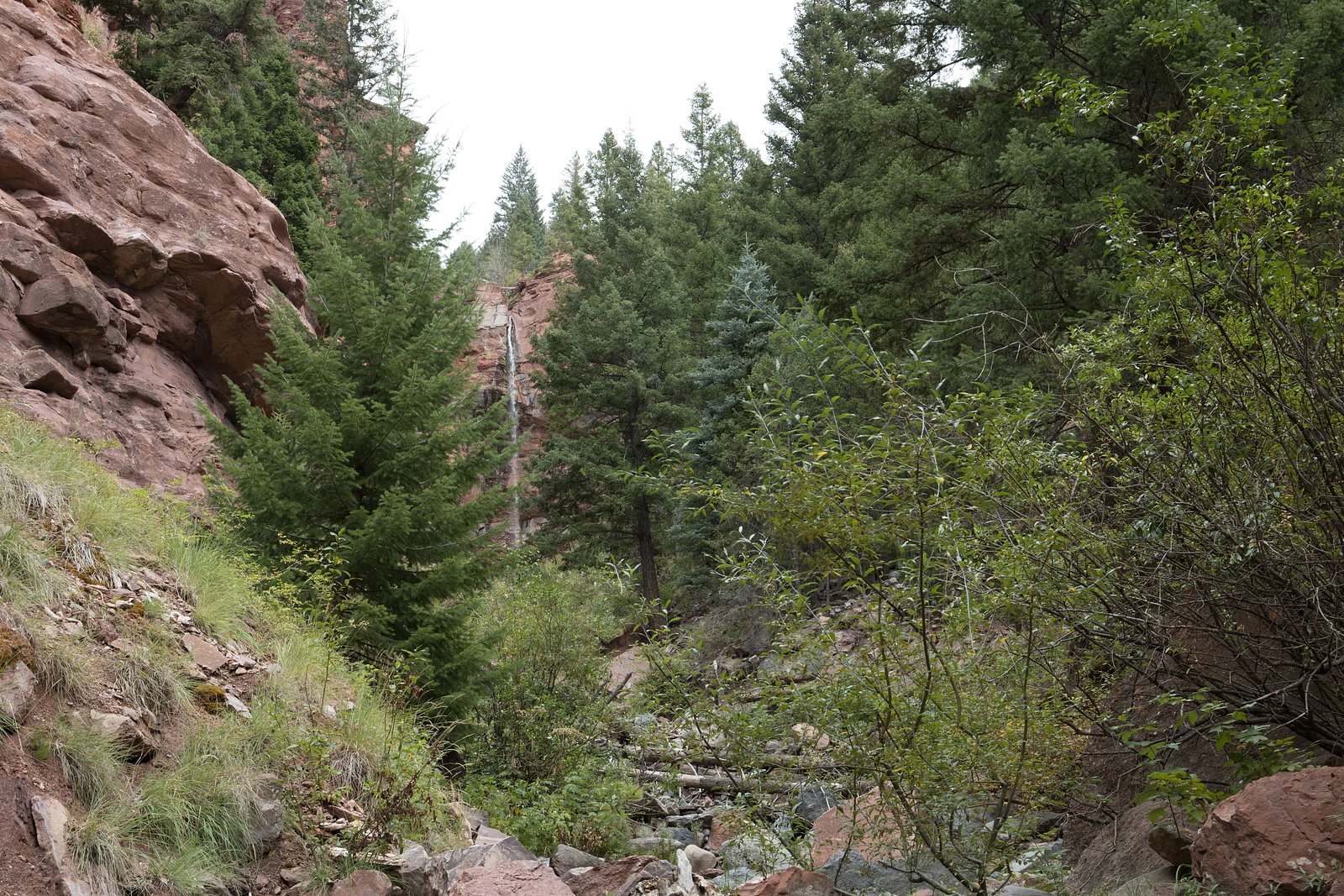
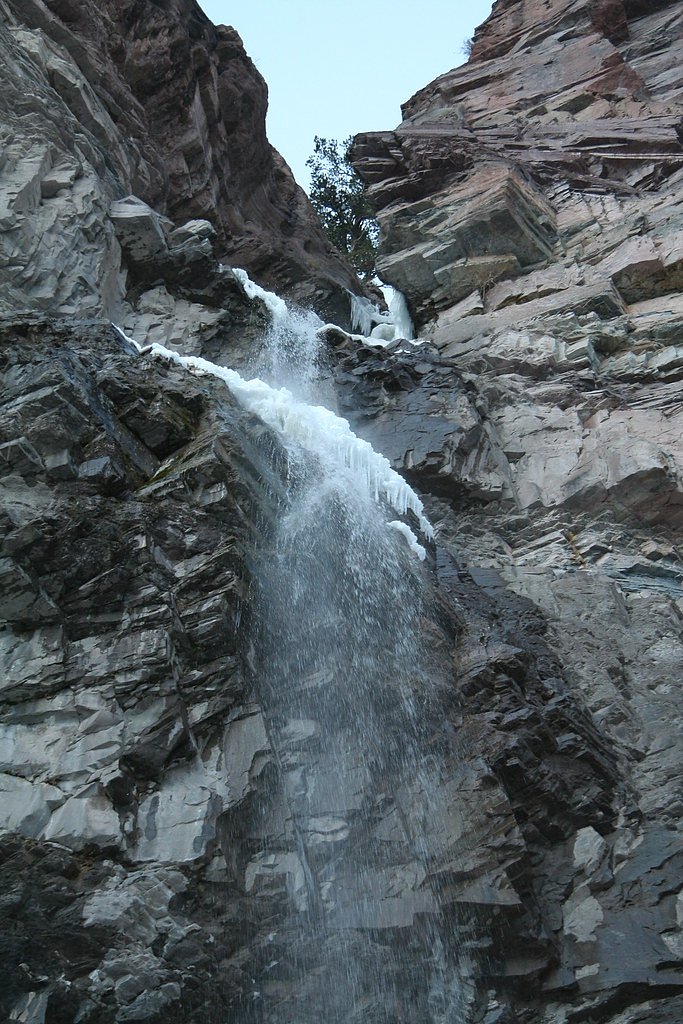
About Ingram Falls
Ingram Falls is a picturesque cascade just outside Telluride, Colorado, spilling off Bridal Veil Creek and framed by the rugged San Juan Mountains. The falls sit on U.S. Forest Service land within the Uncompahgre National Forest, and are often visible from the access road toward Bridal Veil Falls — making Ingram Falls an easy, scenic stop on a mountain drive or a short hike. For those on foot, the most direct approach uses the Silver Lake Trail (USFS Trail #5507.1A). The route to the falls is a moderate out-and-back experience of about 2.4 miles with roughly 350 feet of elevation gain, offering alpine views and classic native-surface tread maintained by the USFS. It’s a welcoming option for day hikers who want a relatively short outing with big mountain scenery.
The Setting
Ingram Falls sits at 10,961 feet within Uncompahgre National Forest, fed by the South Fork San Miguel River, in the high alpine of Colorado.
Nearby Falls Worth Visiting
Bridal Veil Falls, the tallest waterfall in Colorado at 365 feet, lies 0.5 miles to the west. Also nearby: Cornet Falls (80 ft, 3.0 mi).
Trail & Hike Details
The Approach
The moderate hike follows Silver Lake (#5507.1A), a 2.4-mile out-and-back trail over natural surface. Expect 350 feet of elevation gain with grades of 12-20%. The trail is minimally developed (Class 1).
USFS Trail
SILVER LAKE #5507.1A
Trail Class
Minimally Developed
Surface
Avg Grade
USFS Segment
1.01 miTrail Description
Access is via Silver Lake Trail (USFS Trail #5507.1A). The official trail segment is Class 1 with a native material surface and a typical grade between 12–20%. The maintained GIS segment records about 1.01 miles for the mapped portion, while the full route to the falls is commonly described as a 2.4-mile out-and-back with approximately 350 feet of elevation gain. Expect firm, rocky native tread and short, steeper pitches; overall difficulty is rated moderate.
What to Expect
Dogs are welcome.
Accessibility
The trail is not wheelchair accessible. Uneven terrain and elevation changes require steady footing.
Frequently Asked Questions
🐶 Are Dogs Allowed at Ingram Falls?
✅ Dogs are allowed
Are There Any Fees or Permits Required?
🆖 No fees required
🏊 Is There Swimming at Ingram Falls?
❌ Swimming is not allowed
When to Visit
The best time to visit is during late spring through early fall when the trail is clear of snow and the waterfall flow is strongest due to snowmelt.
Seasonal Access
The best time to visit is Spring, Summer, and Fall. Access roads and trails may close during winter due to snow. Check with Uncompahgre National Forest for seasonal road closures.
Safety Information
The trail can be steep and rocky, so proper footwear is essential. Be cautious of loose rocks and off-road vehicles. Weather in the mountains can change rapidly, so be prepared for sudden rain or storms.
Current Water Conditions
50 ft³/s
Current discharge — how much water is flowing
Lower than usual for this time of year
Based on 14 years of record
1.76 ft
Water depth at gauge
7-Day Discharge Trend
What does this mean for your visit?
Flow is lower than usual for this time of year.
About This Gauge
This gauge is on a nearby waterway and may not reflect exact conditions at the falls.
7-Day Flow Outlook
Based on the USGS gauge SOUTH FORK SAN MIGUEL RIVER NEAR OPHIR, CO (13 km away).
Today
Low
56 cfs
3/10Tomorrow
Low
55 cfs
6/10Sun
Barely Flowing
54 cfs
5/10Mon
Barely Flowing
51 cfs
5/10Tue
Barely Flowing
47 cfs
5/10Wed
Barely Flowing
47 cfs
5/10Thu
Low
53 cfs
3/10Best window: Tomorrow — low flow, sunny (trip score 6/10).
Best time of year: this gauge typically runs highest from early May to mid July, peaking in June.
How we calculate this
This is a transparent outlook, not a precise forecast. We take the waterfall's current flow strength (how it ranks against its historical normal for today, from the nearest USGS stream gauge), carry that ranking forward along the gauge's seasonal curve, and nudge it for forecast rain. Confidence is highest for the next day or two and falls further out. Always check official conditions and your own judgment before visiting — high flows can be dangerous.
Know when to go.
Get a free email alert when waterfalls near Telluride hit peak flow. We only send when conditions are worth the trip — no weekly newsletters, no spam.
Weather Forecast
Location & Access
Getting There
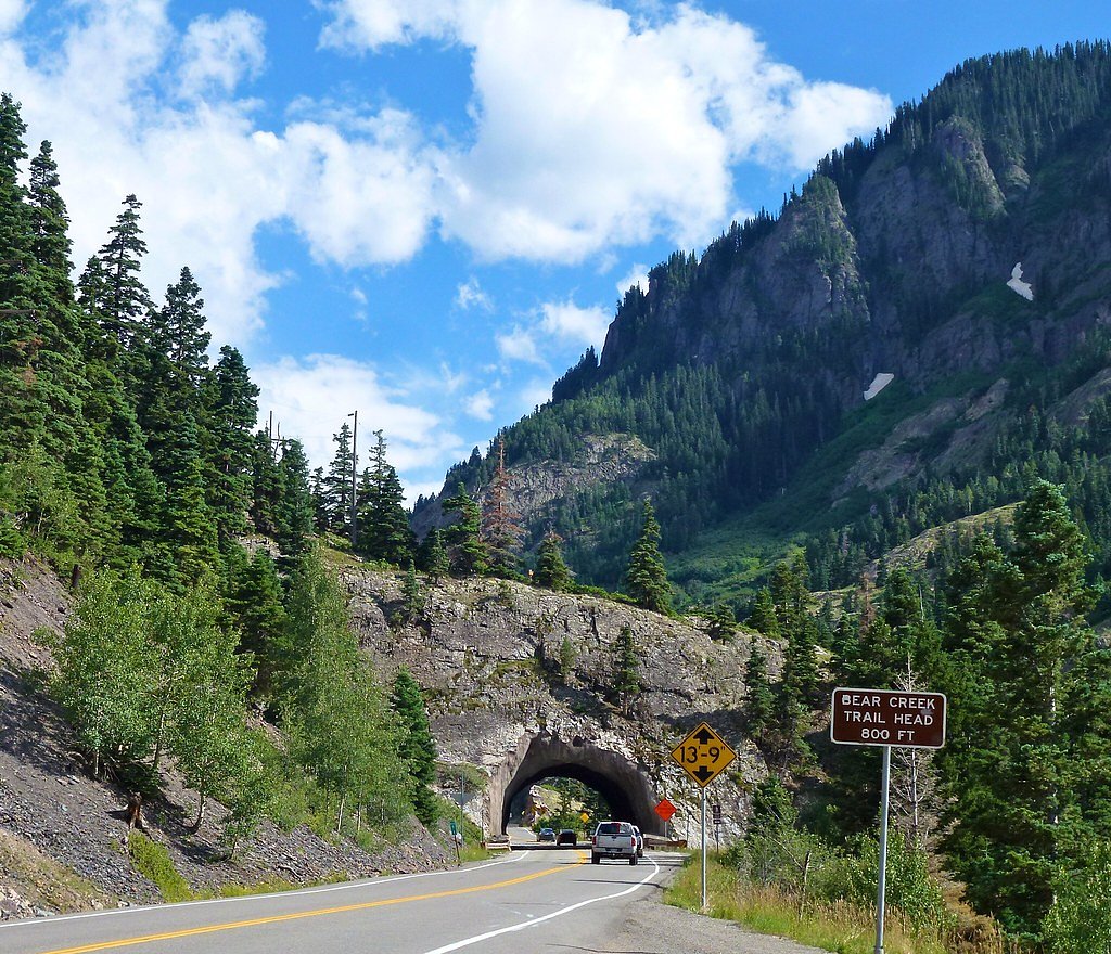
Ingram Falls is located near Telluride, Colorado, along the road to Bridal Veil Falls. Visitors can access the area via a 4WD road that leads to Bridal Veil Falls, with Ingram Falls visible along the way.
Get Directions on Google MapsParking
Parking is available near the base of the Bridal Veil Falls trailhead. Visitors should be prepared for limited parking during peak seasons.
Elevation
10,961 feet above sea level
Coordinates
37.922598° N, -107.761555° W
Land Management
Managed by USFS
Visitor Tips & Gear
Start early to avoid crowds and ensure you have enough daylight for the hike. Wear sturdy hiking shoes and bring plenty of water. Be prepared for rapidly changing weather conditions in the mountains.
This trail sits at 10,961 ft — roughly 30% less oxygen than sea level
Extreme AltitudeAt this elevation, altitude sickness is a real concern. Monitor how you feel, take frequent rest breaks, and descend if symptoms worsen. Visitors arriving from lower elevations should allow time to acclimatize.
As an Amazon Associate, we earn from qualifying purchases.

Coppertone Sport SPF 50 Sunscreen
UV intensity jumps ~4% per 1,000 ft — at this elevation you can burn in half the time.

Sun Bum SPF 30 Lip Balm (3-Pack)
Lips have almost no natural UV protection and burn fast in thin, dry mountain air.

Liquid I.V. Electrolyte Packets
You lose moisture ~2x faster at elevation — electrolytes help you absorb water efficiently.

ROCKNIGHT Polarized UV400 Sunglasses
High-altitude glare off rock and water is intense — UV400 lenses block 99%+ of UVA/UVB.

Boost Oxygen 10L Canister (2-Pack)
Portable supplemental oxygen for quick relief from headaches and shortness of breath.

Altitude Rx OxyBoost Complex
Antioxidant formula designed to support your body's natural altitude acclimation.

Fingertip Pulse Oximeter
Monitor blood oxygen in real time — SpO2 commonly drops to 85–90% above 10,000 ft.
As an Amazon Associate, we earn from qualifying purchases.
With 2.4 miles and 350 ft of elevation gain, sturdy boots and trekking poles will help on this moderate trail. Sun exposure on the trail makes good sun protection a must in summer.

Polarized Sunglasses (Knockaround)
Cuts glare off the water so you actually see the falls — and your photos turn out better too.

Columbia Watertight II Rain Jacket
Packs into its own pocket, seam-sealed, and keeps you dry from spray and surprise rain.

Earth Pak Waterproof Dry Bag
Keeps your phone and gear dry when waterfall mist soaks everything else.

Waterproof Phone Pouch (AiRunTech)
Cheap insurance — take photos right next to the falls without killing your phone.

Timberland Euro Sprint Mid Waterproof
Trusted waterproof boot with premium leather and grippy rubber sole — reliable on rocky, wet trails.

TrailBuddy Trekking Poles
Lightweight aluminum, cork grips, and flip-locks that actually hold — a best-seller for good reason.
Where to Stay

The Hotel Telluride

Mountain Lodge Telluride

Ouray Riverside Resort - Inn & Cabins

The Victorian Inn
Browse vacation cabins and private rentals nearby
Unique outdoor stays — tents, yurts, and treehouses
Rent a campervan or RV for your waterfall road trip
Some links are affiliate links. We may earn a commission at no extra cost to you.
Nearby Campground
South Mineral Campground
8.1 miles away · 0 sites
South Mineral Campground, located along South Mineral Creek, is one of the most popular campgrounds in the San Juan National Forest. The campground has 26 sites, all of which are first-come, first-serve. Most campsites are shaded and well-spaced thanks to spruce and fir trees. Some sites are handicapped accessible. Some sites have large parking areas.Services include water, trash pickup, fire grates, picnic tables, and pit toilets. Bear-safe food storage is recommended. No electricity. Between
Book on Recreation.govNearby Hot Springs
Hot springs near Telluride, Colorado
Chattanooga Hot Spring
Chattanooga Hot Spring emerges at just 49 degrees Fahrenheit at 10,720 feet elevation near Silverton in San Juan County. Locate...
Ouray Hot Springs
Ouray Hot Springs surfaces at a scalding 156°F at 7,800 feet elevation, one of Colorado's hottest springs that demands careful ...
Ouray Hot Springs Pool
Ouray Hot Springs Pool sits at 7,860 feet elevation in downtown Ouray, positioned just 97 feet from Main Street for maximum con...
Orvis Hot Spring
Orvis Hot Spring emerges at 126°F with heavily mineralized water dominated by sulfate, requiring a short walk through Ouray Cou...

Lemon Hot Spring
Lemon Hot Spring emerges at 91°F from Bureau of Land Management property in San Miguel County at 7,320 feet elevation, where fe...
Dunton Hot Spring
Dunton Hot Spring emerges at 108 degrees Fahrenheit in the remote San Juan Mountains at 8,850 feet, requiring a short walk thro...
Looking for a soak after your hike? Explore more hot springs near Telluride, Colorado on SoakingSprings.
Explore Colorado springsAdditional Information
Nearby Attractions
Bridal Veil Falls, Telluride town, San Juan Mountains, Telluride Gondola
Wildlife
Visitors may encounter wildlife such as marmots, deer, and various bird species.
Cities near Ingram Falls
Nearby Waterfalls
Writing about Ingram Falls? Embed this waterfall on your site for free.